The 2026 solar eclipse is the first total solar eclipse in continental Europe since the 21st century began. Basically, the European mainland will be reached only within the Iberian Peninsula, but with respect to it, this eclipse remains the most accessible totality by Europeans since 1999. In 2015, the total solar eclipse missed the continent as its path proceeded between the North Atlantic and the Norwegian Sea, and then through the Arctic Ocean. The only lands where people could experience the totality were the Faroe Islands and Svalbard, not to mention the isolated and uninhabited rock protrusion west of St. Kilda – Rockall, which belongs to the United Kingdom. There was another totality in 2006, which just missed the Greek islands (Crete, Rhodes), leaving them with obscuration of almost 99%, and passed over the Caucasus range, a controversial area in a geological sense, as it is considered part of the Asian mountain range.

Unlike the Great American Eclipse of 2024, this totality isn’t widely discussed as much, probably because the totality doesn’t reach many grounds over its path; however, we can find a couple of interesting links about this event:
https://eclipse2026.is/
https://eclipse262728.es/en/eclipse2026/
https://www.elgraneclipse.com/
And the general websites:
Michael Zeiler’s 2026 eclipse maps and information
Fred Espenak’s interactive 2026 solar eclipse map
Xavier Jubier’s interactive 2026 solar eclipse map
Yuk Tung Liu 2026 solar eclipse map
The longest duration of 2m18s occurs about 40km southwest of the western fiords, where the most extended duration on the ground is 2m13.2s. The eastern Mallorca will experience the shortest duration at the centerline – 1m 35.5s.
This website won’t cover only the section of totality, which has already been widely described in other services on other occasions. It will focus on the totality extension below the horizon within the central Russia and Mediterranean regions, as local people and astronomical institutions should be aware of the occasional, unprecedented, and unrepeatable celestial event!
THE PRIMARY GOAL OF THIS WEBSITE is to make people aware of uncommon observations, which can be performed during the 2026 solar eclipse, and especially its extension within the twilight zone.
SELECT CHAPTER
- GENERAL INFORMATION
- THE ECLIPSE GEOMETRY
- THE MOON’S SHADOW CIRCUMSTANCES
- THE ISOLINES ODDITY
- THE TOTAL PHASE
Iceland | Portugal | Spain - THE PARTIAL PHASE
- ECLIPSE EVENT BELOW THE HORIZON
Algeria | Tunisia | Italy | Malta | Libya | Greece | Other countries | Eastern Europe - ACCOMPANYING OPTICAL EVENTS
- ANTITWILITGHT SKY PROJECTIONS
- ECLIPSE SUNSET CIRCUMSTANCES
- SKY VIEW
- PERSEIDS AND OTHER METEORS
- WEATHER PROSPECTS
- LIGHT POLLUTION
- OBSERVATION CASE STUDIES
Kanoua | Chetaibi | Capo Sperone | Galite Islands | Tabarka | Bizerte | Cap Bon Peninsula | Marettimo | Marsala | Pantelleria | Ragusa | Pelagian Islands | Gozo | Tripoli | Benghazi | Gavdos - RESOURCES
Webcams | Casual flights | Casual cruises | Software - ECLIPSER TERMINUS PROJECT
- OBSERVATION RESULTS
- SUMMARY
- ACKNOWLEDGMENTS
1. GENERAL INFORMATION
The solar eclipse of August 12, 2026, belongs to Saros 126 and occurs between the eclipses of August 1, 2008, and August 23, 2044.
The Saros 126 includes a couple of interesting solar eclipses. First of all, from the perspective of my homeland, I would like to mention the total solar eclipse of June 30, 1954, which was the last one visible in Poland. The same eclipse, as well as the other one in the same saros, the total solar eclipse of July 22, 1990, resulted in the first professional publications about its influence on twilight.


The eclipse path begins in the eastern part of the Taymyr Peninsula in Russia. It proceeds over the Arctic Ocean, where it just misses the North Pole, and continues to Greenland, the World’s largest island. Then, the path continues over western Iceland and the North Atlantic towards the Bay of Biscay and the westernmost part of the Cantabrian Sea, where it enters the Iberian Peninsula. After that, the path proceeds across Spain and grazes the Portuguese border. On its further way, it encounters the Balearic Sea and the Balearic Islands. Finally, it finishes at the Mediterranean, west of the island of Sardinia and north of the Algerian Atlas Mountains.


>>>BACK TO TOP<<<

2. THE ECLIPSE GEOMETRY
The maximum width of the eclipse path is 294km, which refers to the point at which the eclipse is visible at maximum height above the horizon. This height is just about 26,5°, which leads to the conclusion that the entire region of eclipse visibility is adjacent to the pole. As for the first approach to eclipse visibility, the 2026 total solar eclipse falls under type V (Meeus, 1997). In this type of solar eclipse, there is no central eclipse at noon (Meeus, 1997). As mentioned in this article, the umbral path can be seen only at one part of the day (morning or afternoon). In 2026, the entire line of the central eclipse should occur in the afternoon hours, which is illustrated in the image below (Pic. 4).
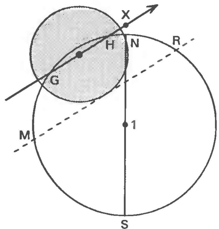
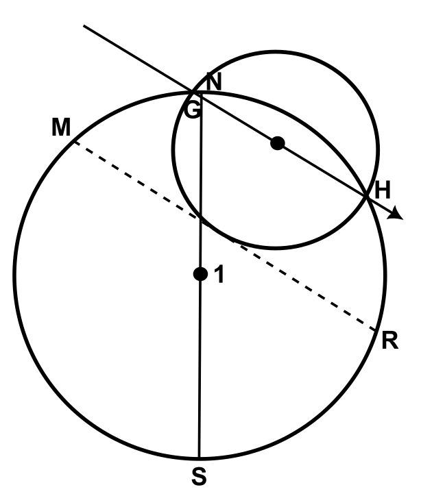
A central solar eclipse can occur only in one part of the day, either in the morning or the afternoon, but never at noon. The segments G-H and N-S don’t intersect. The position of the umbral cone at point X means a deep partial, or at most non-central, eclipse on the Earth. The zone of partial solar eclipse, limited by the segment of M-R, can occur either before or after noon. The configuration such as this can arise in total, annular, or annular-total eclipses. Type V solar eclipse can take place only when the absolute value of γ is between 0.86 and 0.997 (Meeus, 1997). This is the minimum value of γ at which the distance between the solar eclipse and the subsolar point is the closest. For example, on August 12, 2026, the minimum γ value is 0.8977, which, at least in theory, should place the central line of the solar eclipse very close to the moment of noon or midnight, determined by the segment of N-S. However, the 2026 total solar eclipse seems to prove that the absolute value of γ equal to 0.86 is not enough for the type V of solar eclipse occurrence. The best evidence of it can be found in the following illustrations below (Pic. 5 – 7)
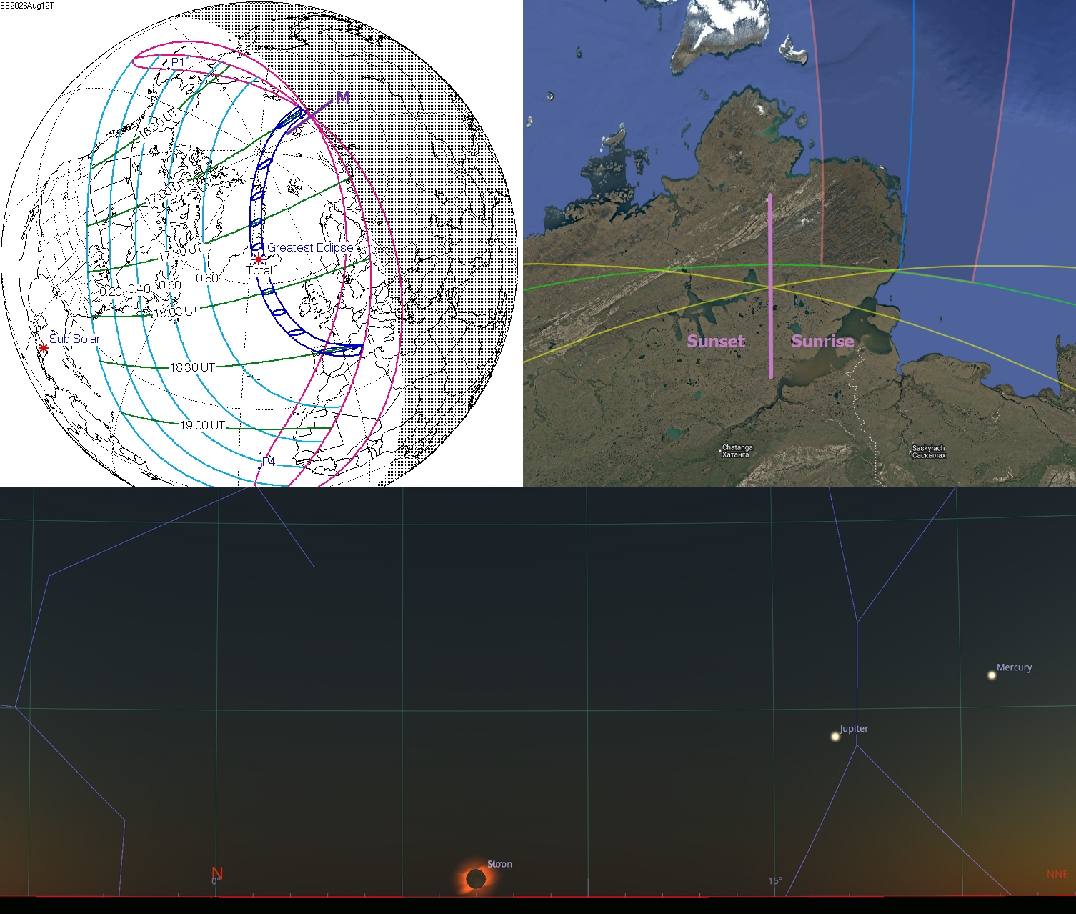
Following a more detailed explanation of « how to read » the eclipse map (Meeus, 1997), three regions near the terminator line are noteworthy. The region 1 bound with ECFW shows the area in which the maximum eclipse is visible. In region 2(AEC), the Sun rises and sets between the maximum eclipse and the last contact. Region 3 (CBF) lies in the area where the Sun rises and sets between first contact and maximum. The lines AEW and AQM mark the last contact at sunset, whereas the arcs WFB and BTR indicate the first contact at sunrise. On the ECF arc, the maximum eclipse occurs at the horizon, around midday or midnight. The other two lines show the most incredible eclipse moment at sunrise (M’G’E) and sunset (FH’R’). The last two lines indicate the last contact at sunrise (M’QAE) and the first contact at sunset (FBTR).
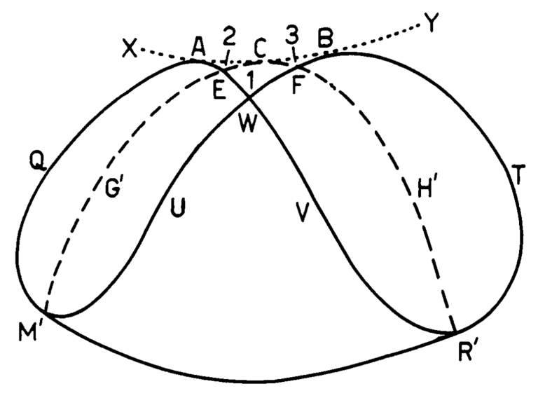
This pattern is well understood, as it applies to the Northern Hemisphere, where the northernmost section of the terminator line lies south of the pole. For the same circumstances in the southern hemisphere, the illustration should be mirrored. In the case of the 2026 totality, there is another problem: the northernmost limit of the solar eclipse area lies beyond the north pole and is on the other side of the globe. In light of these circumstances, the image below shows how to interpret the 2026 total solar eclipse map at the very beginning of the path in Russia (Pic. 9), with the central line marked in red and the path limits in blue. The path of totality misses out the North Pole slightly.
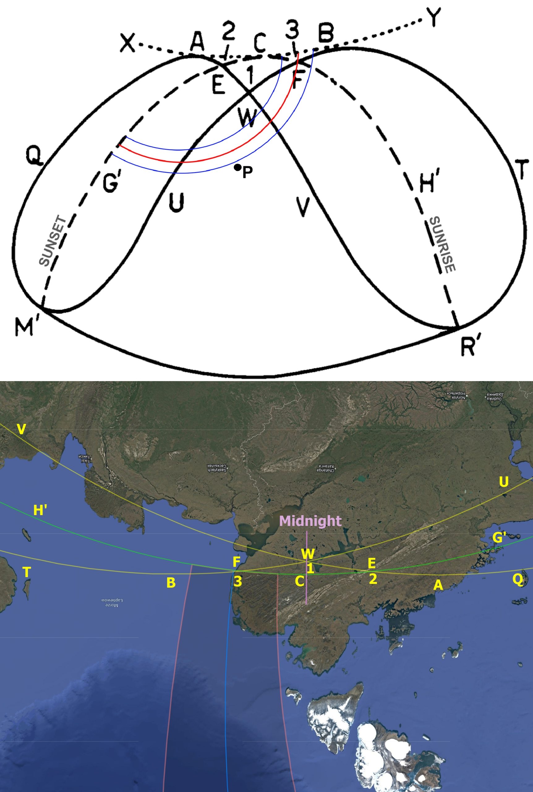
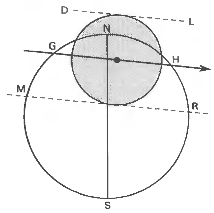
Imagine that you are looking at the beginning of this eclipse from above the North Pole. Now you can see a real example of the pattern mentioned earlier, rotated upside down. This is an intentional illustration as a result of these eclipse circumstances. The geometry of the 2026 total solar eclipse isn’t obvious, as it begins around local midnight. There are three scenarios in which the solar eclipse can be observed at midnight. The 2026 totality applies the second case (Pic. 10), in which the entire path lies between the pole and the terminator on the opposite side of the globe.
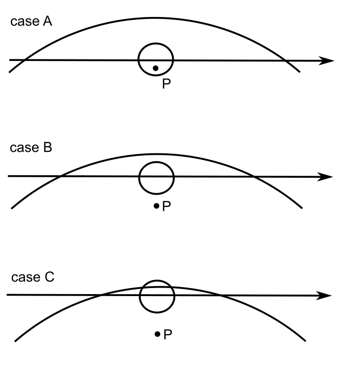
As the Earth’s rotational axis is tilted for almost the entire year, the occurrence of a solar eclipse on the other side of the pole is quite plausible in the circumstances, at which the absolute γ value is close to 0.997 and as small as 0.86 (Meeus, 2007). There are nine eclipses such as this in the XXI century. In fact, the last two occurred in 2021, and, admittedly, this is another rare situation that will repeat only in 2712. It’s such a digression about how rare these eclipses are. The same applies to the latitude of the point, where the central eclipse occurs at midnight. In recent times, the lowest latitude was 70°N on June 6, 1891, when the last central solar eclipse occurred at midnight in the northern hemisphere before 2021. In August 2026, the latitude of this point was 85°N, making it the previous occurrence of this in the northern hemisphere before 2079. The next central solar eclipse at midnight will be observed on December 15, 2039, as a part of the same saros as the 2021 total solar eclipse.
The illustrations below clearly explain how the central solar eclipse can be visible at midnight (Pic. 11).
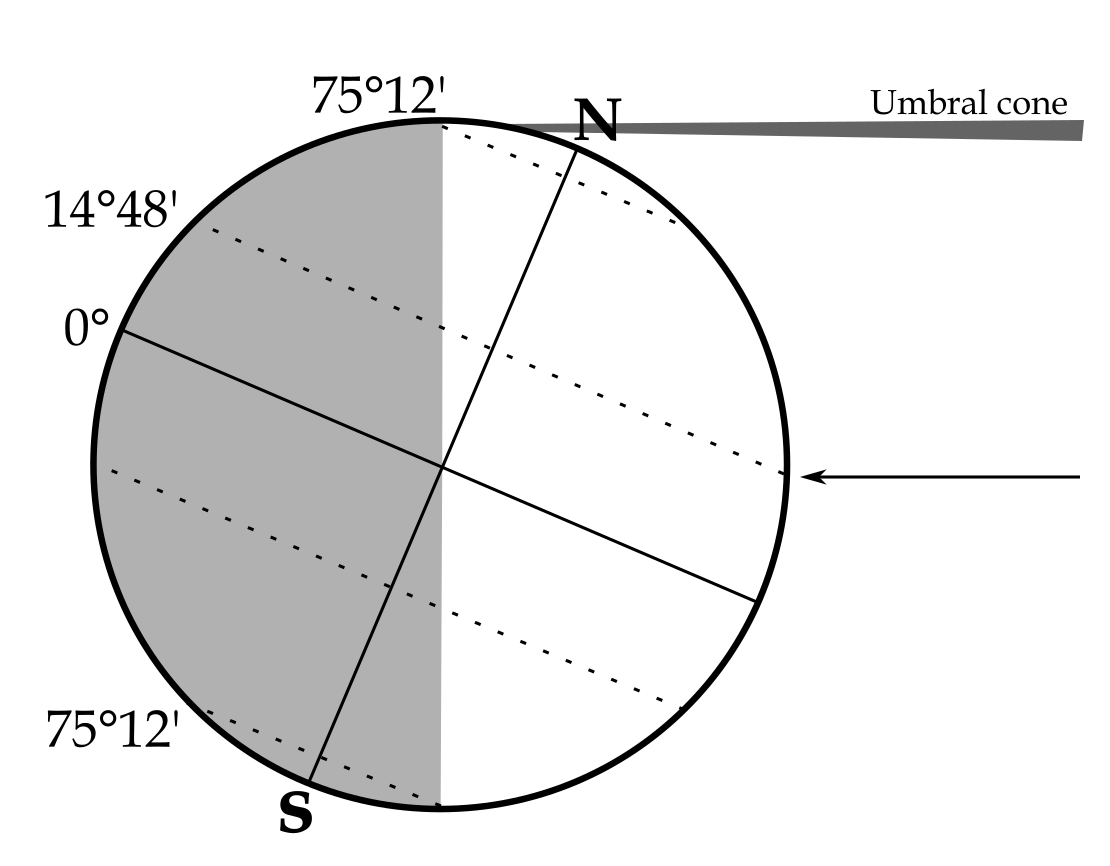
As you can see, the pole’s tilt is the paramount importance. To have a central eclipse at local midnight, the central line must pass between the pole and the nearest limb of the Earth (Pic. 8). It doesn’t happen around equinoxes, when the pole is close to the limb. However, because the 2026 total solar eclipse occurs around mid-August, when the declination of the Sun is +14°48′, the event is technically possible from a latitude higher than 75°12’N (Pic. 11).
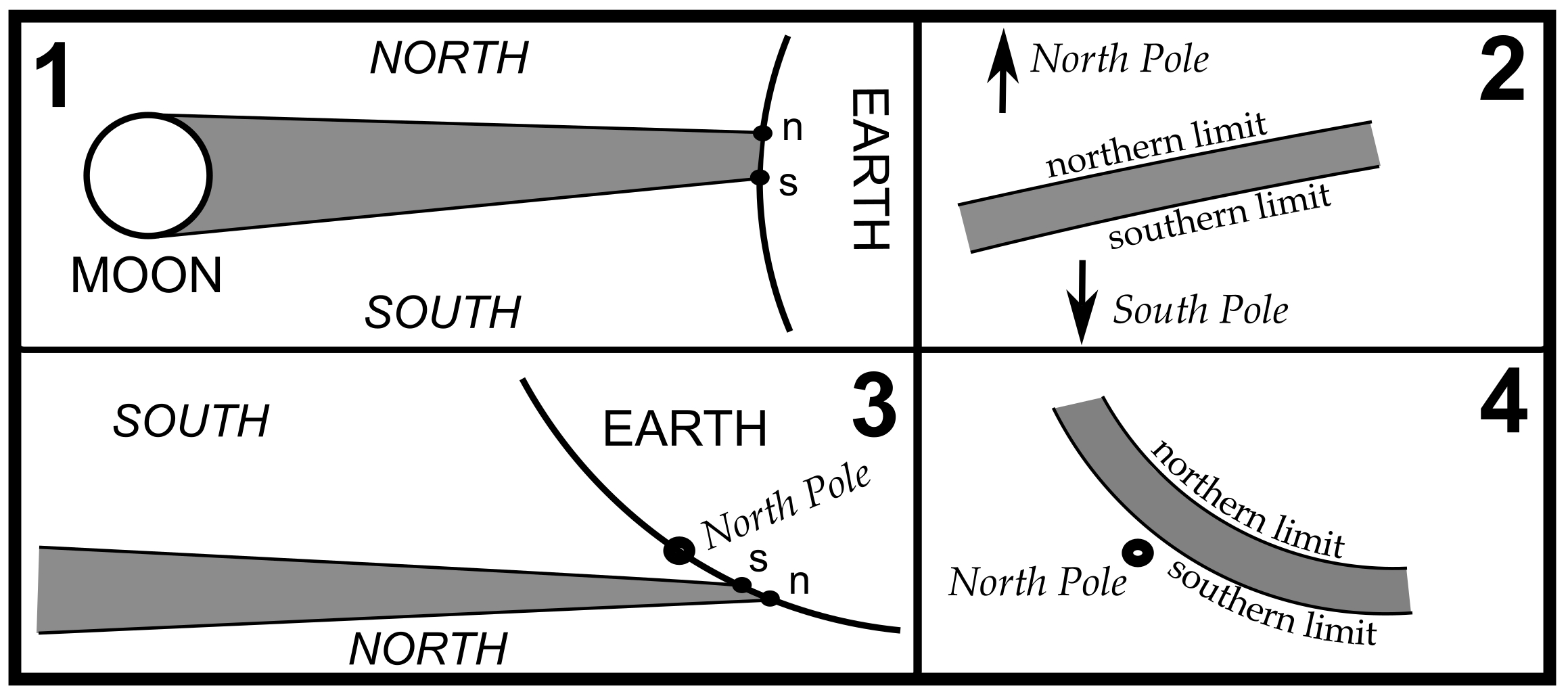
As a basic repercussion of this eclipse, another oddity arises: the reversed umbra limitation. As the umbral cone moves across the Earth’s surface, it traces a long path called the totality (or annularity) zone, which is bounded by two curves: the northern limit (n) and the southern limit (s) of the path (Meeus, 1997). Should we assume that the northern limit corresponds to the north direction in space, thereby the northern side of the plane of the ecliptic, and vice versa. If in some cases the Moon’s shadow happens to fall « above » the north pole, that is, north of it as seen from space. In turn, the southern limit of the umbra is nearer to the pole than the northern limit, and thus lies geographically north of it! This north-south oddity is reflected by the Earth’s illumination zone defined by the aforementioned axial tilt.
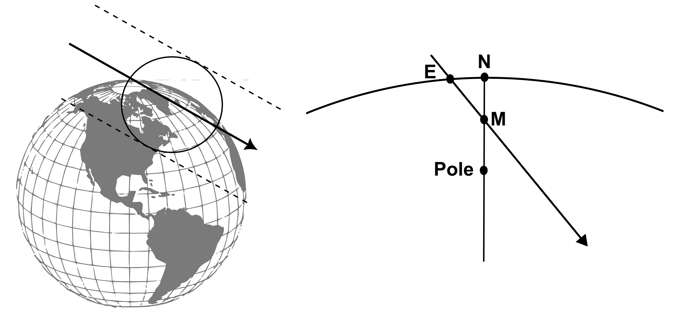
The 2026 total solar eclipse begins at a latitude of approximately 75° north and reaches the maximum northern latitude of 87°53′, although the local midnight, marked as point M, occurs earlier (Pic. 11). The closest approach to the pole doesn’t mean that the eclipse occurs at local midnight and vice versa. The 2026 total solar eclipse is a good example here. The situation changes as the eclipse path proceeds towards the sunset. After reaching the maximum northern latitude, the eclipse path proceeds southwards. Then the north limit of the path is oriented eastwards and south-westwards. At the westernmost longitude of 28° west, the central line changes its orientation again, and from this moment, the North-South oddity doesn’t appear anymore. Finally, the eclipse ends at sunset in the western part of the Mediterranean Sea, at a latitude of 39° north.
>>>BACK TO TOP<<<
3. THE ECLIPSE PATH AND MOON’S SHADOW CIRCUMSTANCES
By definition, for a solar eclipse with the γ value larger than 0, the umbral cone projected on the Earth’s surface is never circular. The Moon’s shadow is always circular when projected onto a flat surface. Because the Earth is a sphere, a situation like this can occur only when the total solar eclipse occurs exactly at the zenith. Moreover, this moment is typical for only the very middle part of the eclipse path, because in other situations the γ value changes. All the γ values provided in all eclipse catalogs represent the moment of the greatest eclipse occurrence elsewhere on Earth, which usually happens halfway between the start and the end of the eclipse path. Usually, but not always, that depends on the position of the subsolar point. For the case of 2026, there is no doubt about it, as the greatest eclipse occurs at an altitude of 26° only. The umbra shape is seriously oval.
The situation, which will occur on August 12, 2026, is illustrated in the image below (Pic. 14).
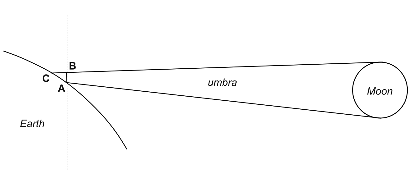
Let the hypothetical fundamental plane act as the dotted line. It goes somewhere beneath the ground, through point A, into the space. Since point A marks the southern limit of totality on the ground, the opposite side of the circular Moon’s shadow is point B, located in space. Due to Earth’s curvature and the low angle at which the umbral cone hits the ground, the true shape of the Moon’s shadow is defined by points A and C. Point C is the northern limit of totality and corresponds to point B on the ground. For better understanding, we can compare the distance A-B, which is the diameter of the umbral cone, with the distance A-C, which is the major axis of the oval umbra visible in reality. This major axis thereby determines the true width of the path of totality on the ground. To have a very wide path of totality, the quantity γ should be larger than about 0.95 in absolute value (Meeus, 2007). In most extreme cases, the width of the path of totality can exceed 800 km. Conversely, the minor axis of the umbra oval will never exceed 270km. However, it’s not the rule that a large γ value means an extremely wide eclipse path. Sometimes, even in these circumstances, the eclipse path can still be narrow. The primary reason is the eclipse’s duration. If it lasts only a second instead of, e.g., 2 or 3 minutes, the path of totality will still be very narrow even for large values of γ.
Now, another thing. The image above (Pic. 14) displays the situation around the middle part of the eclipse with the lowest γ value. This situation is represented by the shape C of the umbra in the image below (Pic. 15). What happens if the eclipse occurs earlier or later than this point? The umbra will be elongated. The largest elongation is to be observed near the beginning and the end of the passage of the lunar umbra over the Earth’s surface. The gliding Moon’s shadow during a total solar eclipse constantly changes its shape and orientation as it moves between the northern and southern limits of totality. I will describe it in detail later. Due to these changes, the aforementioned length of the major axis equals the width of the totality path only once, at the greatest eclipse point, which corresponds to instance C on the image below. In other cases, it will be larger than the eclipse path width.
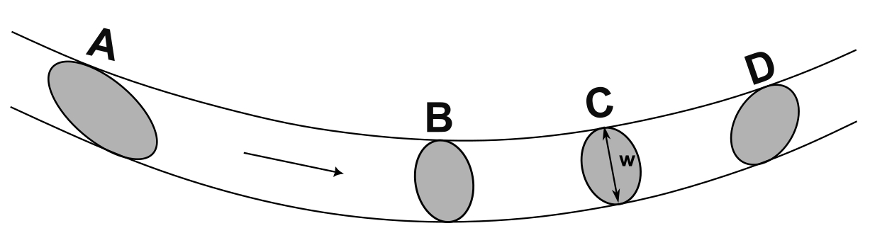
The moment at which the length of the umbra oval major axis defines the width of the totality path is marked with the « w » symbol in the image above. As you can see, other major axes are longer. Paradoxically, as the width of the umbra oval major axis increases, the width of the totality path decreases simultaneously. This is because of Earth’s curvature. The umbral cone has the smallest diameter at the terminator line, and paradoxically, the length of the major axis of the umbra would be the largest if complete.
The image below shows the comparison between the maximum length of the umbra, the width of the umbra, and the width of the totality path (Pic. 16).
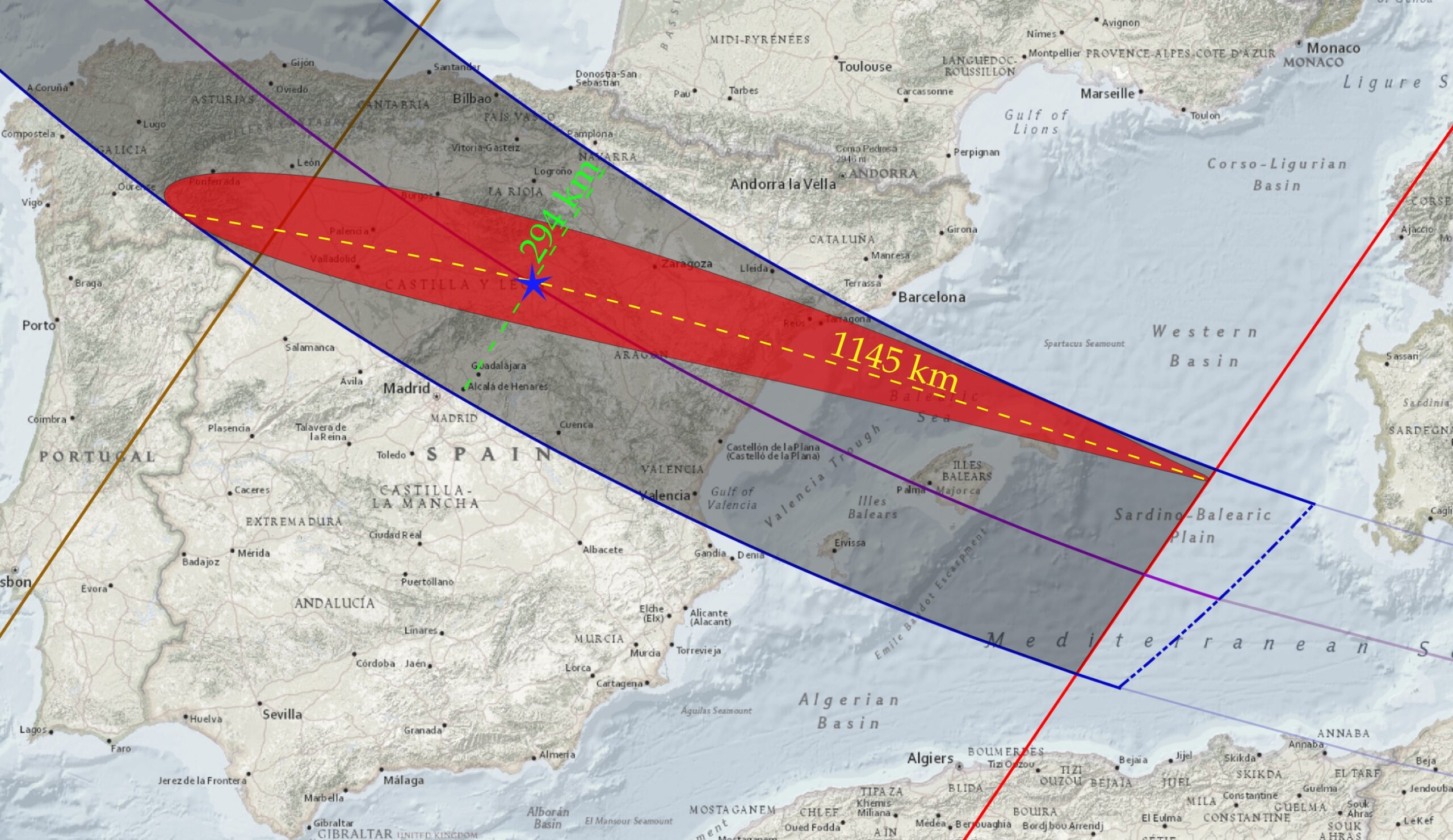
The moment at which the length of the umbra can be considered falls between the moments of U2 and U3, where U2 indicates the full moon’s shadow appearance on the ground after sunrise and U3 its last moment of full visibility before sunset. The moments of U1 and U4 correspond to the first and last appearance of the umbra, respectively, but the shadow isn’t visible in its full shape at these stages. The most dynamic changes of umbra shape, size, and appearance occur at the beginning and end of the totality path.
In the table below, you can find how the total length of the umbra changes over the last 10 minutes of totality in Spain (Tab. 1).
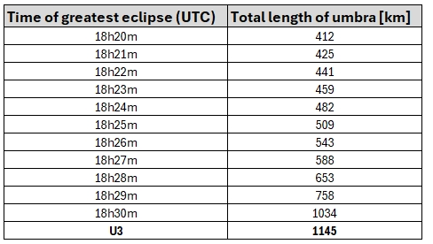
The length of the umbra increases very fast towards the end of the path, and this particular matter will be explained in a separate article in the future. The maximum length of 1145km isn’t something unusual. There are eclipses when the umbra can be longer, reaching up to 1608 km on July 16, 2186.
>>>BACK TO TOP<<<
4. THE ISOLINES ODDITY
Looking at the August 12 eclipse map beyond the terminator line, we can come to the conclusion that something looks really weird, and rightly so! First, the most conspicuous feature is the enclosed isolines, which connect points with the same eclipse obscuration (Pic. 18). The terminator line acts like a mirror here, dividing the « ovals » with the same obscuration level equally. It does the same with magnitudes. Eventually, the entire eclipse path is enclosed, which is best visible when the gamma value is close to 1. All eclipse paths show the locations of the highest sun’s altitude at the greatest eclipse and their true opposite points below the horizon. These two extremal spots are traceable by the eclipse centerline on the day side of the Earth and its extension at night. In fact, the second one isn’t trivial, although Xavier Jubier’s eclipse website helps a lot with finding those points on the night side of the Earth (Pic. 17).

When clicking away from the eclipse area, we usually get the basic info about the coordinates and the « NO VISIBLE SOLAR ECLIPSE » text. However, sometimes, an additional line appears with the information about the solar depression. On the other side of the globe, the umbra appears on its path. This is how Xavier Jubier resolved the indication of the Moon’s shadow axis continuation if the Earth were a transparent globe! The black line in the screenshot above marks the shortest path between these 2 points—the great circle line, widely used in orthodromic navigation.
Thanks to this marvelous feature, we are able to track the eclipse conditions along their entire path, enclosing them in a peculiar « oval » as shown in the image below (Pic. 18).

This so-called « eclipse path oval » (or « eclipse path circle ») mirrors the path of totality below the horizon from beginning to end, which, from a technical point of view, can be hard to imagine as the Earth rotates. For the sake of simplification, we can assume that since the beginning of totality in Russia, the shadow clones at some point were the true umbra, which moves along the geometrical path, and a « false umbra » represents its position exactly on the opposite side of the Earth, as widely described in this article. In the middle of the path, the greatest eclipse reaches its highest altitude above the ground, as marked with the yellow sun. The altitude above the horizon is nothing but the angular distance between the source of light and the most extreme point on Earth, where this source of light is visible precisely at the horizon. The same way it works on the shaded side of the globe, where the night occurs, and the eclipse isn’t visible to the observer. Therefore, the same angle would lead to the point of maximum solar depression, where the eclipse would be observed if the Earth were transparent. Next, the umbra proceeds towards the terminator, as does the « false umbra » on the opposite side of the globe. Finally, they both merge with each other at the terminator, in the place where the total solar eclipse is observed at sunset. Read this article if you still don’t understand what I mean. Since the path of totality represents the peculiar « eclipse oval » on the map, so do the isolines with the same eclipse magnitude or obscuration. Bear in mind that this « oval » is just on the projected map; in reality, it will be the « eclipse path circle. » Every single circle of the same eclipse magnitude represents, to some extent, the apple sliced gradually from its top. By looking at the image above (Pic. 18), we would make 4 slices of this apple from the top and next leave this apple alone at the level where the totality path proceeds. In practice, the obscuration lines correspond to the level of the Sun’s cover at a certain position below the horizon from the ground, not from above!
Where does the great circle line come from? It’s nothing but the isoline connecting the same moment of the greatest eclipse. In all these moments, as shown in time intervals in the map below (Pic. 19), the same time of the greatest eclipse connects the true umbra at its certain altitude with the « false umbra » at exactly the opposite side of the globe.

The shadow axis overshoots the Earth, but the line connecting the two points is a great circle. The most important thing is that the values of eclipse obscuration and mapping on-the-ground path extension aren’t translated into reality at all! This is due to parallax, the difference in distance between the ground-based and elevated perspectives during an eclipse. The best proof of it is the behavior of the umbra beyond the terminator line, which doesn’t follow these lines at all! The image below represents 4 scenarios of the eclipse path extension within the twilight zone (Pic. 20).

The nature of the ground-based totality path has already been explained, and it has nothing in common with the real observable eclipse circumstances elsewhere within the twilight zone. Next, the simplest pattern seems to be the follow-the-sunset totality path, which represents the straight shadow cone tangent to Earth’s shadow at the moment the eclipse ends. In practice, it follows the moment of sunset at any altitude, as indicated in the visualizations below (Pic. 21).

As the total solar eclipse approaches the terminator, the second contact is observed on the ground. The same second contact will be observed at exactly the same moment at various altitudes above the ground as the distance to the terminator increases. The crucial role here is played by the dip of the horizon, which, by definition, is approximately 3° at an altitude of 10 km, 6° at 35 km, 9° at the Karman line, and so on. Wherever an observer is located along this line, the totally eclipsed sunset at the local visible horizon is observed. If it’s still unclear, please refer to the images in Chapter 17, which visualize the umbra beyond the terminator line in a 3D scenario. The Follow-the-sunset totality path extension is straight beyond the terminator line, as it reflects the umbra cone extension in space. However, it won’t be ideal, as the umbral cone gets thinner as the distance to the Moon gradually increases. In fact, we can neglect it for now.
Another projection of the totality path extension seems trickier, as it is based on the atmosphere. For better understanding, it’s advisable to look at the animation below, which projects the movement of the umbra from an altitude of 35 km above the ground.
By the way, noteworthy is the section at which the sun from an altitude of 35 km can still be observed above the local horizon (Pic. 22).

Point 1 represents the total limitations at the terminator line, which is shifted southwards by about 70 km (to be investigated). The situation at point 2 is quite opposite, as the aforementioned shift isn’t observed anymore. Why does it happen like this? When considering the terminator line, the vertical distance to the sunset is 35 km; therefore, parallax occurs. As we move beyond the terminator line, the distance from the ozone layer to the altitude at which the sunset can be observed decreases, and so does the path shift. Eventually, at the end of civil dusk, there is no vertical distance between the sunset observed at the local horizon and the ozone layer; hence, the shift is no longer observed. For better understanding, we can see the visualizations in the image below (Pic. 23).

On the northern limit, there is no totality 35 km above the terminator line, as the obscuration reaches 99.2% and the umbra is visible quite well above the horizon. At a distance of over 600 km ahead, the situation is quite opposite—the totality occurs, but the umbra is mostly under the local horizon. By looking at the southern limit, whereas the totality is observed at the terminator line, a hypothetical observer would see the very tail of the umbra just beneath the Sun with a bright sky above the local horizon beneath. Once the same observer moves more than 600 km beyond the terminator line, the maximum obscuration he can achieve is 99.2%, but the umbra still appears as a column in the sky just above the horizon.
Returning to the video above, we are considering the true limitations of the two remaining eclipse paths shown in the image (Pic. 20). The sequence below (Pic. 24) should shed new light on this issue.

The major moments of a total solar eclipse are defined by the second contact, mid-eclipse, and third contact. From a ground-based perspective, it’s simple because an observer doesn’t need to know anything more, as the Sun is the main object of interest. However, when the umbra movement is taken into account as an additional outreach of observation. When the hypothetical observer hangs 35 km above the ground, he sees it’s the best because, from his perspective, the lowest part of Earth’s atmosphere is compressed. The 35 km of the atmosphere acts as a layer through which the circular-shaped umbral cone passes during the totality. Considering the second contact at the U3 moment, when the umbra touches the terminator line, an observer at an altitude of 35 km will see just a very tip of the shadow cone within the lowest troposphere, whereas the upper troposphere and lower stratosphere will still be illuminated! In practice, the lower troposphere’s total path reflects its most genuine extension beyond the end of civil dusk. This is because the primary source of light is covered, regardless of the brightness of the surrounding atmosphere. Nonetheless, for the sake of interest, we can distinguish an additional variant of the path extension, which will stick to the ozonosphere totality path. In the image above (Pic. 25), there are two contact points marked as IIB and IIIB. The contact IIB, unlike the contact II, means the moment at which the umbral cone covers the entire atmosphere section in its vertical thickness. Next, we have the mid-eclipse, and after that, the event proceeds in somewhat the opposite sequence. The third contact at the U4 location means the end of the totality elsewhere on Earth, along with the lowest edge of the umbra, which should rise above the local horizon. The period between contacts IIIB and II means no total solar eclipse anymore, but only the persistence of the umbra within the lower atmosphere. As totality ends, the umbra moves gradually upwards, leaving the near-horizon sky brighter. Finally, the IIIB contact, located above the U4 location, indicates that the lowest edge of the Moon’s shadow cone leaves the lowest part of Earth’s atmosphere, which is responsible for the vast majority of optical events. In conclusion, the ozone layer’s total path plays a minor role, as does the on-the-ground total path. If anyone would like to send a stratospheric balloon for the totality observation, they must do it within the lower troposphere totality path!
The next thing is the way these two types of totality extend. The limitation of totality extension beyond the end of civil dusk follows just the great circle line, likewise the isoline connecting the moments of the greatest eclipse. This is because an observer, or a stratospheric balloon, at an altitude of 35 km no longer sees the sun above the local horizon and relies solely on the umbra’s position.

How can we define the limit of totality extension when the Sun isn’t visible?
The primary key is the azimuth at which the umbra first appears or disappears on the horizon. If this azimuth matches the Sun’s, it geometrically means that a total solar eclipse would be possible if the horizon were transparent or if an observer were high enough above the ground. The image below shows the ground-based perspective sequence (Pic. 26).

In a geometrical sense, at the second contact at the U3 location (the location where the umbra meets the terminator line at the earliest), the umbra shouldn’t be visible as it remains somewhat underneath the Sun. Therefore, the topmost images show only a slight darkening at solar azimuth. Mid-eclipse at the terminator line indicates the umbra, which spreads precisely from solar azimuth across the zenith. In the case of the 3rd contact, the situation appears to be the opposite. The totality ends below the horizon, which means the umbra’s lowest edge coincides with the Sun. That’s why, for observers located further beyond the twilight zone, the umbral column will look slightly wider south of the solar azimuth, but the umbra itself is getting thinner towards the horizon.
From a 35 km altitude, the situation looks clearer, as the local horizon is dipped by 6°. The umbra edge precisely follows the solar azimuth and indicates the limitation of eclipse path extension exactly (Pic. 27). However, as we go further into the deep twilight zone, the umbra is less noticeable.

If at the contact of U3 (the moment when the umbra hits the terminator line at the earliest), the umbral edge becomes visible precisely at the same azimuth as the sun below the local horizon is located, then we are assured about the northern limit of the totality extension, no matter where inside the deep twilight zone we are placed.
Conversely, if at the U4 contact (the moment when the umbra leaves the terminator line at the latest) we see the southern umbral edge at the same azimuth where the sun under the local horizon is located, we are located exactly at the southern limit of totality extension, no matter where inside a deep twilight zone we are placed.
At last, it’s good to know the behavior of the lines that connect the same level of eclipse obscuration or magnitude. So far, only one scenario has been discussed at the beginning of this article. This scenario shows the grey-colored lines with their labels, as they form the « ovals » on the map and circles in reality. Considering the scenarios presented in the images above (Pic. 20, Pic. 25), we face another 2 scenarios. One of them has the follow-the-sunset character and keeps these lines straight at a fixed distance from the umbra. Another one shows an average obscuration as modeled for Earth’s lowest atmosphere. It doesn’t make sense to split it between the lower troposphere and the ozone layer, since the differences aren’t significant. Therefore, it’s legitimate to estimate the average obscuration for the entire atmosphere up to 35 km above the ground. The principle with the lines is exactly the same as projected for the path of extended totality. This is also why they are shifted southwards on the map. Because the general shift is about 70 km (to be confirmed with Besselian computations), the average value places their position somewhat in the middle of this distance (Pic. 28).

In conclusion, the most reliable isolines from the ground-based observer’s point of view will be represented by the average atmosphere-based projection, because this is what the observer can physically see from the ground in real time.
>>>BACK TO TOP<<<
5. THE TOTAL PHASE
Before analyzing the totality of circumstances across all the countries mentioned below, it is important to flag key scientific aspects that can be undertaken during the total solar eclipse. Most people travel only to witness the totality and look mostly toward the Sun. As a result, many optical effects are missed. Before I start to list them out, let’s consider some events or objects visible in the nearest vicinity of the Sun. In many web sources, if you type, for example, « Total solar eclipse – what can I see, » you can find basic, concise information. Amidst a multitude of websites, it’s advisable to read science-based services that handle popular science well and usually explain everything well enough for novices. For the sake of supplementation, you can read the article about the top 21 things possible to see during a total solar eclipse, which is updated with additional, practical information in the bullet points below.
A. SOLAR CORONA – The valuable information about past solar activity can be found under this link, where we have daily SOHO solar corona information. This data is around 1.5 weeks behind, so eventually you can check what the corona looked like in the near past, but the data gives you a hint of what the coronavirus can look like, i.e., today.
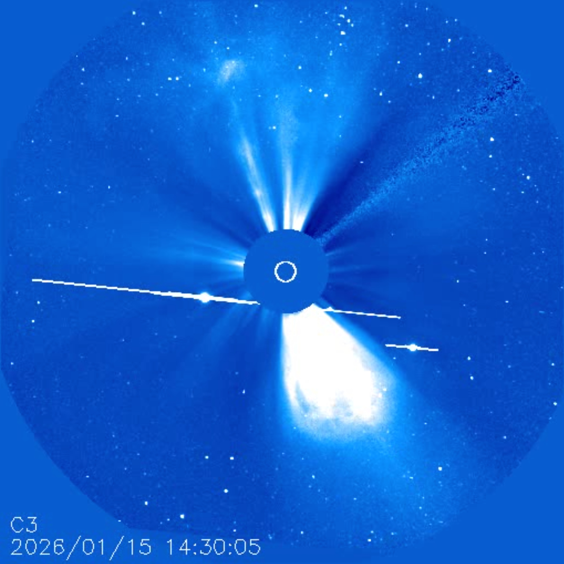
At the moment of production of this text (2.03.2026), the newest SOHO corona images (C2, C3, D2, D3) are dated January 15.
Given the latest solar corona images, we can visit spaceweather.com, which provides a daily fetch of NASA/SDO coronal holes (Pic. 21).
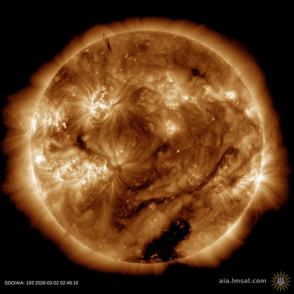
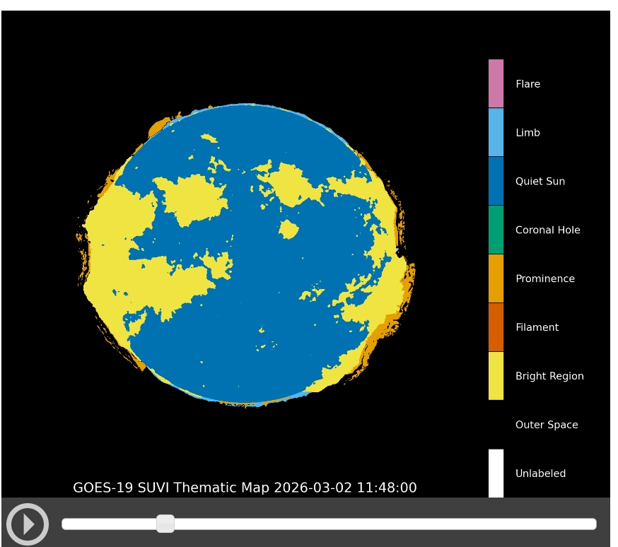
By clicking « More Info » at Spaceweather.com, we are redirected to the GOES Solar Ultraviolet Imager (SUVI), which features daily images of the Sun from a sophisticated extreme ultraviolet telescope. The results of the imagery presented across the several bands are illustrated as a solar thematic map (Pic. 31) on a given day.
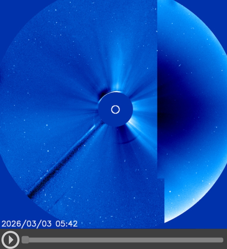
Moreover, in other sections of this website, the actual images of the LASCO C2 and C3 coronal mass ejections are available (Pic. 32).
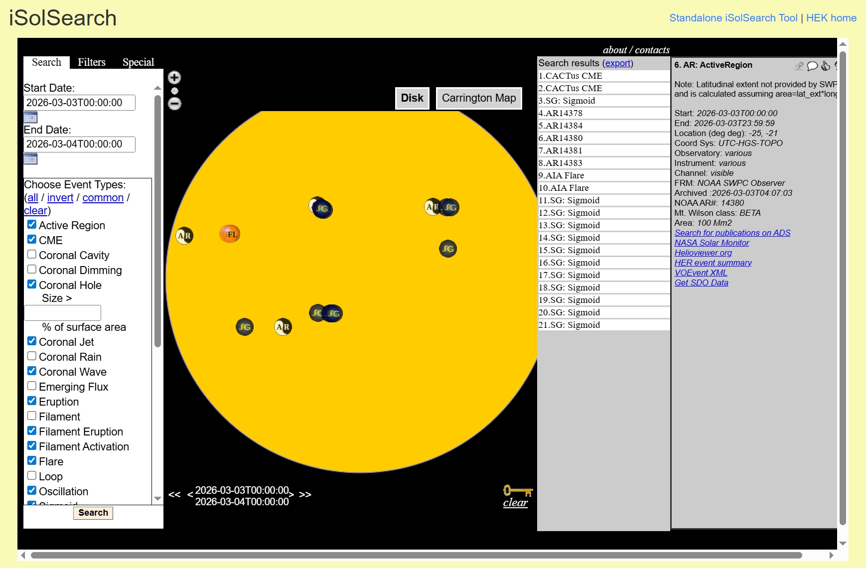
When you need more details about the daily situation on the Sun, it’s vital to visit this website, where you can find more daily images of the Sun and especially the standalone iSolSearch tool dedicated to heliophysics and advanced solar observers (Pic. 33), allowing for the identification of solar activity structures in real time.
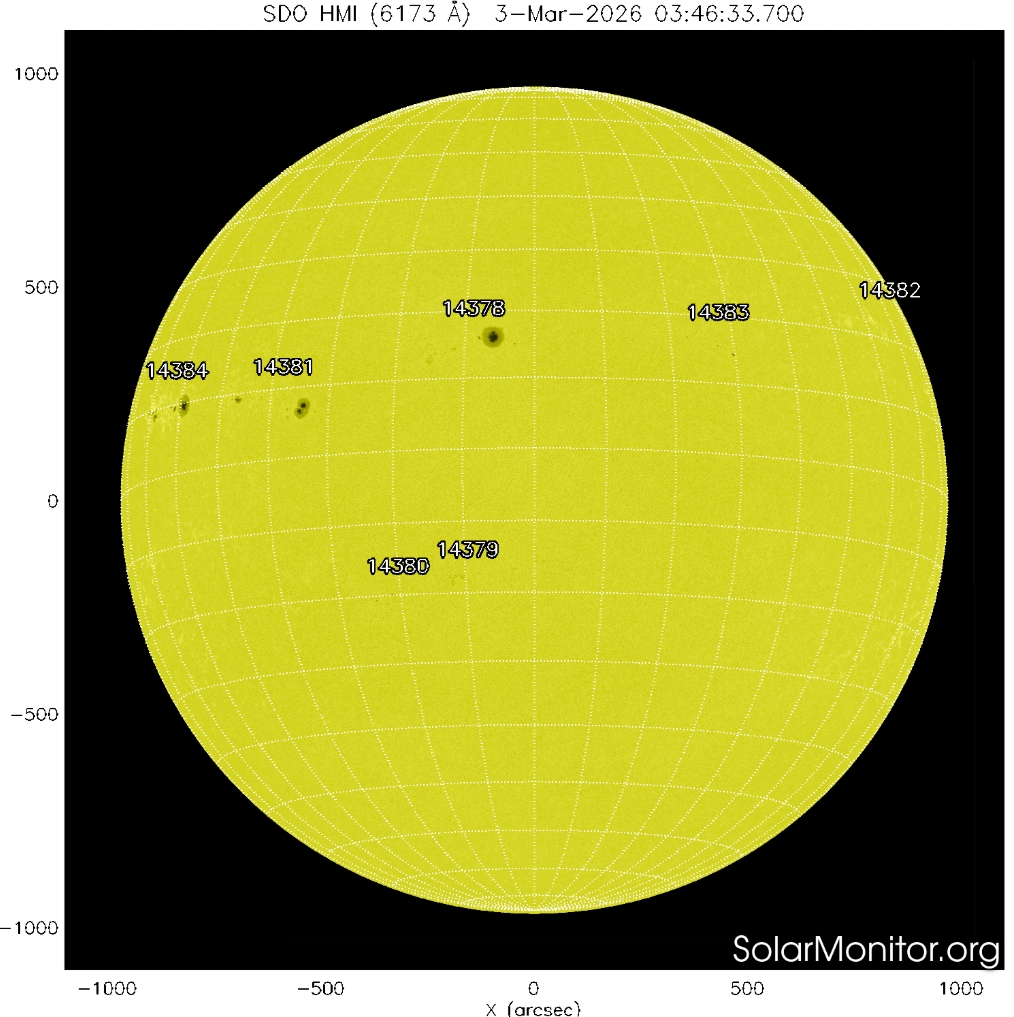
Another detail of the sun’s daily behavior can be found on the Solarmonitor.org website. The general daily map of the Sun in the SDO DMI (6173 Å) can be interesting for the partial phase of the eclipse because of a clear indication of sunspots (Pic. 34). An observer can see how the lunar limb swallows the sunspots during the eclipse.
There are at least a few other websites where we can get the latest images of the Sun, like, for example, here.
The last thing to mention here is, finally, the forecast of solar corona visibility. The best forecast can be gotten just a few days ahead. A good example is a solar image obtained by the Interface Region Imaging Spectrograph (IRIS). For long-term forecasts, we can see text data and expert comments. The example of various forecast data can be found on this website. For example, if we consider predicted sunspot numbers and radio flux, we can find a good tabular dataset here.
Getting around this presented data, we can deliberately plan our solar corona observation during a brief moment of totality. For some hints on how to prepare, we can use the old image sequences from a few days ago. A good example of collecting these images during the total solar eclipse observation can be found here.
B. SOLAR PROMINENCES AND THEIR MOVEMENT – Along with the prediction of the solar corona behavior, we can check what the solar prominences can look like in the near future, directly preceding the eclipse event. Typically, solar prominences become strikingly visible during total solar eclipses. Usually, a total solar eclipse means the Moon’s disk is slightly larger than the Sun’s. Thereby, some of the prominences are visible at the beginning of totality, and others at the end, about which you can read in detail in this article. Among eclipse phenomena, their apparent motion against the lunar disk offers measurable scientific value. Before and after totality, the chromosphere appears briefly as a thin pink rim. Simultaneously, prominences project beyond the lunar edge. Their shifting position along the dark disk reveals the Moon’s steady progression.
Observer location strongly influences perceived prominence motion. Near the centerline of totality, transitions occur rapidly because umbral depth reaches its maximum. Consequently, Bailey’s Beads and chromospheric flashes last only seconds. However, near the umbral boundary, geometric alignment prolongs these transitional effects. In that configuration, a major prominence appeared to rise above the lunar surface as the eclipse progressed.
Parallax further modifies the geometry of the third contact. The returning photospheric light emerges from different lunar valleys depending on the observer’s latitude within the umbra. Therefore, the diamond ring effect aligns with distinct prominence groups at separate locations. Comparisons between central-path and southern-limit observations reveal significant differences in prominence alignment relative to lunar topography.
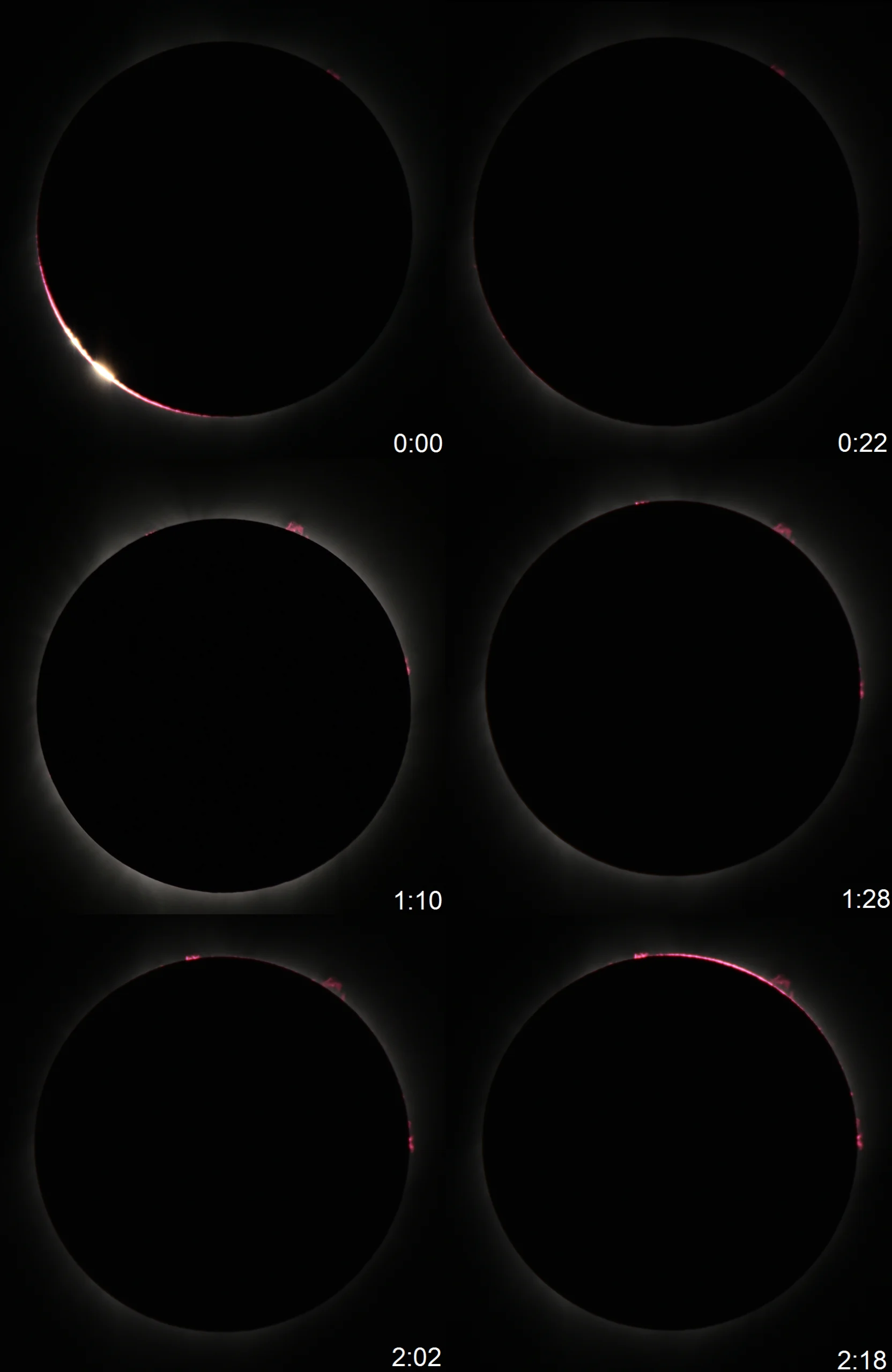
Image sequences from 2017 confirm that prominence morphology evolves rapidly during totality. Even within seconds, brightness and structure change noticeably. Continuous imaging thus provides essential data for analyzing plasma behavior and geometric displacement.
In summary, prominence motion during total eclipses reflects the combined influence of lunar motion and observational geometry.
C. FLASH SPECTRUM – is an array of wavelengths detectable in the emissions from just above the limb of the Sun during the flash periods occurring with the very first and very last light from the solar limb. As the photospheric continuum vanishes through the bottom of the lunar valleys, it’s replaced by an array of wavelengths emitted from the lowermost layers of the solar atmosphere. When the photosphere is entirely hidden behind the lunar limb, the lowermost layers of the Sun’s atmosphere flash into prominence, and the flash spectrum briefly appears, showing bright lines produced by hot, luminous gas. A flash spectrum provides an opportunity to study the physical state of the solar chromosphere. Normally, we can’t see the chromospheric emission lines because their luminance is much weaker, since they are emitted in all directions. During a total solar eclipse, an observer can see the most dominant hydrogen lines in a Balmer series (bright reddish, aqua, and blue arcs); next, calcium H and K; and the single ionized helium (yellow arc), magnesium (bright green arc), and sodium (faint yellow arc). All these spectra determine the chromosphere’s final, purplish-pink hue visible during totality.
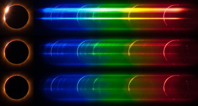
The chromosphere has an angular diameter of only 10″, so from our perspective, we have only a few seconds for capturing this phenomenon. Alternatively, we can position ourselves near the edge of the totality path to slightly elongate this period.
The flash spectra can also be produced artificially by applying slit-less spectroscopy.
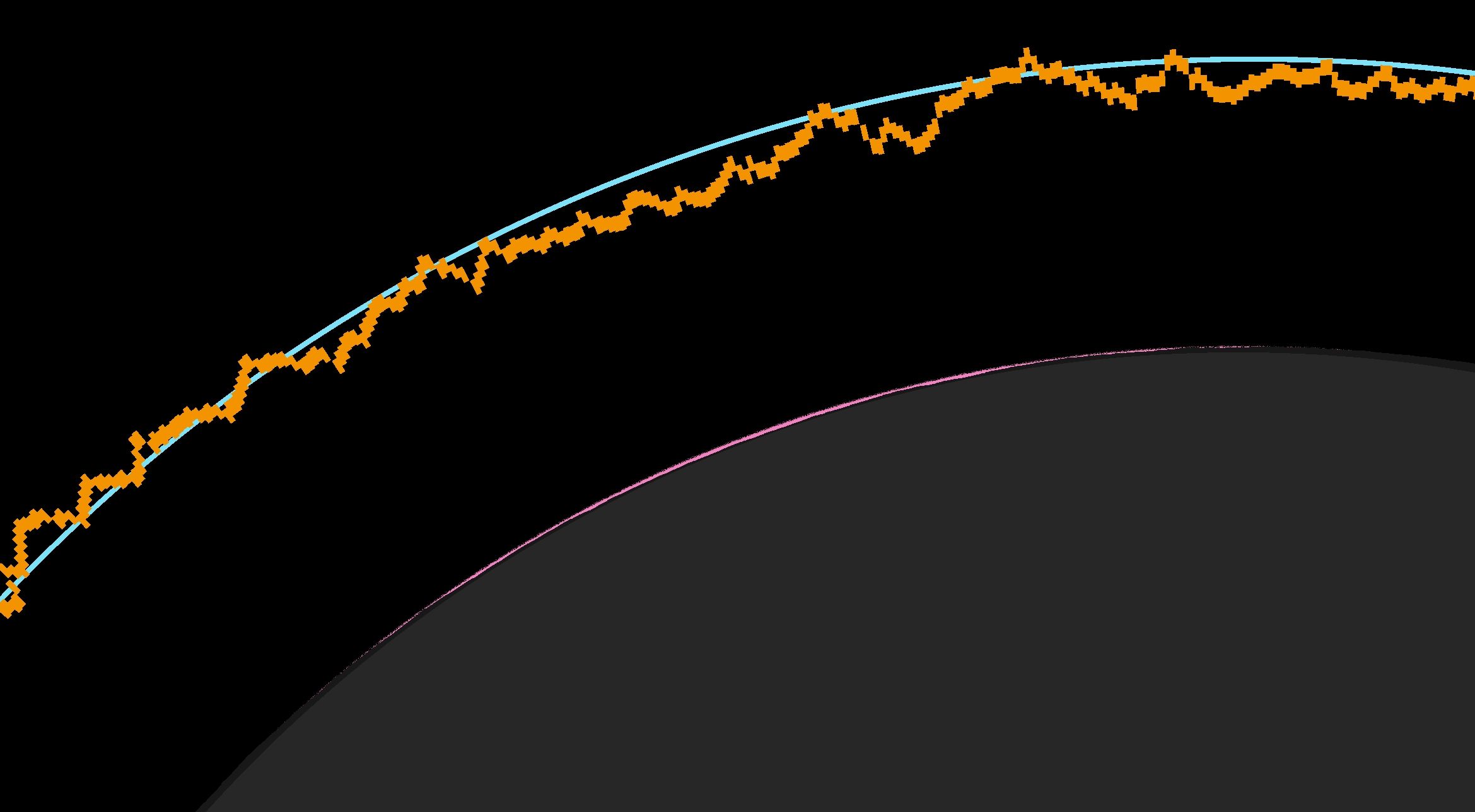
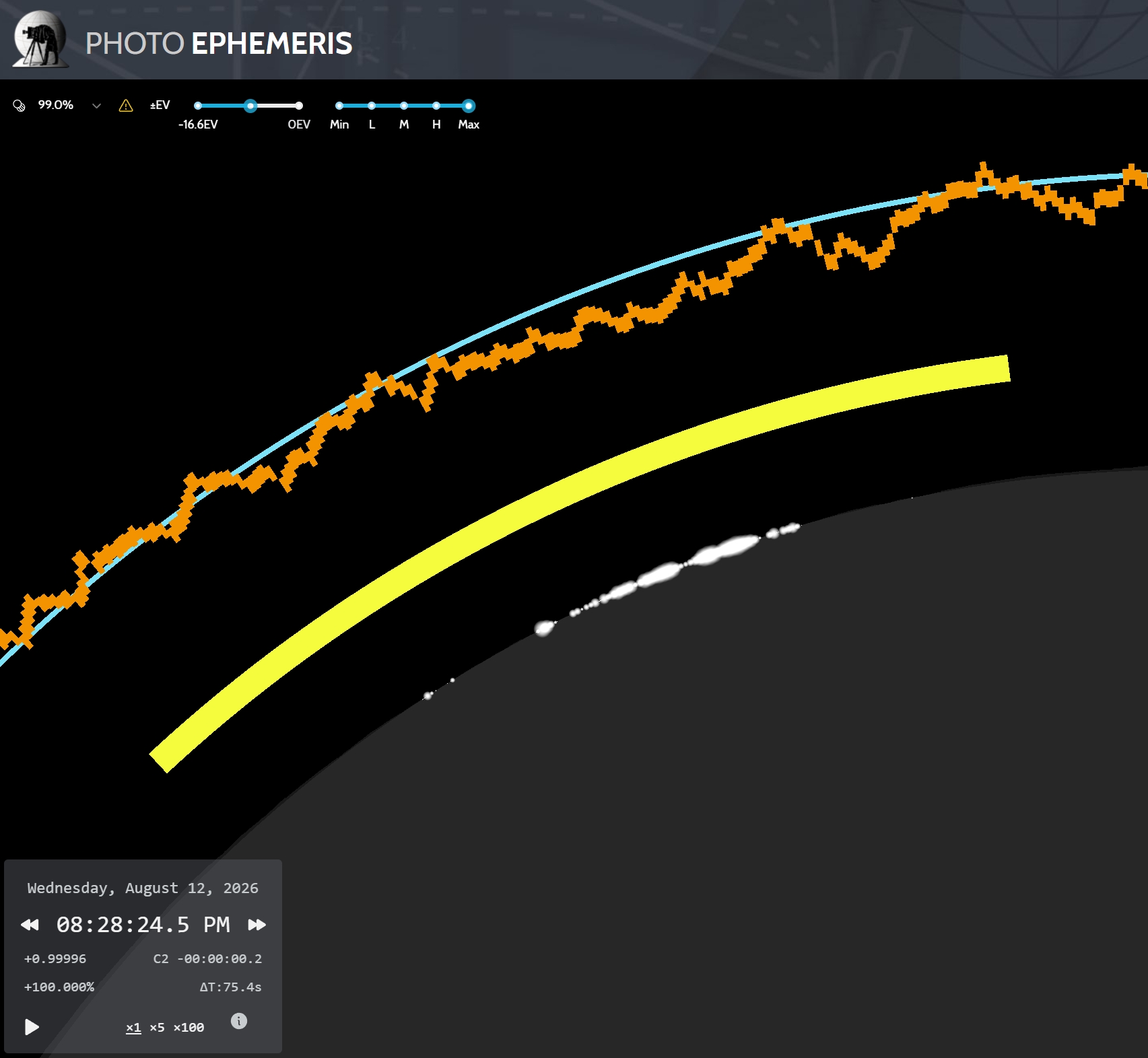
D. BAILY’S BEADS – are caused by rugged lunar topography, which allows the solar rays to shine through the Moon’s valleys. The most effective Bailey’s beds can appear around 22 seconds before totality, when obscuration is greater than 99.5%. You will find a lot of information on the internet about Bailey’s Beads and their reports. Because this thread is dedicated to supplementary stuff, I can share the fantastic tool, a genuine counterpart to Xavier Jubier’s Solar Eclipse Maestro, unfortunately available only for macOS. By purchasing the Pro version of the PhotoEphemeris web-based application, we have access to a modern eclipse simulator that provides Baily’s beads predictions on the same basis as the Solar Eclipse Maestro. As a result, we have the eclipse panel where these events can be visualized under various lightning conditions. The example is shown below (Pics. 38 and 39), and some circumstances for random eclipse locations are considered, as described in subchapters 5.1, 5.2, and especially 5.3.
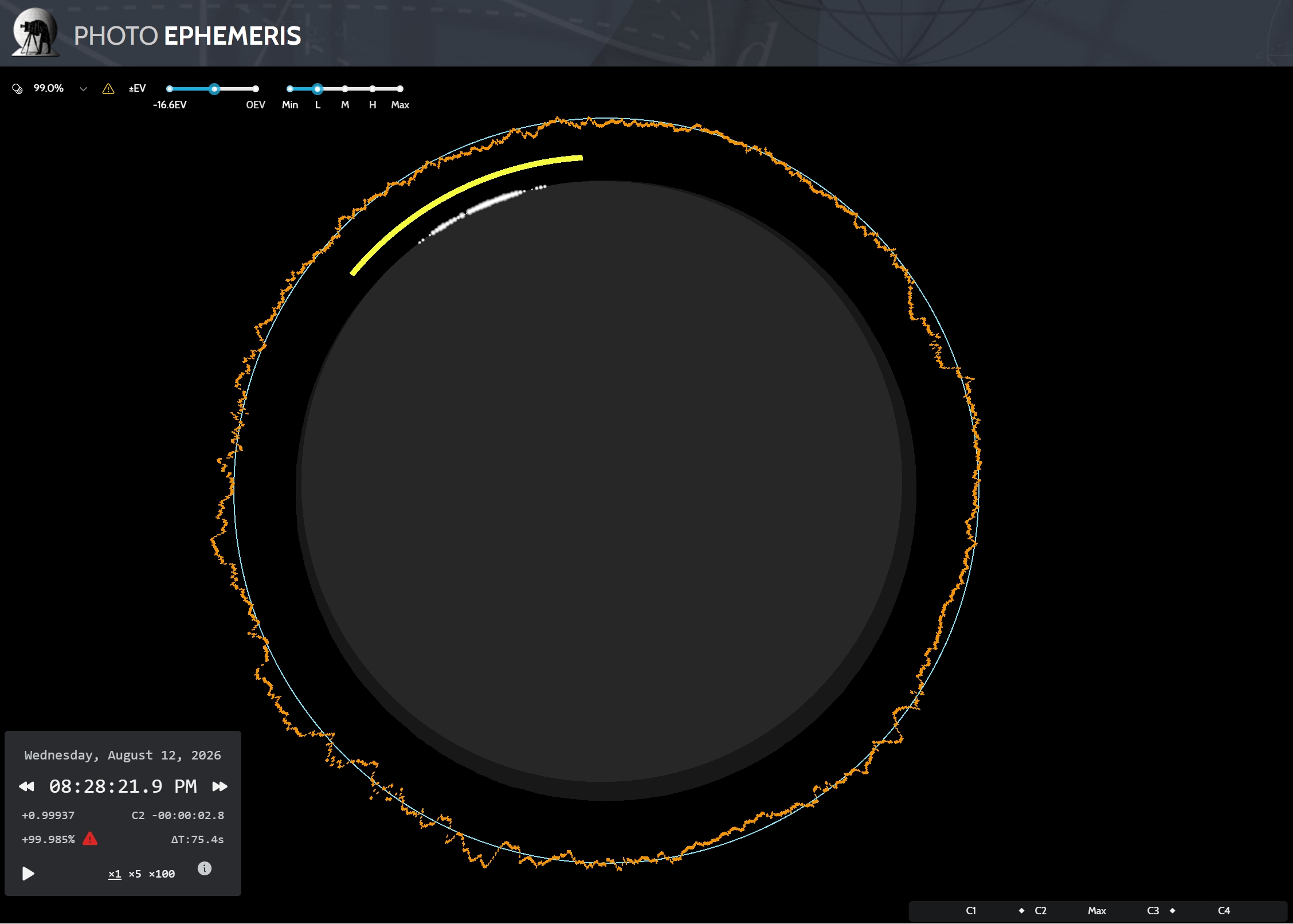
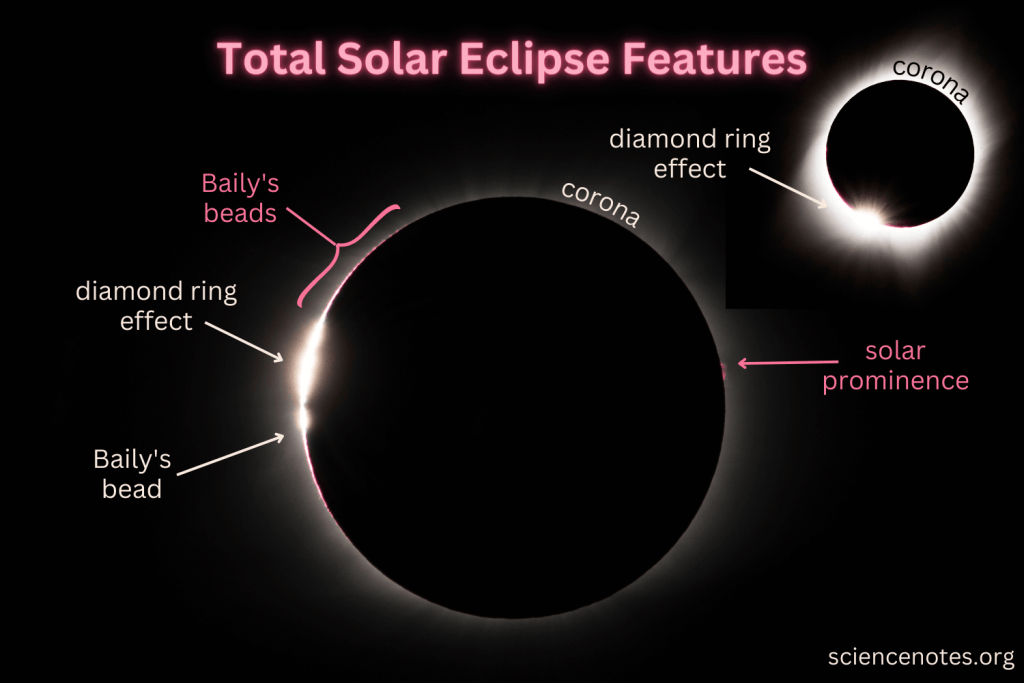
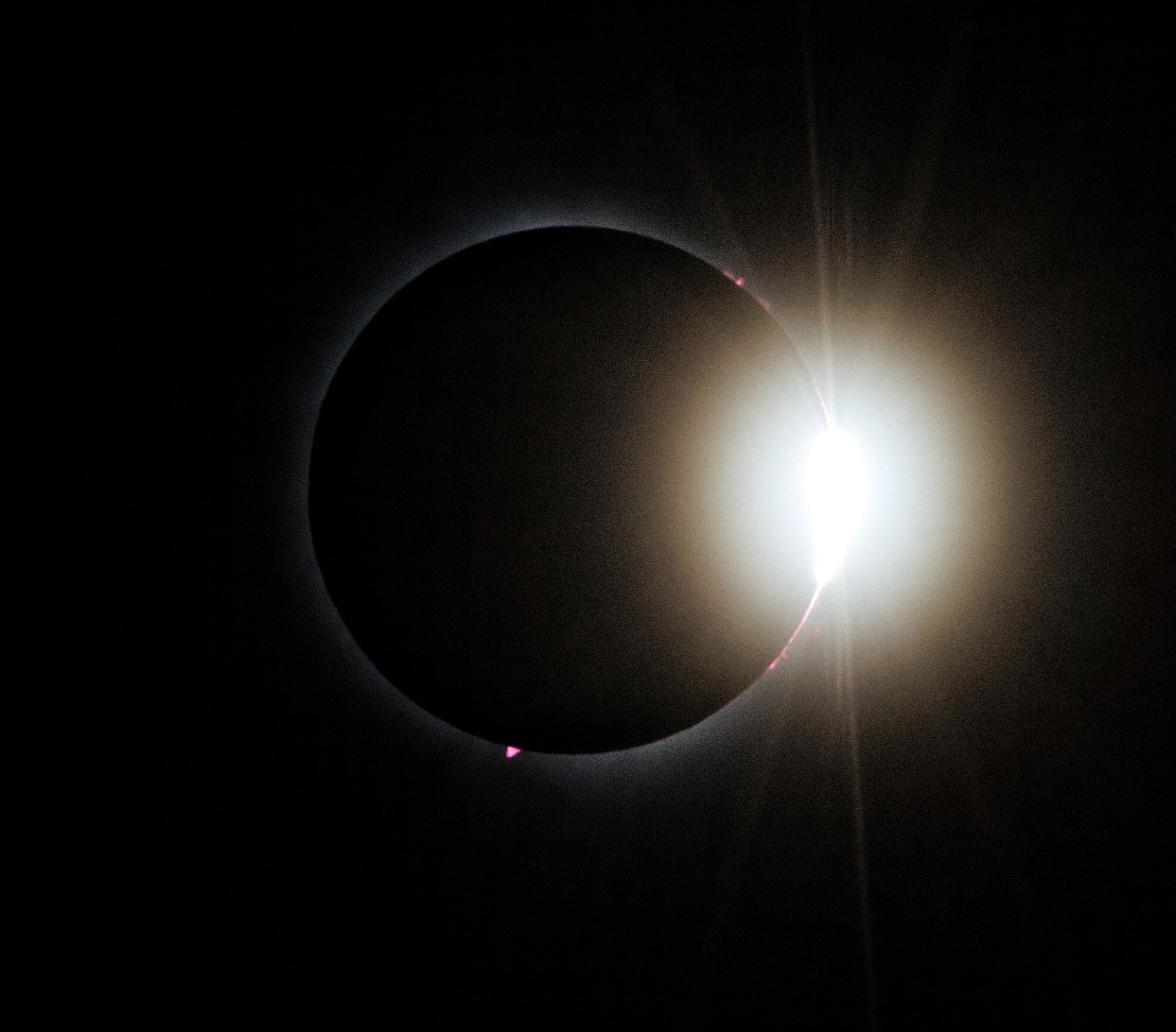
E. DIAMOND RING – This is the most distinct feature of the eclipsed Sun, which is observed along with the Baily’s beads. This is a glittering diamond (final spot of solar beams) set on a ring (bright solar corona), visible about 10-25s before totality completes (Pic. 39).
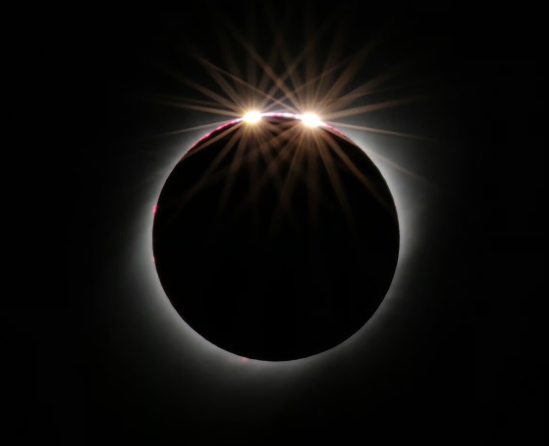
For short-duration totalities or when an observer is placed at the edge of the totality path, the double diamond ring is possible. The key role played by the lunar limb profile on the day of the eclipse.
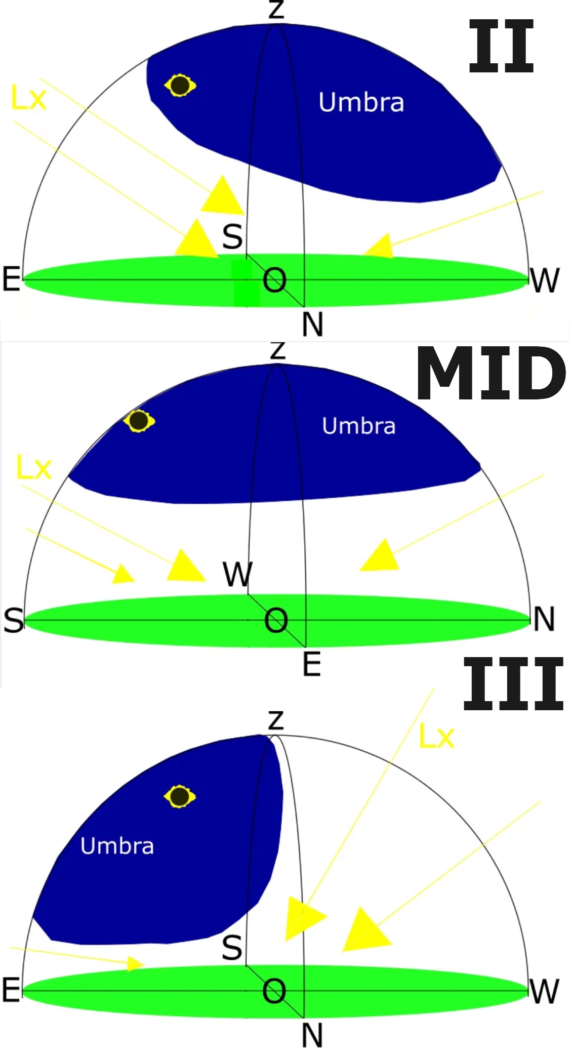
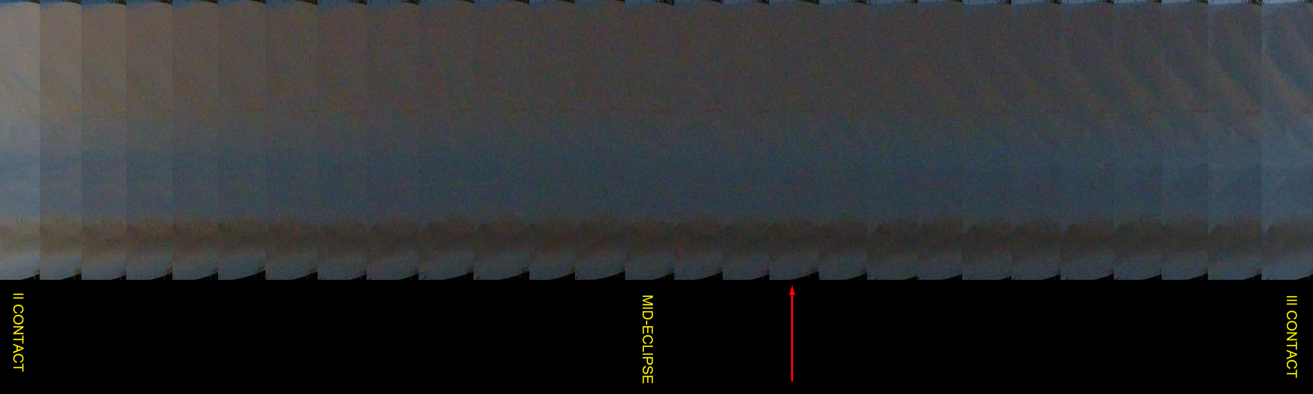
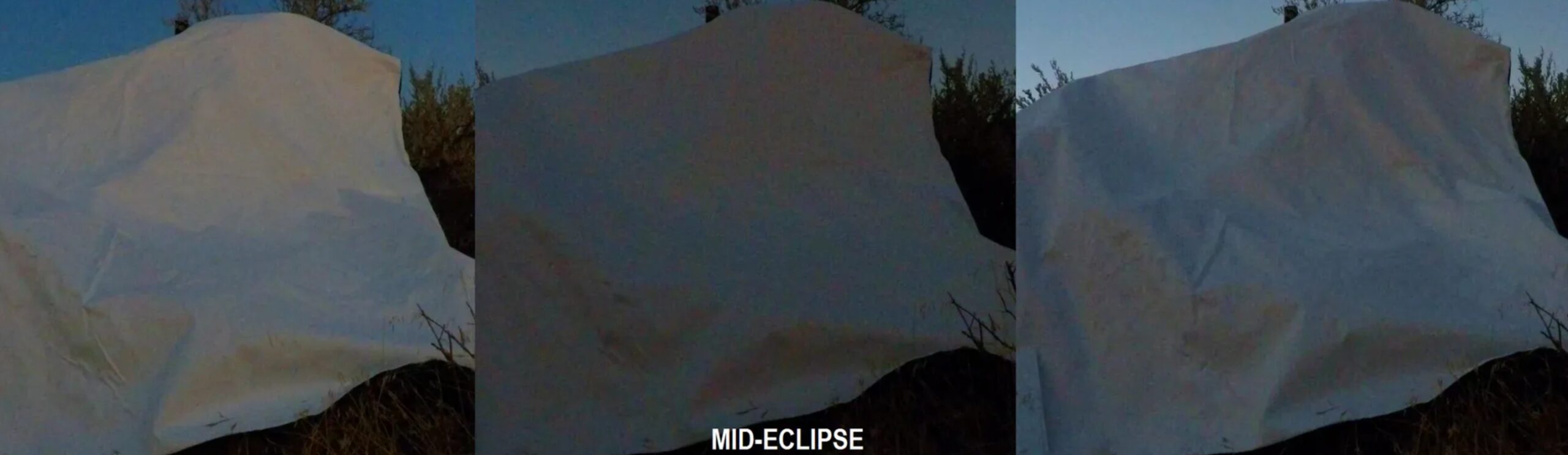
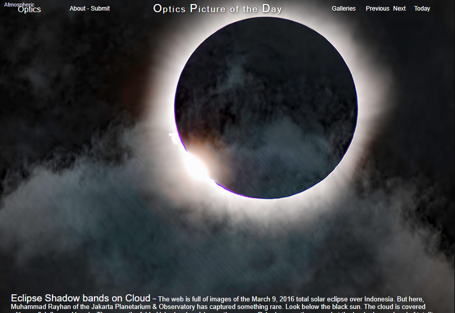
F. SHADE MOVEMENTS AND SURFACE CHANGES – The effect, which can be observed on the occasion of watching shadow bands, has been described in detail here. Since the white plain surface is placed, as it’s usually not flat enough, we can see some shaded areas within it. They help to understand that atmospheric light scattering during totality requires analyzing the spatial distribution of illumination around the observer. The phenomenon can be examined at three principal stages: immediately after second contact, near mid-eclipse, and just before third contact.
Just after the second contact, the solar disk became fully obscured, yet the atmosphere outside the umbra remained illuminated. Consequently, the brightest scattered light originated from the shadow-out sector of the sky. If this section occurs in the same part of the sky where the Sun is located, forward scattering takes hold. In turn, the observer sees enhanced brightness in this region due to the relatively small angular separation between the Sun and the adjacent illuminated atmosphere. As a result, the zenith appeared darker than the southeastern horizon during the initial seconds of totality.
5.1 Iceland
In general, all the important information about the 2026 total solar eclipse in Iceland has been presented on the following websites:
– https://eclipse2026.is/ is the main portal, where you can find maps (including an interactive map), the view of the sky, and very important practical sections like Where to See, Eye Safety, or the external link to the Rent a Car option. It’s the main and best Iceland solar eclipse website, highly recommended for a practical guideline for everyone. Some additional information about the total solar eclipse in Iceland can also be found on the National Eclipse website. Because my text serves as supplementary content, I can add additional info on eclipse conditions for some case studies.
At first, let’s consider the capital of Iceland—Reykjavik—with the detailed map below (Pic. 46).
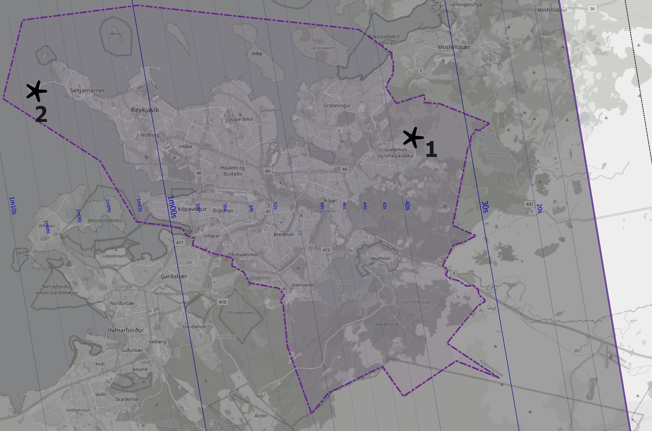
Within the Reykjavik boundary, the duration of totality varies dramatically, from 27s to 1m 13s. It must be translated into the umbra position in the sky and into the Baily’s Beads projection, as presented below.
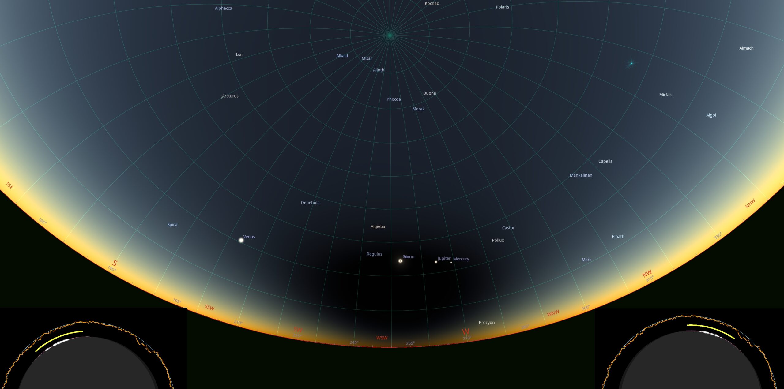
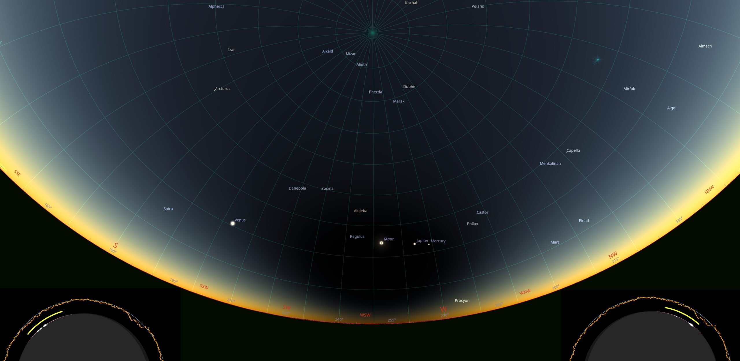
Some additional sky conditions for Iceland were considered in Chapter 10. Regarding the diamond ring’s appearance, the image below shows what it will look like from Látrabjarg, located closest to the centerline (Pic. 49).
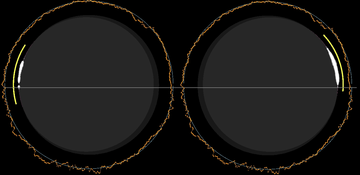
The Látrabjarg point has the best 2026 total solar eclipse location because of the duration (2m 13s) and the Sun’s altitude above the horizon, which is almost the highest along the entire path (approximately 26°). Because the place is located just about 40 km from the point where the eclipse reaches maximum altitude over its path and around 35 km to the centerline, the progression of totality is quite typical. The image above shows the diamond ring position at the second and third contacts relative to the gray line, which divides the solar disk in half. As you can see, the position of the diamond ring isn’t aligned ideally with this line, which is the consequence of a distance from the centerline towards the north. Additionally, the umbral depth of this place is about 75% instead of 100%. By analyzing the lunar limb profile, we can adjust our observation place to the size of Baily’s beads and the diamond ring effect! Picking the location with the longest duration isn’t always a good choice, though it depends on what we want to see. It will be explained in further readings.
More detailed maps are presented on the website mentioned above. Unfortunately, what is missing there is the list of potential observation venues where you could set up with a nice view and watch the eclipse. Including the noteworthy optical phenomenon, which is the visual range extension during totality, I would suggest the elevated and « open-horizon » places, which are, in fact, easily accessible and covered by the Google Street View, so we can easily identify the horizon. See the maps with points included and refer to the list below.
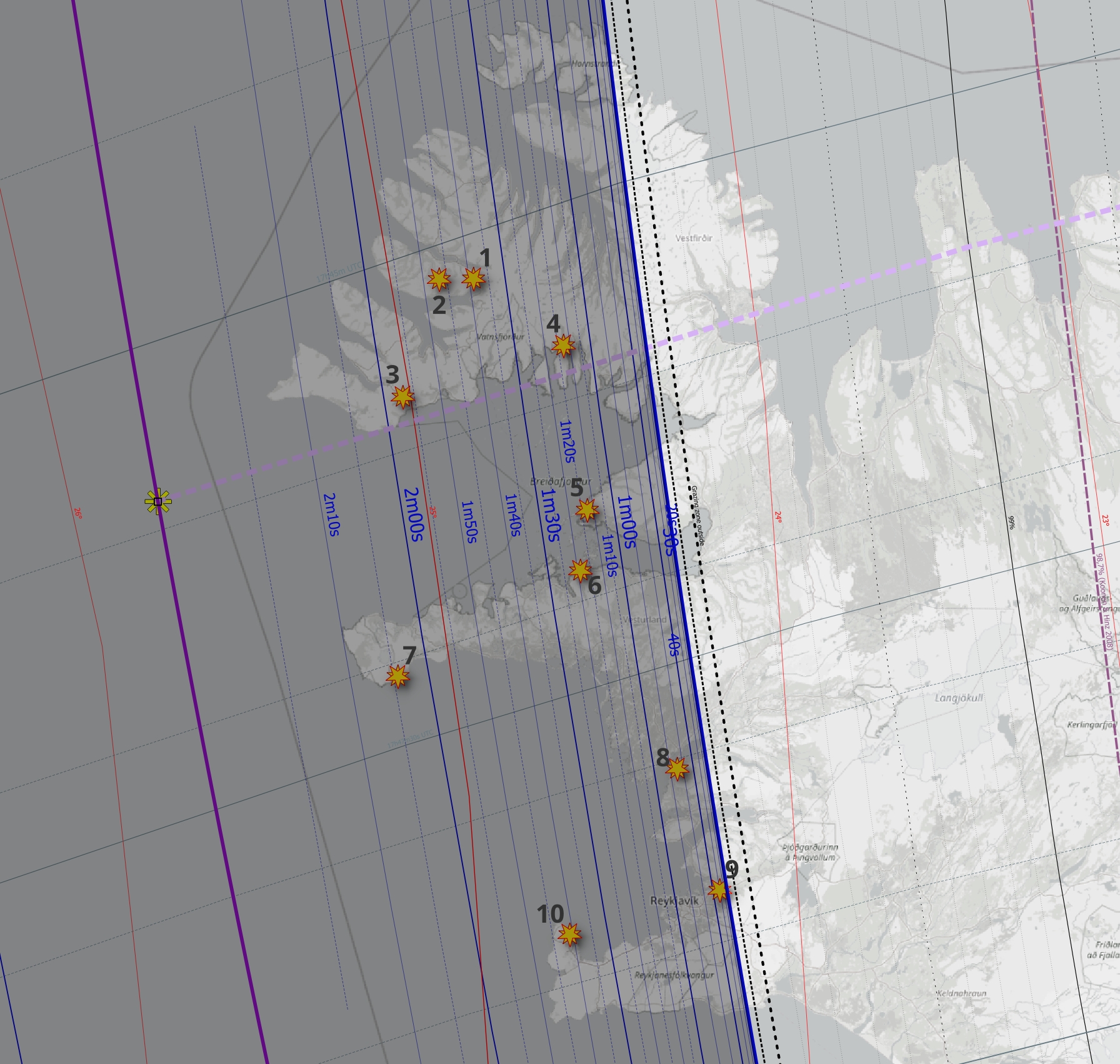
Point 1 – Google Maps – Google Street View – Ulrich Deuschle Panorama – Xjubier Map
Point 2 (Hrafnseyrarheiði mountain pass) – Google Maps – Google Street View – Ulrich Deuschle Panorama – Xjubier Map
Point 3 – Google Maps – Google Street View – Ulrich Deuschle Panorama – Xjubier Map
Point 4 – Google Maps – Google Street View – Ulrich Deuschle Panorama – Xjubier Map
Point 5 (Klofninsvegur) – Google Maps – Google Street View – Ulrich Deuschle Panorama – Xjubier Map
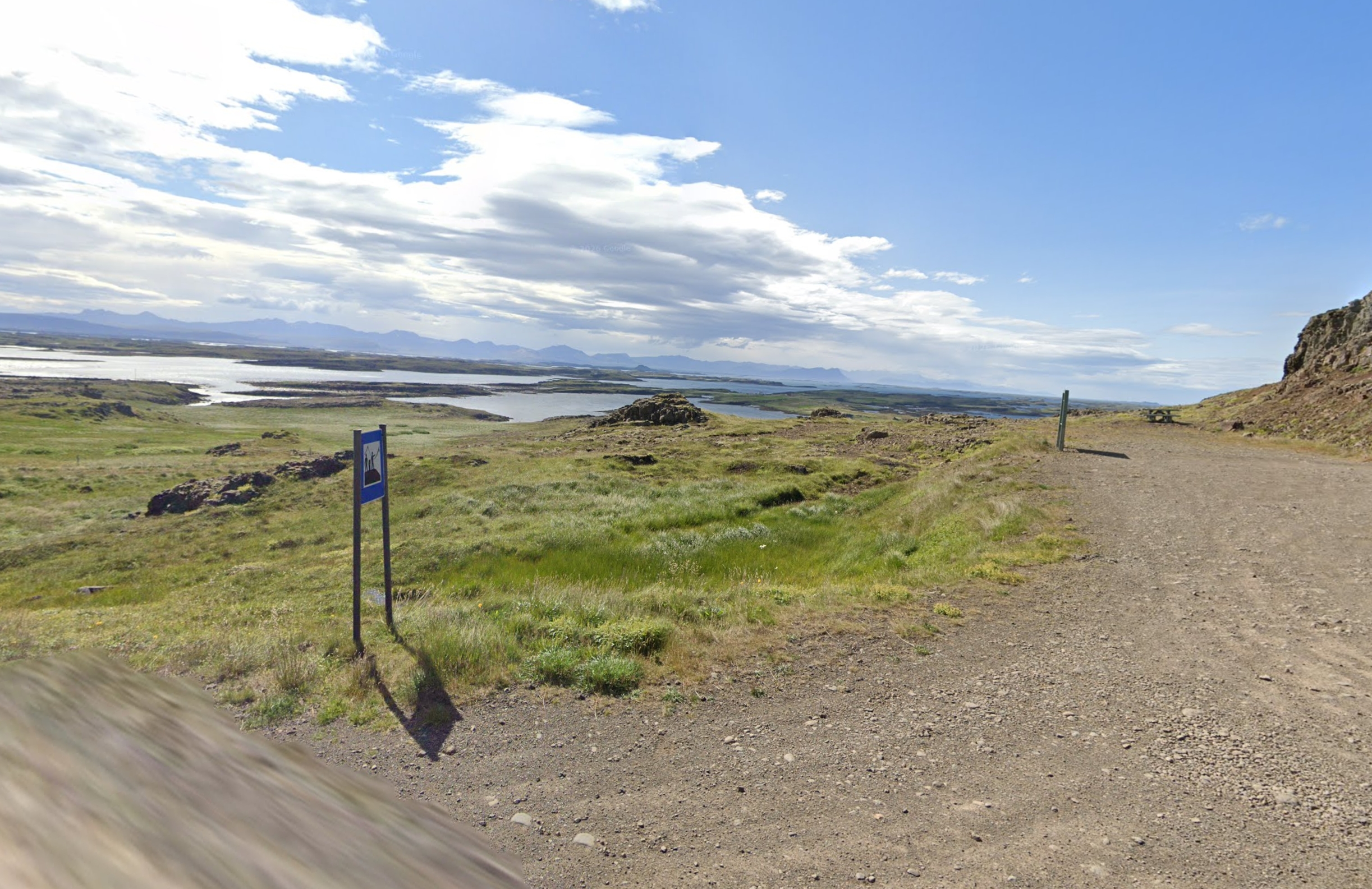
Point 6 – Google Maps – Google Street View – Ulrich Deuschle Panorama – Xjubier Map
Point 7 – Google Maps – Google Street View – Ulrich Deuschle Panorama – Xjubier Map
Point 8 – Google Maps – Google Street View – Ulrich Deuschle Panorama – Xjubier Map
Point 9 – Google Maps – Google Street View – Ulrich Deuschle Panorama – Xjubier Map
Point 10 – Google Maps – Google Street View – Ulrich Deuschle Panorama – Xjubier Map
These are only the top 10 random places. A similar view will probably be around the world too. If you live in Iceland or visit this country quite often, you will probably find more interesting venues. This section just gives you a hint as a supplement to the main page about the Iceland eclipse.
5.2 Spain
The largest portion of totality and the most popular eclipse destination for anyone is Spain. There is quite a lot of specific information available about the 2026 total solar eclipse. I am pleased to list them here and briefly describe their content.
SolarEclipseSpain.com – this website includes basic guidelines for preparing, finding a place, and watching the eclipse. In the same manner, the SpainSolarEclipse.com and Eclipse26.com websites were created. Other websites have dedicated tabs for the forthcoming eclipse event, like Eclipse-Spain.es. which includes information about all the eclipses in Spain. Not to mention the websites listed at the very beginning of this long text. Despite quite a short time until the eclipse event, there are still some websites in preparation, like SolarEclipse2026Spain.com, where you will find only empty tabs and space for content, which, in the long perspective, might look promising. Similar content is available on the TrioEclipses.es site, launched recently by the Spanish government. Admittedly, I could find at least a few others whose content is pretty much the same, including what to expect on the afternoon of August 12 and how to watch the eclipse safely. The worst thing is that there is no comprehensive website that includes all the necessary information, such as detailed maps, potential observation sites, weather predictions, etc. Everything, of course, we can find, but in general, the information is sparse, which is the primary goal of this section: to gather all of them together.
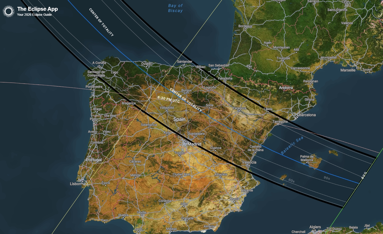
A. MAPS – There are interactive maps of the eclipse available on commonly known websites like NASA Eclipse, Eclipsewise.com, Xavier Jubier 2026 solar eclipse map, or TimeandDate eclipse map. However, they’re not the only ones! In recent times, we have seen the emergence of various interactive maps of varying quality. Amongst them, I would highly recommend TheEclipse.app, which displays the path of totality on satellite imagery (Pic. 35) and includes lines of the same eclipse duration.
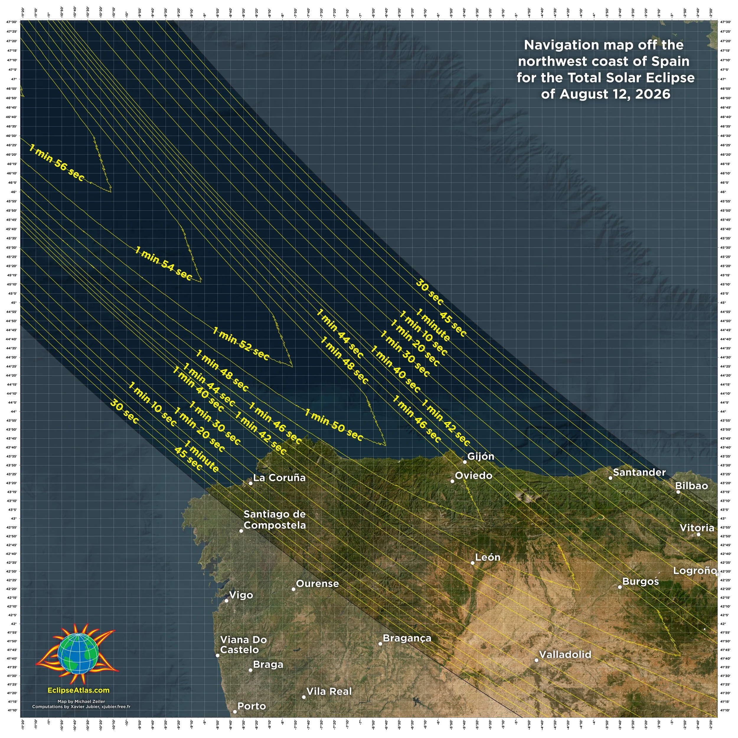
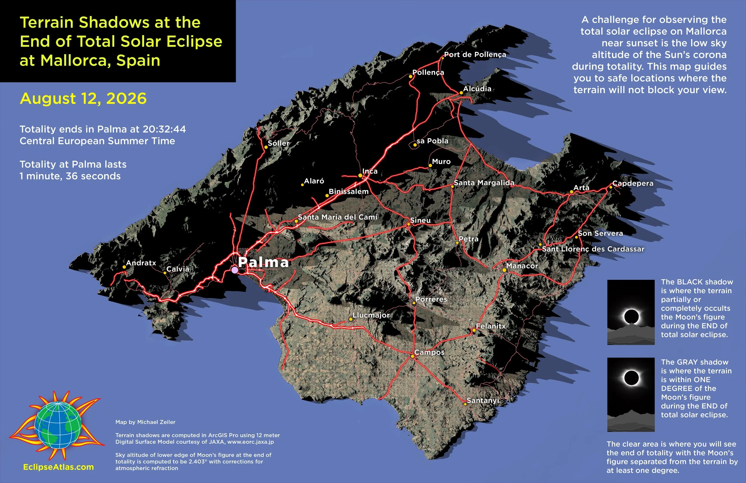
Apart from the interactive versions, it’s always good to have something like a poster map—a static mapping illustration of the event, which is good to look at straight away without clicking for more information. Sadly, this kind of map is missing from all the top eclipse websites for Spain, and anyone has to rely on EclipseAtlas.com, developed by Michael Zeiler, which provides fantastic, high-quality eclipse maps for any single event. One of them is shown below; visit the website for more.
Given the high level of detail in the street plan, you can see the most detailed eclipse maps for the largest cities across Spain (Pics. 54-61).
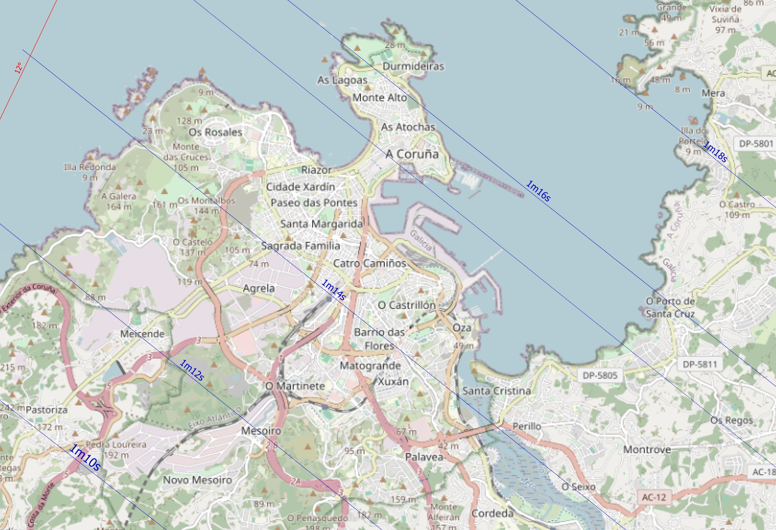
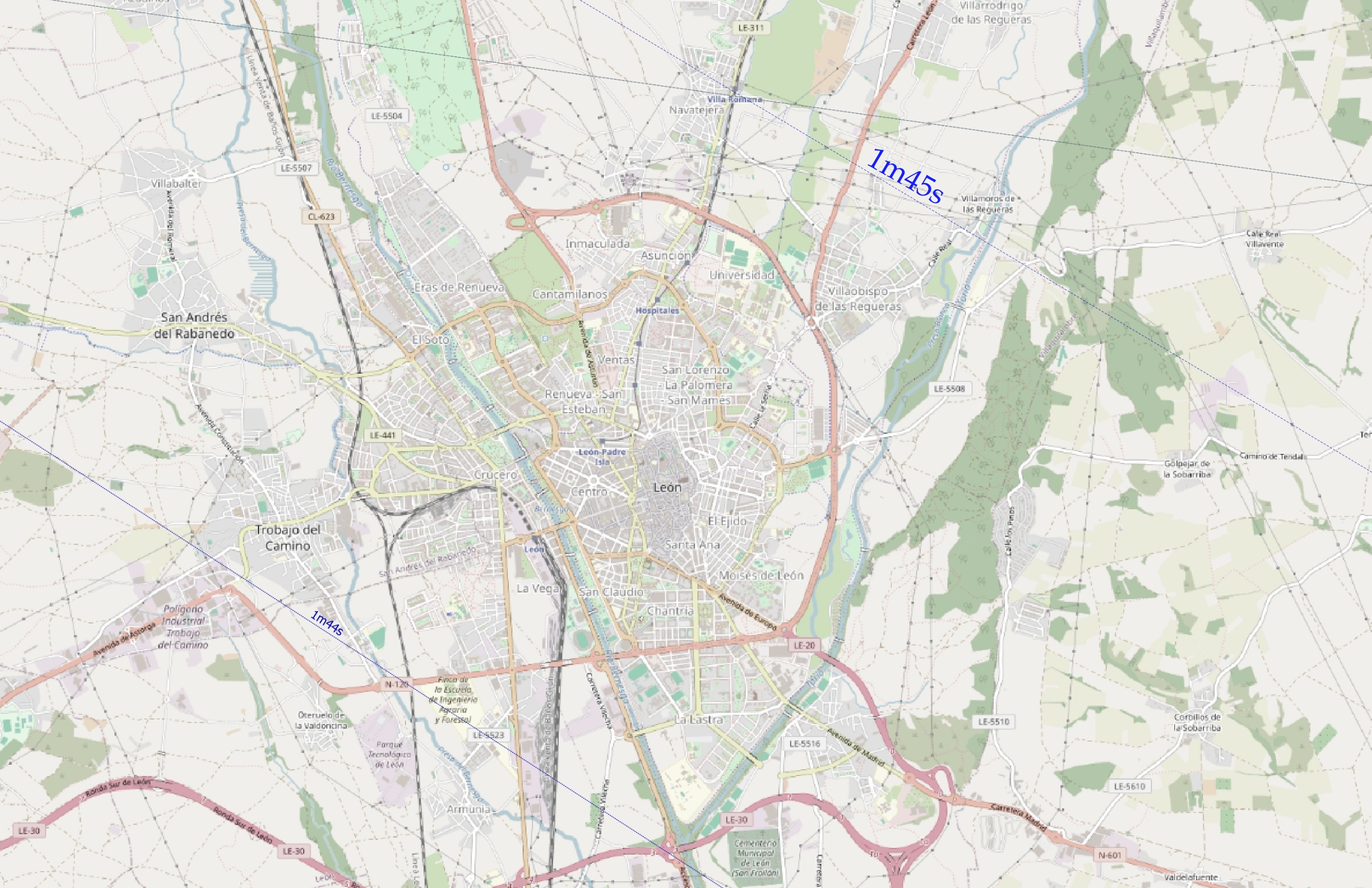
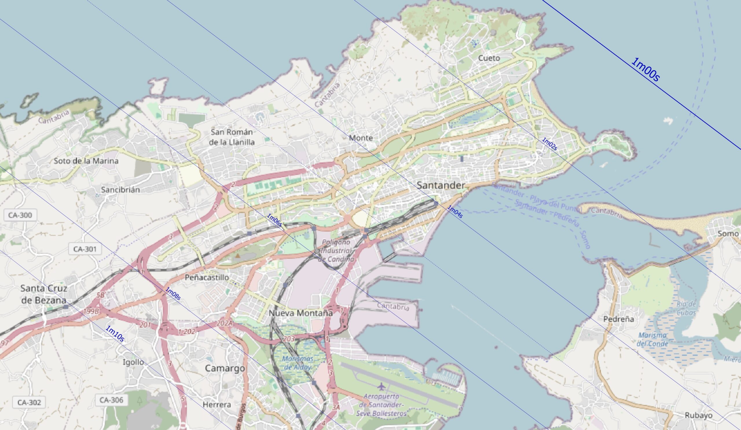
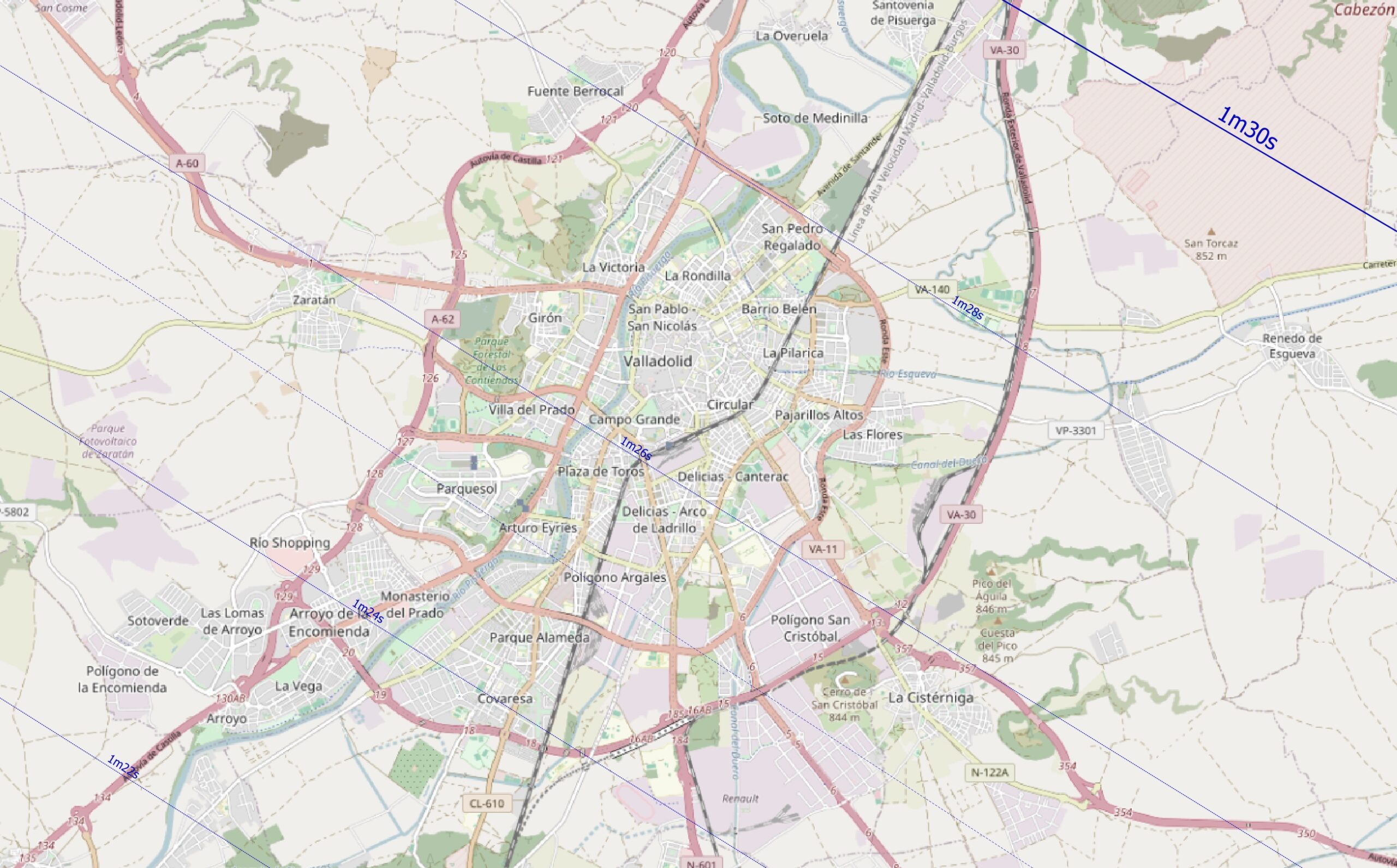
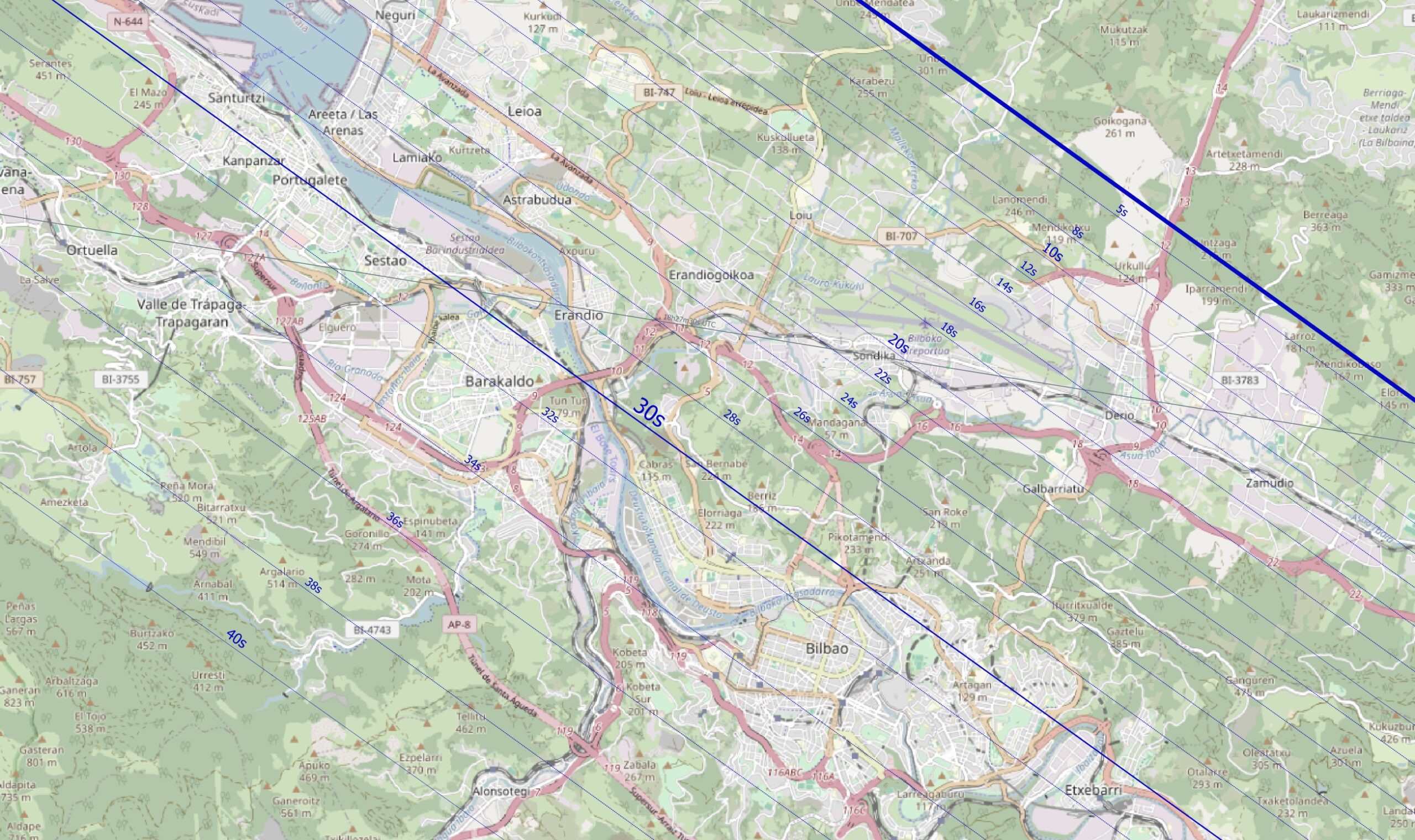
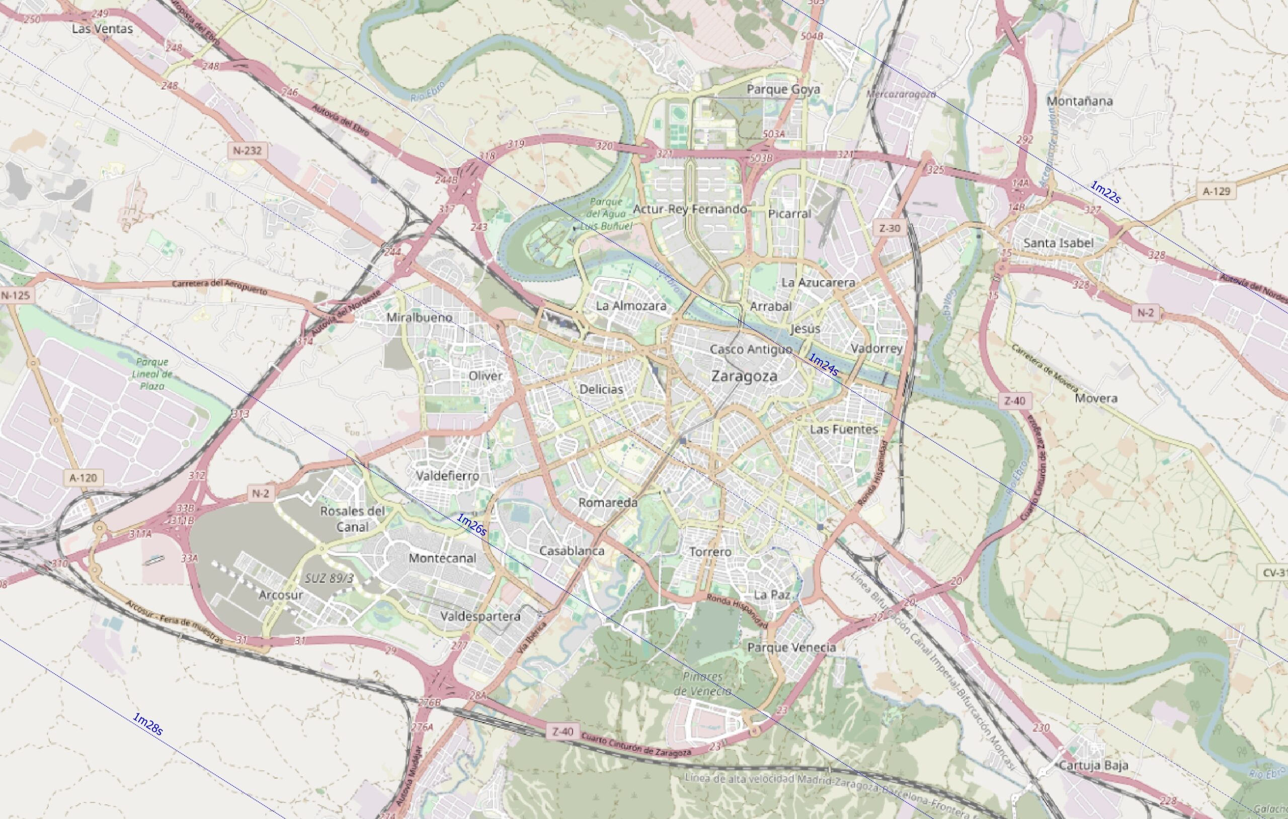
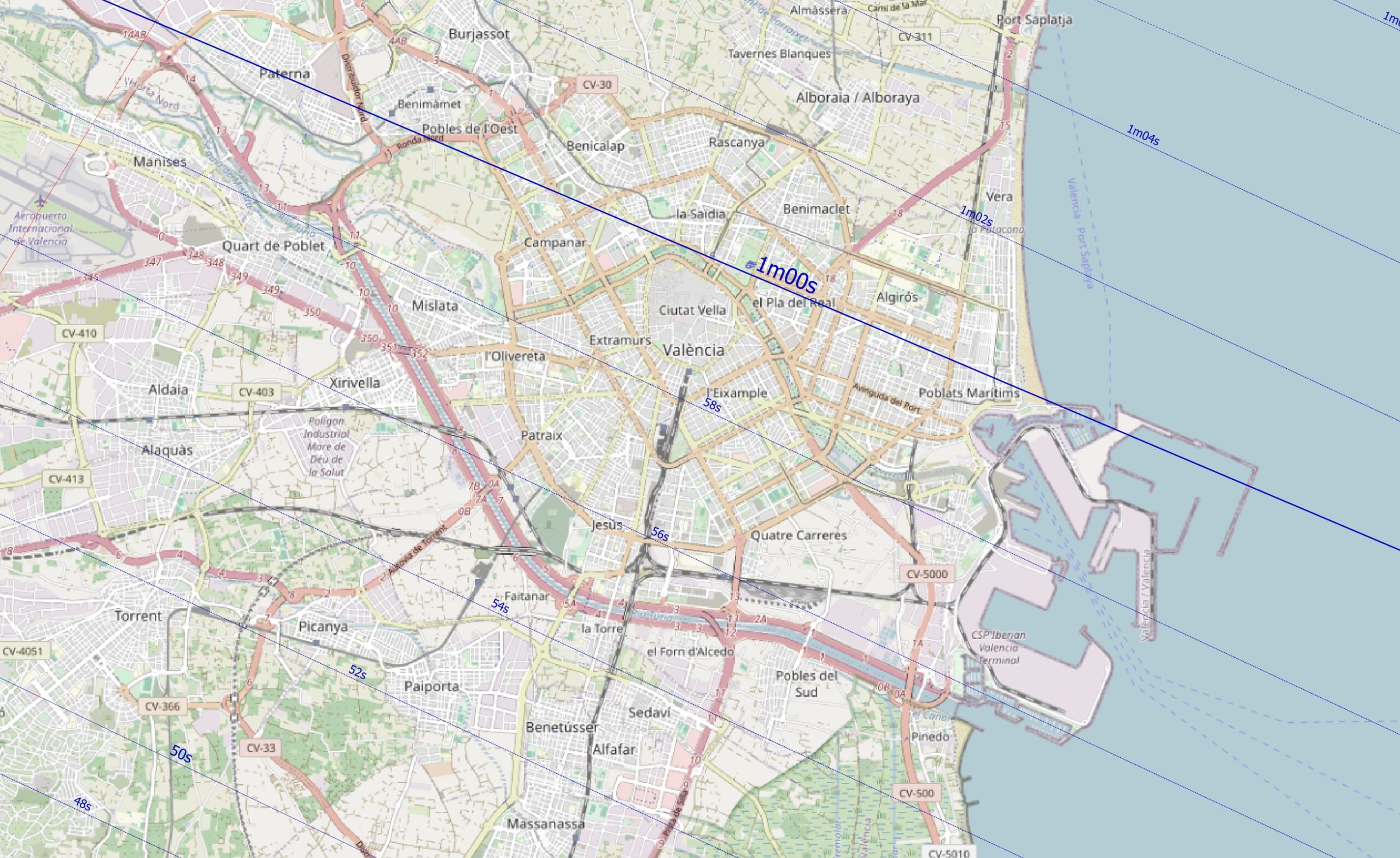
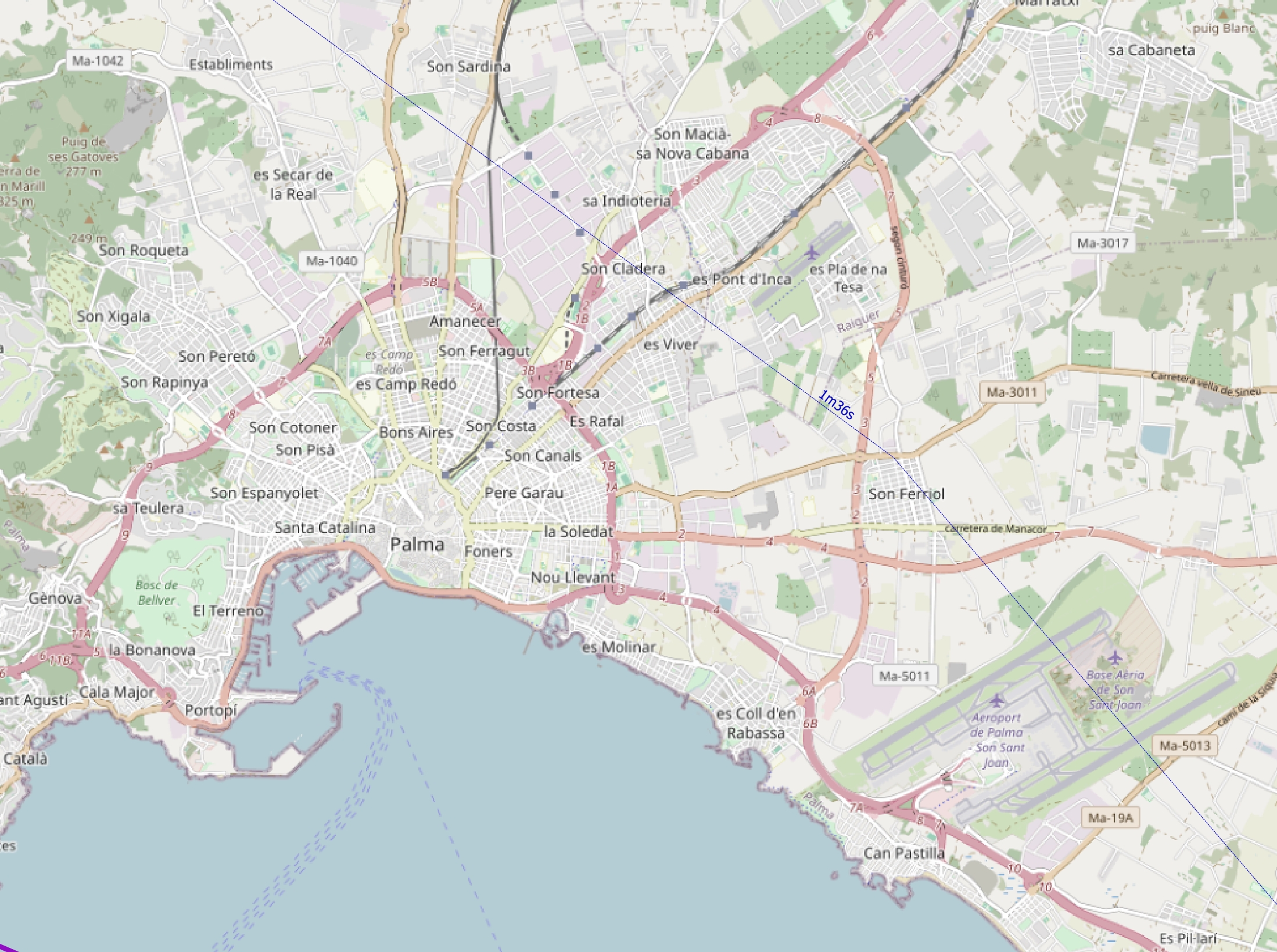
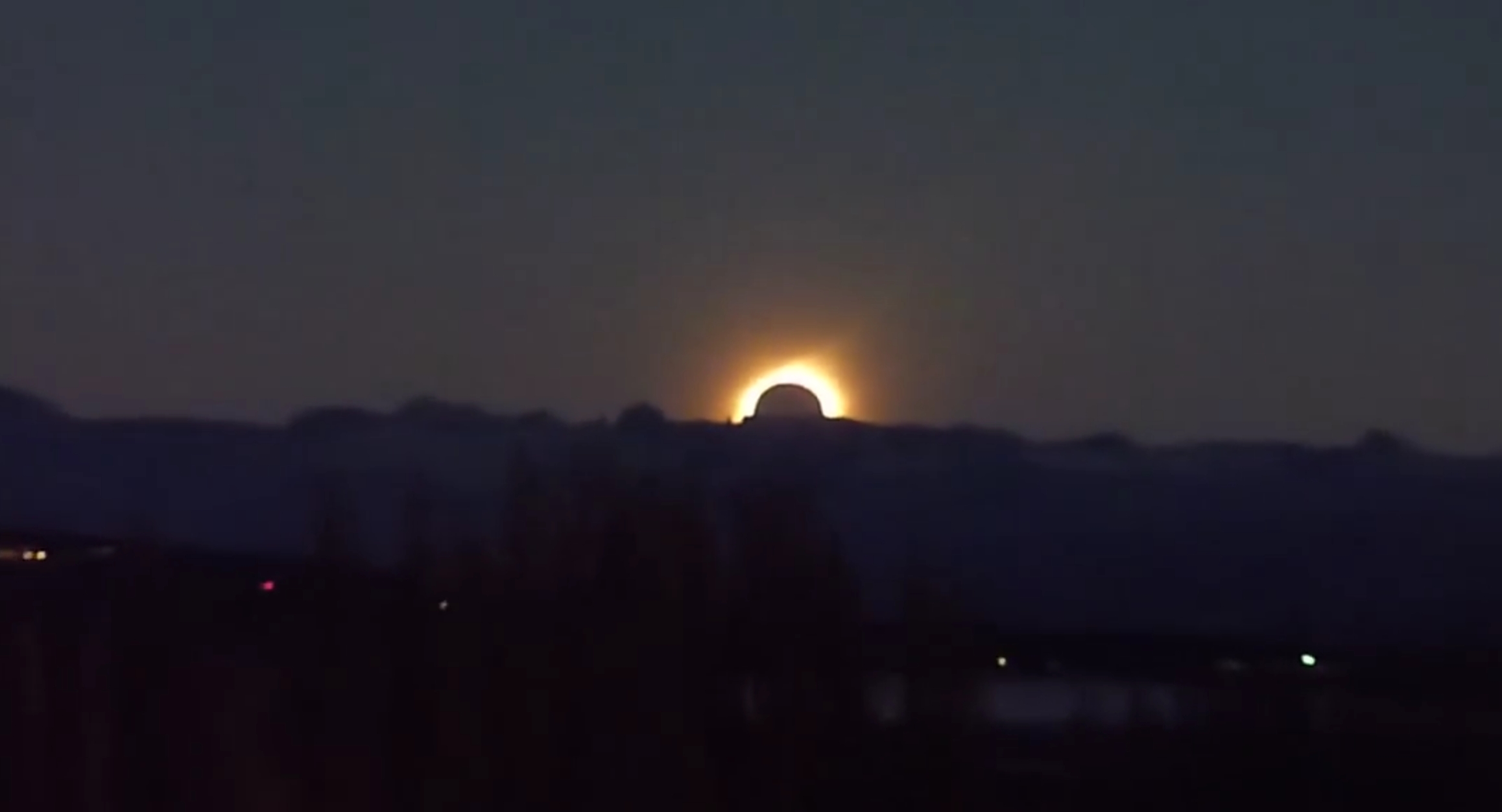
Unfortunately, the last map isn’t valid, as Palma de Mallorca will be completely shaded by the Sierra de Tramuntana, and the eclipsed sun won’t be visible! With respect to these circumstances, we need to go back to the very important section of the EclipseAtlas.com content, which is the work on 2026 eclipse shadow maps, which are necessary, especially in the eastern part of the Spanish mainland and specifically on the Balearic Islands, where the Sun will be very low above the horizon. The Terrain Shadows over Spain section includes a detailed map showing how ground features will chase the shadow at the moment of greatest eclipse. In Mallorca, for example, the totality visibility zones are planned to be determined on May 1, when the Sun has a similar declination to that on August 12, so the relevant information, including maps, will be published afterward. The observations of totality, when the Sun is very low above the horizon, are very risky, as sometimes people might locate themselves on too low grounds and see only the passing shadow instead of the eclipsed Sun. A good example was the observation of totality in El Calafate on July 11, 2010, as shown in the video below.
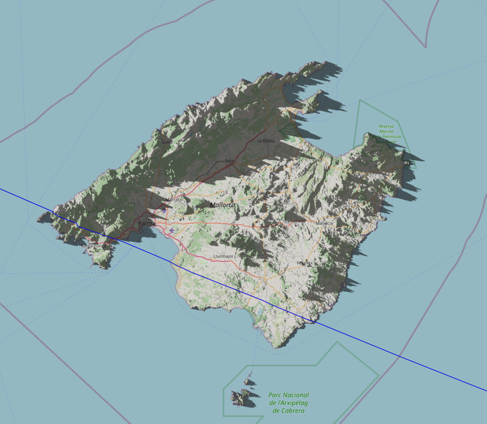
Alternatively, we can use the BesselianElements eclipse map (Pic. 64), which allows you to analyze the shadows cast by local topography at various zoom levels.
Another website, the Shademap.app, can render detailed shading conditions for us. However, they aren’t as good or elegant as Michael Zeiler’s map and can be used only locally when a large zoom factor is necessary, especially since this application also includes shadows from buildings and other artificial objects.
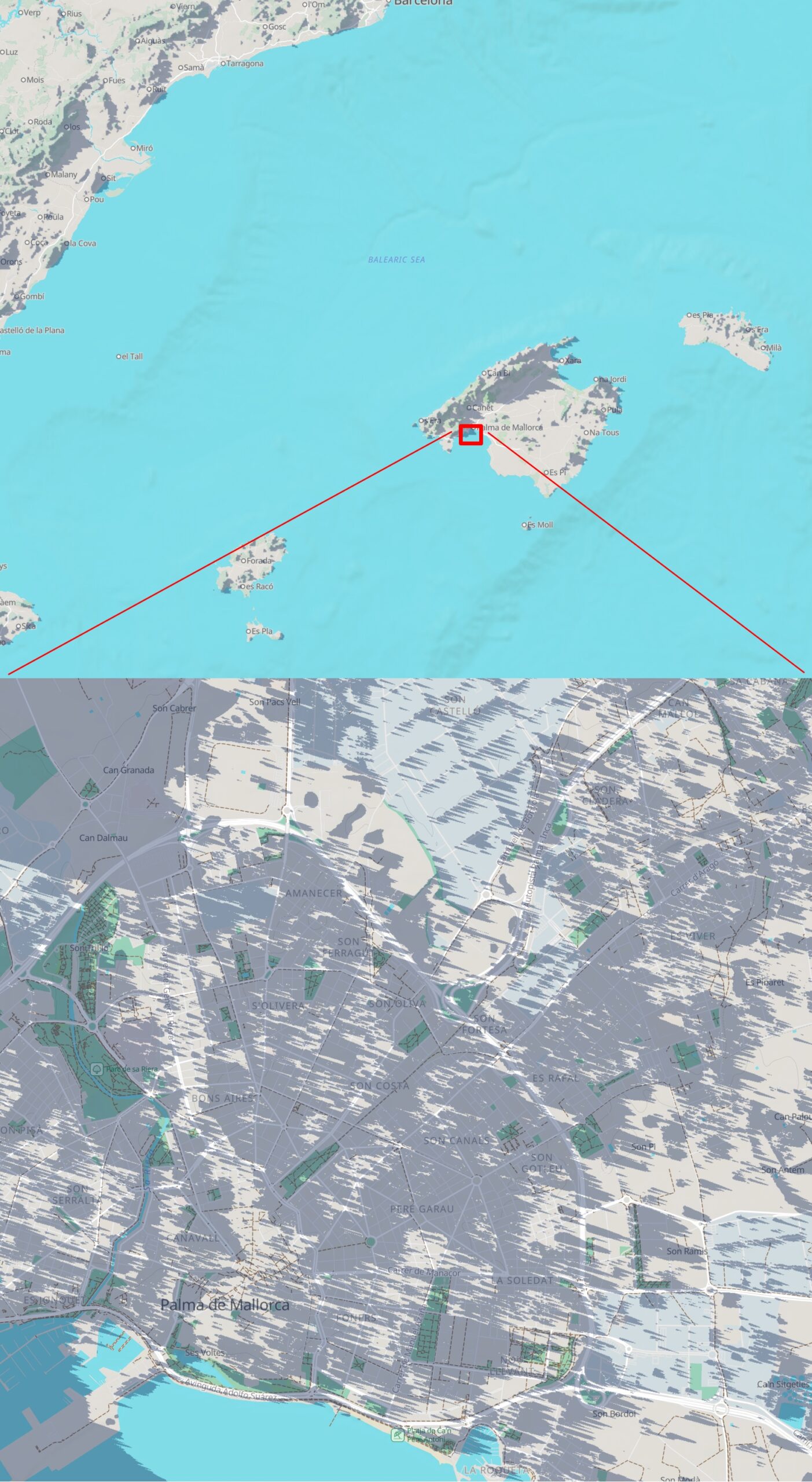
An alternative source of information about shadows in Mallorca is the Photoephemeris platform, which offers a free example. If you wish, this is a good GitHub tool that can be installed and run for more details based on the SRTM model.
Just recently, photoephemeris.com launched dynamic shadow maps for Mallorca and Northern Spain.

B. PLACES – As the area is enormous, it’s a great choice for planning your eclipse photography with some interesting objects. Some of them, UNESCO-listed, were discussed in this article a while ago.
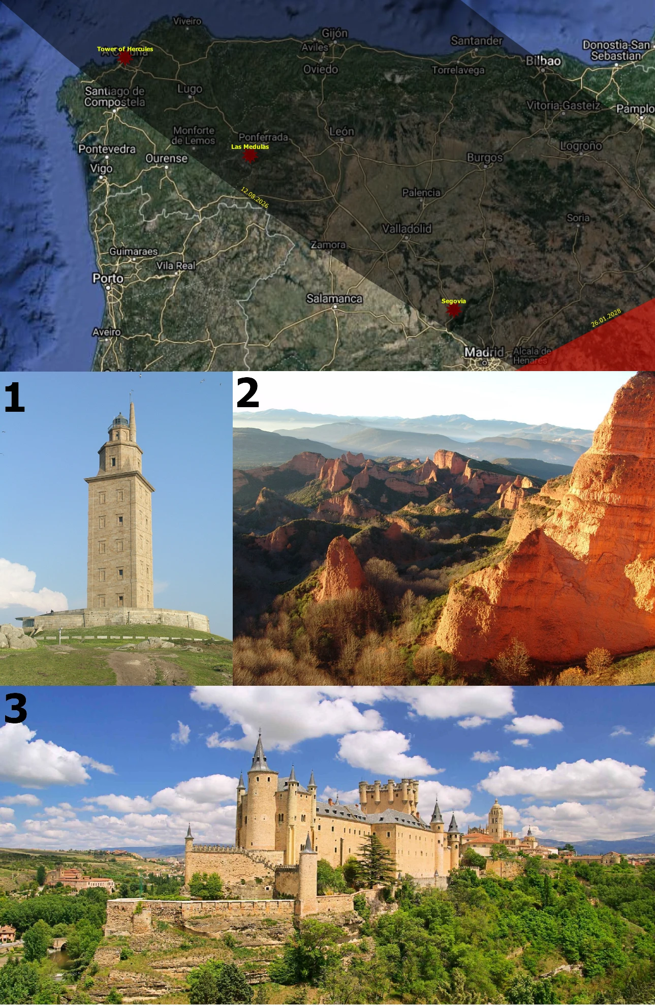
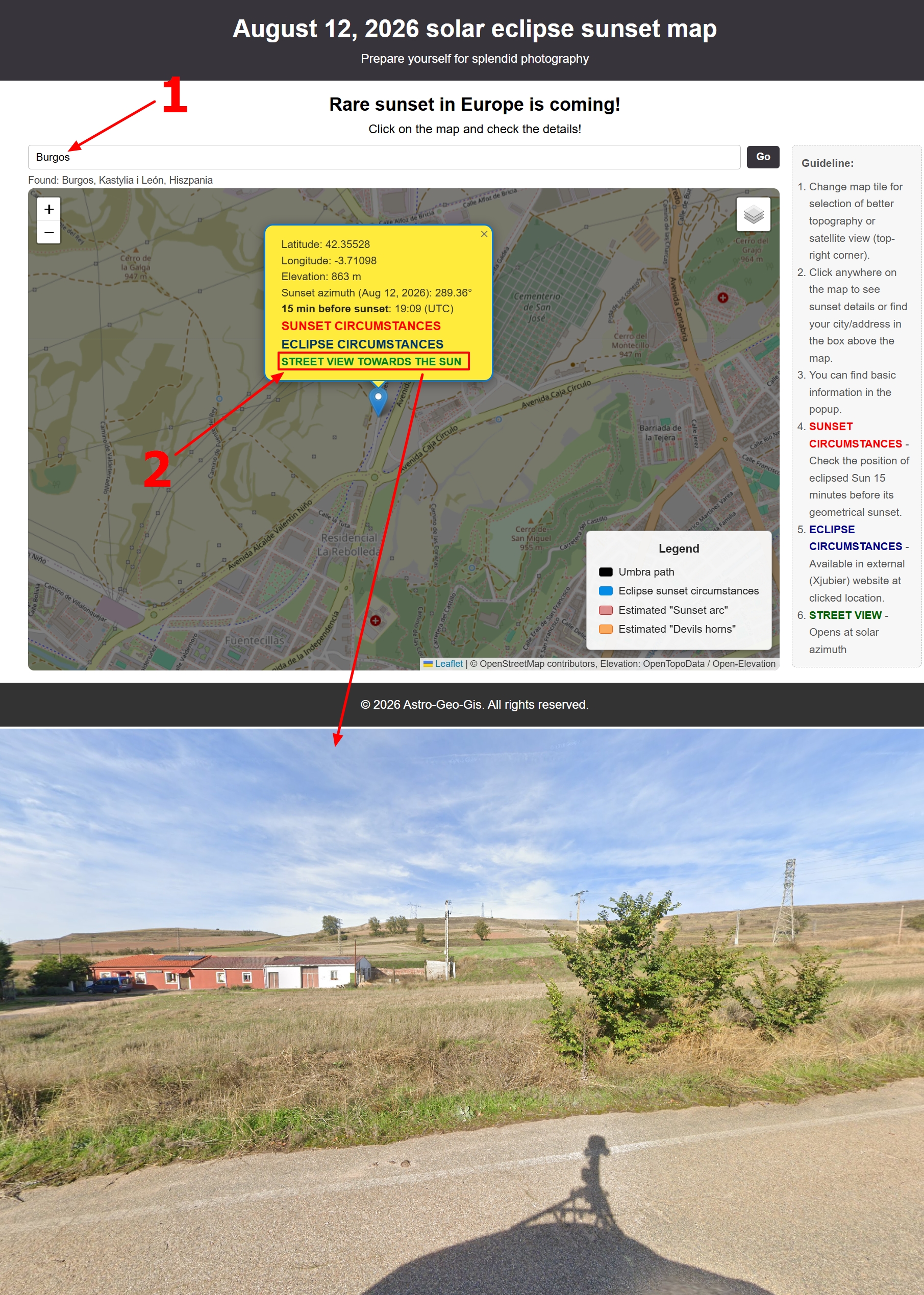
For other landmarks or scenic views, it would be extremely hard to gather them all here. Many observers travel across Spain and choose their best venues. Listing interesting venues is a subjective approach, so I propose another approach. I’ve upgraded to the Eclipse Sunset Map described in Chapter 10, which includes an option to quickly find the address and open Google Street View in the desired direction! This is a handy benefit that can help anyone choose a good observation spot. As the primary drawback is limited street coverage, you can sometimes find user-contributed Street View images that are also oriented to the solar azimuth on August 12.
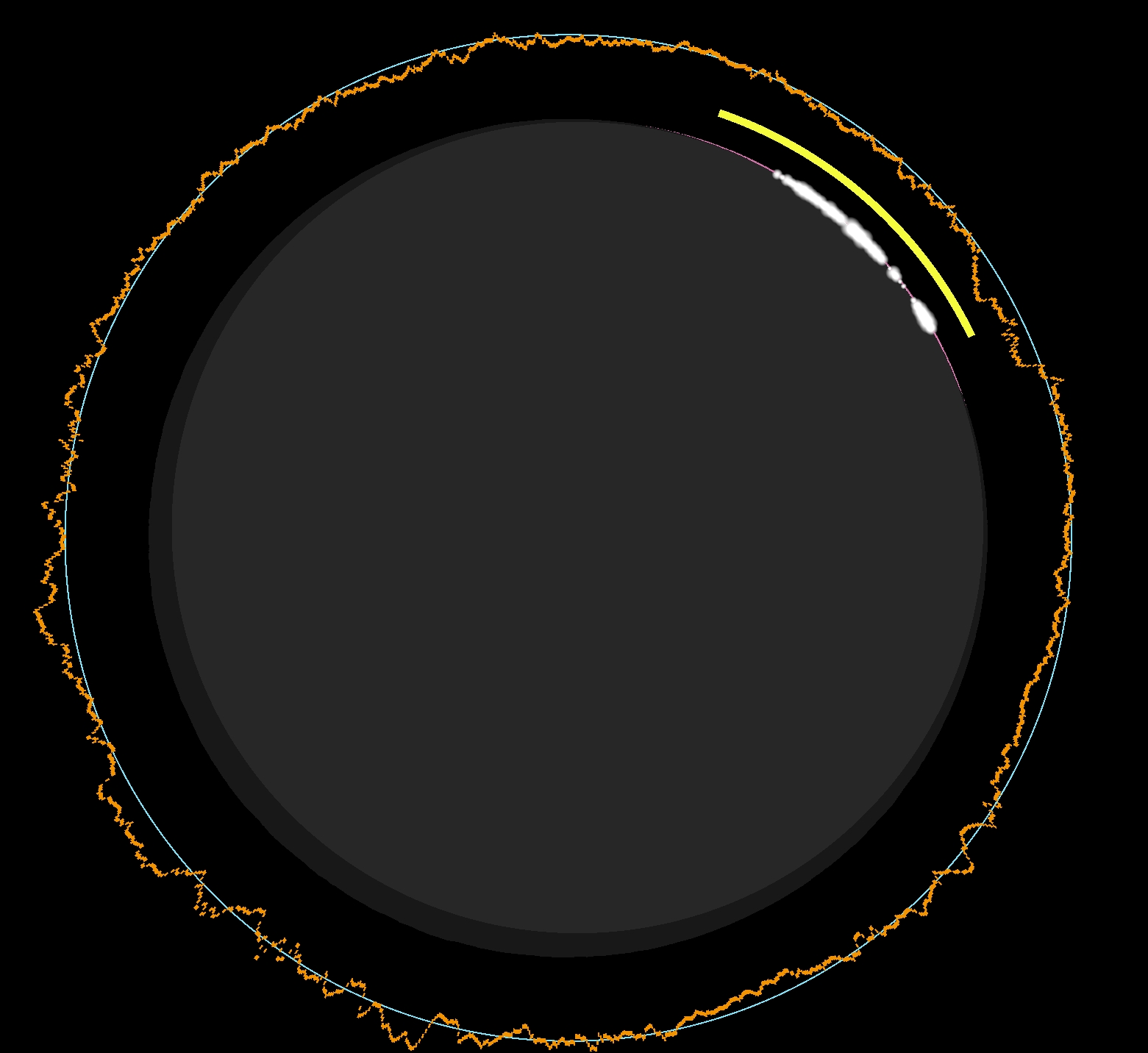
C. CIRCUMSTANCES – as Spain lies on the entire path width, an observer can theoretically be placed on any side of the zone of totality as far as various umbral depths are concerned. It’s surely translated to various characters of Bailey’s Beads’ appearance, which mostly rely on the lunar limb profile. Analyzing some instances from the northern to the southern limit of totality, we can start from Bilbao. This city is located nearly at the edge of the northern totality limit, as you know from earlier text about the umbra. According to the PhotoEphemeris application, there is 1 minute from the moment the solar filters can be theoretically taken down to the second of the second contact. It’s quite a long time, because the umbral depth is 3-4% only, and the chromosphere remains visible over the entire short period of totality. The transition between the diamond ring and Baily’s Beads is also gentle, and it looks best after the third contact due to the lunar limb profile (Pic. 69).
The most interesting situation will apply to Santander. Despite an estimated 1m02s of totality in the city center, Xavier Jubier estimates just 57 seconds after lunar limb correction! It’s about a 5-second difference, quite a lot!. A deep lunar valley will shorten the eclipse along the line of umbral depth by about 18% on the northern side of the path. (Pic. 70)
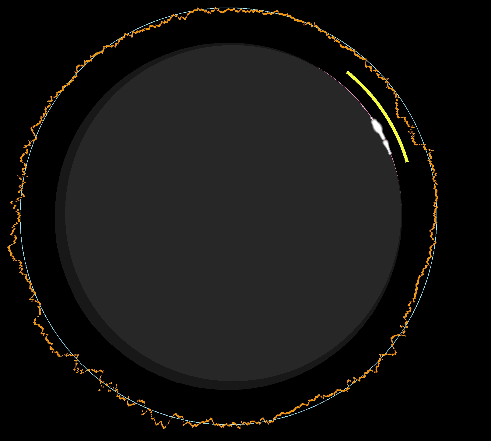
The first shaft of sunlight will shine through this deep lunar valley at all locations with a shadow depth of 15-45% on the northern side of the path. In Zaragoza, where umbral depth is 42%, the first shaft of sunlight, approximately 1.5 seconds before the 3rd contact, will precede an exciting chain of Baily’s Beads 3-4 seconds later (Pic. 53).
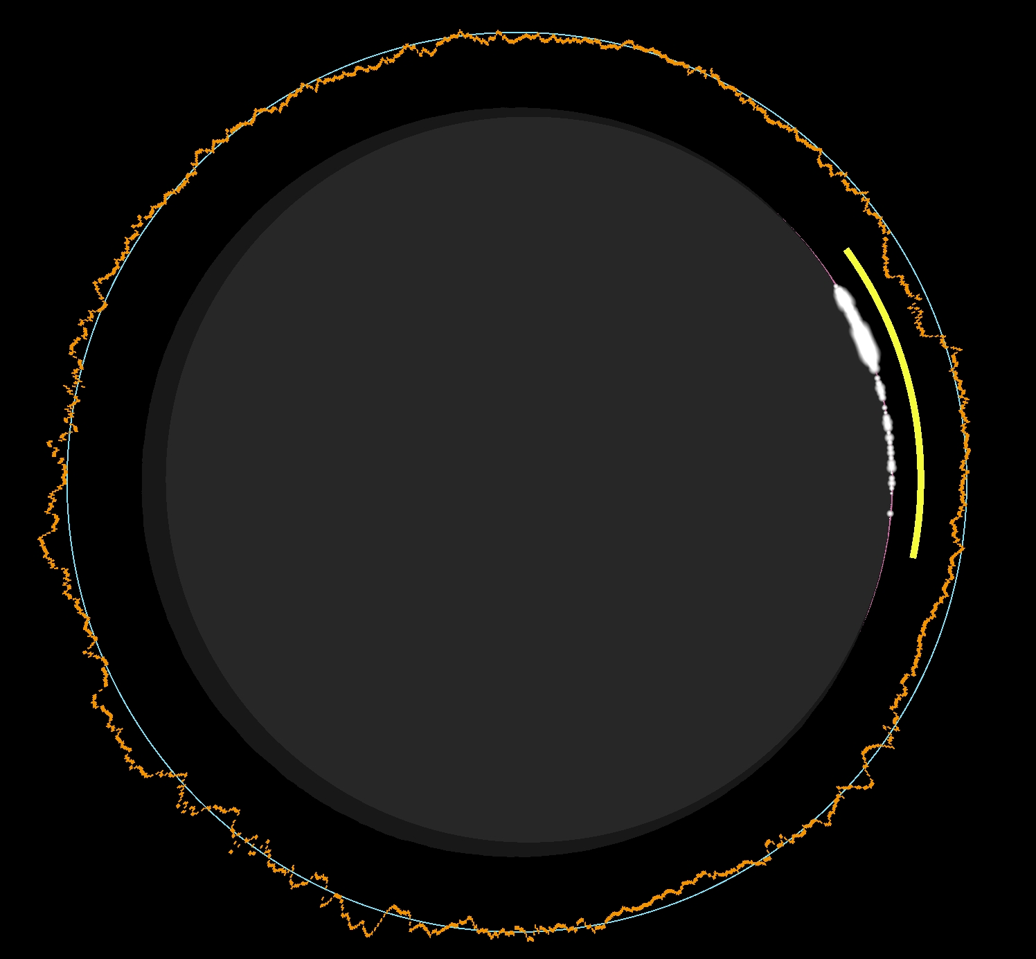
At all locations with an umbral depth greater than 70%, the chance of seeing Baily’s Beads is small. The lunar limb profile is quite unfavorable, and it’s visible just for a couple of seconds before and after totality. This situation applies to cities like Burgos, Leon, or the southern surroundings of Palma de Mallorca, which lie roughly along the centerline. The Bailey’s Beads appearance will look as illustrated below (Pic. 72).
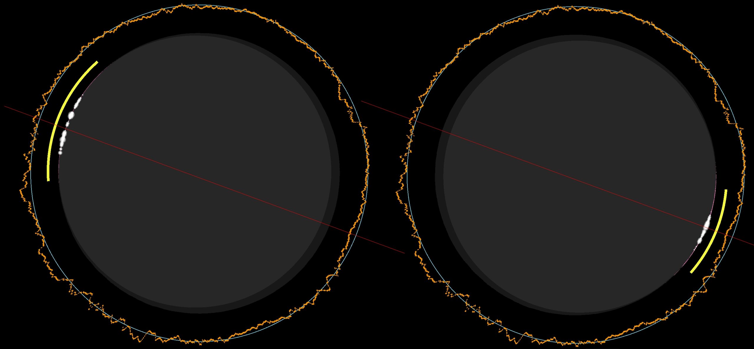
The southern part of the eclipse path looks more dynamic due to favorable lunar topography. The chance for a double diamond ring, which lasts only 1-2 seconds, increases along with the umbral depth of 40-50%, where cities like Valladolid are located (Pic. 73).
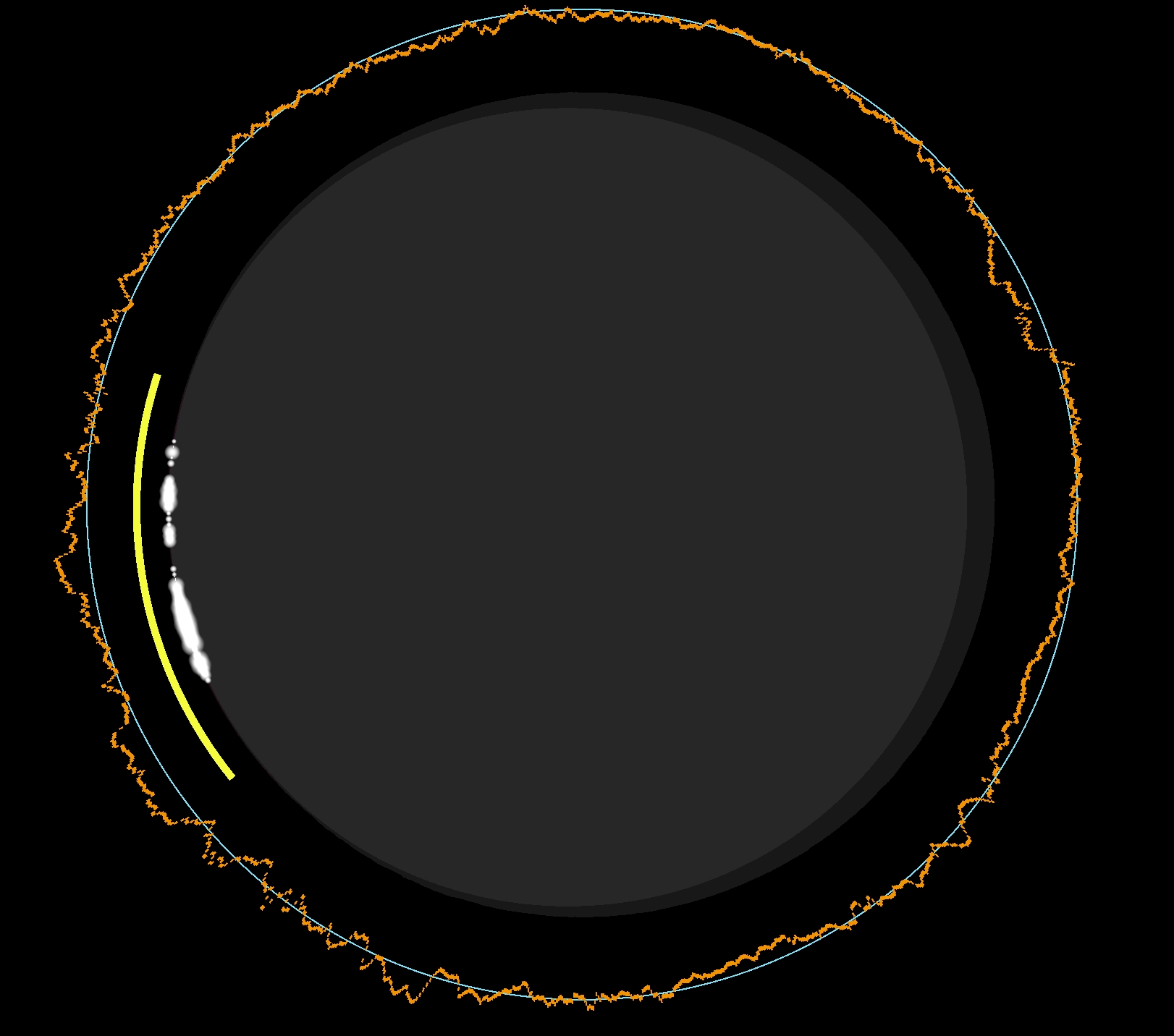
As moving towards the southern limit of totality, the Baily’s beads tend to look more extended and prominent before the second contact. A good spectacle is expected in A Coruña, located within the umbral depth of 28% (Pic. 74).
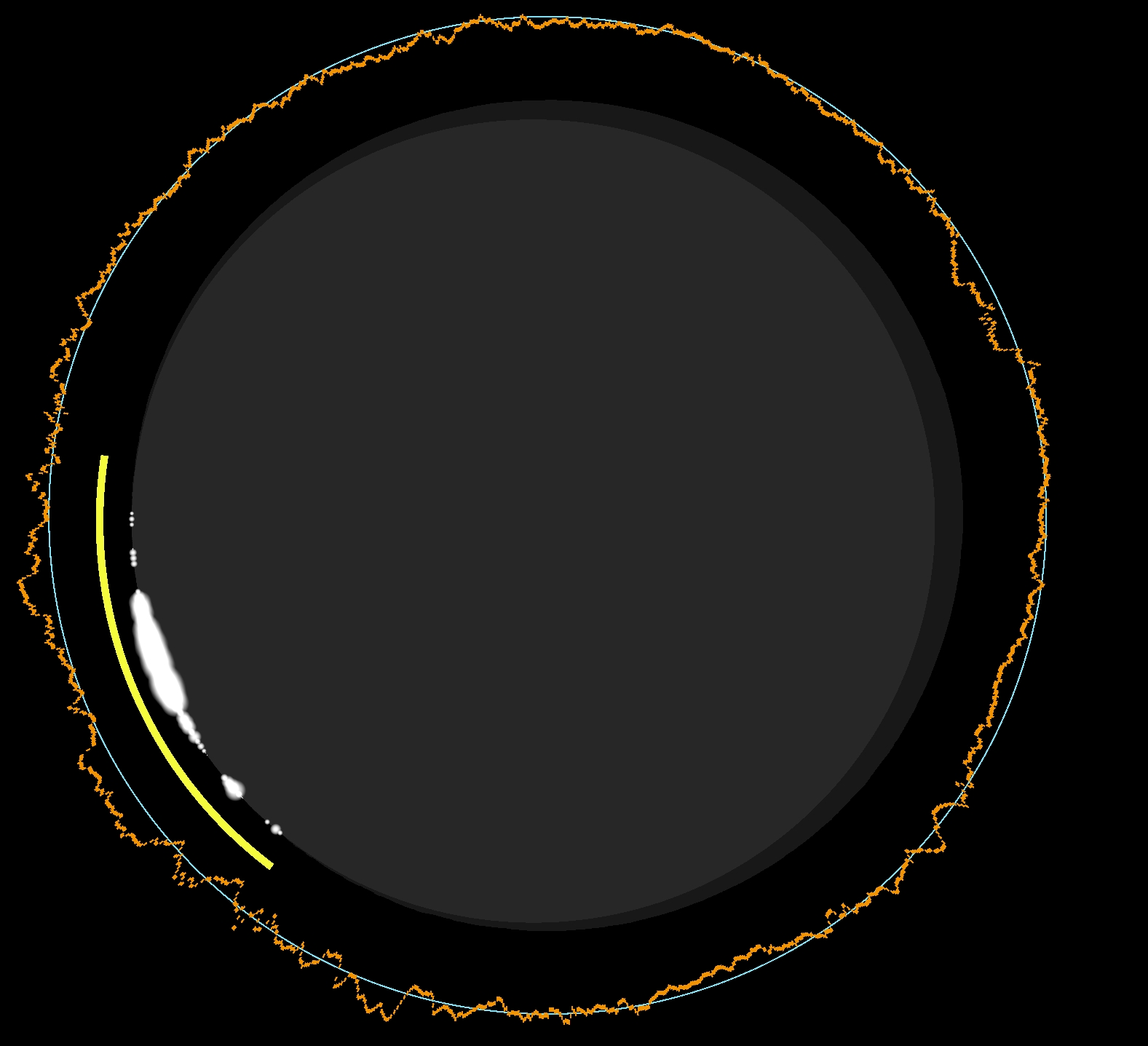
A similar view is expected in Valencia, where the umbral depth is around 20% (Pic. 75).
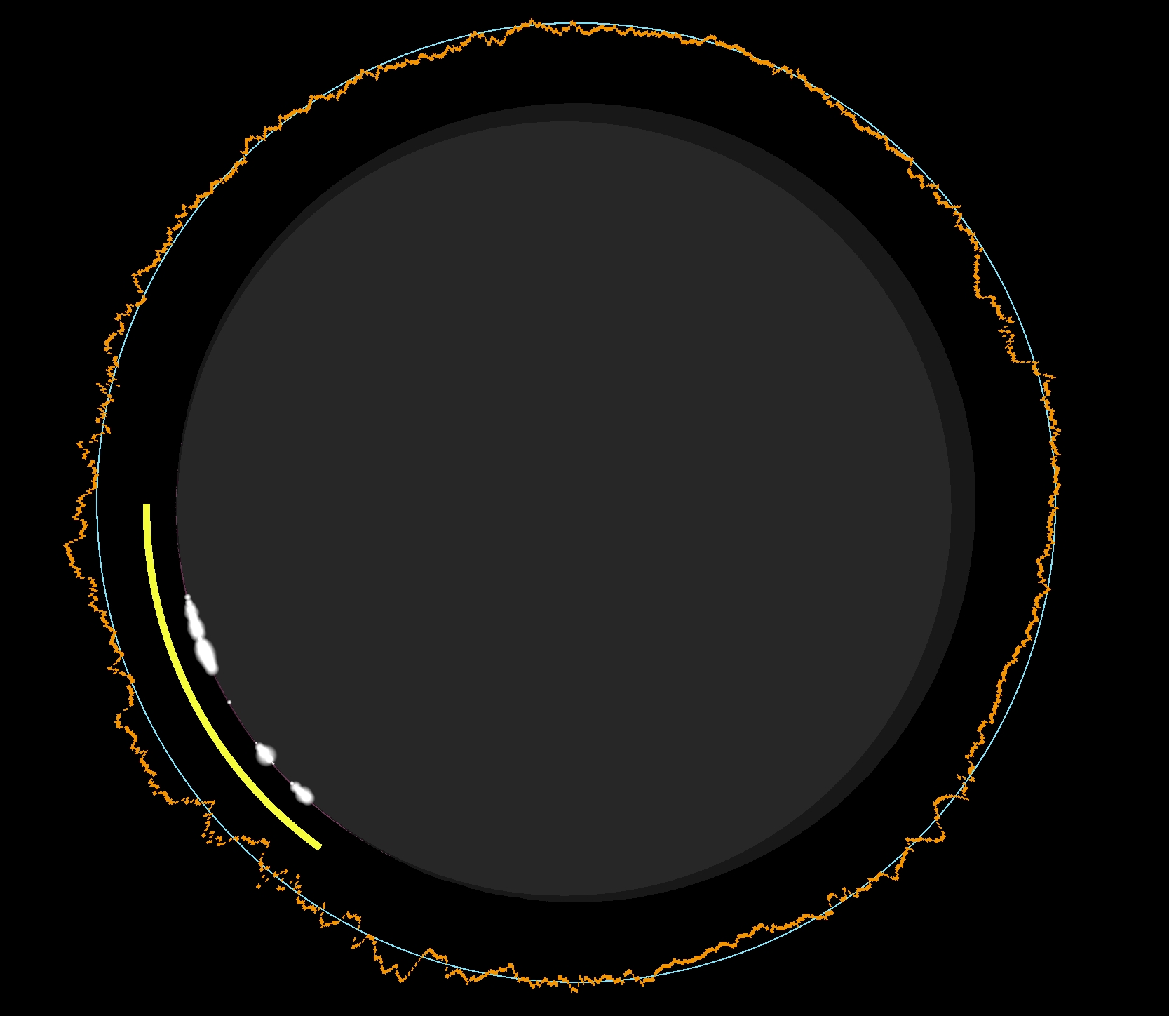
In conclusion, the appearance of Baily’s Beads looks very interesting at small umbral depth, especially at the southern side of totality. The last thing is the visibility of the stars during totality, which varies slightly with the umbral depth and the Sun’s position above the horizon. The separate analyses will be performed in the future text, but for now I just want to share the comparison between the two most extreme locations in Spain lying on the centerline (Pic. 76).
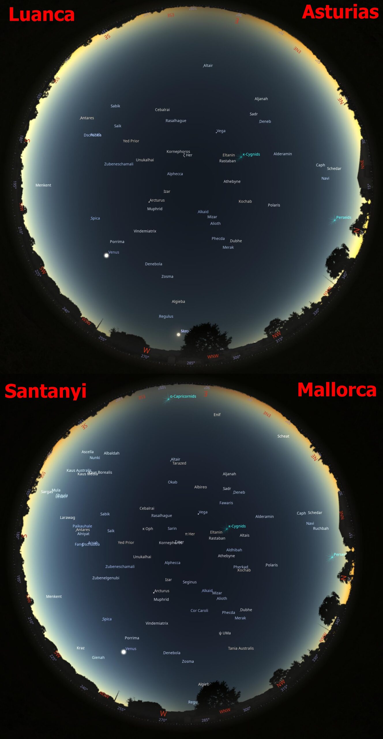
The difference in altitude between over 10° in Asturias and just 3° in eastern Mallorca reflects the number of stars possible to see with the naked eye. We will see a few in Iceland, which is typical. However, the situation in Spain is different, as the low position of the Sun causes light extinction in the atmosphere, reducing the solar corona and ambient light. In turn, up to 45 stars can be detectable by the human eye during mid-totality in Asturias and even 77 at Mallorca, according to Stellarium calculations. Especially at Mallorca, when the eclipsed sun will be very low above the horizon, an observer should experience conditions comparable to early nautical twilight.
5.3 Portugal
The most unsung country, which lies on the path of totality, and it’s true at some point, as only the northeasternmost corner will experience this fascinating event. The main website for information about the solar eclipse in Portugal in 2026 is Eclipse2026pt. However, because the totality almost misses the country, there is not much information, much less than in the case of Iceland, and especially in Spain.
It doesn’t change the fact that if anyone at some point watches the totality from Portugal, they might not regret the decision!
The detailed map below shows the circumstances of totality across Portugal’s northwestern corner.
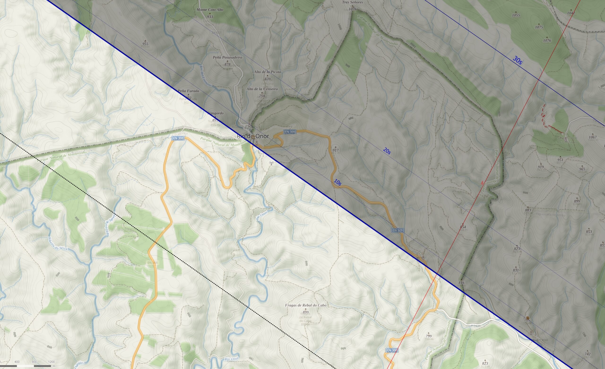
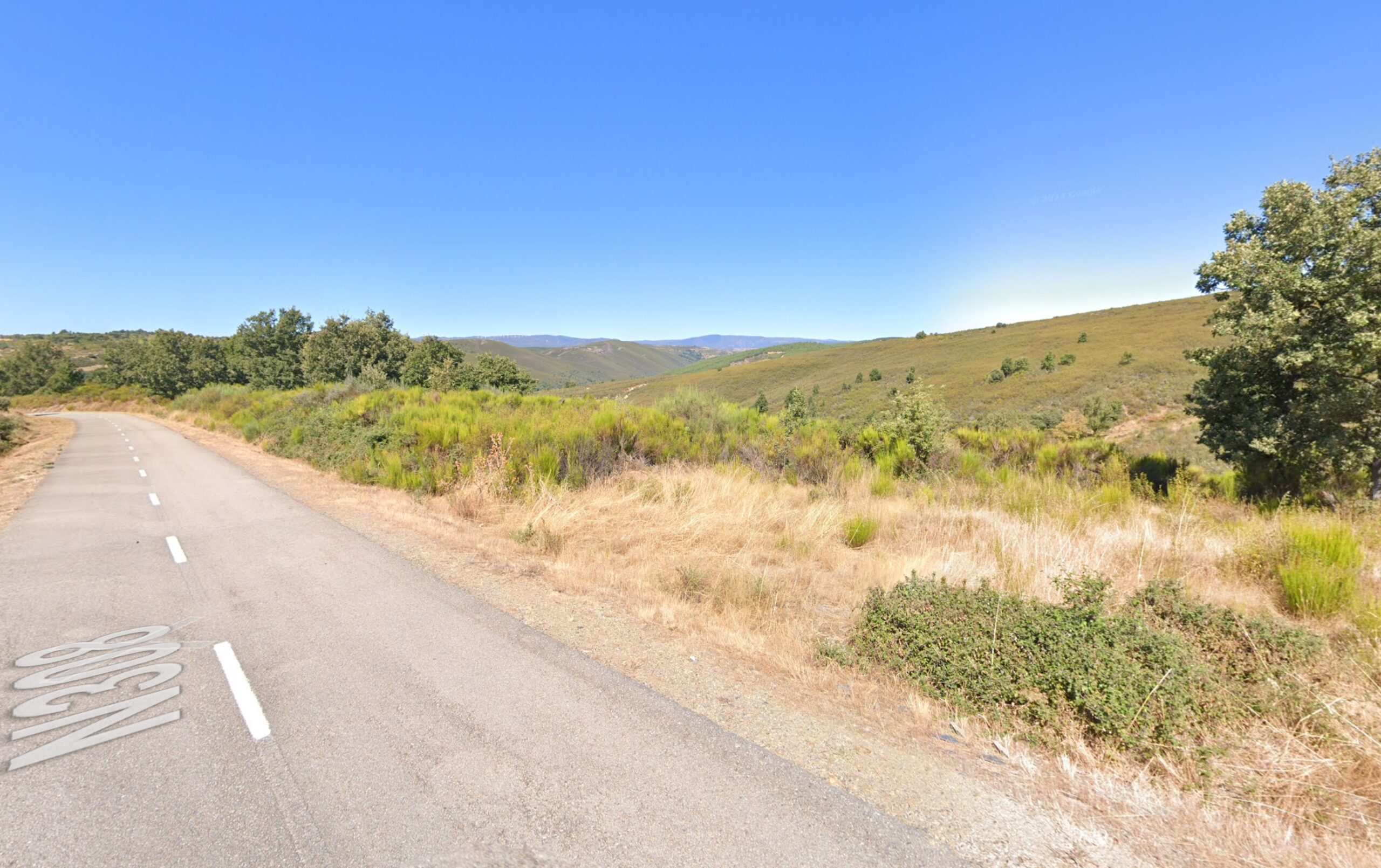
The only reasonable way to get there by car is to take the EN308 road and pull over onto the tarmac subsidiary road leading to the farmlands. Alternatively, the Tres Señores hill (1076 m.a.s.l.), marking the geodetic northeastern « corner » of the country, is accessible from the path along the country’s border on the Spanish side. The area is part of the Montesinho Natural Park and has very limited tourist infrastructure. The exact position of the southern path of totality can be ambiguous and depends on lunar limb correction. The fixed edge of the limit means the eclipse magnitude of 1.00, at which, in theory, the Sun’s disk shouldn’t be visible. But because of lunar topography, the Sun still shines through the Moon’s valleys. Another reason is the general accuracy of the eclipse maps, about which you can find more information in this article. We can assume that the maximum duration of totality on Portuguese grounds is approximately 30 seconds. Below, you can see three case-study visualizations for the 2026 totality in Portugal (Pic. 30).
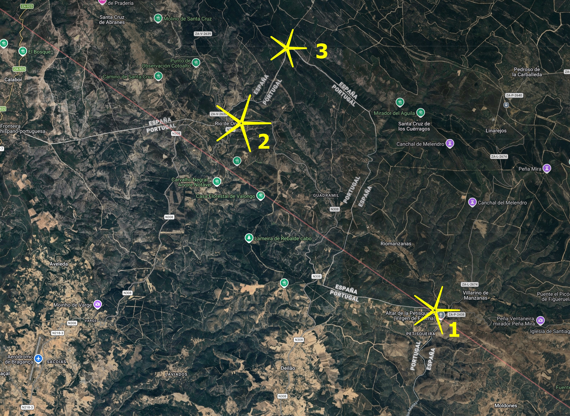
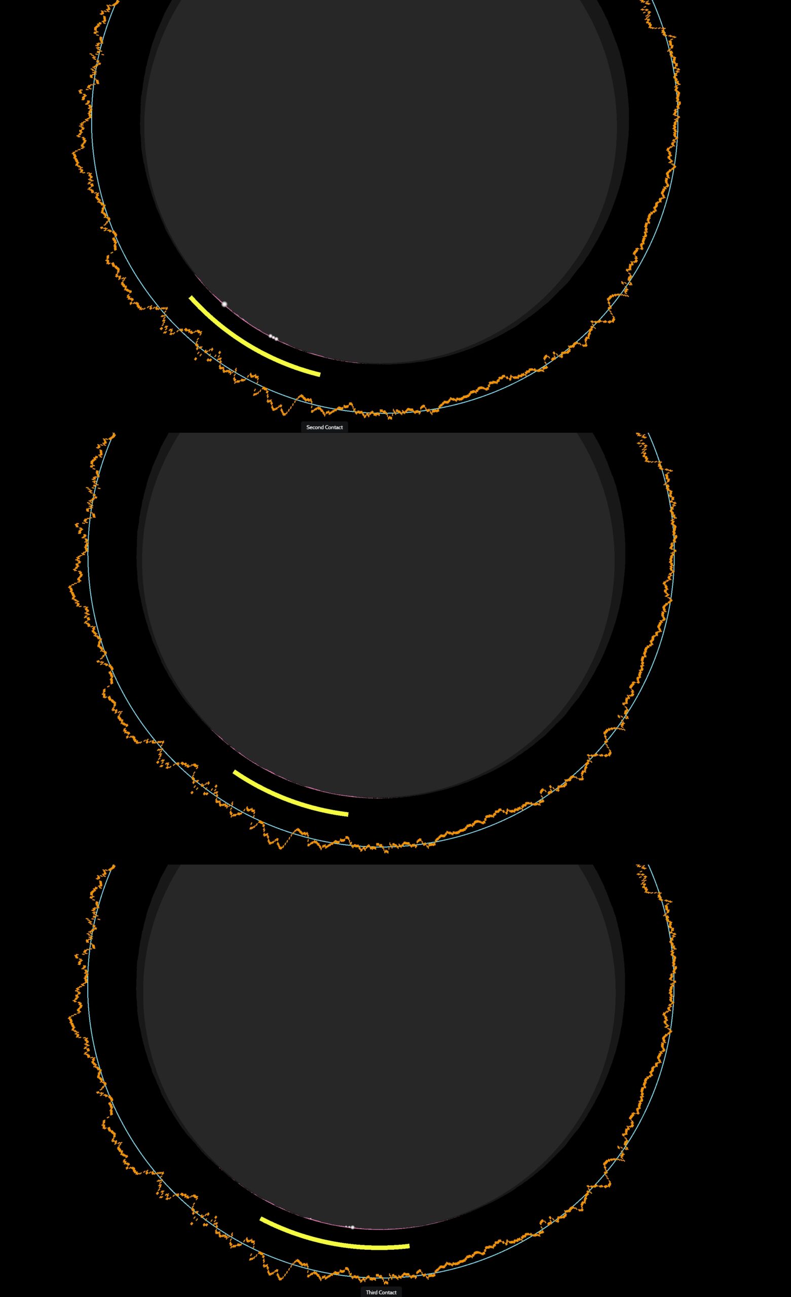
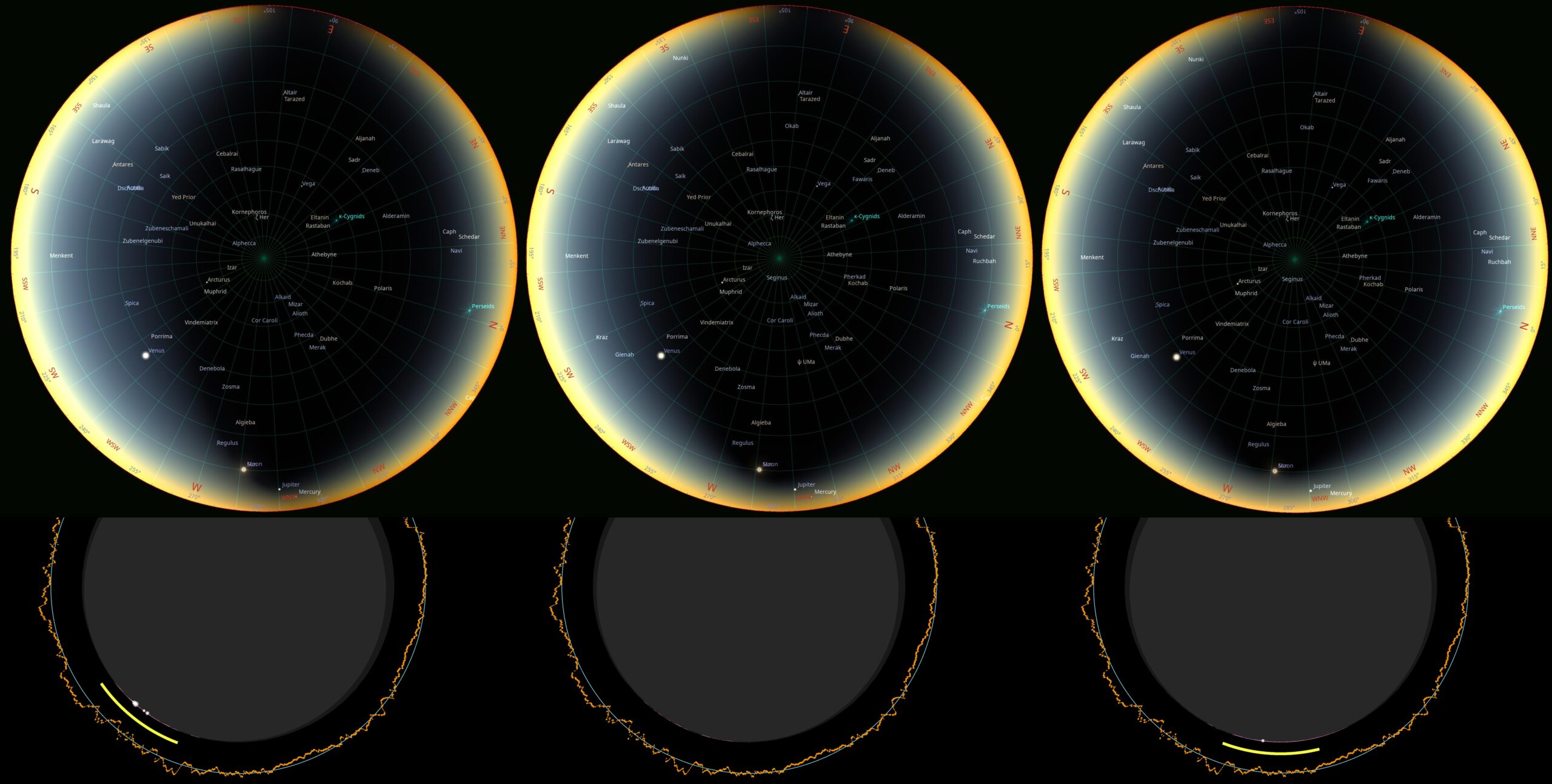
The first place is on the eastern slope of the Boca da Baleia (839 m.a.s.l.) hill, in the Petisqueira village, and falls at the exact edge of the totality. According to the Eclipsewise.com website, this corner of Portugal falls within the grazing zone, whereas according to Xavier Jubier’s eclipse website, it gains even 15 seconds of totality. Indeed, the total solar eclipse occurs here, but it is very short. The overall duration between separate « beads » is just 10.8 seconds. The Petisqueira village will experience the deep partial eclipse with 100% of obscuration. How is it possible? The lunar limb profile at the direction of greatest eclipse is rich with a few lunar valleys, which will allow the solar beams to pass through, despite Xavier Jubier’s estimated totality of approximately 10 seconds!
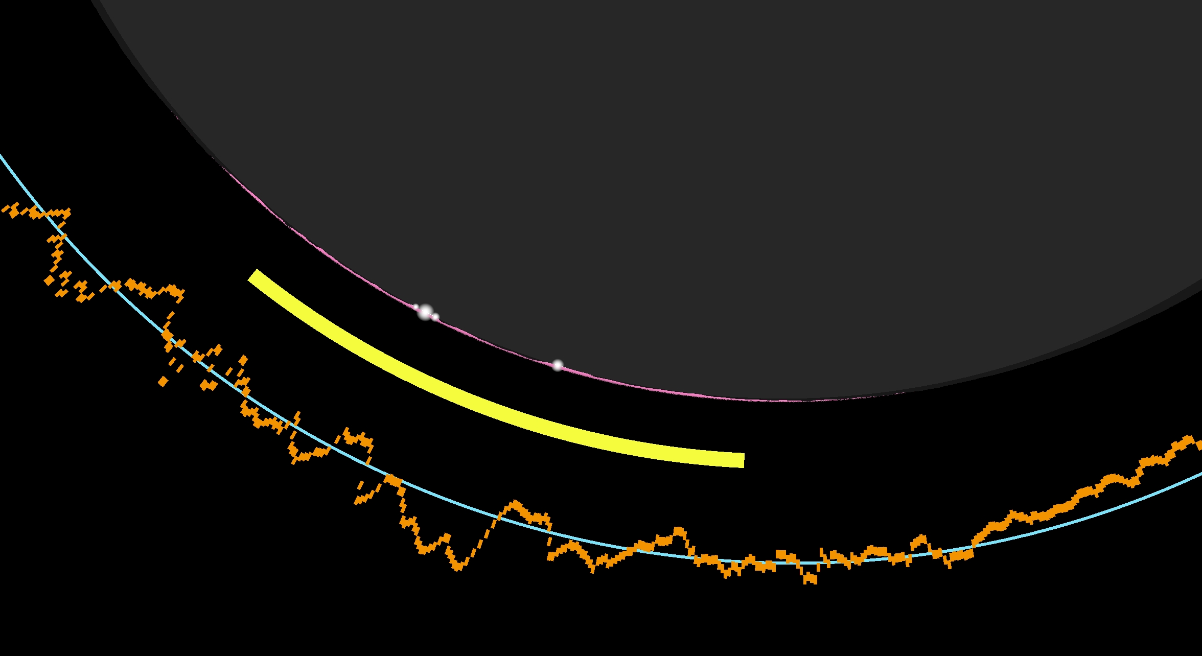
According to the Photoephemeris application, the southern limit of totality lies just a few tens of meters south of the Nossa Senhora de Fatima religious complex, which straddles the Spanish-Portuguese border. On the Spanish side, it’s called Altar de la Petisqueira. Anyway, the estimated totality at this location is just…4 seconds, and, what is most curious, the single solar beams will pass through the deepest lunar valleys over this entire period! (Pic. 80).
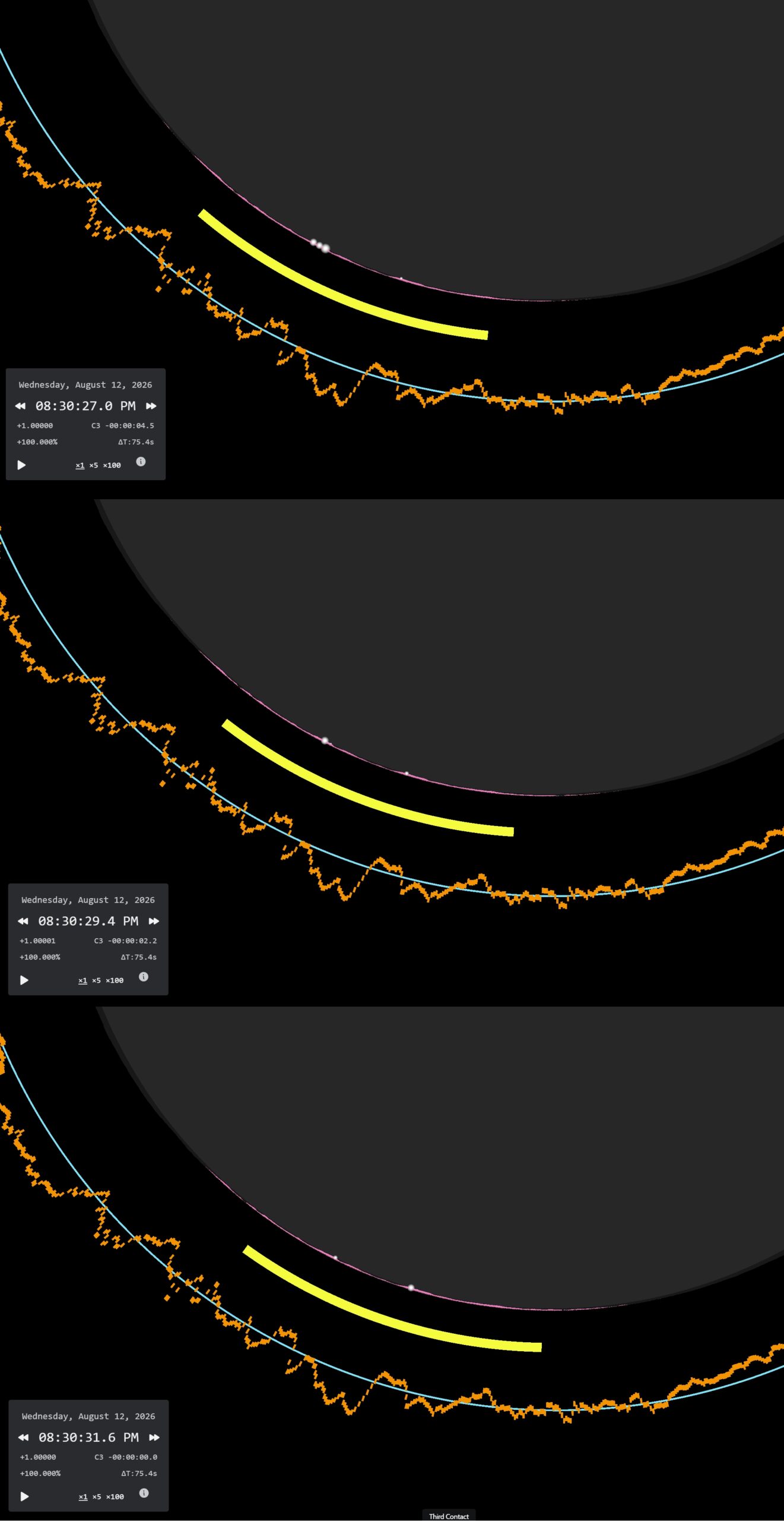
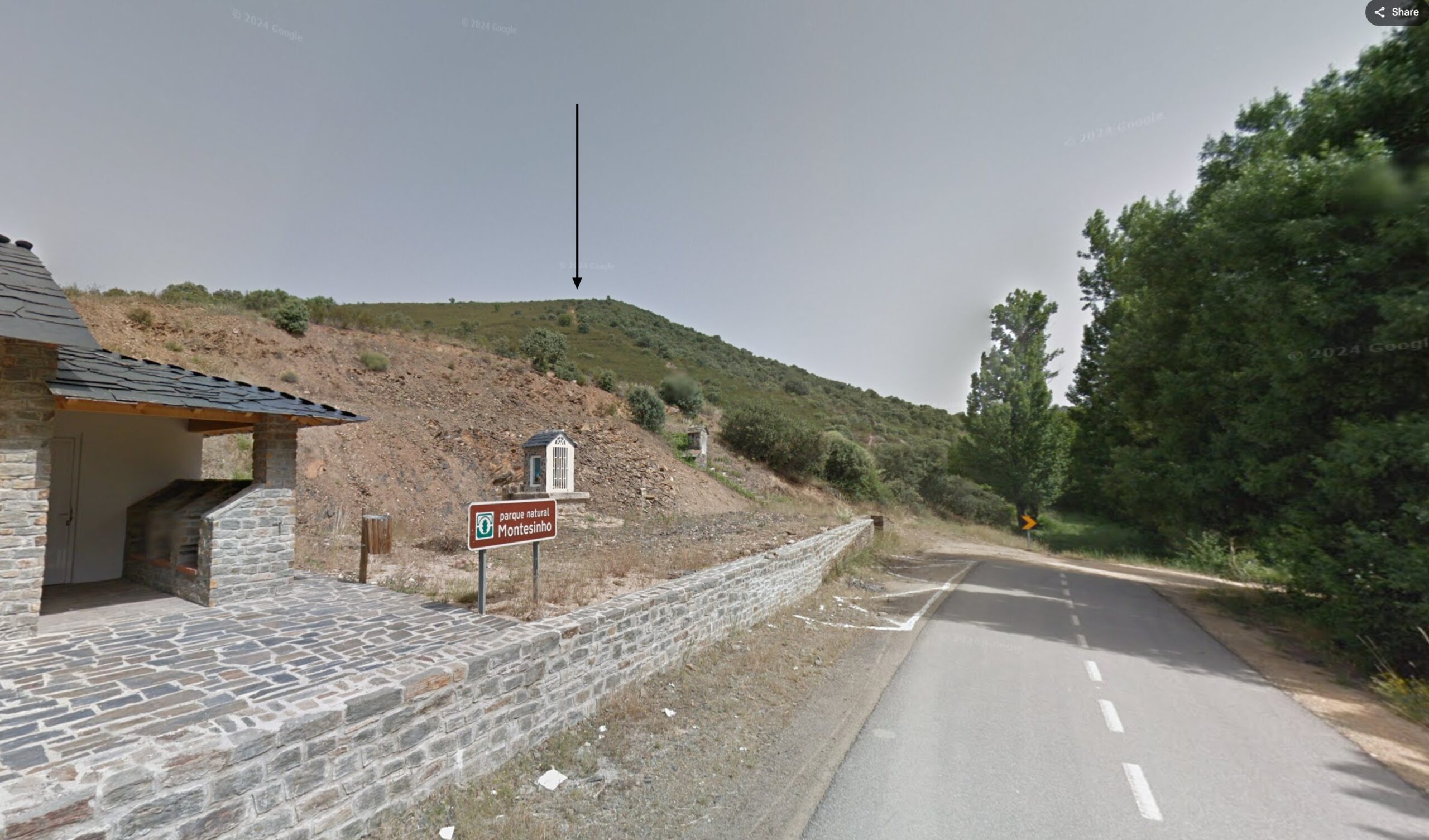
Finally, at « Point 1, » the totality lasts around 10 seconds, and the shadow is well visible in the sky for a while (Pic. 82).
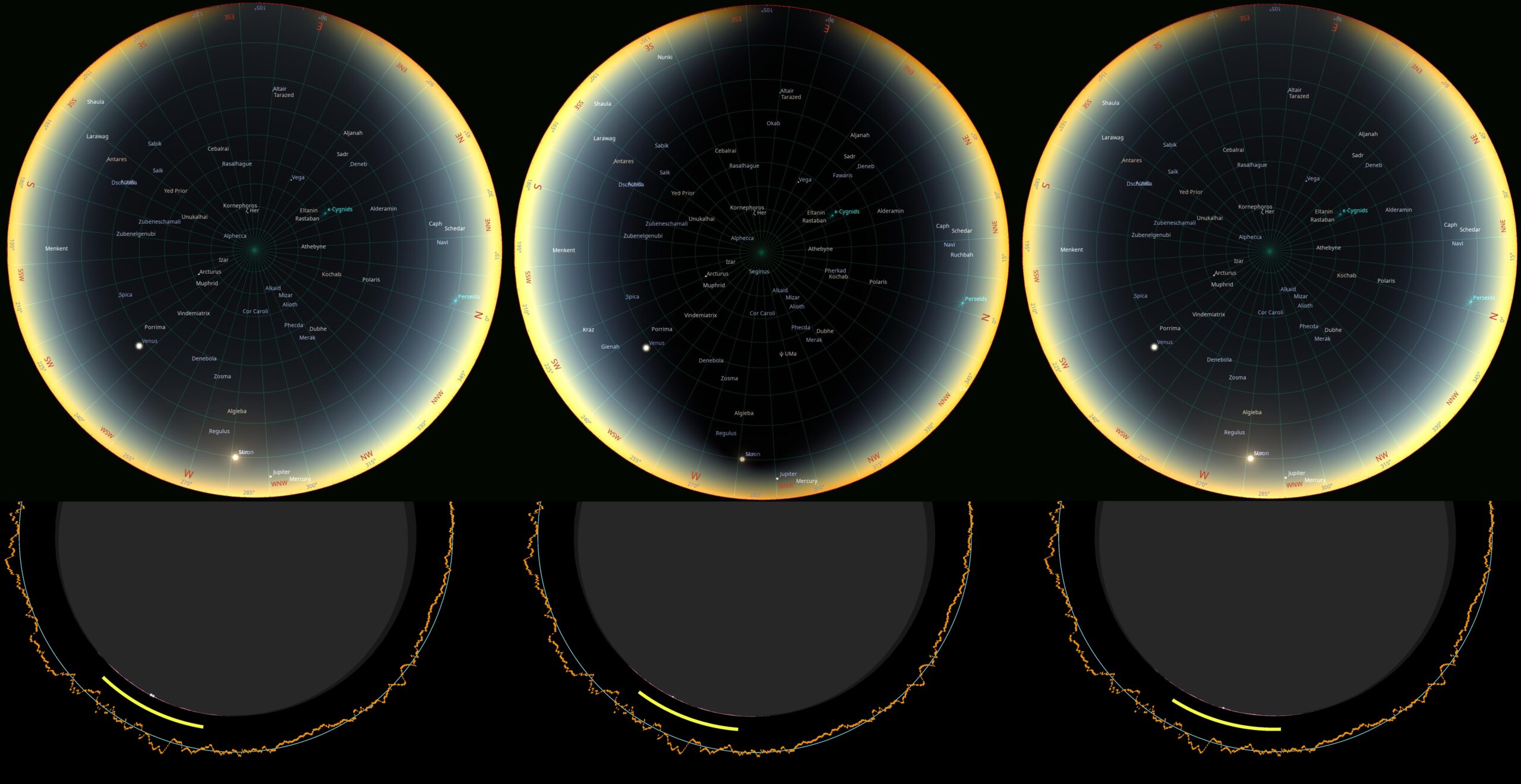
The second considered place is located east of Rio de Onor, where the estimated duration of totality is approximately 20 seconds. Amidst the forestry sections, there is a decent viewpoint from where the eclipse can be watched without additional walking from your car.
The umbral depth of 2.5% is enough to block the solar beams completely, even if the lunar limb profile is unfavorable for it. During this short period of totality, the chromosphere will be visible very well.
Finally, the third place is the geodetic point marking the Tres Señores hill, which gains about 30 seconds of totality. The difference in the sky between the very edge of the path and the projection of contacts (Pic. 85) isn’t big.
The most challenging is getting to the top of this hill, as there is no marked trail, and an observer has to use the local road leading from the Rihonor de Castilla village on the Spanish side. After reaching the traverse of Alto de Fuente Abedul (1022 m.a.s.l.), at least a 2.5 km walk is required. Not sure if this road is accessible by car. Alternatively, we can get there from Puebla de Sanabria, a Spanish town located over 10km away.
>>>BACK TO TOP<<<
6. THE PARTIAL PHASE
As with the total phase, the partial phase of the eclipse can also be interesting, especially since the minimum obscuration in Europe on the afternoon of August 12, 2026, will reach 79%. There are many events accompanying the partiality, which can be boosted by golden-hour conditions in some cases. On the other hand, the partial solar eclipse also includes grazing zones, where a diamond ring and Baily’s beads can be visible without a moment of totality. Thirdly, standing in the direct vicinity of the totality path, an observer can experience similar optical effects as known from the period of totality. This chapter is not for discussion about the obscuration across various European countries, as was presented in the case of the 2024 analyses. The primary focus is on various phenomena that occur during the eclipse and at specific locations, which should be described in as much detail as possible for a given European country.
At first, some of the phenomena accompanying the deep partial solar eclipse are listed in bullet points below.
A. SKY BRIGHTNESS AND COLORATION CHANGES – Sky brightness and color changes during a solar eclipse become noticeable when solar obscuration exceeds 50%. As the Moon progressively covers the solar disk, the overall illumination decreases, and the sky becomes darker. During deep partial phases, a subtle shift toward reddish tones may occur. At the maximum phase of a partial eclipse, the reduction in brightness and slight color modifications can become clearly perceptible.
One important factor responsible for these changes is solar limb darkening, a phenomenon in which the outer regions of the solar disk emit less intense radiation than the central region.
The Sun, a G-type main-sequence star, emits light that is slightly yellowish due to radiative processes occurring in the solar photosphere. During a partial eclipse, the obscuration of different parts of the solar disk alters the spectral contribution of these regions, which may influence both the color of direct illumination and the scattered light in the atmosphere. In natural environments, these effects are often difficult to detect because objects reflect light differently across wavelengths. As a result, small spectral changes in sunlight may remain unnoticed when observing scenes containing many colors and textures.
As the Moon covers different parts of the Sun, the relative contributions of the bright central region and the darker limb to the total solar irradiance change, about which you can read more here.
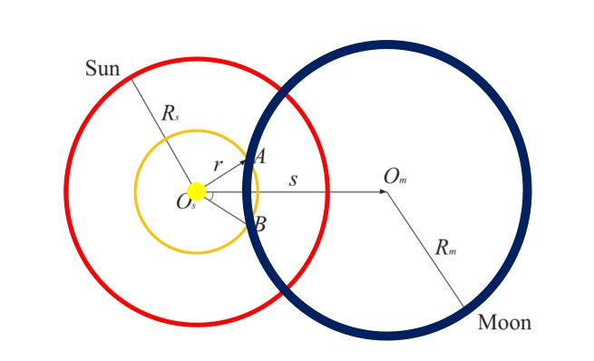
These variations slightly modify the spectral composition of the sunlight reaching the Earth’s surface. Atmospheric Rayleigh scattering also contributes to the observed changes, because the wavelength-dependent scattering of sunlight determines the color of the sky. Small shifts in the spectral distribution of incoming sunlight, therefore, translate into subtle changes in sky color. Because the proportion of Rayleigh scattering changes as the Sun shines lower above the horizon, this effect in the sky can be enhanced (Learn more in chapter 8).

Overall, the changes in sky brightness and color during a solar eclipse result from a combination of reduced solar irradiance, the spectral effects of solar limb darkening, and atmospheric scattering processes. Atmospheric conditions such as humidity and clarity can further modify these effects, which explains why the observed color changes may vary between different eclipses and observation sites.
B. PINHOLE CAMERA EFFECT – During a partial solar eclipse, crescent-shaped projections of the Sun can be observed on the ground beneath trees. Sunlight passing through small gaps between leaves acts as a series of natural pinholes, projecting images of the partially obscured solar disk onto nearby surfaces such as sidewalks or walls. This phenomenon is an example of the pinhole camera (camera obscura) effect.
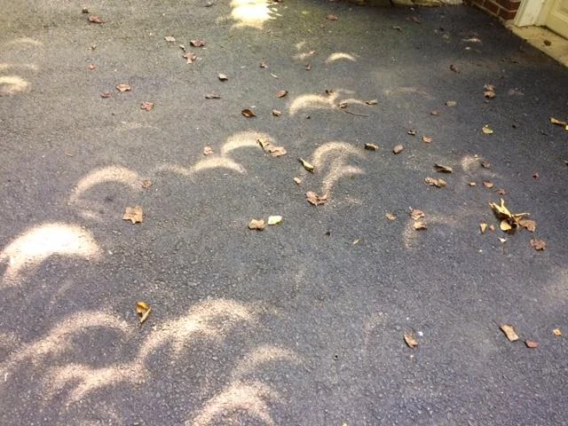
The effect occurs on any sunny day; however, the projected images normally appear circular because the unobscured solar disk is round. During a partial eclipse, these projections become crescent-shaped, reflecting the current phase of the eclipsed Sun. As a result, observers can indirectly view multiple real-time projections of the eclipse without specialized equipment.
The principle of image formation through small apertures was recognized in antiquity. Aristotle is often credited with describing this phenomenon after observing crescent-shaped solar images projected onto the ground during a partial solar eclipse.
C. SHARP AND FUZZY SHADOWS – visible by deeper partialities when the sun shines as a crescent over 50% of obscuration. When the object is in line with the crescent, then a sharp shadow is produced. Conversely, for objects perpendicular to the crescent sun, the fuzzy shadows are produced.
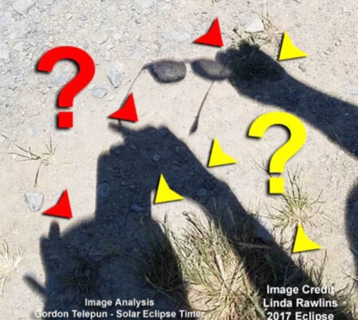
D. CORONALITY – This phenomenon is defined as a period when the brightness of the sky falls below the brightness of the solar corona. Instead of totality, the event can be observed just outside of the umbral path within the so-called grazing zone. The event is also seen well from a location very close to the path edge, where it lasts much longer than the totality. For example, if an observer is located several hundred meters within the path, he can see, i.e., 10-20 seconds of totality and even 1 minute of coronality.
E. SOLAR CORONA OUTSIDE OF TOTALITY – As it has been mentioned in the previous section, the solar corona visibility isn’t restricted just to the period of totality. In principle, the solar corona, with a brightness comparable to the full Moon (about –11.5 mag), could be visible during the deep partial phase when the lunar disk nearly covers the Sun. In practice, however, the bright solar crescent usually overwhelms the faint coronal light. When the Moon nearly obscures the photosphere and the observer is close to the umbral region, the brightness of the solar crescent becomes sufficiently reduced to allow a faint coronal outline to appear on the opposite side of the lunar disk. The detectability of this feature strongly depends on the thickness of the solar crescent and on atmospheric scattering of sunlight. By placing the solar crescent outside the field of view to reduce glare, a faint coronal arc could be recorded during the deep partial phase.
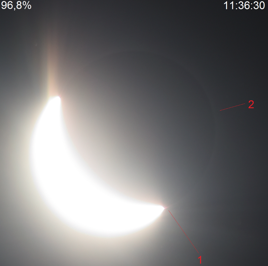
F. DARK SHADOW CONE – Occurs shortly before or immediately after totality, usually at the same azimuth where the eclipsed Sun is visible in the sky. It appears as a grey, wall-like structure adjacent to the illuminated region where the observer is located. Its character is driven by light’s forward scattering. As the umbra approaches the observer, the directly scattered sunlight is reduced by shadowed haze, forming a blue-grey zone.
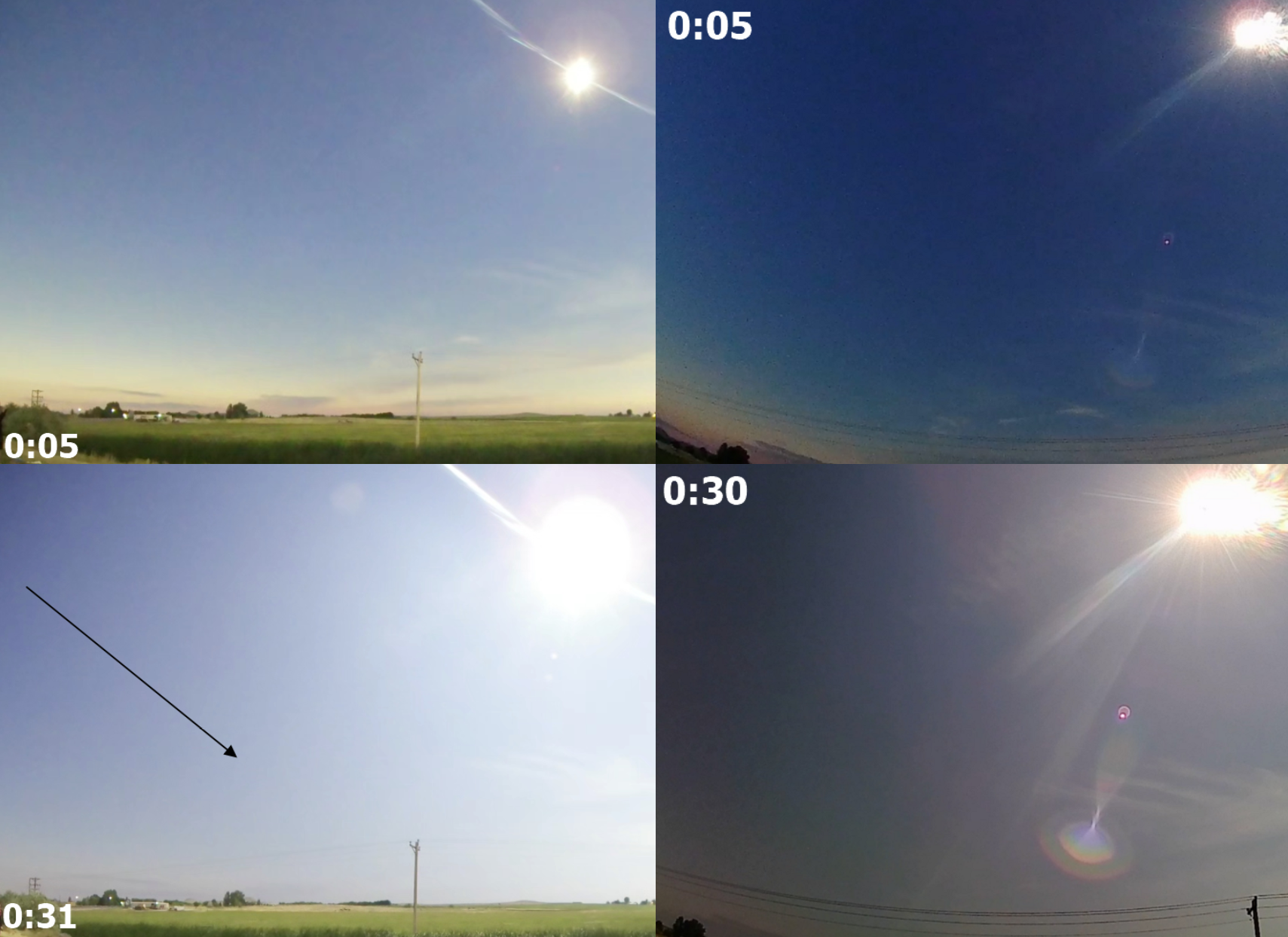
This example represents the umbra cone visible directly after totality. However, we can experience the effect at solar azimuth when watching a very deep partial eclipse. One of the best examples was visible in Iceland in 2015.
Below are some example projections of the dark shadow cone, which will be visible in Iceland (Pic. 93).
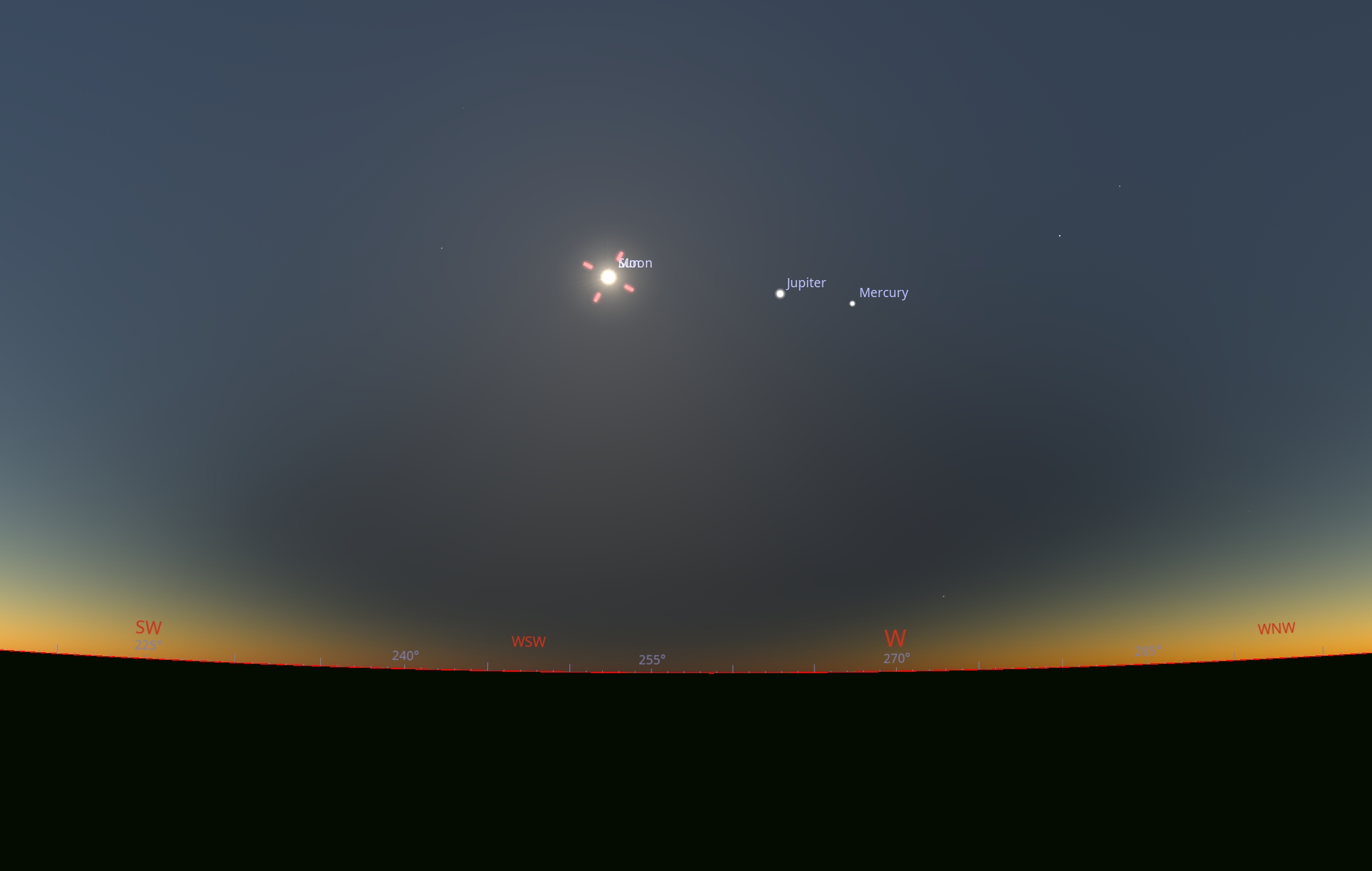
Below, we can see the rendered shadow cone passing the observation place from about 30 km at solar azimuth. Because the Sun is obscured in 99.8% of the sky, the directly scattered bright light mixes with the dark, shadowed area beyond, giving a grayish visual output (Pic. 94).
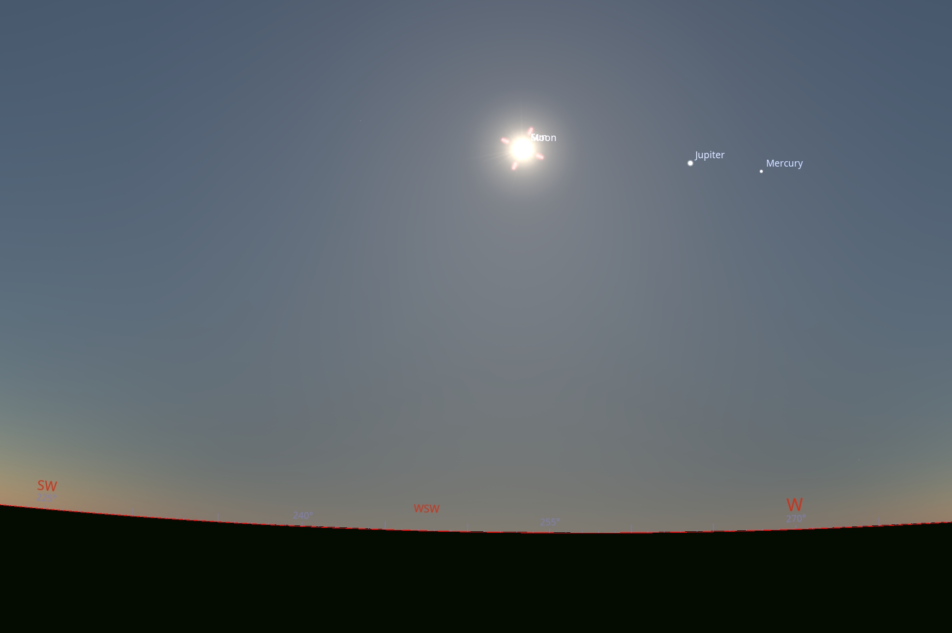
Another image shows the effect at a distance of 60 km from the eclipse path, where the Sun is obscured by 99.4% at the greatest phase.
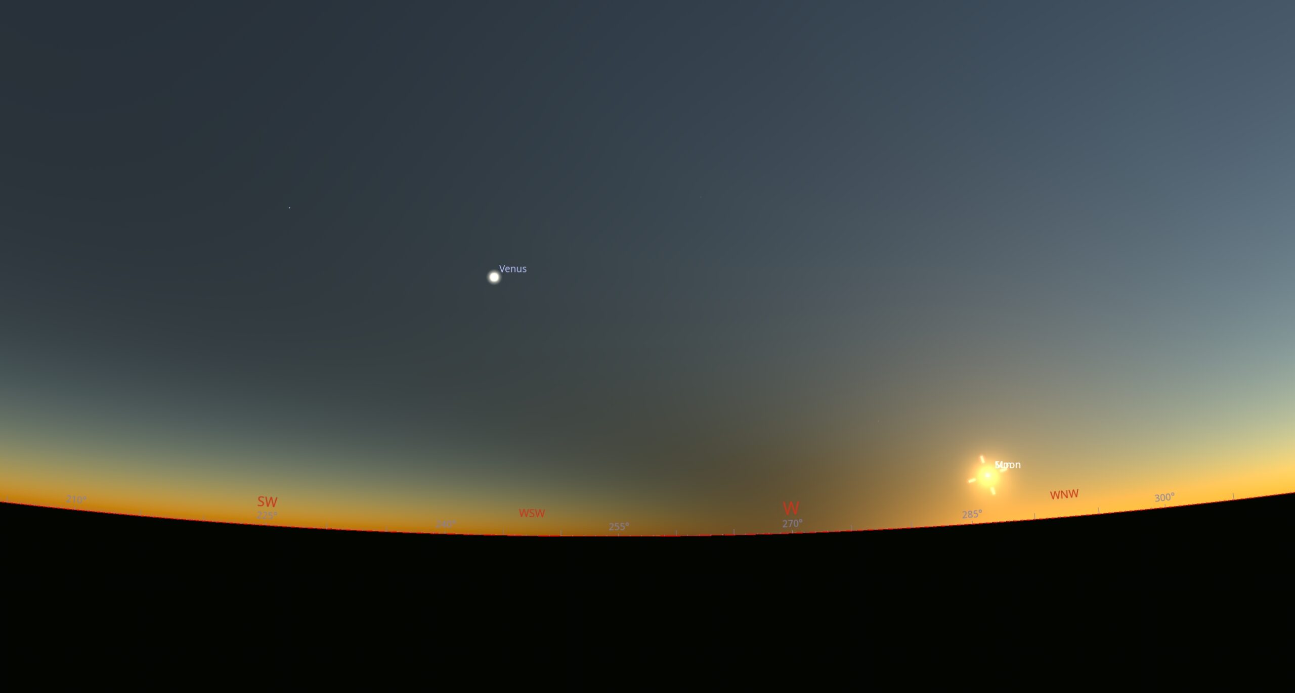
G. UMBRA AT A DISTANCE – The deep partial solar eclipse gives an opportunity to see the umbra at a larger distance. However, in this case, it’s advisable to look in the antisolar direction, which is south of the limit of totality. There are reports of umbra visibility at 250km in daylight conditions. Rather impossible by the August 12, 2026, eclipse configuration from European lands. It doesn’t mean the effect isn’t visible in the solar sector of the sky. When the totality occurs about 100 km ahead at solar azimuth, an observer can detect some changes in the horizontal sky (Pic. 45).
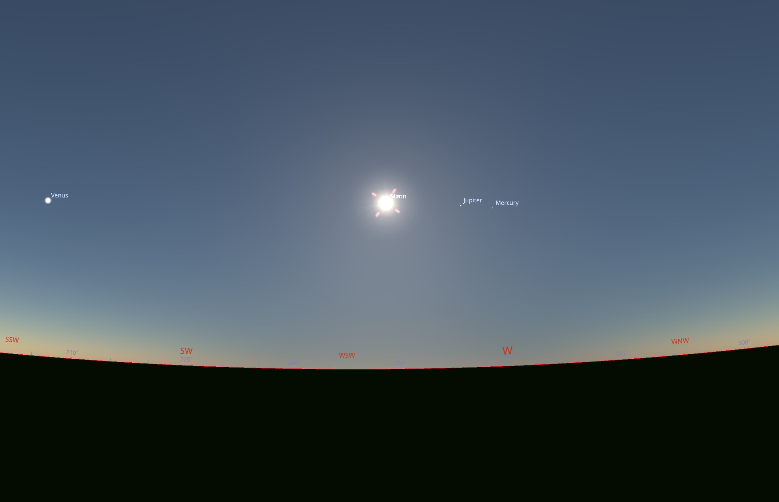
The situation will look different in Spain, Portugal, or even France, where the deep partial eclipse occurs late in the afternoon. Depending on the location relative to the path, the observers will see a different configuration of the umbral column. For anyone located north of the path, e.g., in Barcelona, the umbra will emerge in the southern part of the sky and then disappear in the southern direction (Pic. 96, 97).
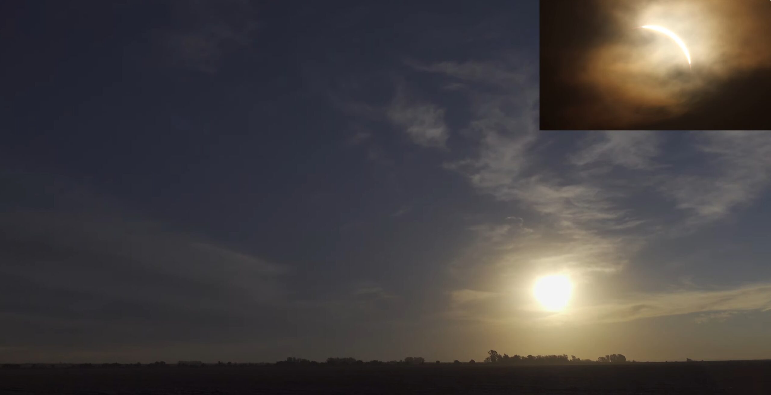
In fact, the center of Barcelona lies just 23 km north of the path, but because the eclipse occurs low above the horizon, the umbral column stretches across the entire sky, and there is no option to see the « gray wall » because the umbra is situated next to the Sun, not under the Sun. In exchange for it, an observer will see the « dark zone » very similar to, or even identical to, the one below, captured on July 2, 2019, by Jorg Schoppmeyer in Argentina.
For observers located in Alicante, over 90 km from the southern limit of totality, the umbra will appear as a darkened patch in the northern sky, whereas the northern horizon should look relatively brighter (Pic. 98).
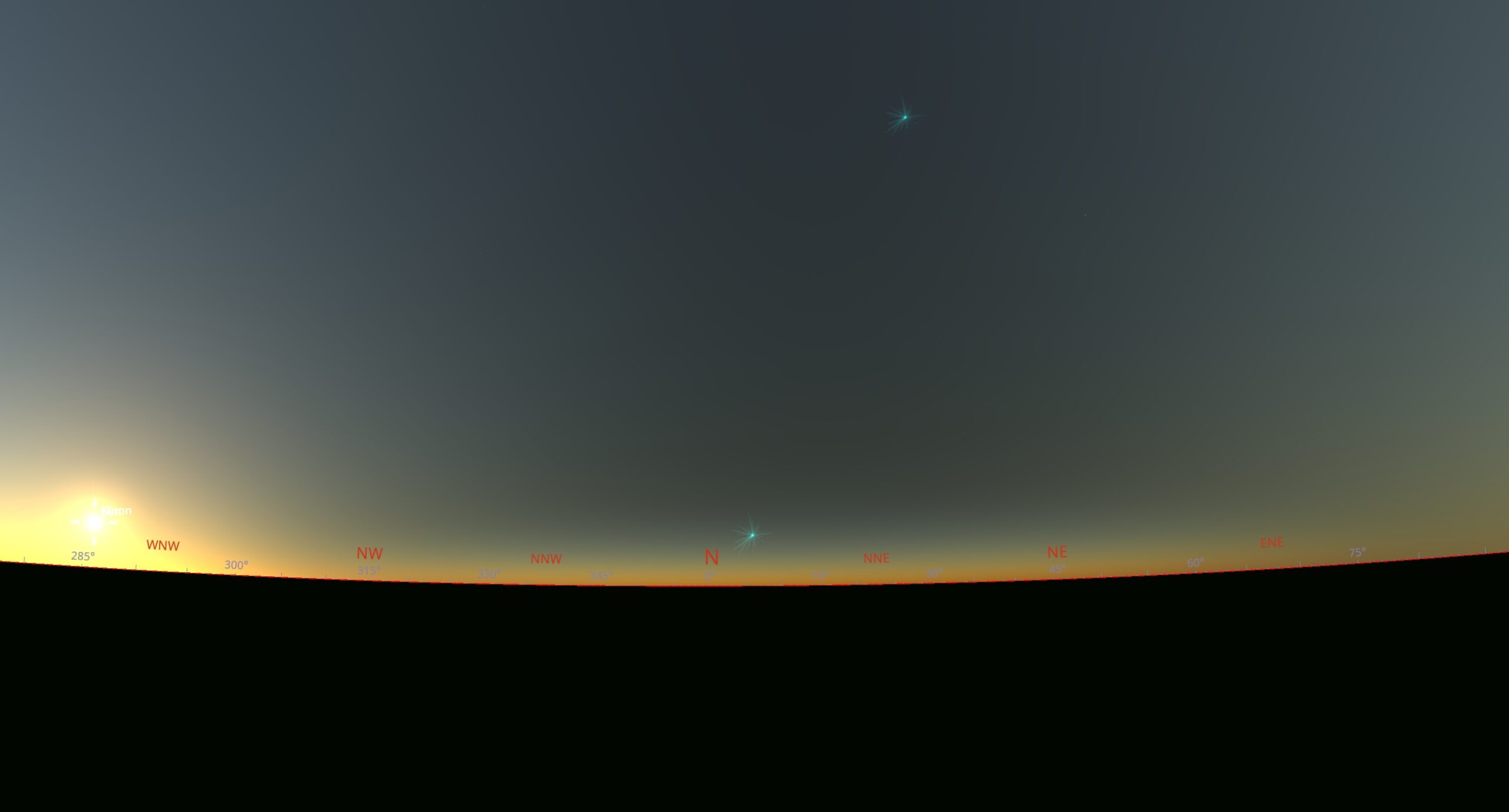
Concluding, an observer should be able to detect the Moon’s shadow from a distance of over 100 km during the forthcoming 2026 total solar eclipse.
H. ISS TRANSIT ACROSS THE ECLIPSED SOLAR DISK – The International Space Station (ISS), the largest artificial object in low Earth orbit (~400 km altitude), can occasionally be observed transiting the solar or lunar disk. These events occur along a very narrow ground track and typically last less than a second, requiring precise timing and accurate positioning for successful observation. The visibility and duration of a transit depend on the observer’s location and the altitude of the Sun or Moon, with geometric effects such as parallax causing significant variations even over short distances. Everything can be checked shortly before the eclipse event by using the Transit-finder.com website (Pic. 49).


Due to the ISS orbital period (~90 minutes), such transits may occur infrequently at a given site, often no more than twice within a short time window. Consequently, dedicated prediction tools and careful planning are essential for observational success.
6.1 Sample Locations
A. ICELAND – This small country will experience the partial solar eclipse with the minimum obscuration of 95.1% (Pic. 101).
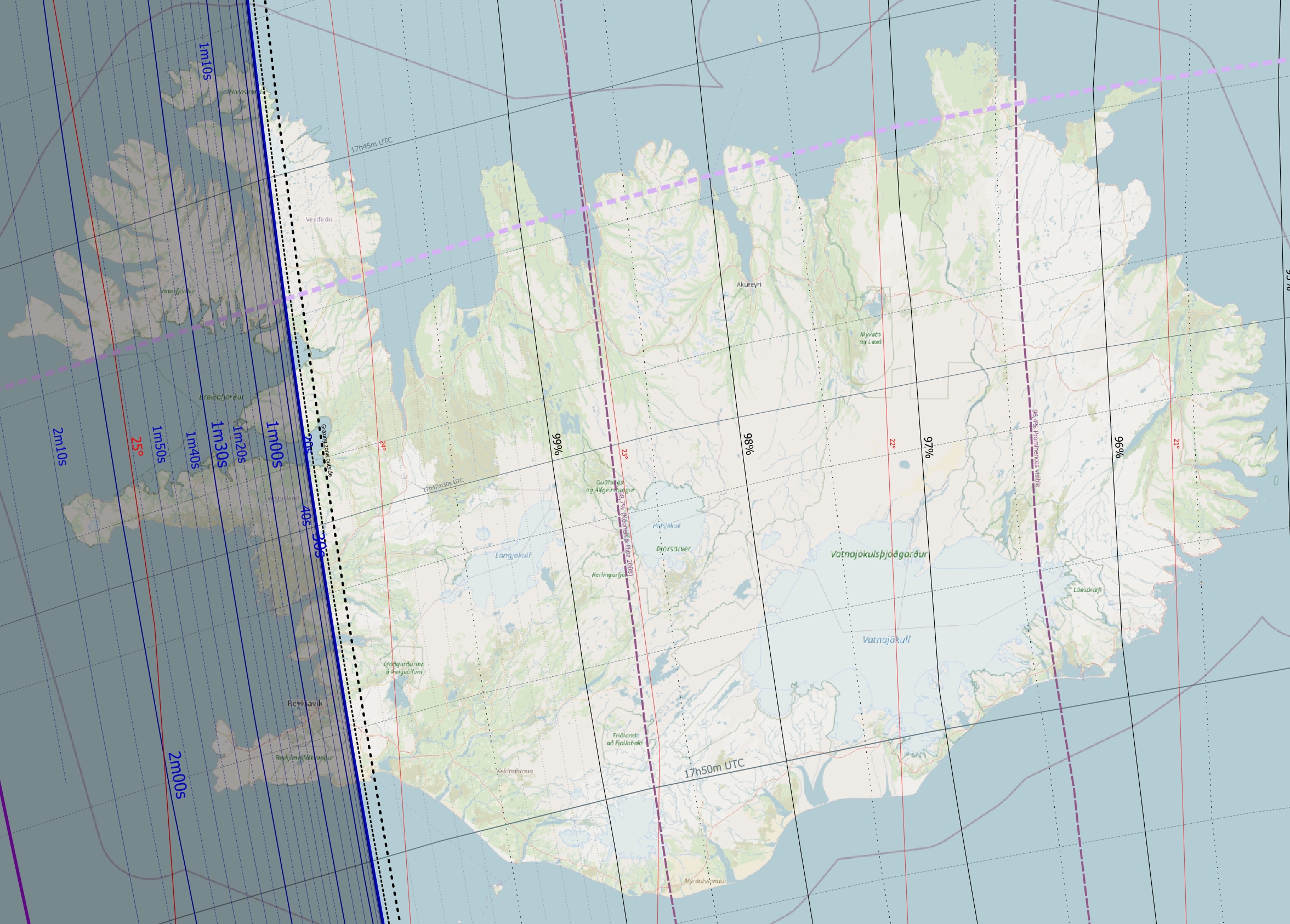
The most interesting locations are undeniably in the vicinity of the edge of totality. The map below presents two example locations considered for the observation within the grazing zone, with a level of obscuration of 99.8%.
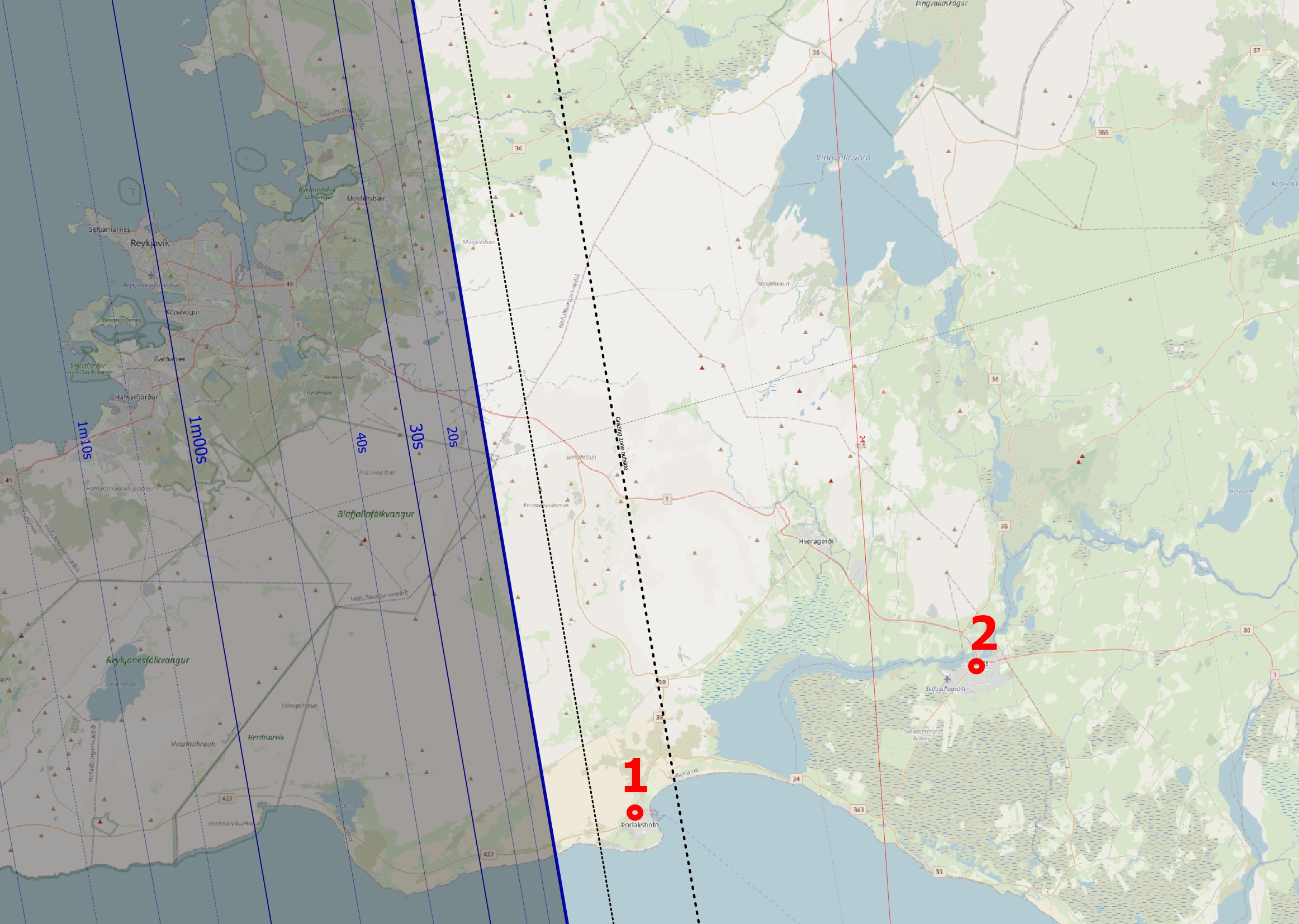
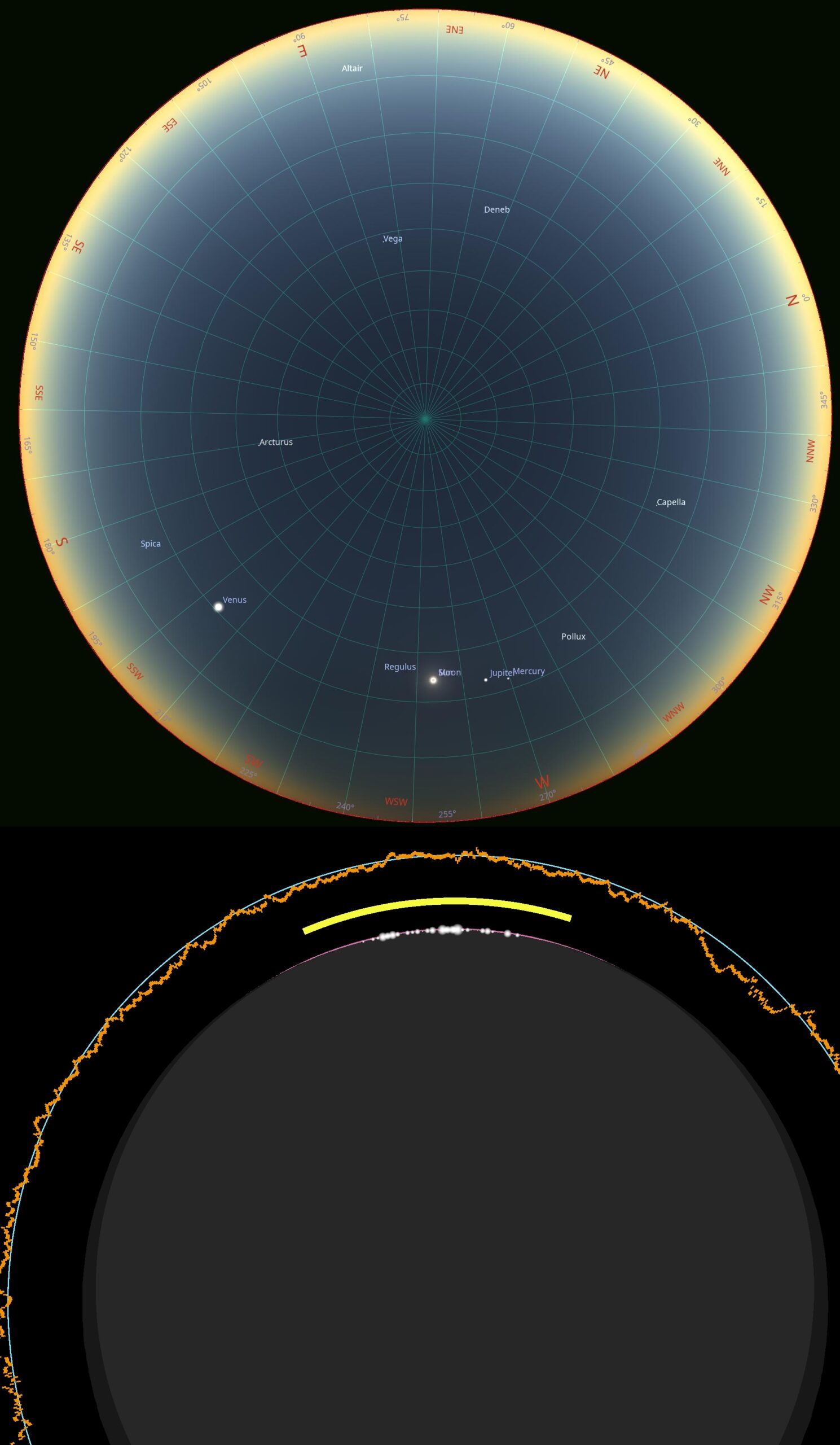
In the Þorlákshöfn village, located within the grazing zone, there is 2m55s of eclipse exceeding 99% obscuration, meaning de facto the time without solar filters and over 1 minute of beautiful diamond ring combined with Bailey’s Beads. The chances for a double diamond ring from this location are the same as those at other locations and occur shortly after the greatest phase. Meanwhile, the shadow is visible in great detail just under the Sun, along with its opposite, the southern boundary just above the horizon. There will be a few stars visible.
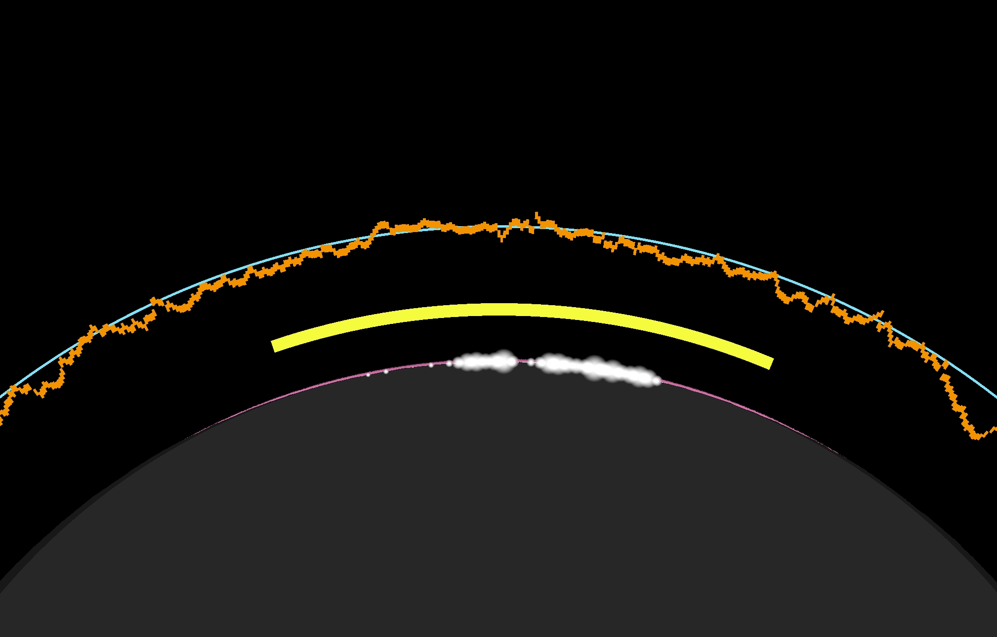
The town of Selfoss is located 5 times farther from the eclipse path than the village of Þorlákshöfn. As a result, there is no chance for Baily’s Beads, in exchange for which the large diamond ring will be visible (Pic. 105).
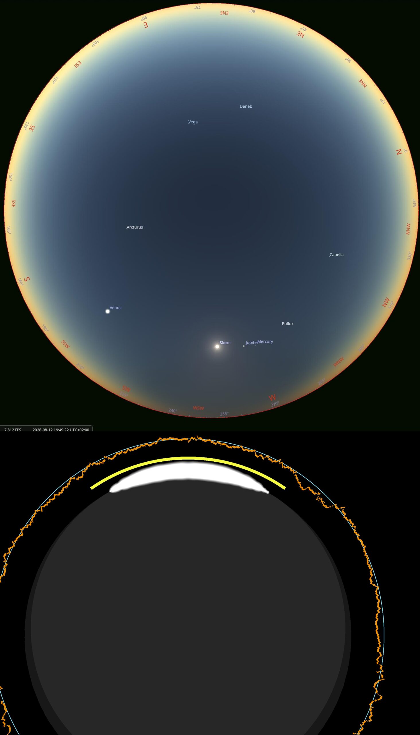
Despite almost 1m50s with obscuration exceeding 99%, the difference in the greatest eclipse is striking between these 2 locations. This is only 20 km! An observer can literally see a thin solar crescent from these locations. On the other hand, the sky sphere still looks interesting, with some bright stars visible and the umbra outline just beneath the Sun. The final obscuration is estimated to exceed 99.8% across all these locations.
The interesting subject for consideration is the presence of umbra, discussed earlier in this chapter with respect to the transition of light between the illuminated and shadowed sections of the sky.
The opposite side of the umbra can be visible during deep partiality, but only above a certain obscuration, which is quite flexible as far as the air quality is considered. In Stellarium 25.3, SkowMySky mode simulates it in ideal near-Rayleigh atmospheric conditions, free of water vapor particles and any aerosols. In practice, we should expect different circumstances, especially within the planetary boundary layer, where, by definition, the air isn’t fully clear. The presence of aerosols enhances forward light scattering.
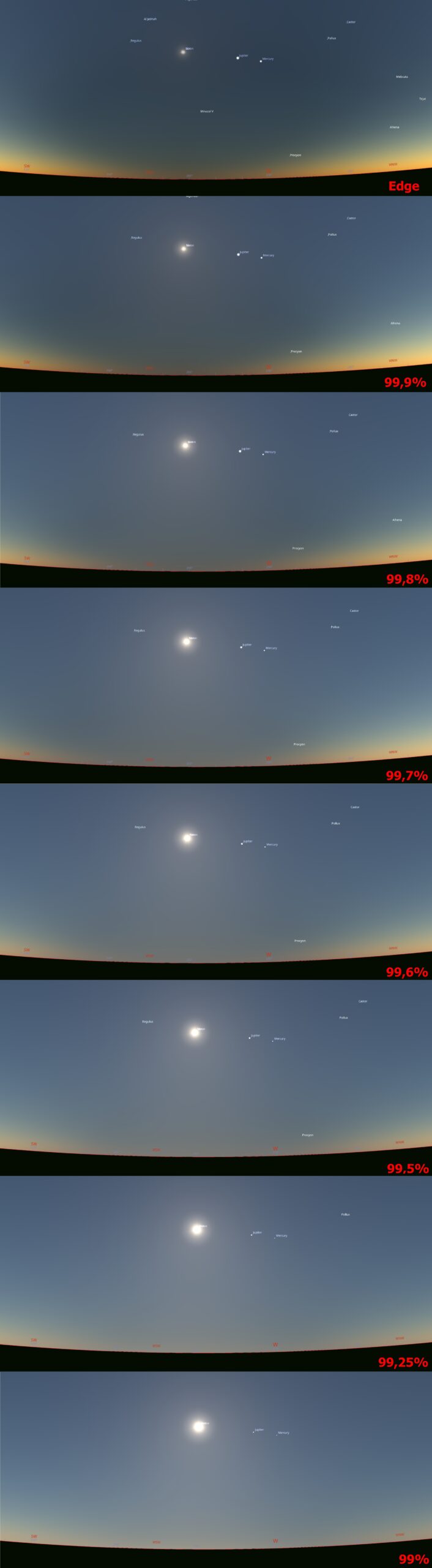
The image below, rendered by Stellarium, shows the relevant circumstances. The opposite side of the umbra becomes invisible at an obscuration of 99.7%, and next, the « gray wall » represented by the umbral cone disappears at an obscuration of about 99.2-99.3%. As the obscuration decreases, the near-horizon sky brightens again, though it remains darker than the surrounding horizon, allowing the shadow column to be identified from a distance.
B. UK & IRELAND – The British Isles will face a deep partial solar eclipse with obscuration over 90% as presented on the map below (Pic. 107), which covers the easternmost coast and Orkney & Shetland islands.
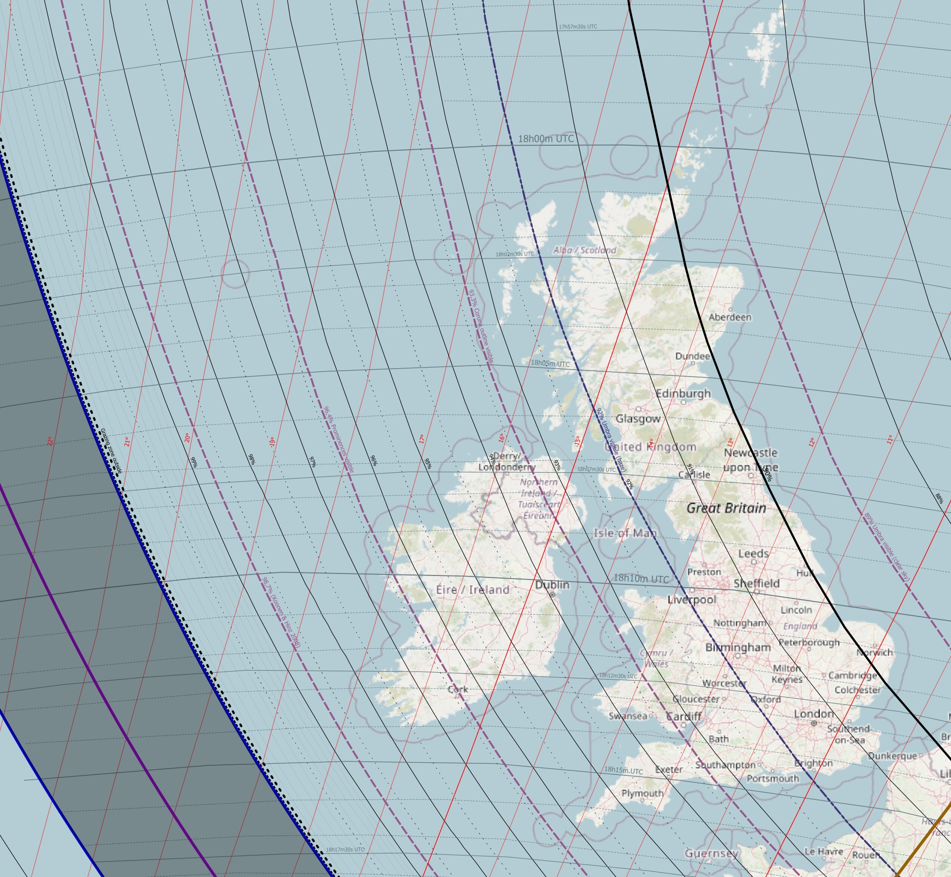
The most interesting places are the Iveragh and Dingle Peninsulas, as well as the Blasket Islands, where obscuration reaches 97-98%.
Our considered place is the Bolus Napoleonic Tower (Pic. 108).
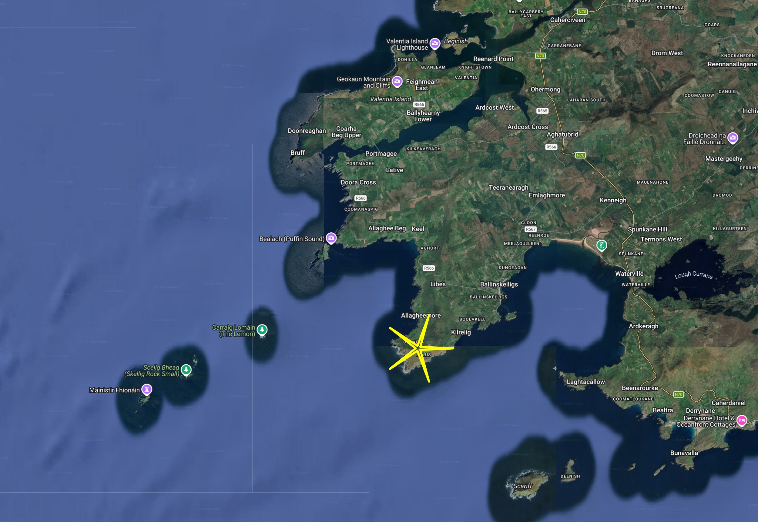
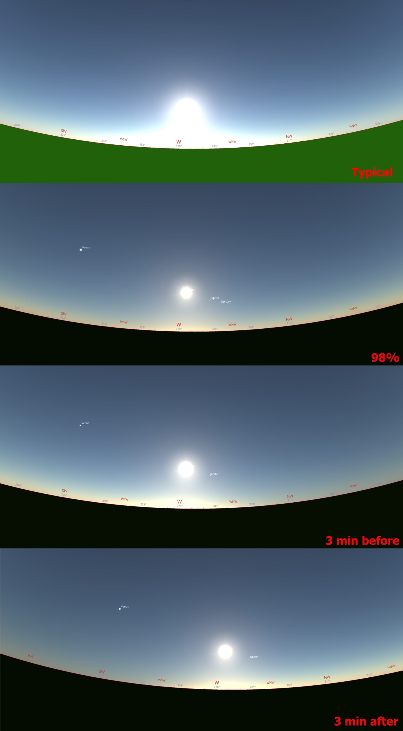
The shadow column should still be visible before and after the greatest phase because of a bit smaller forward light scattering when the observer isn’t looking directly at the solar azimuth. The distance to the limit of totality is approximately 220 km from this location.
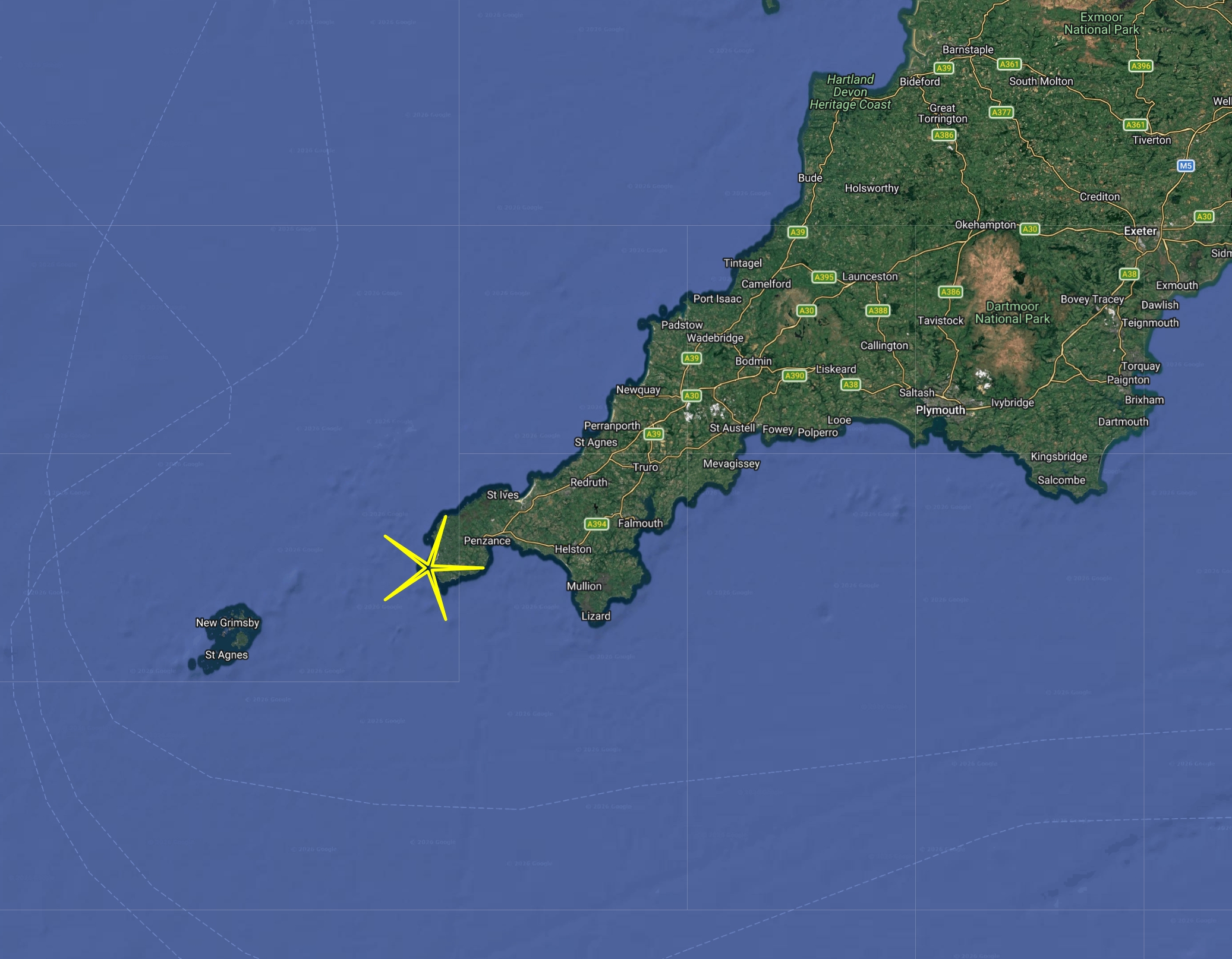
In Great Britain, the highest level of obscurity, 96.5%, will be observed at the Isles of Scilly and 95.9% at the southwesternmost tip of Cornwall.
Our case study is Lands’ End (Pic. 110), which is easily accessible by car (Pic. 111).
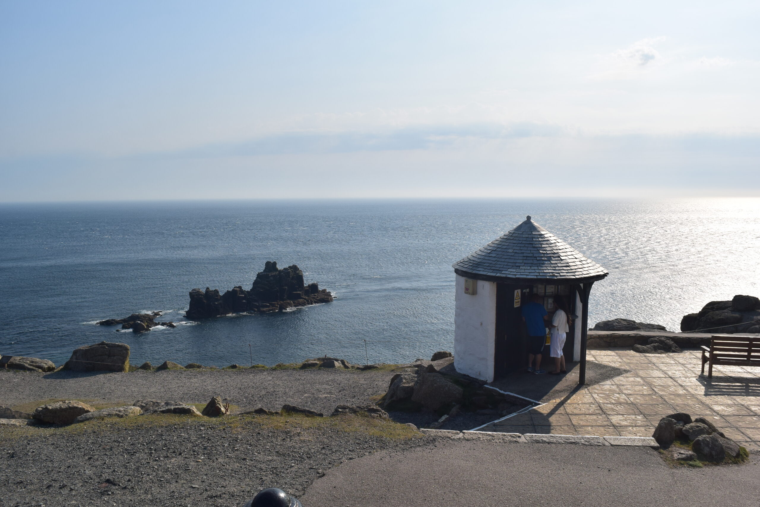
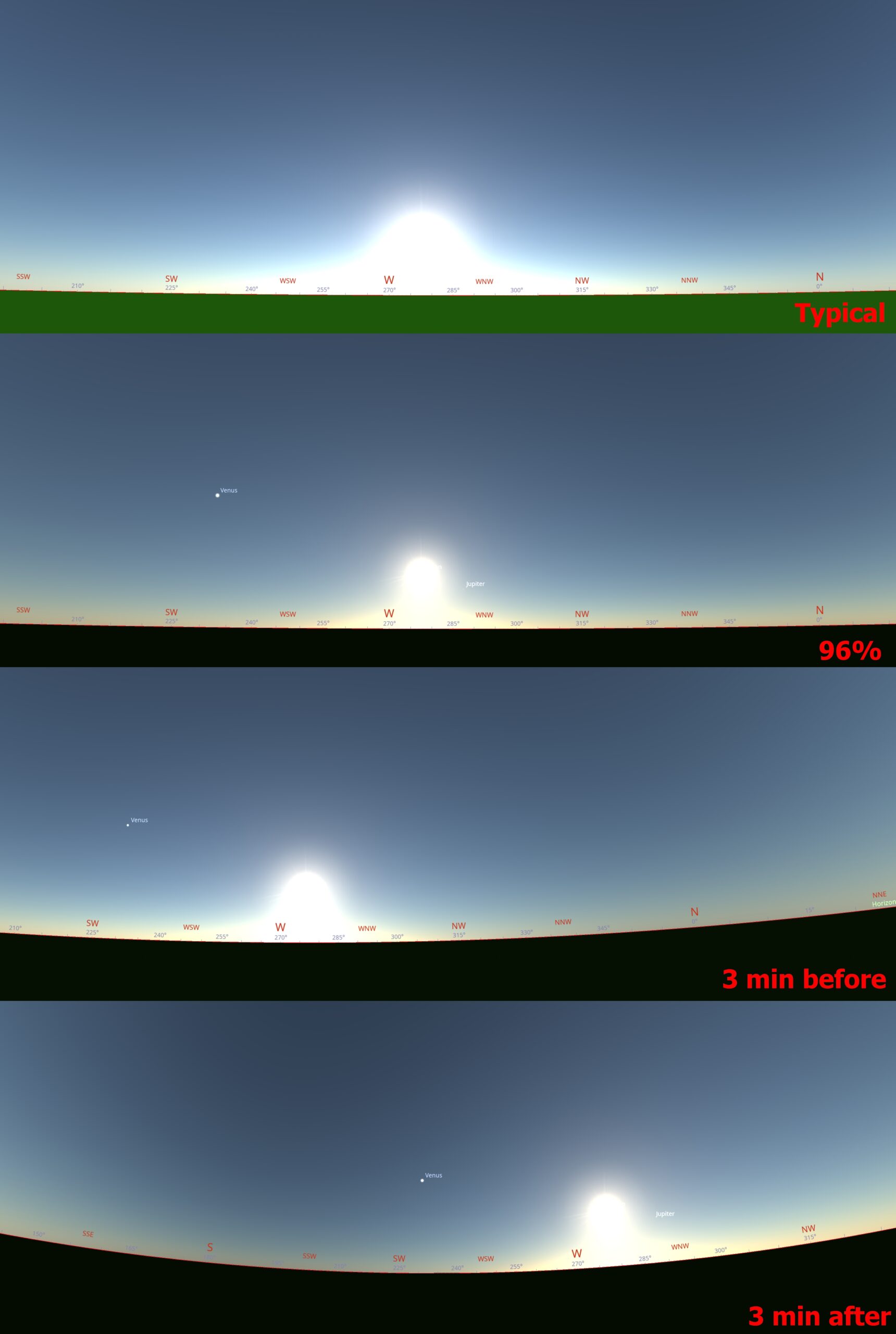
The distance from Land’s End to the totality path is over 390 km, so chasing the distant umbra column will be a challenge. However, an observer will see an interesting optical phenomenon mentioned in Chapter 8—the contrast triangle. On Ireland’s coast, this effect should be boosted more by a deeper eclipse phase.
C. FRANCE – The deepest partial eclipse will be observed in a municipality of Urepel (97%) and the Isterbegi hill (1027 m.a.s.l.) (Pic. 113) straddling the border with Spain, where the expected maximum obscuration is to reach 99.72%.
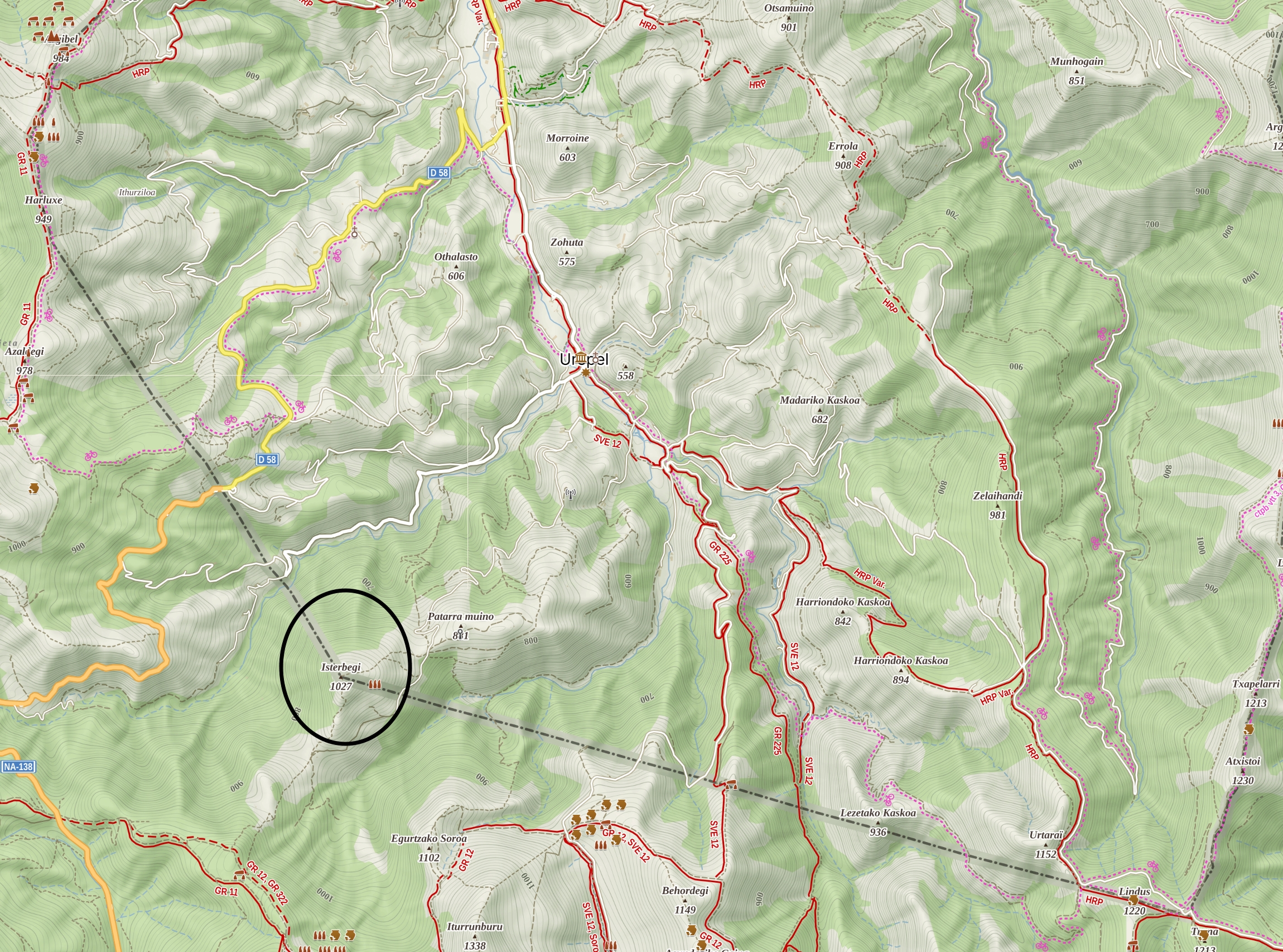
Unfortunately, no chances for Baily’s Beads. At most, a large diamond ring can be visible during the period of coronality. The Sun, obscured by at least 99%, will be visible for about 1m 40s.
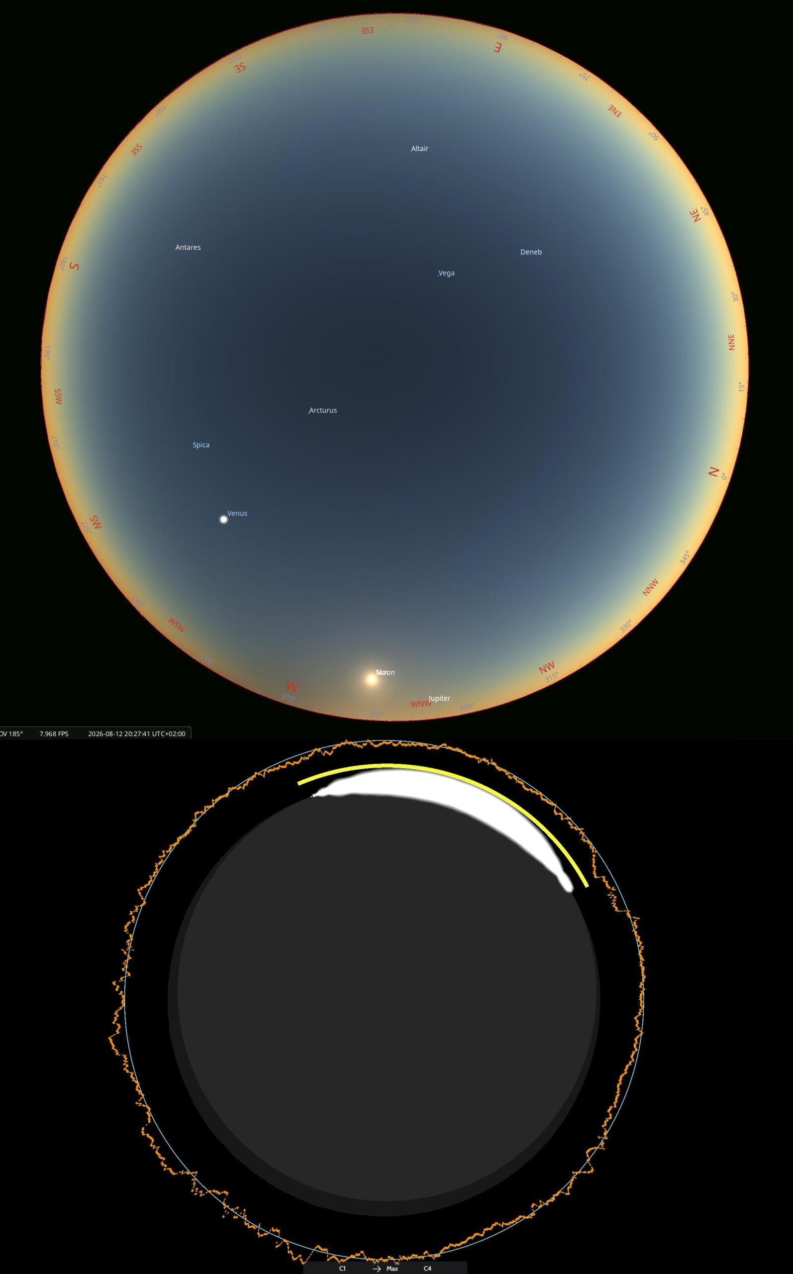
The obscuration is large enough to cause the thin solar crescent to break in several places around maximum. During this moment, an observer should detect at most 6 bright stars in the sky, except for bright Venus and maybe setting Jupiter.
The last thing is the position of the Moon’s shadow in the sky, which will be best expressed right after maximum (Pic. 115), because it will be very close to the location. The minimum distance of French grounds from the limit of totality is only 41.5 km; therefore, the umbra should be visible quite well in the southern section of the sky.
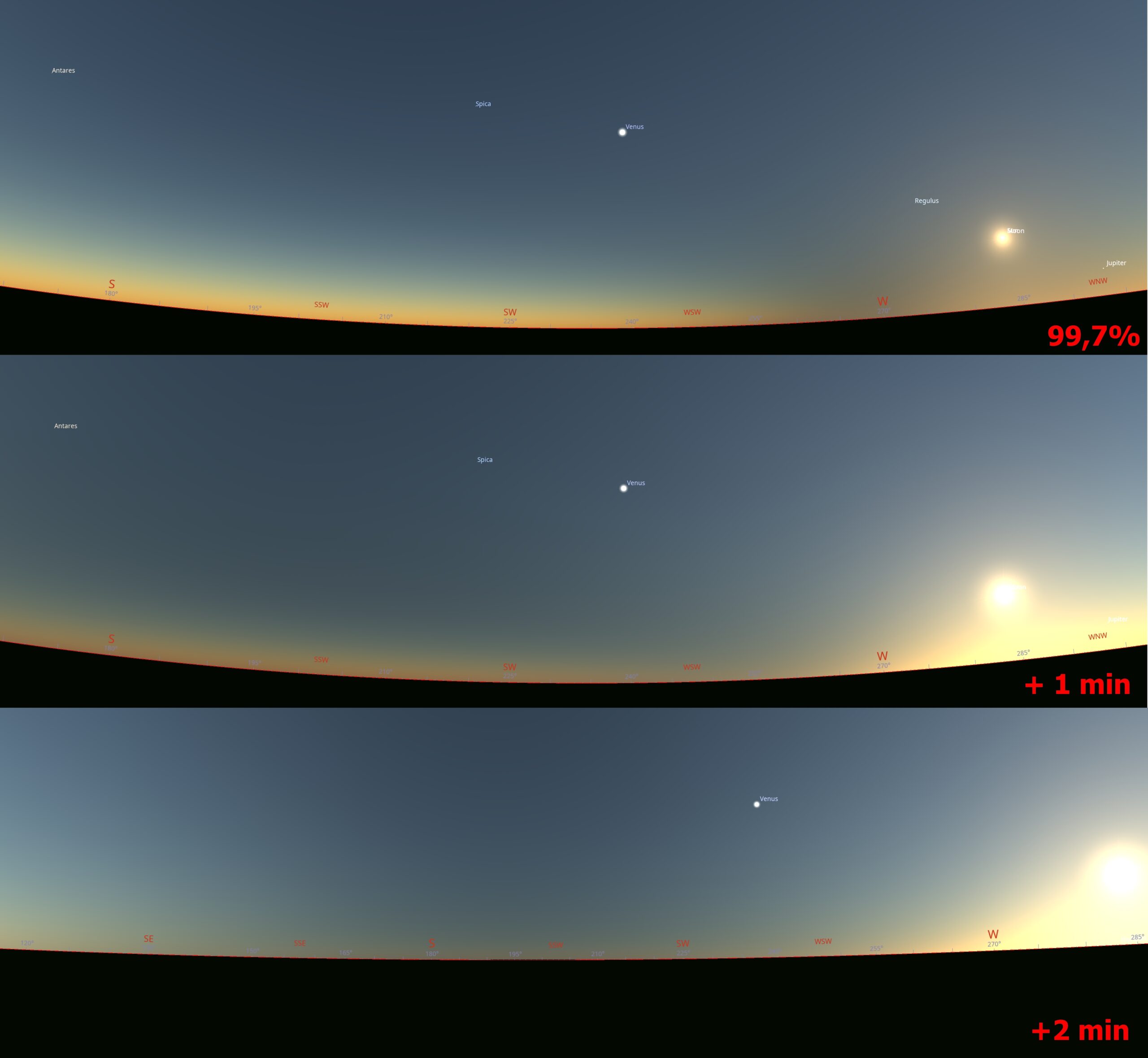
D. ANDORA – This small country will experience around 99% eclipse obscuration, so technically speaking, the period of observation without solar filters will be very narrow. The observation will be impossible in most places across the country, as the greatest eclipse will occur when the Sun, shining at an altitude of just below 5 degrees, sets behind the mountains.
E. SPAIN – As this is a major country with a total phase along with Iceland, there are the same circumstances, which refer to the grazing zones and the nearest vicinity of totality. Unlike Iceland, the observers in Spain can watch these phenomena from both sides of the path. As we know, the southern limit looks more interesting for two reasons:
– possibility of capturing a double diamond ring,
– better visibility of the shadow.
Considering the first element, the illustration below represents the view of Baily’s Beads and diamond ring at the greatest phases for all deep partialities down to 99,91% obscuration (Pic. 116).
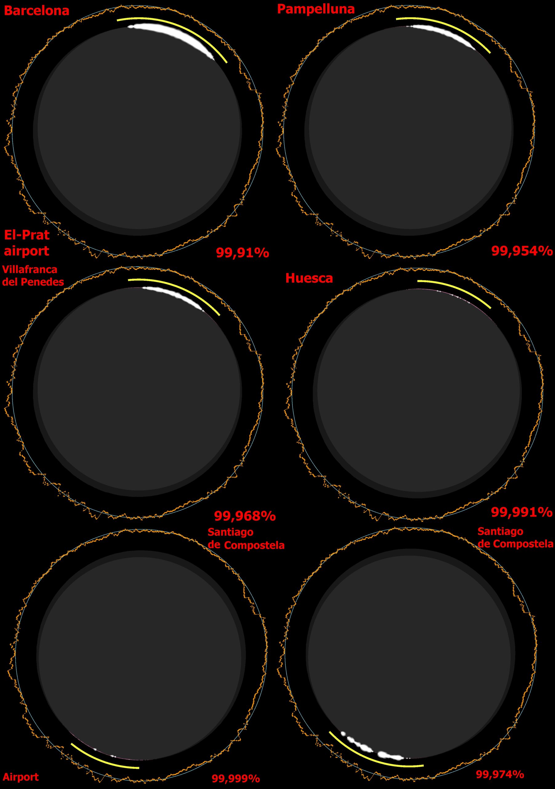
The distance from Barcelona El-Prat airport (BCN) to the northern limit of totality (Xjubier) is around 18,5km. Observers can see large Baily’s Beads.
On the opposite side, at Santiago de Compostela Airport (SCQ), located only 3 km along the path, the Baily’s Beads should be visible for over 30 seconds.
The most interesting deep partial eclipse view is expected in Madrid, where views will be quite different across the city (Pic. 117), offering a chance to capture a double diamond ring in some places.
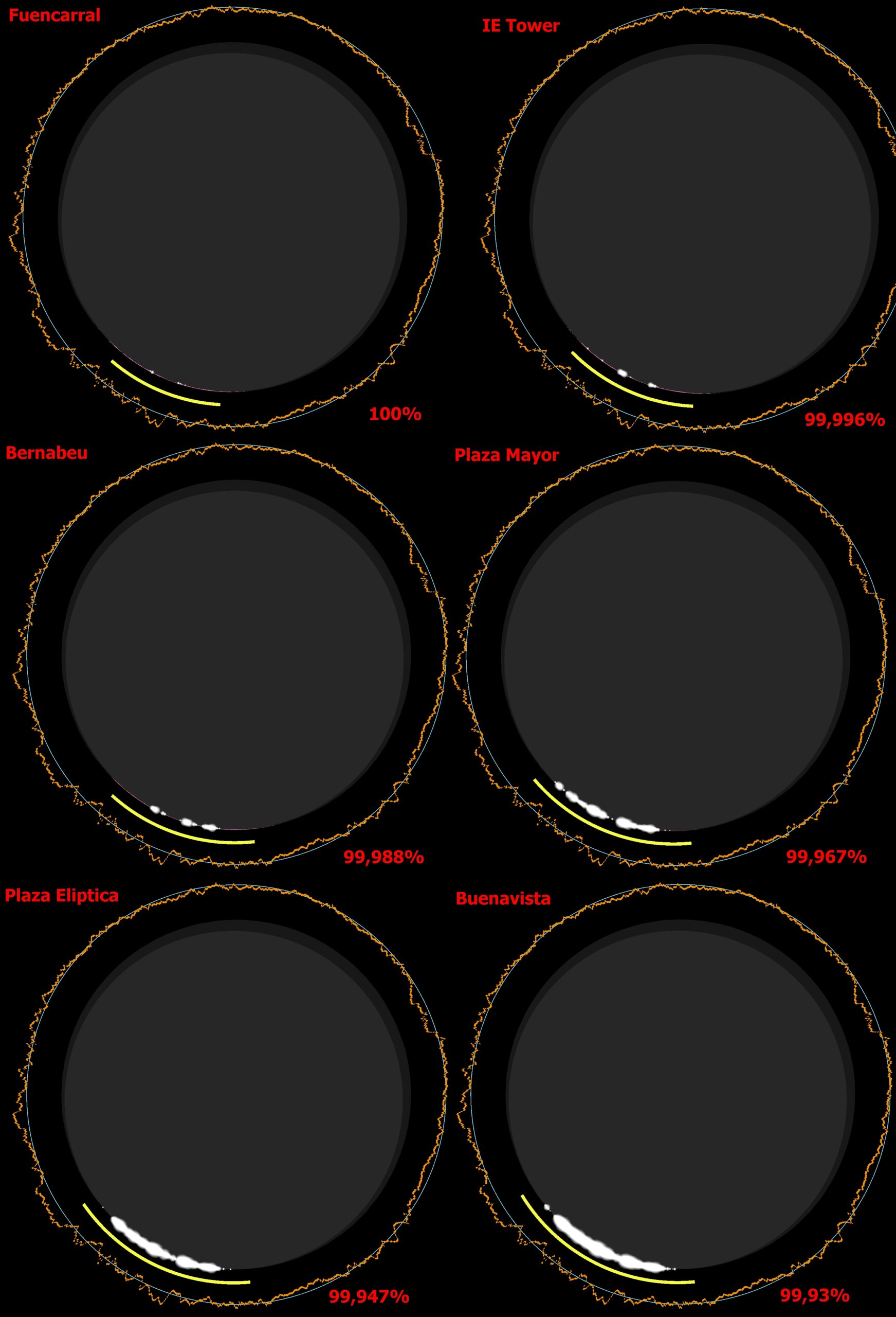
As far as the umbra is concerned, there are decent analyses for its view from the south in the Portuguese section. It will predominantly apply to Spain as well. The view from the north is much different, as an observer can see the shadow passing somewhat « under » the eclipsed Sun. The best view is, of course, at the closest locations; likewise, the center of Huesca town, located just 1km north of the path (Xjubier). In any case, the best umbra visibility occurs not at the greatest phase, as it happens for the southern side, but about 1 or even 2 minutes after (Pic. 118-120)
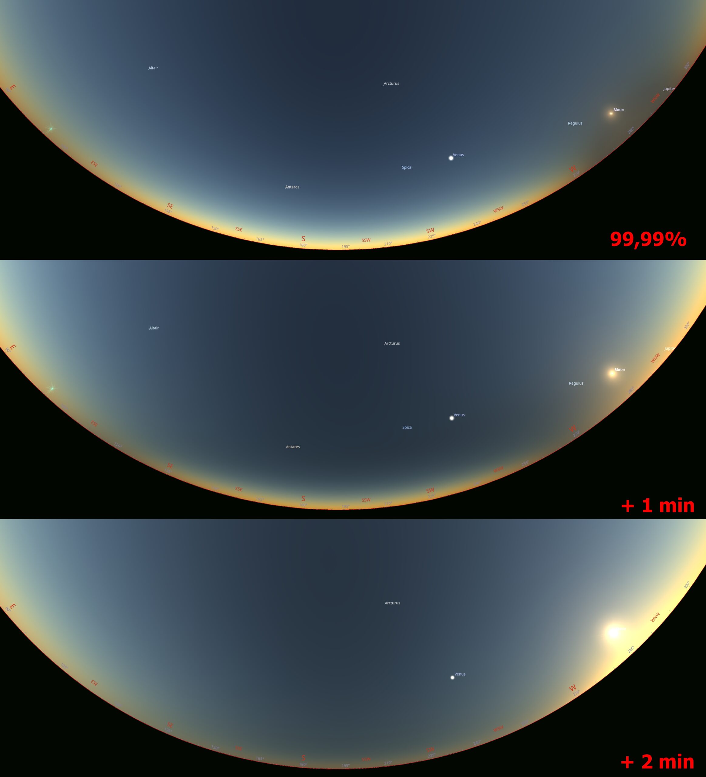
On the northern side, in any case, the greatest phase corresponds to the umbra at solar azimuth; next, an observer would need to « wait » one minute for the best contrast between the southern sky and the southern horizon. About 2 minutes after the greatest eclipse, the southern horizon looks dark.
In Barcelona, located around 35 km from the limit of totality (99,9% of obscuration), this effect is naturally weaker, but still visible well.
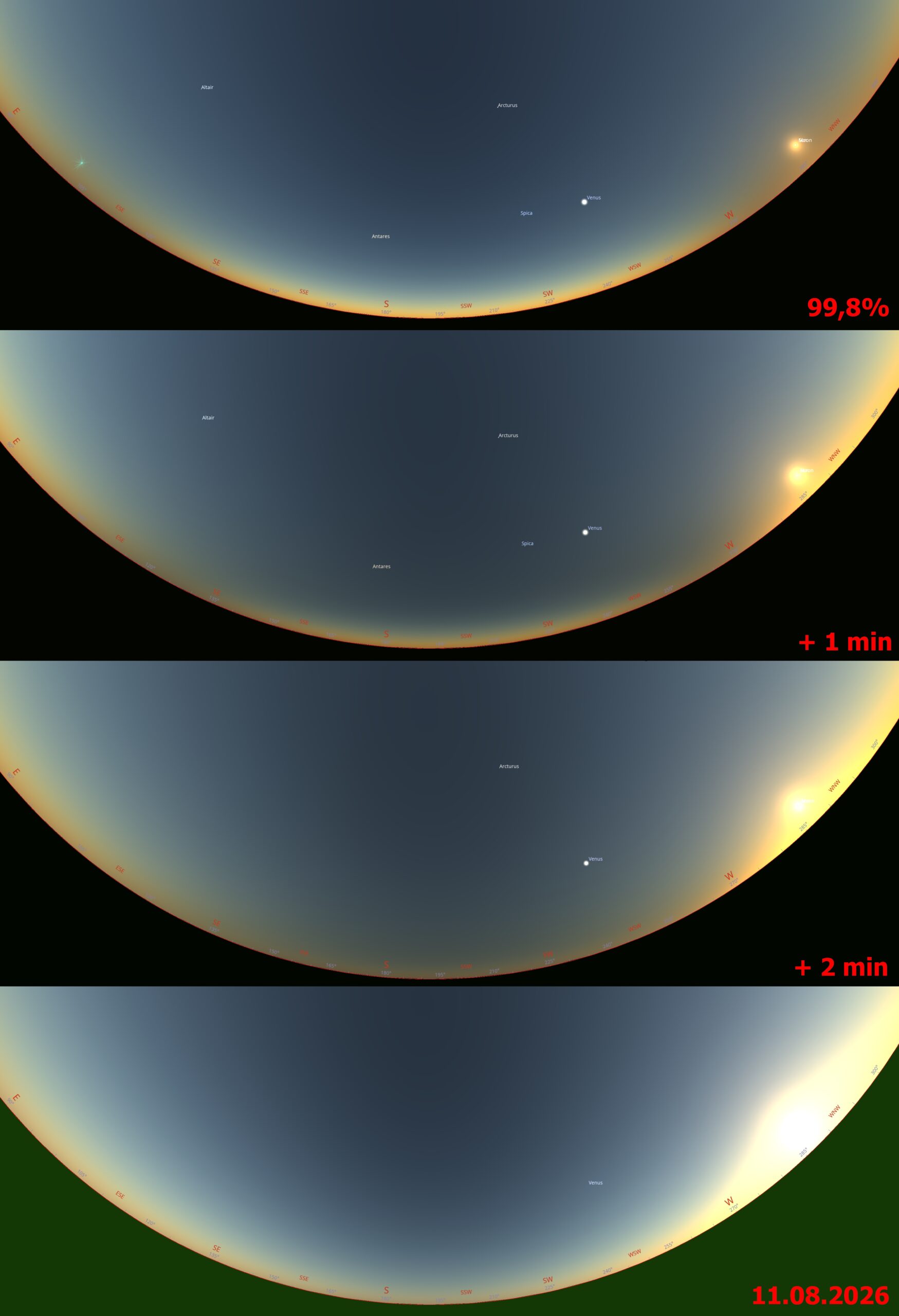
The most intriguing is the view from Girona town, located 115 km from the path, with the « magic » obscuration of 99%, which somewhat reflects the « psychological » barrier between partial and total solar eclipses, as many people deem that 99% doesn’t make a large difference. They’re wrong! The 99% obscuration means that removing the Sun’s filters is risky, and the umbra at a distance is only barely visible.
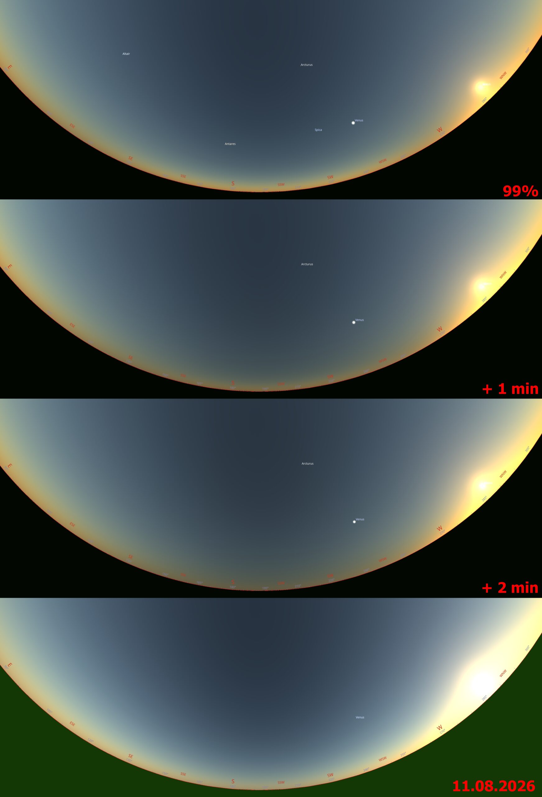
The smallest obscuration in Spain north of the path is about 98,7%, indicated as the boundary at which the sky view significantly changes due to the eclipse’s impact (Koonen & Hinz, 2008).
F. PORTUGAL – Except for the southeasternmost corner, which will experience the totality (see chapter 5), the adjacent municipalities can also be good venues to watch the grazing total solar eclipse event. The Braganca airport is located just 12km southwest of the totality path. The greatest eclipse will reach 99,85% obscuration, giving a chance to see spectacular Baily’s Beads for about 10 seconds, whereas the entire period without solar filters will last 2m10s.
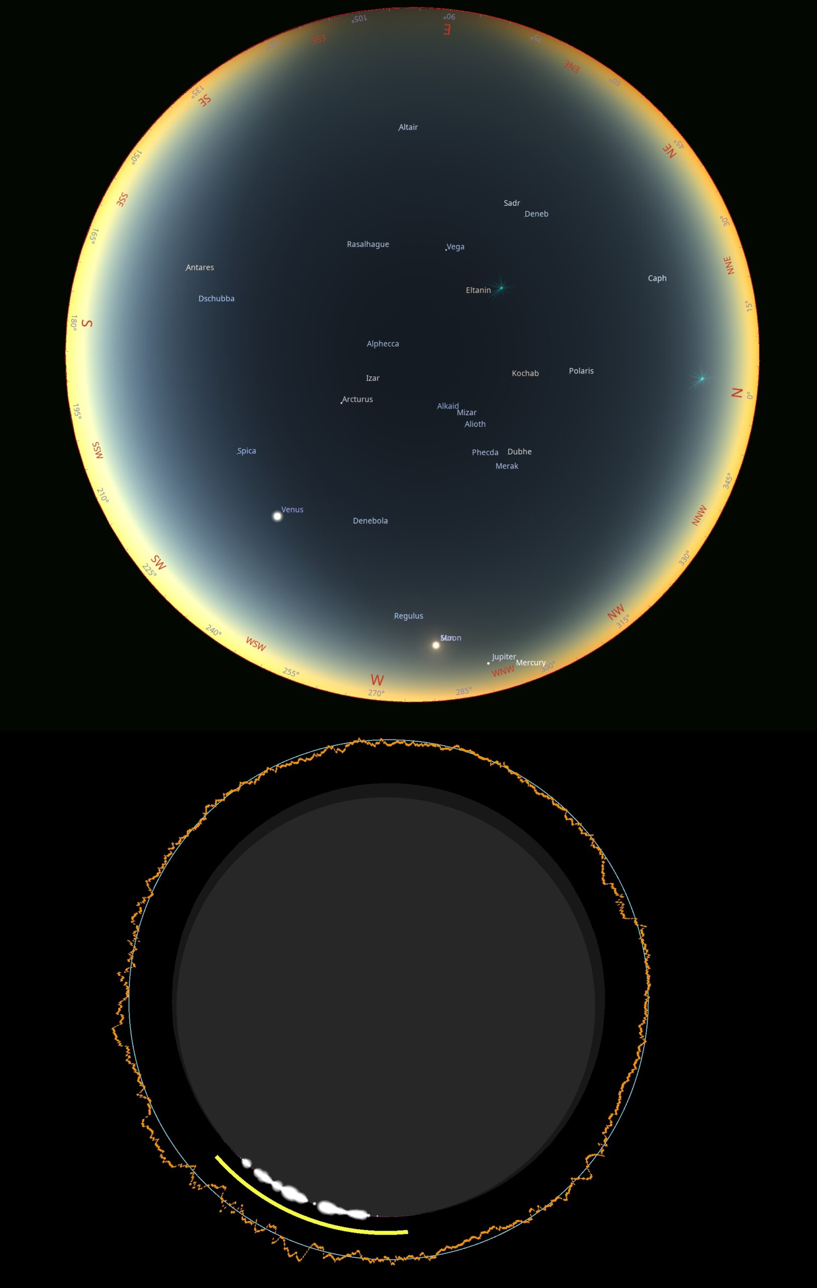
This spectacle will be visible in an almost entirely shadowed sky! The reason the zenith sky is shadowed in these circumstances will be explained later.
Below, you can find the Baily’s Beads circumstances within the obscuration of 99,95% and higger (Pic. 122).
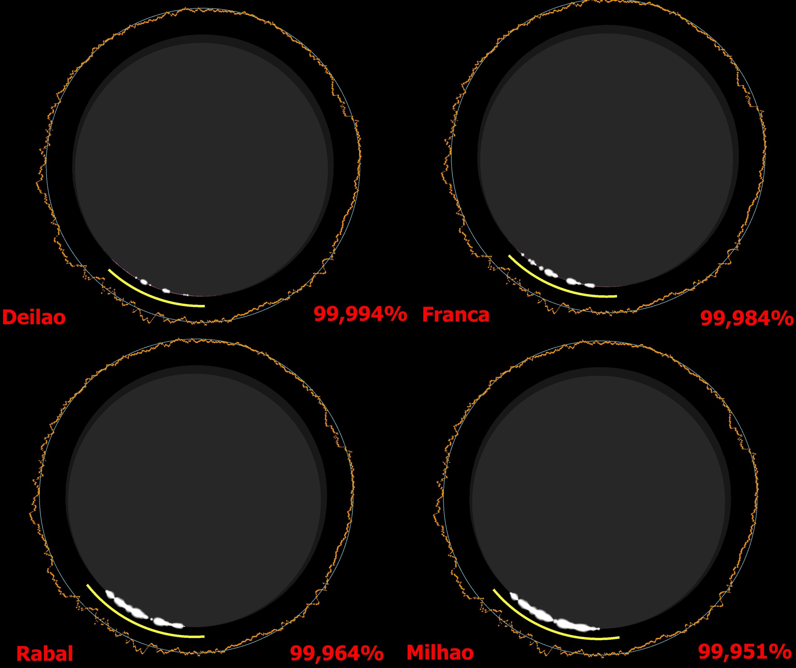
The last thing is the shadow in the sky, which requires attention in areas farther from the zone of totality, especially because, given the Sun’s low altitude above the horizon, the umbra behaves differently.
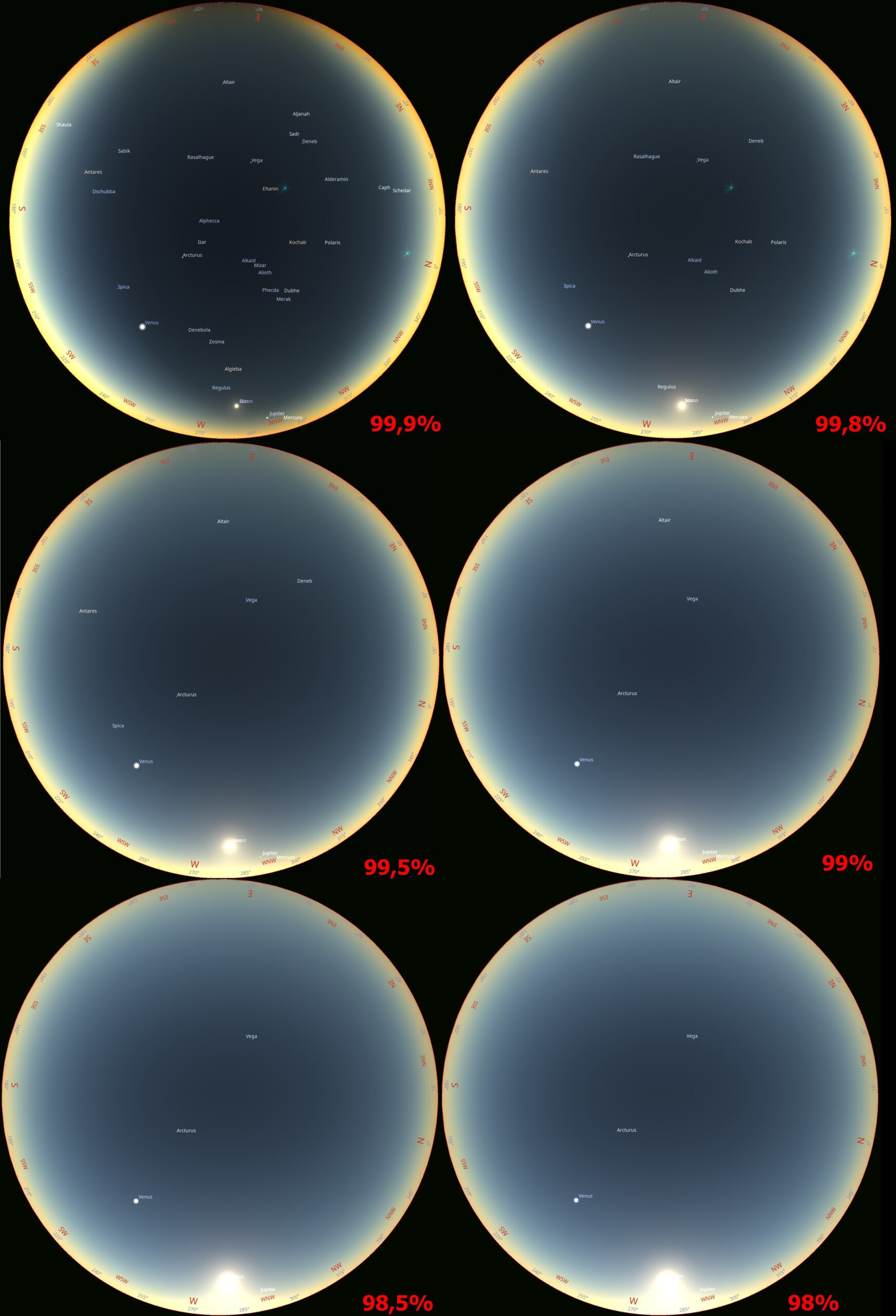
To better identify the presence of an umbra when located south of the totality path and the Sun is about to set, we need to look in the antisolar direction. At the eastern azimuth, the horizon looks much darker. It occurs for obscurations larger than 98%. For obscuration levels above 99%, some bright stars are visible.
H. ITALY – The partial eclipse will be visible across the entire country, and especially the Sunset arc, as mentioned in chapter 10, is worth attention. In this text, only the greatest eclipse is considered. The maximum obscuration, which can be observable at the horizon or above, is at most 98,5%. Of course, it will occur along the western coast of Sardinia, as mentioned especially in chapters 7 and 15.
An example of a venue that will experience a very thin crescent is the Argentiera village (Pic. 124).
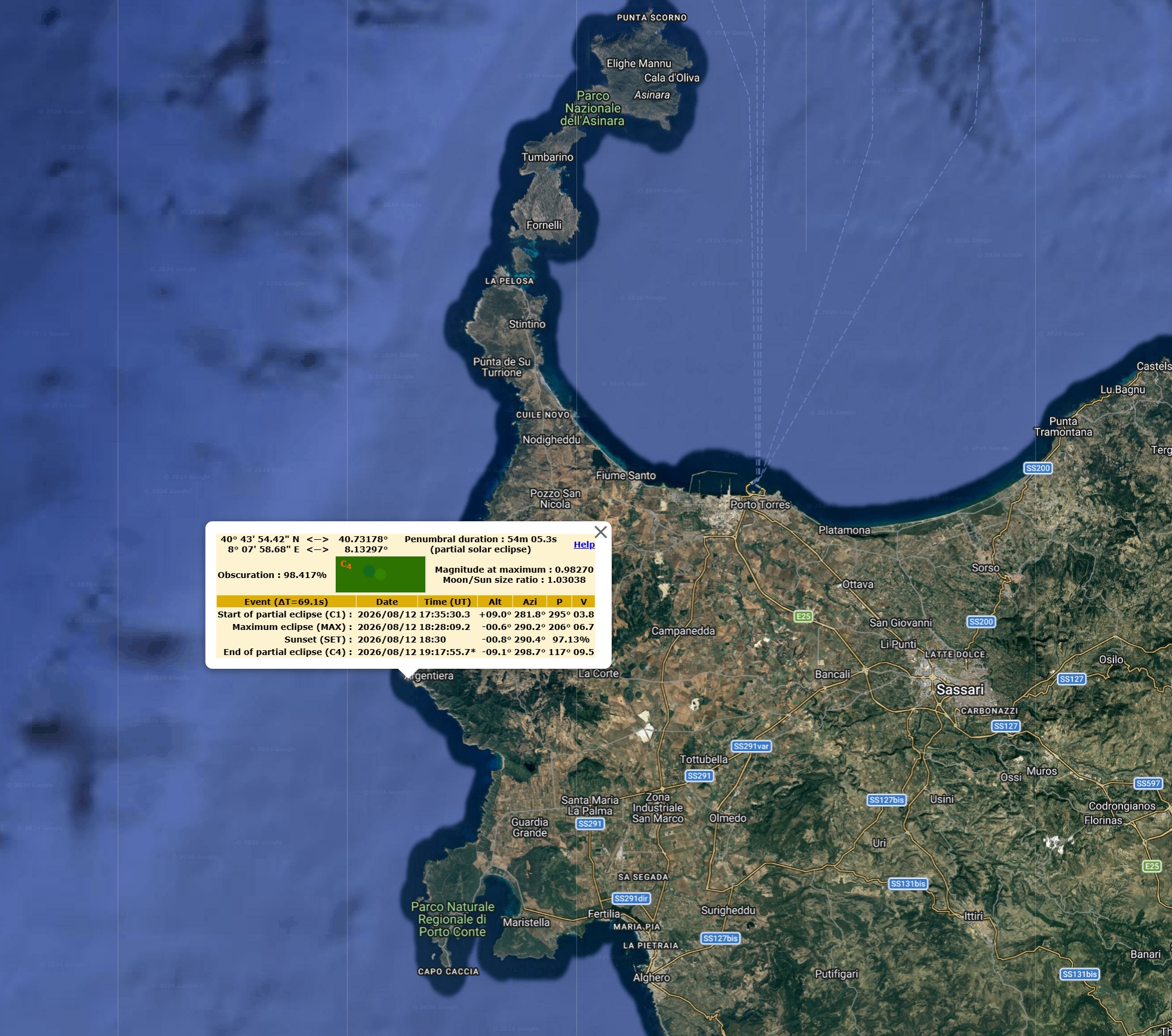
The sunset arc is, unfortunately, the least favorable for potential viewing of the solar corona outline. There is no such observation, and personally, I am looking forward to it!
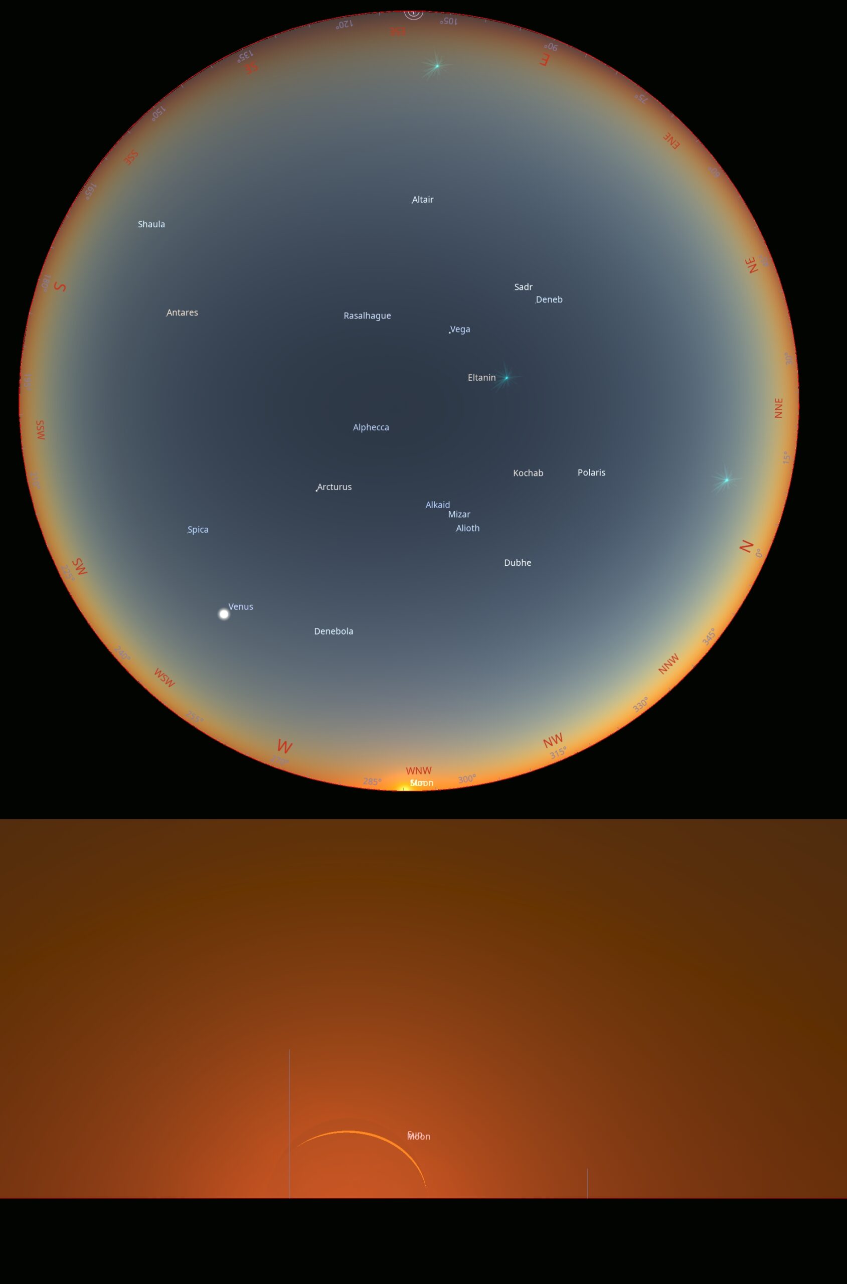
The serious obscuration of the Sun, combined with its position against the horizon, and therefore the level of light diminishing in a thick atmosphere, should allow observers to see quite a lot of bright stars in the sky, which normally appear at least about a mid-civil twilight. Another thing is darkening at the antisolar azimuth, which is related to the false umbra emerging from behind the globe, as explained in this text. Next, the observer should see the umbra outline at a distance, which will move rapidly southwards.
>>>BACK TO TOP<<<
7. ECLIPSE EVENT BELOW THE HORIZON
As over half of the European continent will experience the eclipse culmination after sunset, it’s worth describing and visualizing how this event will look. This chapter also covers locations in Northern Africa, which lie directly south of the totality path extension. The analyses presented here are further discussed in the following article, which results in animations of the event from various perspectives. The eclipse’s impact on twilight has been described in order of increasing solar depression. For supplement details, including the description of random places, please refer to chapter 15.
7.1 Algeria
The largest country in Africa lies entirely south of the eclipse path and its extension. Except for the coastal section between Kanoua and El Kala, the umbra visibility will be reduced or just marginal. Two places, as examples of the best eclipse visibility, are described in chapter 15 (15.1 & 15.2). Another matter revolves around what can be seen in the situation when the eclipse isn’t total anymore. Due to its specificity, occurring below the horizon, we don’t deal with direct light scattering. Undeniably, the most interesting in this case will be the anti-twilight sky, at which the rising Belt of Venus will clearly coincide with the fading umbra. The animation below shows the central position of the umbra or deep penumbra for 4 locations up to about 200 km south of the totality extension limits (Pics. 126, 127).


Another very interesting part of this event will be the visibility of the faint umbra in the northern sky. As the eclipse progresses, observers near the event can see the rising umbral band from the north. This fascinating occurrence will also be noticeable for observers located further south, up to about 100 km from the path limitation (Pic. 128).

Due to a significant difference in direct sunlight scattering, the effect will look quite different for Bejaia, where the crescent sun will be setting, than for Constantine, where everything will happen at a solar depression of 1°.
The last aspect to be mentioned here is passing the reddish band over the observers’ heads. As the umbra won’t be visible anymore, the deep penumbra will cause a significant reddening of the sky across the entire celestial dome, driven by the limb-darkening effect and position of the crescent against the horizon. As the Devil’s Horn sunset is expected to be visible from most places along the terminator line in Algeria, the sun’s crescent will shine through the thickest part of Earth’s atmosphere, resulting in long wavelengths of light being scattered. Therefore, the umbra, visible only from the northeastern shores of the country, will gradually turn into an intense reddish band, fading out as the eclipse approaches its end or as a hypothetical observer continues southward. The all-sky perspective for several places across the country shows what it looks like. On the other hand, south of the Batna town, the solar eclipse culmination won’t be deep enough to keep this effect retained (Pic. 129, 130).

The animation above represents the view of the effect from several locations up to 200 km south of the totality extension limit. As the umbra moves southwards, its disappearance is clearly observed, followed by an intense reddening of the sky where it had been. In any case, except for Batna, the umbra (or deep penumbra) is projected above the observer’s head. Batna is the southernmost city considered, where the effect at zenith is no longer visible.
The compilation below compares all these locations to each other and the same moment of twilight a day after.

The umbra encompasses the celestial dome, then disappears, superseded by an intense reddish band that eventually fades. One reason it happens this way has been described in this article. A location south of the totality path extension is more favorable than one north of it, as mentioned in the Italy (7.3) section.
7.2 Tunisia
The aspect of the solar eclipse’s impact on twilight in Tunisia cannot be considered only within the path extension for the following reasons:
– The lack of direct light scattering means that the optical effects in the sky are visible far away from the central position of the event,
– The circumstances of umbral movement make the locations south of the path extension more favorable.
Analyzing the first case, the animation and image below (Pics. 131, 132) are noteworthy, as they compare the effect at the greatest eclipse from 4 different locations. The first location represents the central alignment with the eclipse path extension. All the others are situated at some distance southwards, which in turn makes the view more from the side. At the farthest location, the umbra effect is almost invisible at the eclipse culmination and barely visible at the end of the event (U4).


Regardless of the path extension, we aim to achieve the minimum light drop in the scene. The chart below (Pic. 133) shows two locations with similar umbral depths but on opposite sides of the eclipse centerline. The first one is the best example of how the solar eclipse shapes the early twilight, when totality can be physically observed above the horizon. This is Menorca, the easternmost of the Balearic Islands, which will experience the totality just 1.5 degrees above the horizon (see Chapter 9). Another example is Bizerte, the northernmost city in Tunisia, where a very similar scenario will be observed somewhat later from the observer’s perspective—during the civil dusk. They both look quite similar as the totality unfolds. However, there are two aspects to be covered. One of them is a small difference in latitude. As Menorca lies more to the north, the curve looks slightly more compressed because the twilight progress lasts a bit longer. Another thing is the moment of the eclipse’s impact relative to the overall rate of decline in the light level. If we take into account the obscuration of 95% (the very last node in the curves on the left from the maximum drop), we can see the difference of even 6 degrees within the golden hour period and just about 3.5 degrees within the civil dusk zone. This relation will be described in future texts, but for general understanding, it’s good to know that typically a faster light drop is inversely proportional to its eclipse-induced acceleration.

When moving 250 km south of the eclipse extension limit, the Moon’s shadow effect is marginally visible. The image below shows the rendering of Gafsa town in central Tunisia, where observers should expect the umbra from the north. At 19:32 local time (Tunisia doesn’t use daylight saving time!), the antitwilight arch will be unnaturally bent westwards, covering the northern azimuth entirely. As the maximum darkening reaches only a few degrees, the event might not be noticeable under poor atmospheric conditions. The shot underneath, reflecting the same moment on August 13, displays the difference exactly at the northern azimuth (Pic. 134).

As mentioned above (Pic. 134), the effect will be more visible later, as the umbral column, despite leaving Earth’s atmosphere, continues to point south. Interestingly, it looks like the anti-twilight sky at various locations. For the Gafsa town considered above (Pics. 135, 136), the third row from the top represents an effect of a deep partial solar eclipse affecting the Belt of Venus and twilight wedge, making it much fainter than usual. Unlike locations further north, the upper part of the blue band (BB) marks the darkest part of the sky. It means that the scene and planetary boundary layer are bright enough to scatter light into the horizontal band beyond. It doesn’t happen when the antitwilight sky is affected by the umbra. What is expected to be seen from Gafsa is most similar to typical twilight conditions illustrated at the bottom of this graph.

At last, the most remote town included in these analyses warrants consideration. The Tazaur is a small settlement in southern Tunisia, located approximately 400 km south of the extended eclipse path limitations. The compilation below (Pic. 138) shows the projected sequence of the event from the estimated end of the eclipse at 19:34 local time to the moment 4 minutes later, when the umbral column reaches the observer’s head but is too high in the atmosphere to produce the effect of extended totality in the sky.

The twilight glow will still be significantly disturbed, as the isophotes remain the « symbol of indefiniteness. » In fact, the civil twilight at a solar depression of about 4-5° might not be enough for the detection of this optical event by casual people. However, the situation can become more favorable as we move several degrees deeper into the twilight zone. The compilation below shows what will happen in the sky between 19:34, when the eclipse reaches its maximum, and 5 minutes later, from the perspectives of Gafsa, a town, and Tripoli, the capital of Libya, located 450 km away. In Gafsa, the greatest eclipse, defined as the moment when the deepest penumbra passes above the observer’s head, occurs near the end of civil twilight, when the Sun is about 5° below the horizon. The observer will probably notice little change in the twilight glow, unlike his colleague near Tripoli, who will see a more pronounced effect (Pic. 139).

How is it possible? The twilight progress is based on a logarithmic scale, which means that when the amount of light is large enough, the differences are less noticeable. When the amount of light starts to decrease rapidly, then the differences in illumination, produced by the deepest penumbra, become serious. It’s a separate matter for further texts. For now, we just need to be aware that the twilight stage will play an important role in the optical extension of the eclipse.
7.3 Italy
Almost the entire of Italy is located north of the path extension. The exceptions are only the small islands located in the Mediterranean. The impact of the August 12 solar eclipse on twilight falls into two distinct scenarios across the country. The first refers to Sardinia, the largest island, which lies directly behind the terminator line. The second scenario straddles between civil and nautical dusk, where the chance of seeing the full event in an antitwilight sky is rather small. The northern location along the path extension offers an unprecedented opportunity to observe the extremely elusive « false umbra », which emerges at the antisolar direction directly before the second contact. The details of this event have been described already in this article. The sequence below keeps the deep penumbra, and eventually the umbra, precisely above the potential observer’s head. Before the « false umbra » emerges from the horizon above the antisolar direction, the sky gets slightly darker at the lowest altitude (Pic. 140,141).


All the sequences presented above refer to the situation in which the umbral (or penumbral) axis passes exactly above the observer’s head. In that case, the most prominent effect is visible exactly at the antisolar direction. If anyone is unable to see the difference, the sequences below represent the detailed breakdown with respect to coloration and isophotes – the lines connecting the same level of color brightness as rendered by Stellarium 26.1 ShowMySky mode (Pic. 142).

For the full false umbra visibility against the entire celestial dome, please refer to Chapter 15.4, where the Capo Sperone has been analyzed in detail. As we remain on the northern side of the total solar eclipse event below the horizon, we have an opportunity to compare the positions of the deep penumbra and umbra with their southern counterparts in northeastern Algeria, as discussed above in Chapter 7.1. As mentioned there, the eclipse effect will be visible up to 200 km south of the totality limit. In fact, it refers to any part of the sky (mainly northern azimuth) at which the shadow column will be visible at the end of the event. The opposite situation will happen at Sardinia, where the same umbra will be visible, but at the very beginning of the totality (Pic. 144). However, considering the sky at the antitwilight direction, the maximum distance at which an observer can detect something is up to 130 km as per the Stellarium 26.1 ShowMySky visualizations provided. The deep penumbra and umbra appearance looks completely different on both sides of the totality path extension! (Pic. 143).

The reason is described in this article, which explains the umbra’s position near the terminator line. The location of Tortoli corresponds to the obscuration of 99% at the greatest phase. The city of Cagliari gets 99,75% accordingly. Looking at the projections above, we can conclude that the effect of the « rising umbra » becomes visible at an obscuration of 99%. The location of Olbia town provides up to 98% obscuration, which is not enough to detect this event. It doesn’t change the fact that all the effects associated with a deep partial solar eclipse will affect early dusk. On the Algerian side, the situation looks very similar, as the city of Constantina, with an estimated obscuration of approximately 99%, encloses the event occurrence.
The solar azimuth looks more interesting, even though it is farther from the totality line. Even in Olbia, the observer might be able to detect the umbra far above the southern horizon (Pic. 144).

The town of Sorgono will experience 98,9% obscuration at the eclipse culmination. The umbra column, although tilted, still looks good. The level of obscuration is enough for these sorts of changes to be spotted under daylight conditions, as the defined threshold for significant changes driven by solar eclipse is 98,7% (Koonen, Hinz 2008).
Finally, we are approaching the event’s peak in terms of visibility. The sequence and animation below show the moment when the umbra appears most visible from Sardinia, around 20:31:00 UTC+2 (Pic. 145, 146).


Basically, both the animation and the sequence in the graphs above show the umbral position relative to Capo Sperone in real time as the eclipse progresses. Because the southwesternmost corner of Sardinia could get up to 20-30s of totality if it happened above the horizon, the Moon’s shadow appears for a very short period close to zenith and sweeps away southwards. At 20:34:12 UTC+2, when totality ends over the Mediterranean, the umbra is no longer visible except for a slight darkened swath at the southern horizon; likewise from Olbia at 20:31:00 UTC+2. The most interesting are two elements. One of the brightly illuminated sections of the sky, just behind the shadow, represents a strongly illuminated area during early civil dusk. The second aspect is the strong reddening on the closer side of the shadow column, which accompanies the event from the very beginning. The All-sky perspective (Pics. 147 and 148) shows it best.


Usually, at this stage of civil twilight, the Belt of Venus and following antitwilight arch is visible low above the horizon at antosilar direction, on the opposite side of the setting Sun. On the evening of August 12, the situation will look different. Because the intensive reddish band directly following the fleeting umbra, the appearance of the band, called the Belt of Venus, will spread into 3 directions! Moreover, the effect will be visible quite well from most parts of Sardinia at various altitudes above the southern and southeastern horizon. Obviously, as shown in the upper images, the longest duration is expected along the southwestern shores of the island, which lie within the path extension. At that location, the event will last the longest, representing various stages of shadow disappearance, although the reddish band will persist until the end of the visible event.
Considering the Italian grounds east of Sardinia, the situation will look much differently, as the eclipse culminates at late civil dusk and even early nautical dusk. The difference between the moments of eclipse occurrence is shown well in the chart below (Pic. 149).


Additionally, it is worth analyzing how the event will appear just before the eclipse culminates. The difference in solar depression can make the appearance of the effect optically different, as presented in the sequences below (Pic. 151).

The sequence above shows exactly the same moment before the greatest eclipse, spanning from 1 minute back to 5 minutes before. Everything is displayed against various twilight moments, based on the 3 locations shown in the chart above (Pics. 149, 150). The biggest difference is observed at 5 and 4 minutes before the second contact. The situation resembles that in southern Tunisia and Libya, discussed earlier (7.2 Pic. 139). Another situation shows an intensive reddening only in southwestern Sardinia, which is explained by the shallow angle of the Sun against the horizon. The reasons behind these two have been explained earlier (7.2), as has the fact that direct sunlight scattering still occurs at various altitudes. From the perspective of the southwestern shores of Sardinia, this altitude will be just about 2 km above the ground, which in practise means that even low-level clouds can be illuminated. These circumstances lead to a weakening of deep-penumbra visibility at greater distances.
Interesting is also the moment of the second contact, where the umbra starts to emerge from solar azimuth, but it’s not present at the zenith sky yet. An observer will see the darkening towards the horizon at lower altitudes. This situation will apply to most of the locations considered for these analyses, as shown in the attachment above at 20:30:12 UTC+2. This is the moment of second contact at the terminator line. The timespan between the second contact and the greatest eclipse is 2 minutes. How is that possible if the eclipse at the centerline lasts only 1m33s? This is because the umbra, being extremely oval, sweeps through the entire totality zone along the terminator line for about 4 minutes. The umbra’s oval shape means it’s extremely long and relatively narrow, as mentioned in Chapter 3. At the terminator line, the umbra is narrower than the entire width of the totality path. Therefore, it needs additional time to move from its northern to the southern limit. Its movement is clearly visible in the twilight sky, as direct sunlight scattering no longer plays a crucial role. It is important to set yourself close to the centerline extension, which, unfortunately, under the August 12, 2026, circumstances, can be difficult. The Entire southern Italy, except for the Pelagian Islands and Pantelleria, is located north of the centerline extension, and as it is at worst, barely within the totality extension itself. The image below represents two situations from Palermo and Catania. At both locations, the greatest eclipse reaches approximately 99,5%, assuming that happens above the horizon. The emerging umbra at solar azimuth at 20:30 heads directly south and never reaches the zenith sky, but remains visible at least until the eclipse reaches its culmination at the terminator line at 20:32:12 UTC+2 (Pic. 152).

As moving further north, the effect becomes less visible, but it is still worth capturing, as it may be visible as far north as Bari or Naples (Pic. 153). In Bari, the estimated eclipse obscuration below the horizon is 95%, but because of quite deep twilight (end of civil dusk), the umbral column should be noticeable at the southwestern horizon. In Naples, where the estimated obscuration will reach 96,3%, the view will be just a tad better, as the observer will receive more scattered light from the civil dusk glow. The common denominator of these two locations is the visibility of just one side of the umbra, which will eventually make the twilight glow optically reduced and sharper from the south, unlike the other two locations, which are more southerly, where observers will be fortunate to see two separate dusk glows for a short while.

The estimated minimum obscuration for a situation such as this is about 97,5%. It would allow anyone to see the dark column for several seconds in the southwestern direction. Generally speaking, the effect such as this will be visible everywhere south of Calabria.
The last thing to summarize is the position of the umbra at various locations along the end of dusk from an all-sky perspective (Pic. 154).

The position of the umbra in the sky determines the location of the darkest part of the sky. Typically, it should occur at zenith, but when the deep penumbra or umbra affects the sky, usually the darkest place falls at the altitude of between 45-90° above the horizon and around 90° away from the solar azimuth due to polarization matter. The difference in illumination at antitwilight sky is rather minimal when the greatest eclipse occurs at the end of civil dusk. This is because the sky is engulfed by the Earth’s shadow and no longer affected by the umbra. A slight brightening near the horizon is an overmature horizontal band, where the light from other, bright sections of the sky is scattered on aerosols. This horizontal band looks the darkest, usually at the rough extension of the umbra. This is because the central, brightest section of the twilight glow is temporarily covered by the Moon’s shadow. The effect, such as this, is estimated to be visible at a solar depression of 7°, fair enough to be detected from southern Italy.
7.4 Malta
Malta is a small European country that lies exactly at the end of the total path. The partial eclipse begins shortly before sunset. At sunset, the obscuration reaches approximately 23%, making the eclipse event itself not particularly special in terms of its visual period. However, the spectacle begins afterward. At first, the rising Belt of Venus will be rather the same, or a bit less pronounced, as the limb-darkening effect will have a negative impact. Learn more about it in this article. The civil dusk will keep accelerating. The blue hour conditions at its geometrical end will resemble nautical twilight at a solar depression of at least 7.5°, as shown in the chart below (Pic. 155).

The beginning of twilight is accelerated by about 0.5 degrees. In practice, it means that the brightest stars like Vega or Arcturus should become visible to the naked eye when the eclipsed Sun plunges just barely 2.5° below the horizon.

The chart above (Pic. 156) shows what conditions will resemble exactly the given eclipse-induced moment of the dusk. With just a small difference at sunset, the dusk progression will be rapid, reaching 2° of acceleration at the beginning of nautical twilight, when the solar obscuration increases to 93%. At a solar depression of 7.3°, as considered from Gozo, the greatest eclipse impact occurs. At the same moment, the central eclipse ends at the terminator line, located approximately 830 km ahead in the northwestern direction.
The image below shows the isophote distribution at the moment of a total solar eclipse compared to normal twilight conditions (Pic. 157).


The greatest eclipse impact should resemble the light levels observed at mid-astronomical dusk, making the Milky Way and zodiacal light visible to the naked eye without difficulty. After that, the brightness increases, reaching a local maximum at a solar depression of 8.5°, when the natural twilight will still be accelerated by 2 additional degrees. In other words, the Milky Way should remain visible for almost the entire time. When the eclipse event ends, the Sun is actually 15° below the horizon.
For more detailed visualization, please refer to chapter 15.6.
7.5 Libya
Libya is one of the largest countries in Africa, but, unfortunately, it isn’t a travel destination for political reasons. However, as far as I am concerned, it is slowly getting better. Unfortunately, it is too slow to make this country widely available for tourists or astronomers within just a week, but the hope lies with the local people.
In eastern Libya, especially from Benghazi towards the southeast, along the southern boundary of the Derna district, anyone can observe the solar eclipse’s influence on the astronomical twilight. In fact, the city of Benghazi has the most favorable conditions, with a solar depression of 13.5°, but due to severe light pollution, the effect will be hardly noticeable. At most, the seaside resorts located north or south of the city will have good enough conditions for the observation of the northwestern horizon. The country road between the towns of Adam and Ajdabiya boasts the best skies of all considered places (see chapter 13). Considering a Bortle 1 sky, an observer could technically see some thin light glows from Benghazi at a distance of 200 km if the atmosphere is clear. If not, the sky will be ideally dark. The eclipse event culminates far too late, at late astronomical twilight, when the Sun is already 15-16° below the horizon. The difference will be the presence of a faint twilight glow on the northwestern horizon a day before and after the eclipse (in normal conditions) and its utter absence on the eclipse evening. All the analyses below refer to the city of Benghazi, which has the best conditions among the remaining locations.
The twilight period from the perspective of this location will be seriously shortened without its astronomical section (Pic. 159-160).


The eclipse event starts when the sun is 4.5° below the horizon, which is close to the end of civil dusk. The end of nautical dusk corresponds to a solar depression of nearly 16°, allowing theoretically for the airglow to be visible! The difference below (Pic. 161) shows the situation at 20:25 UTC+2, just before the nautical dusk ends.

Since, under typical conditions, the brightest glow is visible at an azimuth of approximately 295°, it shifts towards less than 290° under the influence of a deep partial eclipse. At 20:30 UTC+2, when the umbra reaches the terminator line (U3), the astronomical twilight begins in the city of Benghazi. The isophotes tend to be flattened from the north, which means the approaching influence of the umbra (Pic. 162).

Because the sky directly illuminated by the sun is not visible anymore, we can’t say anything about the fleeting umbra but rather about its footprint in the lower atmosphere, which is a result of a sudden drop in scattered light.
If anyone manages to see the twilight glow on the evening of August 12 from Libya, it will be separated into two small equal sections around 20:33 UTC+2 (Pic. 163).

The all-sky perspective shows typical nighttime conditions for eclipse-induced astronomical twilight, where, apart from a tiny doubled glow at the northwestern horizon, the truly dark sky is visible. Isophotes are distributed equally over the sky, which means no influence of the umbra in the sky anymore (Pic. 164).

In practice, the Milky Way will shine brighter than the eclipse-induced twilight glow in the northwestern direction.
On the opposite side is the northwestern part of the country. Tripoli doesn’t align with the path extension, as it lies about 250 km south of it. However, even here, the effect is clearly visible. In the definition of logarithmic function, on which the light level behavior is based, despite relatively small obscuration, the most affected section of the sky represents serious darkening, which is not easily observable at smaller solar depressions (Pic. 165).

Situations such as this make the area between the Tunisian border and Misrata very favorable for watching the event. West of Tripoli, the eclipse begins before sunset and ends almost at the same time as astronomical dusk. Misrata is a good example, where the eclipse isn’t visible, but the Moon’s shadow will pass across the sky. The chart below shows how twilight will look from these 2 locations, based on light levels.


7.6 Greece
Greece lies entirely beyond the eclipse limit, even as far as the partial phase is concerned. The only exception applies to the northwestern border with Albania and to some of the islands, such as Corfu and Othonoi, which mark the westernmost Greek lands. Even there, the observer won’t see much of the eclipse, as the first contact occurs around sunset. The best spectacle occurs in the dusk, although far too late to be observed in its entire beauty. Neverthelles it’s worth trying to observe how the dusk accelerates by increasing eclipse obscuration. The totality extension is far south in the Mediterranean, but the analyses below consider three major venues that lie closest and are situated in slightly different « stages » of the twilight. The view of the event differs slightly across these three instances. In any case, an observer will have a chance to spot the approaching umbra. A key direction is Venus’s azimuth, which will be about to set this evening.
Chapter 15.15 considers Gavdos Island to be the southernmost place in Europe and the closest to the umbral path extension. The event culmination can be observed from 21:26 UTC. The solar eclipse is deep enough to produce a soft, dark, fuzzy band that will divide the faint twilight glow into two separate cells, as shown below (Pic. 168).

The Sun will be over 13° below the horizon. By adding the eclipse effect, the twilight glow is estimated to look much fainter than the towering center of the Milky Way, visible partially near the left edge of the frame. At 21:30 local time, the umbra should be most visible at the southwestern edge of the remaining twilight glow. As an observer is located within the astronomical twilight zone, the amount of scattered light is very low. From the mathematical perspective, the astronomical dusk turns into a full night, likewise in Benghazi (Pic. 162, 163).
From an all-sky perspective, no major difference is reported. It leads to the conclusion that the solar depression is too big to make the umbra influence visible across the celestial dome (Pic. 169).

Despite the increasing distance from the path extension, a more interesting view can be found along the southwesternmost coasts of the Peloponnese Peninsula. For example, in the town of Methoni, located vis-à-vis the Sapienza island, the greatest eclipse effect will occur at the end of nautical twilight, when the Sun will be about 11,5° below the horizon. Normally, in this case, the horizon at solar azimuth is still visible well. With the eclipse effect, the situation will resemble a very deep astronomical dusk. The location is close enough to make the umbra visible at the southernmost section of the twilight glow (Pic. 170). Because the amount of scattered light will be relatively small, the effect of the deepest partial phase of the eclipse should be noticeable at 21:28 local time. The most interesting will be noticeable slightly north of Venus’s azimuth.

As the event occurs during nautical dusk, the difference between the typical twilight at analog time should be more noticeable (Pic. 171).

Similarly, like in the case of Gavdos, nothing major happens in general over the entire celestial dome, which remains undeniably darker with the umbral injection possible to spot at the western horizon near the azimuth of Venus (Pic. 172).

The brightness of the Milky Way center should be pretty much comparable to the eclipse-affected twilight glow, whereas it is just noticeable against the celestial background in typical conditions.
Heading northwest of the Peloponnesse coasts, we are moving just slightly away from the extended path of totality. On the other hand, viewing conditions are improving significantly as the culmination occurs earlier in the dusk. The Zakynthos island seems to be one of the best, next to Strofades. The eclipse begins when the Sun plunges around 2,5º below the horizon and culminates at the depression of approximately 10°, which marks a quite wide section of the sky directly illuminated by the Sun in the western direction. Even in typical conditions, it looks interesting, as this section marks a significant cut-off from the Earth-shadowed celestial dome. Since the eclipse factor is added, an additional effect arises. This effect will be visible from 21:28 local time as a dark column approaching the azimuth of Venus (Pic. 174).

In the isophotes distribution, we can clearly see the « flattening » on the southern side of the glow, which definitely indicates the proximity of the umbra (Pic. 175). The Milky Way should be visible well and get more prominent as the eclipse reaches culmination at 21:30 local time. However, the twilight glow will remain much brighter than its center.

At 21:30 local time, the umbral column will pass directly under setting Venus, making it easier to notice by potential observers.
From an all-sky perspective, there is still not enough light in the atmosphere to make the eclipse impact visible, especially since the event is far from central. The faint presence of the shadow is visible towards the southwestern azimuth (Pic. 176). Within the secondary twilight zone, the brightness of the Milky Way takes hold.

The chart of light-level changes looks very interesting for locations in southwestern Greece, where the eclipse starts relatively early in twilight. In both cases, the culmination means the full night, during which the light of the Milky Way and starlight would take hold if the Bortle 1 sky applies to these locations. In practice, except for long-exposure shots, the effect should still be hard to detect with the naked eye. The twilight progress should draw attention because of its incredible pace (Pic. 177, 178).


At Zakynthos, the end of nautical twilight will mean the local maximum of brightness, which should resemble conditions known from mid-astronomical dusk. At Methoni, when the greatest effect is expected at solar depression of 11,5°, the airglow should be visible for the entire time to the end of astronomical dusk.
Despite the unfavorable position of Greece against the August 12 solar eclipse extension, the effect is worth chasing, especially when you own a good DSLR camera and are able to capture long-exposure astrophotography. The presence of the setting Venus will be very helpful.
7.7 Other countries
All the areas located east of Greece or Libya will experience at most the greatest eclipse impact on late astronomical twilight or even just a partial influence of this celestial event. There are three major countries where, technically, the effect could be just detectable in astrophotography under a decent degree of atmospheric clarity.
Cyprus
The eclipse event begins at late nautical twilight and progresses into astronomical dusk. Eventually, the full night comes at solar depression of approximately 16° as the chart below indicates (Pic. 179, 180).


It’s incredible that the distance from western Cyprus to the limit of the eclipse path is almost 2400km in a straight line!
Turkey
In western Turkey, the eclipse culminates at various moments of astronomical twilight. In Istanbul, when it reaches a solar depression of 4,5°, the circumstances are very similar to those in southwestern Greece, unlike the final obscuration, which only exceeds 90%. Because it occurs at solar depression of 13°, the light level should reach a local maximum later, resembling astronomical twilight, with the solar position 17,5° below the horizon (Pic. 181,182).


In practise, no astronomical dusk was observed that day. In Antalya, the maximum eclipse is expected at a solar depression of 16,5°; twilight is shorter due to the lower latitude. The eclipse starts when the Sun is over 8° below the horizon, and the full night begins at solar depression of 14,5°, with astronomical dusk progressing very rapidly at this location. Turkey represents a classic example of two-stage twilight, where the astronomical dusk period is wiped out by the eclipse.
Egypt
The northwesternmost corner of the country, where the town of As Sallum is located near the border with Libya, will experience the best conditions for the eclipse’s impact on August 12. The area is perfectly aligned with the totality, although the culmination of the event occurs just before dusk ends, at solar depression of 17°. In practice, the full night will be observed rather than astronomical twilight, as shown in the provided graph. The influence of the August 12 solar eclipse will be marginal on astronomical dusk in other parts of the country, as the culmination occurs outside the twilight zone. In Cairo, for example, the eclipse event starts at a solar depression of 13,5°, and at the mathematical end of twilight, the eclipse obscuration reaches over 38%, which corresponds to a shortening of the astronomical dusk by 1 degree. A very similar situation will occur in Tel Aviv, Israel. Both cities are about 2400 km from the eclipse path.


The astronomical dusk at As Salum will feature double acceleration, ending when the Sun is just 15° below the horizon. In Cairo, for example, at a solar depression of 16°, the astronomical dusk is accelerated by just 0,5 °. It can be noticeable just in high-ISO DSLR astrophotography. Shall we assume that the distance of 2500km from the eclipse path marks the limitation of the eclipse influence on visibility? It can be somewhat average, as everything happens on low latitudes. Considering these circumstances for Russia or higher latitudes on the other occasion, this distance will extend, but it’s not a subject for now.
7.8 Central and Eastern Europe
The specificity of the August 12 solar eclipse is that the magnitude won’t be smaller than 0,82 across the European continent as far as the terminator line is considered. In practice, it means a significant impact on twilight in any form. It would be quite tedious to include charts and analyses for every country or large city in this area. The umbra won’t be visible, as the major event occurs far away. The only significant disturbance to the light level will be the limb darkening effect.
The only area where observers could see the fleeting umbra is in southern Albania.
The Pindus Mountains and coastal cities like Saranda will be close enough for observers to see something extra. In the image below, the umbra is noticeable around 20:30 and is preceded by a darkening section, which represents the area of deepest partiality, a kilometer away (Pic. 185).

The light-level disturbance appears as shown in the chart below (Pics. 186 and 187).


The eclipse at Saranda starts just before sunset and ends around the end of the astronomical dusk.
In the Balkan region, the greatest eclipse will exceed 0.9 magnitude, accelerating twilight by at least 2°. On the opposite side, western Russia is located, where the magnitude is slightly smaller, but the twilight period is significantly prolonged due to its high latitude. The chart below shows the difference between Sofia, the capital of Bulgaria, and Moscow, the capital of Russia.

The basic difference between these 2 capitals is the latitude. There is almost a 14° difference in latitude. It results in an extended twilight period against the eclipse timeframe. As the eclipse magnitude decreases, the eclipse event becomes shorter. This is why Moscow’s curve is less affected. A longer twilight also compresses the eclipse’s impact. The opposite situation applies to Sofia, where the twilight is shorter against the eclipse period, making the curve more extended over the chart.
On the other side of the discussion are changes within various stages of twilight or even the golden hour. Poland, for example, is a country that is divided almost in half by the terminator as far as the greatest eclipse is considered. The western part of the country can enjoy the greatest eclipse, whereas the eastern part can see only the beginning (Pic. 189, 190).


Looking at the chart above, we have two separate situations. In the first case, the greatest eclipse is visible, so its effect on twilight is quite marginal, or larger when culmination occurs near sunset. In the other scenario, the eclipse’s impact on twilight is much larger, as the greatest phase is not observed above the horizon.
Another interesting optical effect that occurs alongside the significant influence of a solar eclipse is limb darkening. It’s also visible well in twilight, especially at antitwilight, when the Belt of Venus is visible. The twilight wedge, visible in the background of the Belt of Venus, shows the actual boundary of Earth’s shadow in the sky, which appears as a grayish-blue band. Since the deep partial solar eclipse occurs, this band is dark blue. The Belt of Venus shows pronounced reddish coloration, whereas the upper sky can shift toward greenish (Pic. 191).

The screen above shows the situation in which the greatest eclipse, with an obscuration of over 85%, occurs at the beginning of civil twilight. The Earth’s shadow looks darker, and the Belt of Venus is redder.
Finally, we can discuss the acceleration or deceleration of the dusk progress across Europe. The Magnitude of 0.82 applies just to the terminator line at the moment of the greatest eclipse in a given time. When these circumstances differ, the influence on twilight will also vary. The chart below shows the light change circumstances for various solar obscurations (Pic. 192).

In general, the changes are best visible when we have a high or very low level of light in our scene, or, in other words, when the typical changes in this regard are small. It can refer to the time before golden hour and under astronomical twilight conditions. When the dynamics of light level changes are large, the changes driven by the eclipse are less pronounced. For example, the acceleration of a late civil dusk by 1 degree is the same as the acceleration of early golden hour or late astronomical twilight by over 3 degrees!
This is just a basic explanation for now; more details will be elaborated on later.
>>>BACK TO TOP<<<
8. ACCOMPANYING OPTICAL EVENTS
There are at least several rare optical phenomena possible to see on the path of this total solar eclipse and its extension. They have been described extensively in this text and are now listed in a concise form.
A. AURORA BOREALIS – The simultaneous observation of a total solar eclipse and the aurora borealis is theoretically possible, but it requires specific photometric and geophysical conditions. The principal constraint is the brightness relationship between the eclipsed sky and auroral emissions.
Aurorae are produced by collisions between energetic solar wind electrons and atmospheric gases in the ionosphere. Excited oxygen atoms emit mainly green light at 557.7 nm (and sometimes red), while nitrogen produces blue and purple emissions. As per Auroral brightness classification, which uses the International Brightness Coefficient (IBC), expressed in kiloRayleighs (kR), where 1 Rayleigh corresponds to approximately 1.5 × 10⁻⁷ lux at 557.7 nm we would need extremely bright aurorae (IBC4, ~1000 kR), comparable to full-moon illumination (~0.15 lux) able to cast shadows, and possible only during strong geomagnetic storms (Kp 8–9), although such events are rare.
Auroral visibility strongly depends on sky brightness. In general, aurorae become clearly visible near the end of nautical twilight (Sun at –12°). Bright events may remain visible when the Sun is 10–11° below the horizon, but typical strong aurorae fade when the Sun rises above –8° to –8.5°. There is no confirmed evidence of auroral visibility during civil twilight. During a total solar eclipse, sky brightness approaches deep twilight levels but does not reach full nighttime darkness, especially near the solar azimuth. The zenith and antisolar directions remain significantly darker and thus more favorable for auroral detection. The total solar eclipse of 12–13 August 2026 crosses northern Russia near local midnight. At locations such as the Taymyr Peninsula, totality occurs at low solar elevation, when the midnight sun is overhead. With Solar Cycle 25 approaching its maximum around 2025–2026, the probability of strong geomagnetic storms increases. In addition, the migration of the north magnetic pole toward the Russian Arctic enhances the likelihood that the region will lie near the auroral oval (Pic. 40).
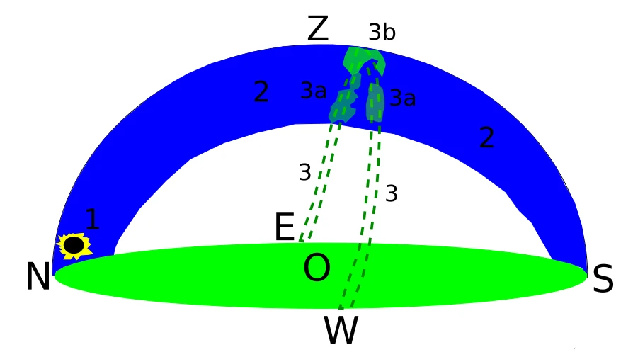
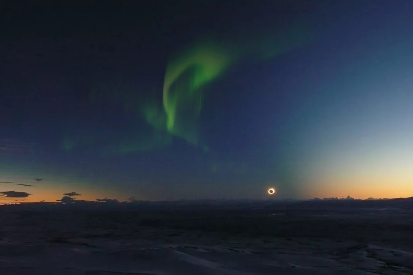
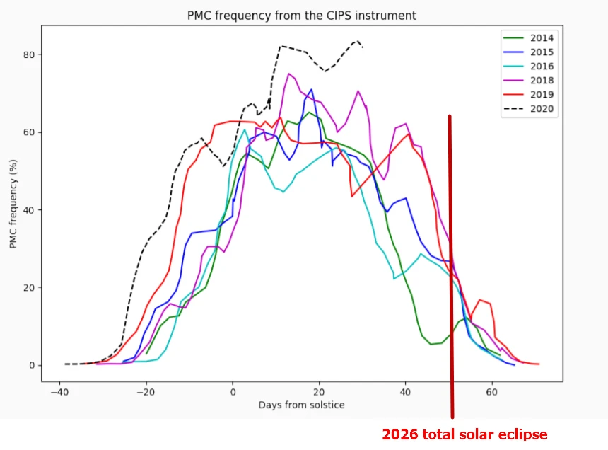
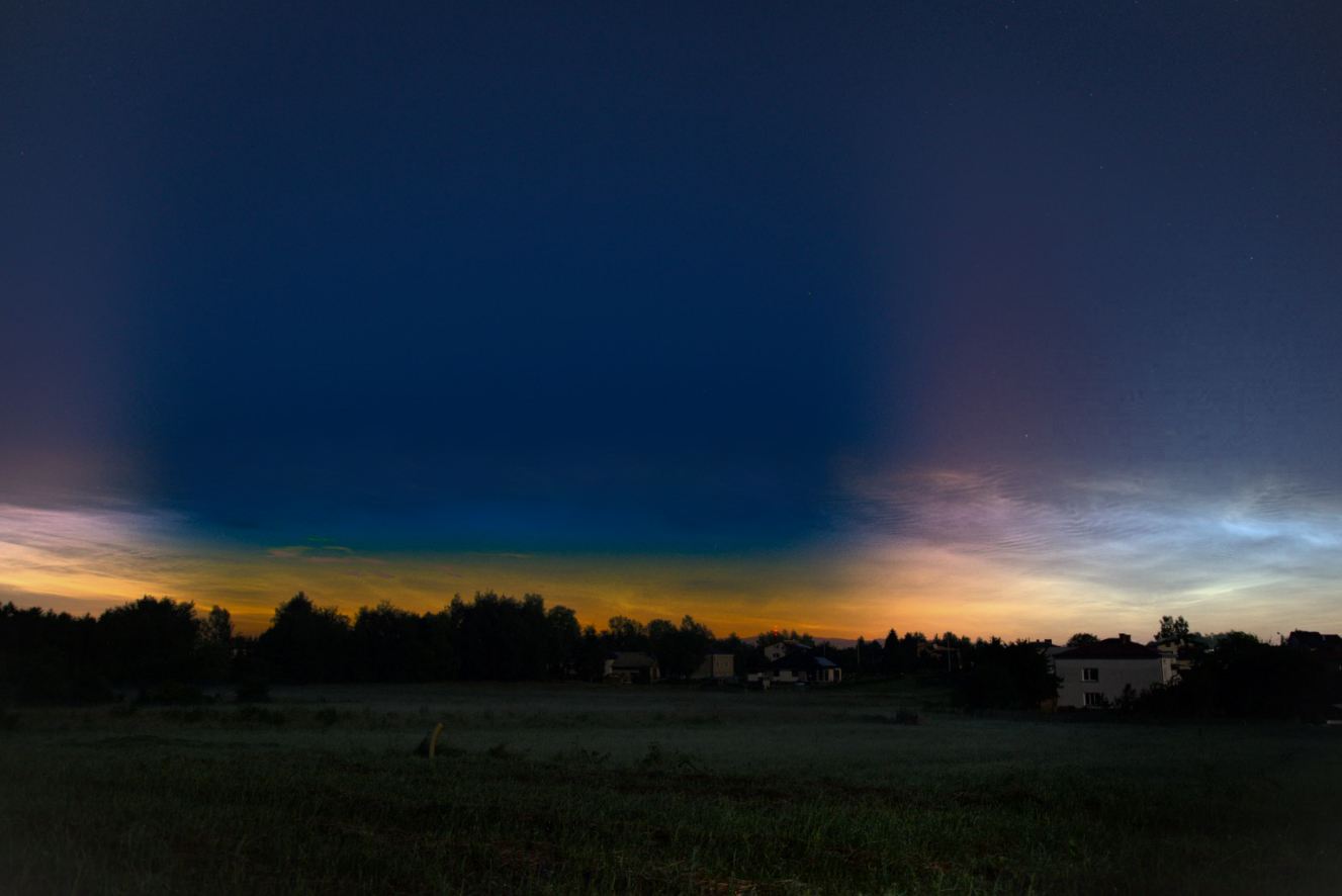
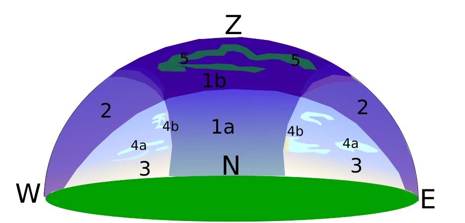
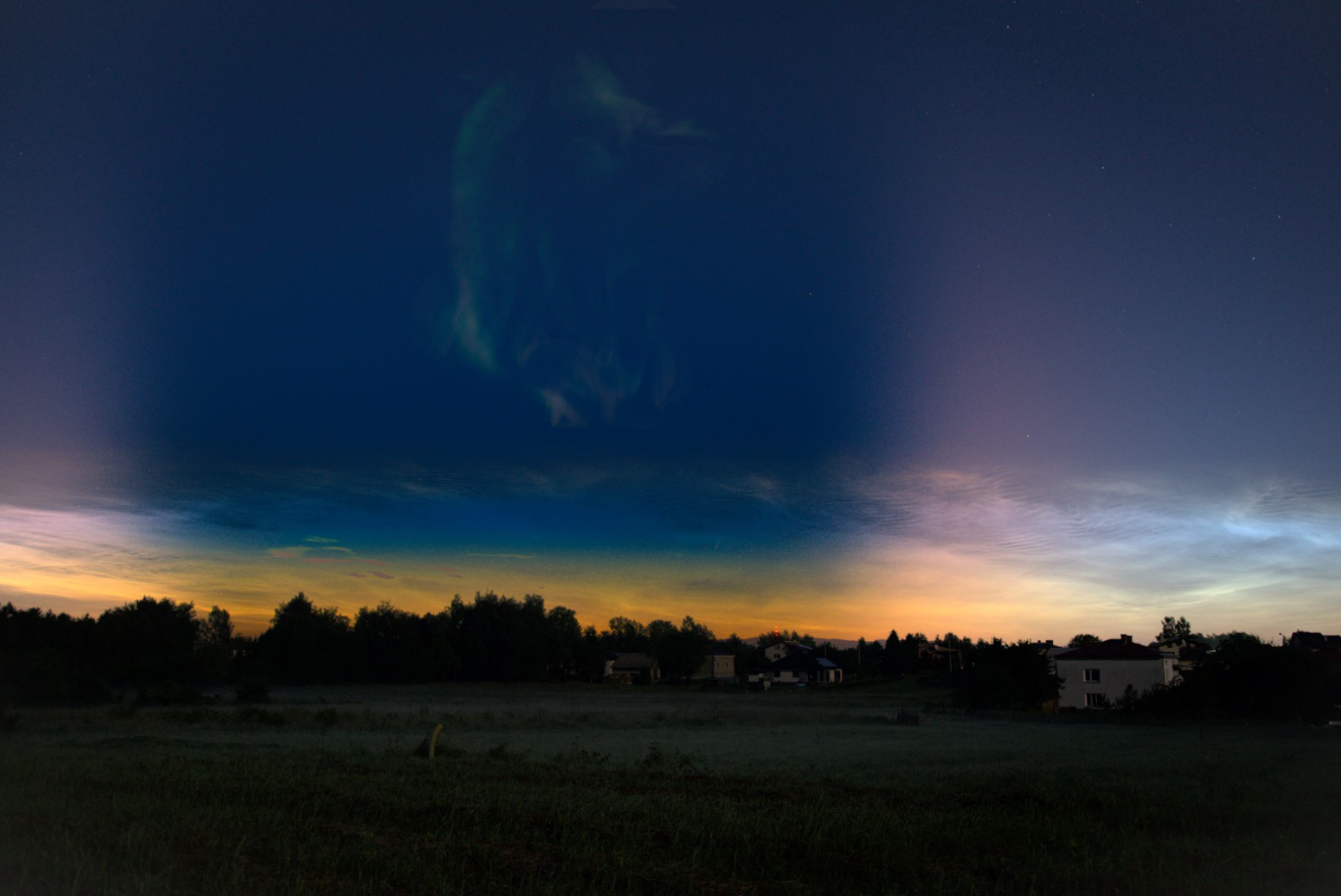
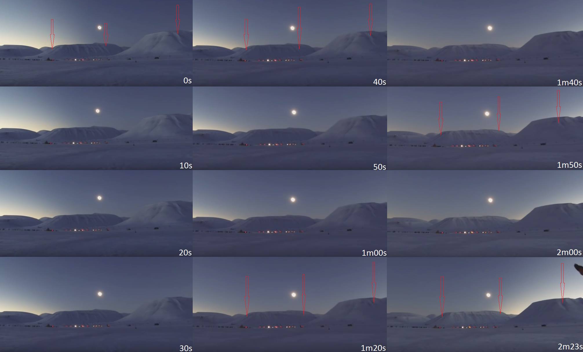
E. LARGE-SCALE SHADOW BANDS – Possible to observe over Greenland at cruising altitude. The Greenland Ice Sheet provides optimal conditions for observing shadow bands during the 2026 total solar eclipse, as these faint, alternating light-and-dark stripes are most visible against uniform, high-albedo surfaces such as snow or ice. Shadow bands typically appear immediately before and after totality, when the Sun is reduced to a thin crescent. Before totality, they generally move toward the advancing umbra; after totality, their orientation may shift relative to the eclipse track. The most widely accepted explanation attributes shadow bands to atmospheric scintillation and refractive index fluctuations in turbulent air. When sunlight from a thin solar crescent passes through layers of the atmosphere with varying temperature and density, it is refracted along slightly different paths. Constructive and destructive interference of these perturbed wavefronts produces a moving pattern of bright and dark bands on the ground. The bands tend to align approximately parallel to the solar crescent. Diffraction effects from the narrow crescent may contribute, while hypotheses involving infrasound remain less established. Because the phenomenon depends on atmospheric turbulence rather than surface structure, large, homogeneous reflective areas enhance visibility but do not generate the bands themselves. Observations have demonstrated that shadow bands can also be detected from aircraft at high altitude, where a uniform cloud deck or ice surface increases contrast. The 2026 eclipse over Greenland offers particularly favorable conditions for large-scale documentation of shadow band dynamics both at ground level and from cruising altitude.
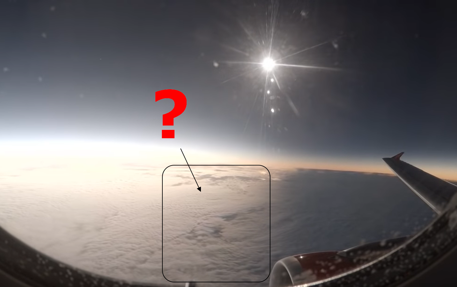
F. ENHANCED CONTRAST TRIANGLE – The typical optical phenomenon is widely described here. During the deep partial phase of the 12 August 2026 solar eclipse, southwestern Great Britain and southwestern Ireland will experience very high obscuration, reaching approximately 96% at Land’s End (Cornwall) and up to about 98% near Dursey Island off the Beara Peninsula. An even greater magnitude will occur offshore near the Skellig Islands and the Isles of Scilly. Although brightness reduction during a partial eclipse is nearly uniform across the sky, strong horizontal luminance gradients may arise due to proximity to the path of totality.
From southwestern Ireland, located roughly 230 km from the umbral path, it may be possible to observe the so-called “contrast triangle” effect over the sea. This phenomenon consists of a darker triangular sector extending upward from the horizon toward the Sun, caused by reduced forward scattering and by the contrast between the eclipsed solar disk and the surrounding sky. Under clear conditions, the distant umbral column may also be detectable as a grey or bluish darkening of the sky beyond the triangle, similar to the shadow cone observed shortly before and after totality.
If haze or mist obscures the distant umbra, the contrast triangle may still be enhanced by the overall darkening toward the totality region. In southwestern England, approximately 420 km from the umbral path, direct observation of the umbral column is unlikely; however, a pronounced luminance gradient toward the solar azimuth may still intensify the contrast triangle effect.
Because maximum eclipse occurs in the late afternoon, low solar elevation and sea-surface reflection are expected to strengthen perceived contrast. Under favorable atmospheric conditions, the combination of high obscuration and proximity to totality could produce a visually distinct and scientifically interesting large-scale gradient in sky brightness.
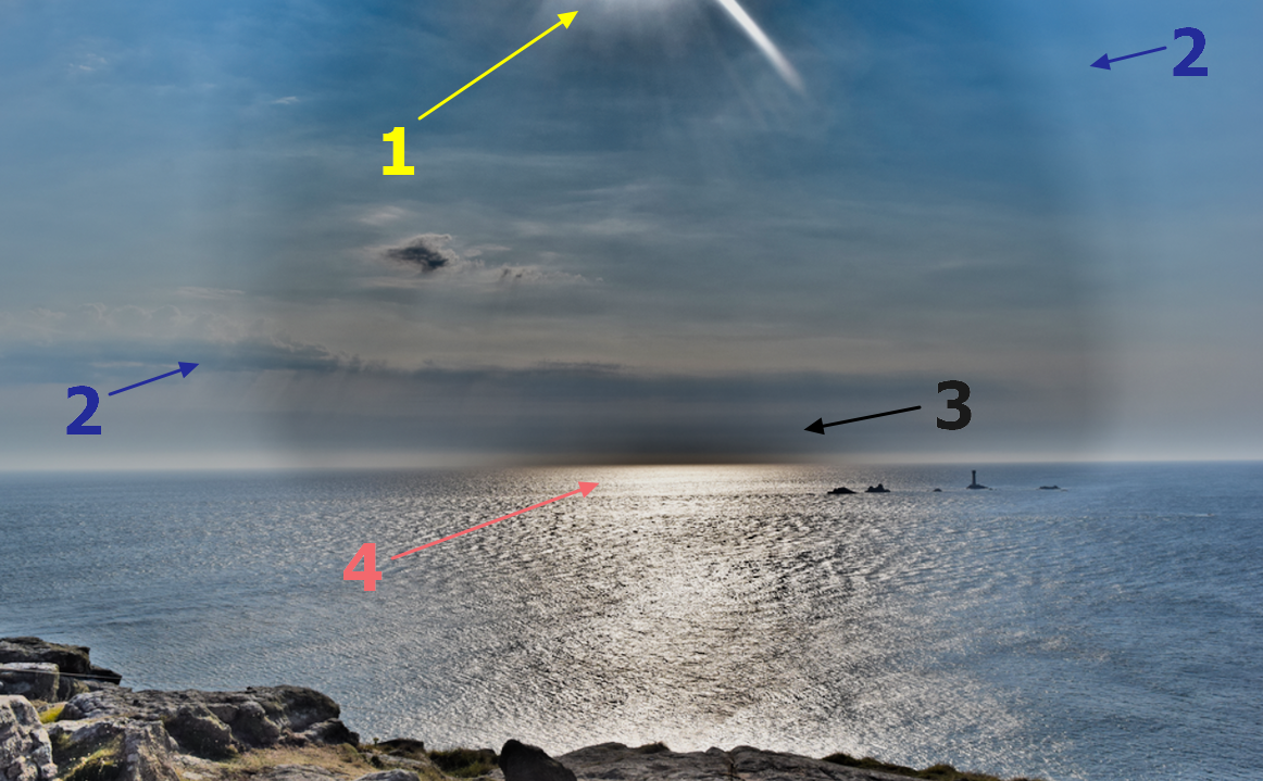
G. SUN’S GLITTER DISAPPEARANCE – A notable optical effect during a total solar eclipse over coastal regions is the disappearance and reappearance of the Sun’s glitter (specular reflection) on a water surface. When direct solar rays strike the sea, reflection occurs according to the law of reflection and Fresnel equations, producing a bright elongated glare aligned with the observer’s line of sight.
As totality approaches and the lunar umbra intercepts direct sunlight, the solar glitter shortens rapidly and vanishes as the illuminated sea surface enters shadow. If the observer is sufficiently elevated above sea level, the progression of the umbral boundary across the water can be clearly perceived. During totality, a much fainter glitter may persist due to the reflection of coronal light, whose integrated brightness is comparable to that of the full Moon. After totality, direct solar illumination reappears beyond the retreating umbra, and the bright solar glitter rapidly expands toward the observer.
Low solar elevation enhances this phenomenon because reflection dominates over subsurface scattering at shallow angles of incidence. Observer altitude is also critical: a higher vantage point increases the visible extent of the sea surface and lengthens the observable transition as the shadow advances and recedes. For the 12 August 2026 eclipse, elevated coastal locations in Spain provide optimal conditions. Suitable sites include high cliffs in Galicia and mountain summits overlooking the Mediterranean in Mallorca, where totality of approximately 1 minute 40 seconds will coincide with extensive sea horizons. These locations offer favorable geometry for detailed observation of umbral motion and specular reflection dynamics.
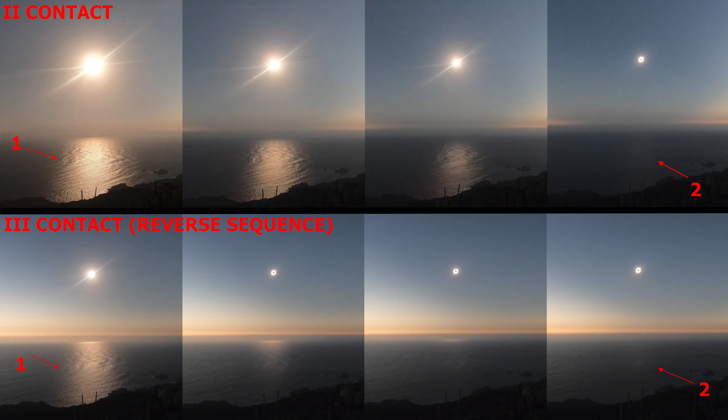
We observe phenomena like this mostly when the Sun is low enough above the horizon, when most of the light is reflected from the water body rather than diffracted within the medium (Fresnel equation). Moreover, the elevated position offers an opportunity to observe how this glitter casts an umbra and, conversely, how the umbra casts a shadow on it at the end of the eclipse (Youtube.com). Click to enlarge.
H. EXTENDED LIMIT OF HORIZONTAL VISIBILITY – An exceptionally long-distance terrestrial observation was recorded from Puig d’en Galileu in the Sierra de Tramuntana, rising above the Lluc Sanctuary, toward Pic de Salòria in the Pyrenees. The line-of-sight distance of approximately 324 km is among the longest documented in a single country.
Such extreme horizontal visibility results primarily from favorable atmospheric optical conditions. A substantial reduction in Rayleigh scattering by air molecules and Mie scattering by aerosols decreases attenuation along the optical path, allowing more reflected light from distant terrain to reach the observer. Additionally, under specific illumination geometries, such as during a solar eclipse, contrast may increase between shaded terrain and the brighter sky beyond Earth’s shadow. In this particular case, only the reduction in atmospheric scattering is fully applicable, as the Pyrenees would not simultaneously experience totality. Nevertheless, transient decreases in atmospheric turbidity can significantly enhance long-range visibility and facilitate similar observations.
Comparable extreme-distance sightings have been reported between the Sulcis Mountains in Sardinia and the Tell Atlas, specifically Kef Seba (1025 m a.s.l.) near Annaba, at distances of approximately 260–270 km.
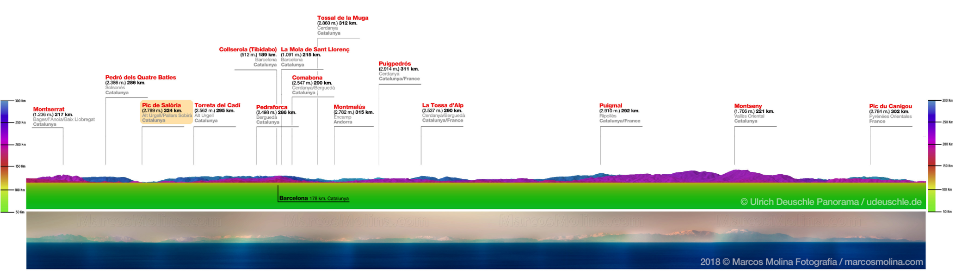
I. ZODIACAL LIGHT – A total solar eclipse occurring with the Sun below the horizon may enhance the detectability of zodiacal light by temporarily reducing sky surface brightness. This possibility was previously proposed for 30 June 1992 (Guliaev, 1992), but without observational confirmation. A comparable configuration will occur on 12 August 2026 across parts of the Mediterranean region, including southern Europe and North Africa, where totality will coincide with sunset or occur just below the horizon. Zodiacal light is produced by the forward scattering of sunlight by interplanetary dust concentrated within the inner Solar System. These particles, typically tens to hundreds of micrometers in size, originate from primordial debris, cometary activity, and asteroid collisions. The dust density increases toward the Sun and extends beyond the orbit of Mars. When particle sizes fall below ~10 μm, radiation pressure efficiently removes them from the inner Solar System. Observationally, zodiacal light appears as a diffuse conical glow aligned with the ecliptic and is most prominent near the Sun. Its surface brightness near 30° elongation is on the order of 10⁻³ cd m⁻² (~0.005 lux), comparable to or exceeding that of the Milky Way under dark-sky conditions. Maximum visibility occurs near the equinoxes, when the ecliptic forms a steep angle with the horizon (after dusk in spring, before dawn in autumn in the Northern Hemisphere). During the August 2026 eclipse, the ecliptic will lie relatively shallow to the horizon; however, low latitudes may partially compensate for this geometry. Because atmospheric scattering normally obscures the innermost zodiacal light (the F-corona region), any eclipse-induced reduction in atmospheric illumination could improve contrast between the dust-scattered light and the background sky. Although the 2026 configuration is not optimal, the combination of sunset geometry and eclipse-related sky darkening may allow detection of the brighter inner zodiacal cone from selected Mediterranean sites, including parts of Italy, Malta, Greece, Tunisia, and Algeria.
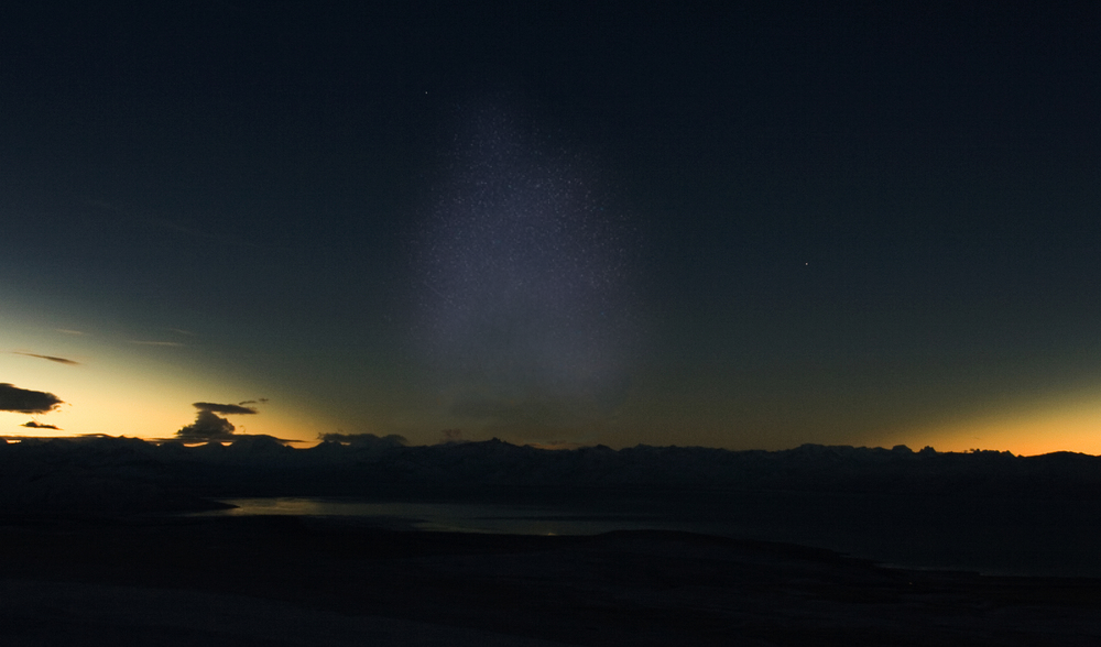

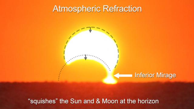
9. ANTITWILIGHT SKY PROJECTIONS
The very late part of the day, when totality will occur east of the Spanish mainland, will affect the antitwilight sky immediately after the eclipse’s greatest phase. The sky at antisolar direction is rich with many optical phenomena around sunset and at the early stage of civil twilight. We shall consider the position of the Sun at the major moments shown in the simulations below (Pic. 50).
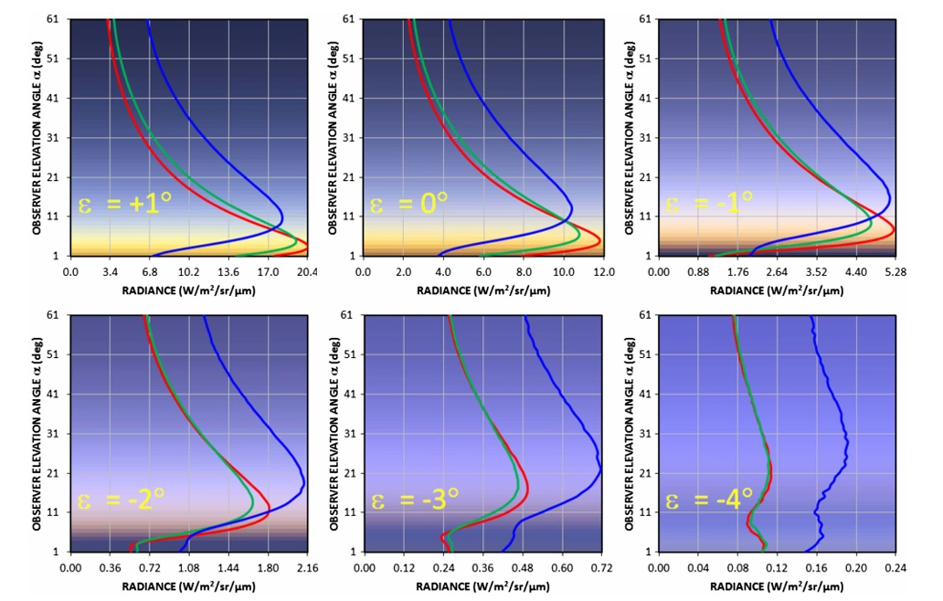
The dynamics of the color band are significant, leading to changes in atmospheric illumination around the elevated terminator. The position of the Belt of Venus changes rapidly as solar depression increases, thereby changing the visibility of antitwilight features. The solar depression is inversely proportional to the vertical transition width between the Belt of Venus and the Blue Band, which is the sky shadowed by Earth (Pic. 207).
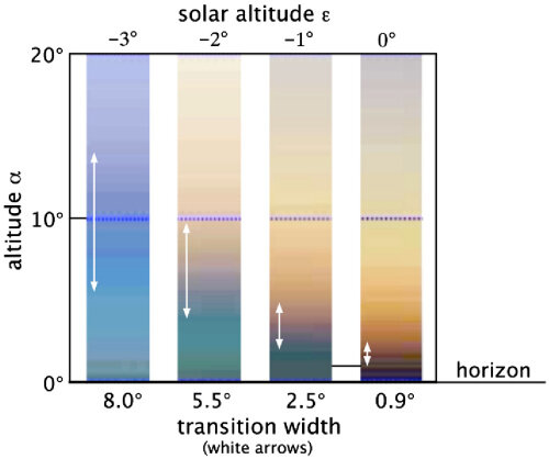
The position of the Sun determines what an observer can precisely see on the antisolar side of the sky within civil twilight. The map below shows the estimated locations of the optical phenomena in the antitwilight sky at various solar positions (Pic. 208).
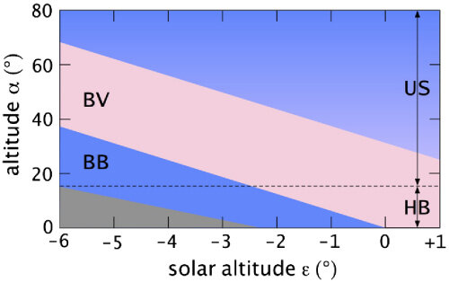
In my opinion, this map requires redefinition, as the Belt of Venus at a solar depression of 6° should be located much closer to the zenith. The shape of antitwilight features should be more parabolic than linear, because as solar depression increases, they move closer to the zenith and, therefore, to the observer. This is, anyway, a subject of future investigation.
The dynamics of coloration during civil twilight raise the question of how their distribution would appear during a solar eclipse at any level of obscuration.
Any hint can be found in the limb darkening effect (Koepke, 2001), which is an inherent part of a solar eclipse. The obscuration of the solar disk by the Moon changes the distribution of the light in the color band that reaches Earth’s atmosphere. This article explains it well.
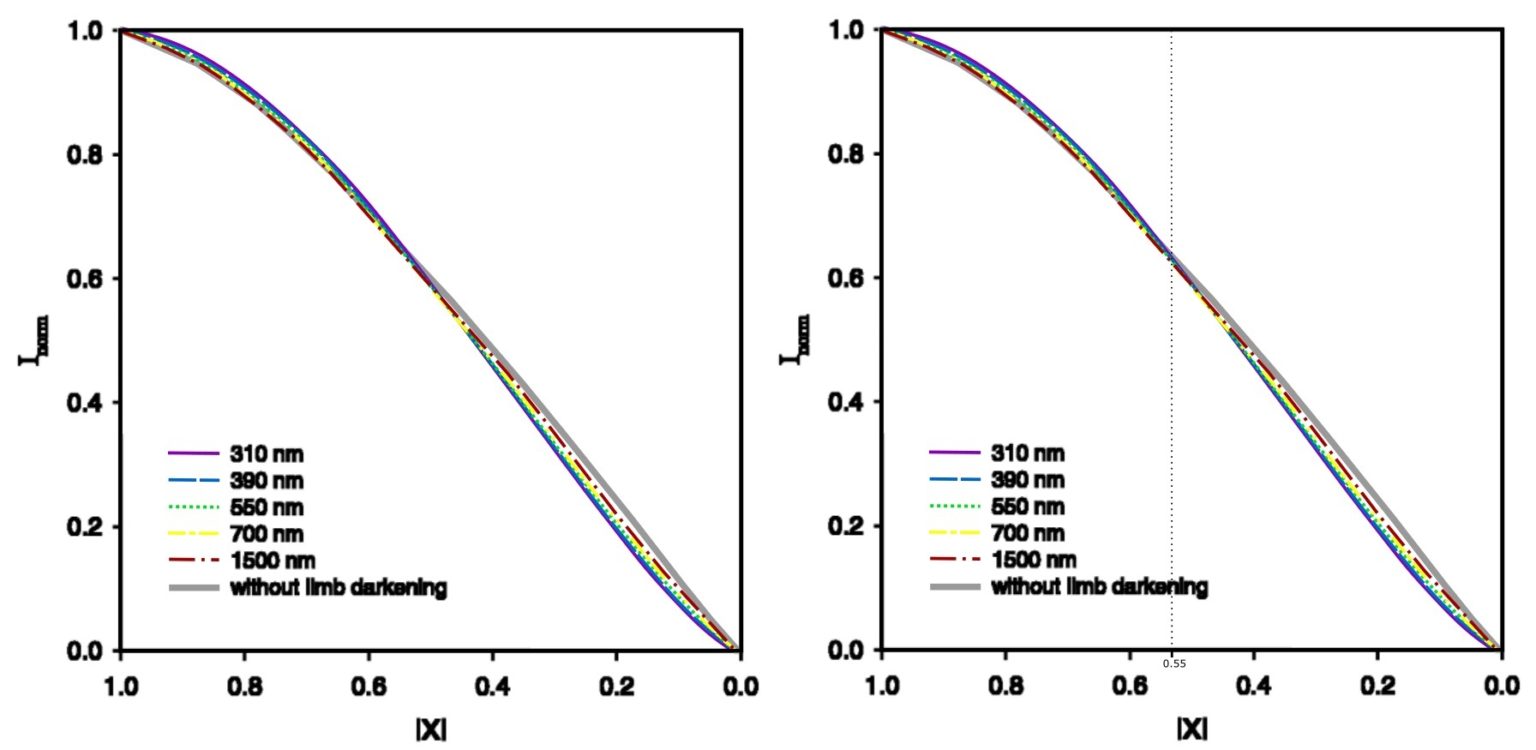
The effect of limb darkening is nullified at an approximate eclipse magnitude of 0.55. When the magnitude is low, the effect is negative, resulting in a pronounced bluish coloration of the sky. When the eclipse magnitude exceeds 0.55, a reddish tinge appears due to the positive limb darkening effect. It continues to increase until the eclipse reaches totality.
Now, let’s consider the following circumstances (Pic. 206) regarding the influence of a solar eclipse. In practice, the Spanish mainland won’t experience significant changes in the appearance of the antitwilight sky as the partial solar eclipse approaches its end.
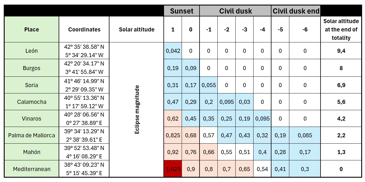
Considering the moment after sunset, when the Belt of Venus becomes visible, the best and most significant influence of the limb darkening effect will be observed at Menorca and the Mediterranean Sea east of the Balearic Islands. It doesn’t change the fact that people in other locations won’t notice anything. The eastern coast of Spain, where the estimated eclipse magnitude is expected to be about 0,29 at sunset, might notice that the antitwilight sky is not as reddish as usual. However, the key factor here will be the weather, precisely the aerosol optical thickness, level of humidity, and degree of atmospheric clarity. Observations such as this require comparing a day before or a day after the eclipse event at the same time.
Unfortunately, Stellarium ShowMySky doesn’t support this kind of observation in full visibility, as a user can only see a small difference in light level and a thin shift towards red.
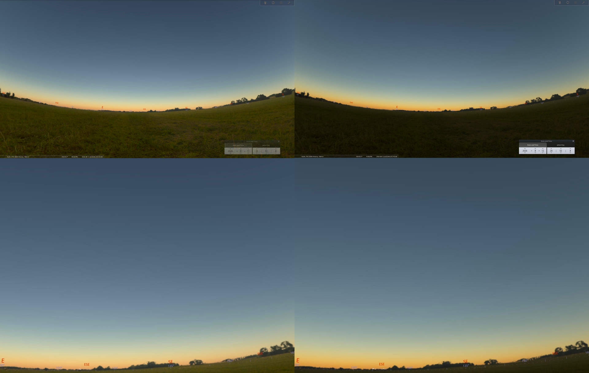
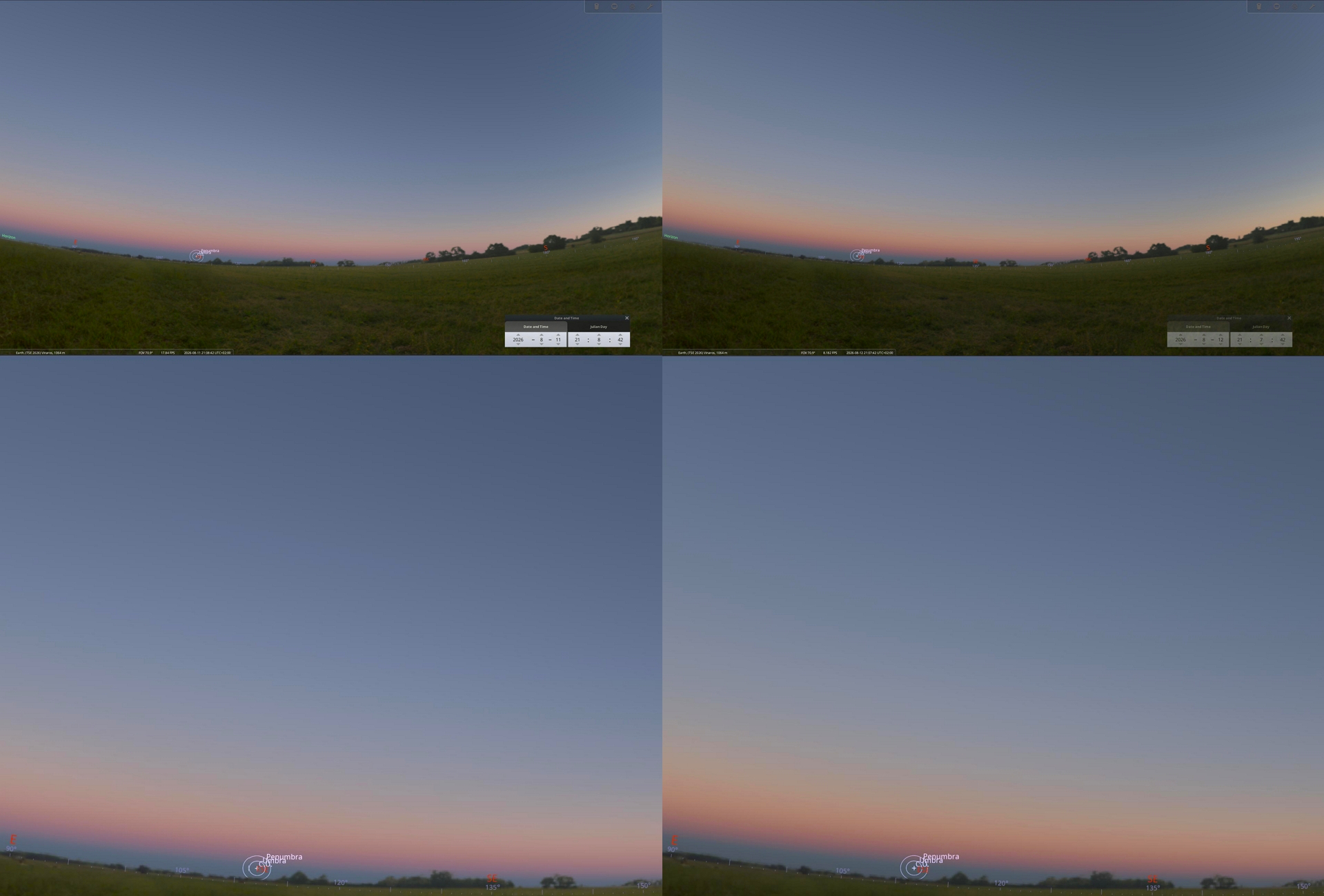
Taking into account the eastern coast of Spanish mainland, where the eclipse obscuration at solar altitude of 1° above and 1° below the horizon will be 52% and 19% respectively an observer should expect slightly redder (Pic. 210) and slightly bluer (Pic. 211) sky scene because of various influence of limb darkening effect as preesented in the table above (Tab. 2). In the other hand, at Menorca, located closely to the geometrical eclipse limit, the influence of limb darkening will be positive only, which however decreases as the Sun goes more down beneath the horizon due to eclipse obscuration of 90% and 58% at solar altitudes of 1° above and 1° below the horizon respectively.
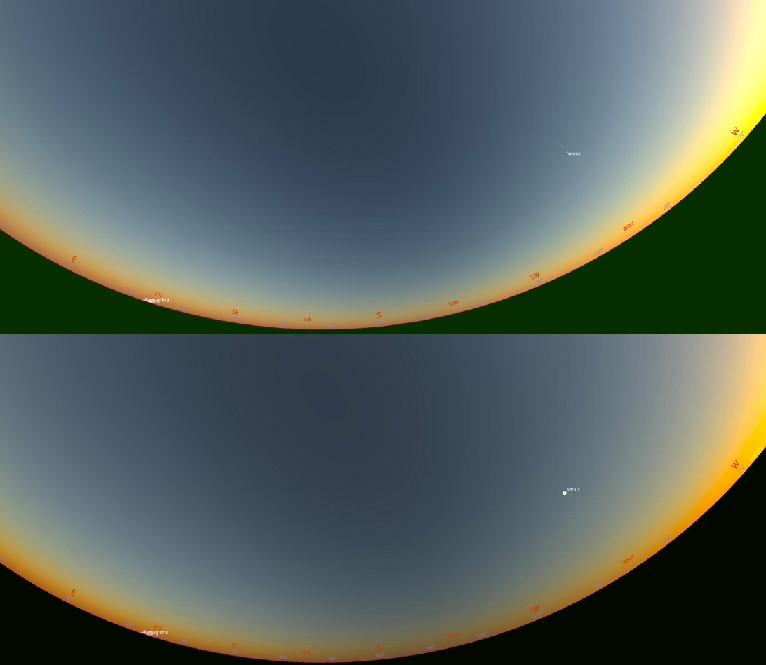
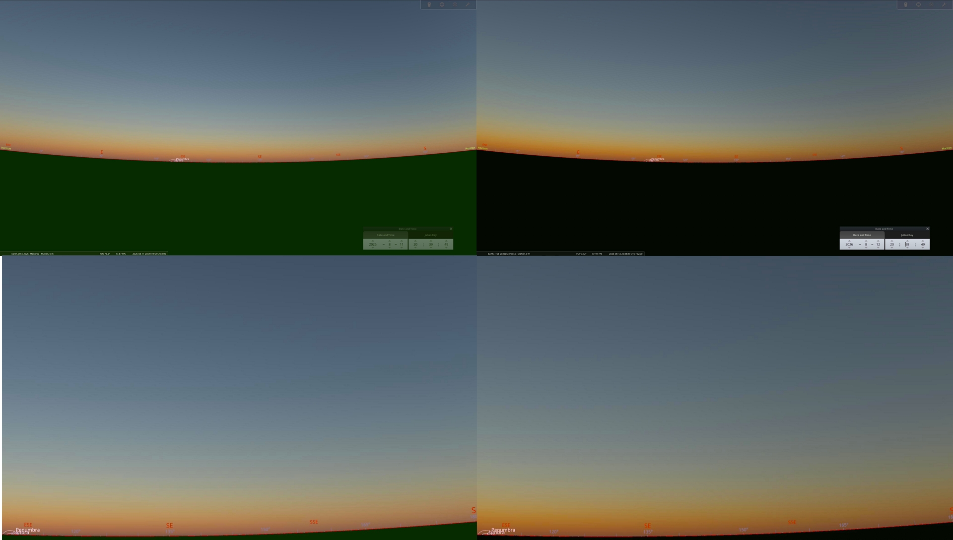
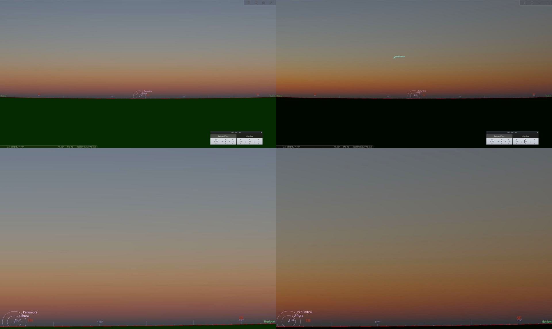
The most effective solar eclipse influence is to be observed on Mahón – the capital of Menorca, lying in the vicinity of the geometrical end of 2026 totality. The observer should expect an interesting combination of long-wavelength light scattered in the twilight atmosphere, along with the limb darkening effect produced by the partial phase of the eclipse. The dynamics of the antitwilight arch during typical twilight are typically large (Fig. 206, 207), especially in the evening, when the air tends to contain more haze particles. As the partial solar eclipse progresses, we expect this dynamic to intensify, and it’s worth reporting against the existing normal twilight observations.
There are rare situations in which many people flock near the geometrical end of the eclipse path. It’s vital to inform observers that immediately after totality, they can turn their heads in the opposite direction, switch to wide-angle recording, and capture these phenomena from multiple locations.
>>>BACK TO TOP<<<
10. SUNSET CIRCUMSTANCES
A rare observational phenomenon occurs when the Sun sets as a thin crescent rather than a full disk, due to significant partial obscuration during a solar eclipse. The solar eclipse of 12 August 2026 will produce such conditions across much of Europe, where the magnitude of obscuration will exceed 80% in many regions.
Importantly, the time of greatest eclipse will coincide with late afternoon or sunset for a large portion of the continent. As a result, the solar disk will already be substantially covered by the Moon as it approaches the local horizon. In some locations, the maximum eclipse will occur shortly before sunset, while in others it will take place just after the Sun has set.
Under favorable atmospheric conditions—particularly in regions with elevated or mountainous western horizons—the partially eclipsed Sun may appear as a narrow crescent descending behind distant terrain features. The combination of high obscuration, low solar altitude, and atmospheric extinction near the horizon is expected to produce unusual visual effects, potentially making this one of the most remarkable sunset phenomena observable in Europe in recent decades. The image below illustrates several examples of the August 12, 2026, partially eclipsed sunset (Pic. 215)
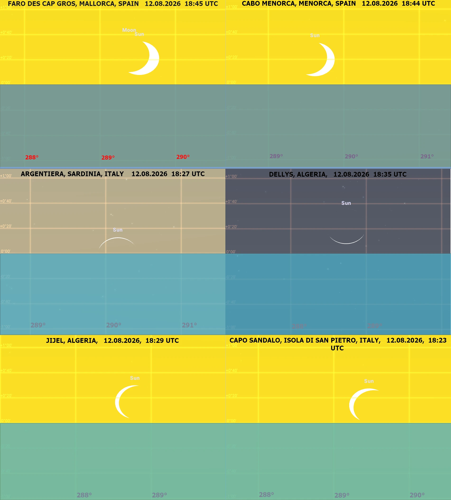
Amidst a number of potential places to watch the eclipsed sunset, there are two elongated regions (or zones) that require special attention. Due to the eclipse geometry and the difference between the horizontal and celestial coordinates (Pic. 216), the Sun’s crescent can appear as an arc or as the devil’s horns, as seen in deep partial eclipses.
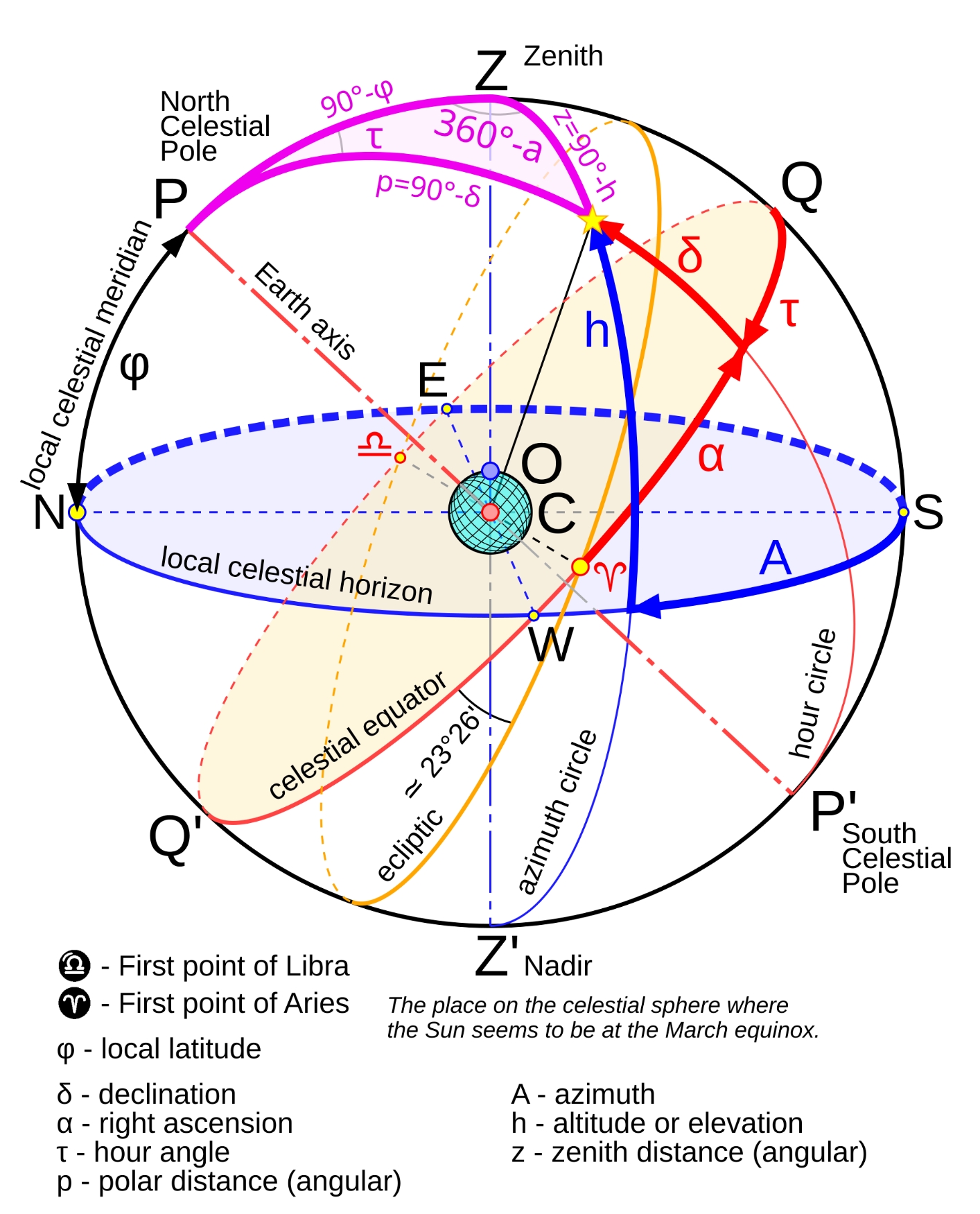
Because of the middle latitudes, celestial bodies rise and set diagonally, as shown in the pattern below (Pic. 216).
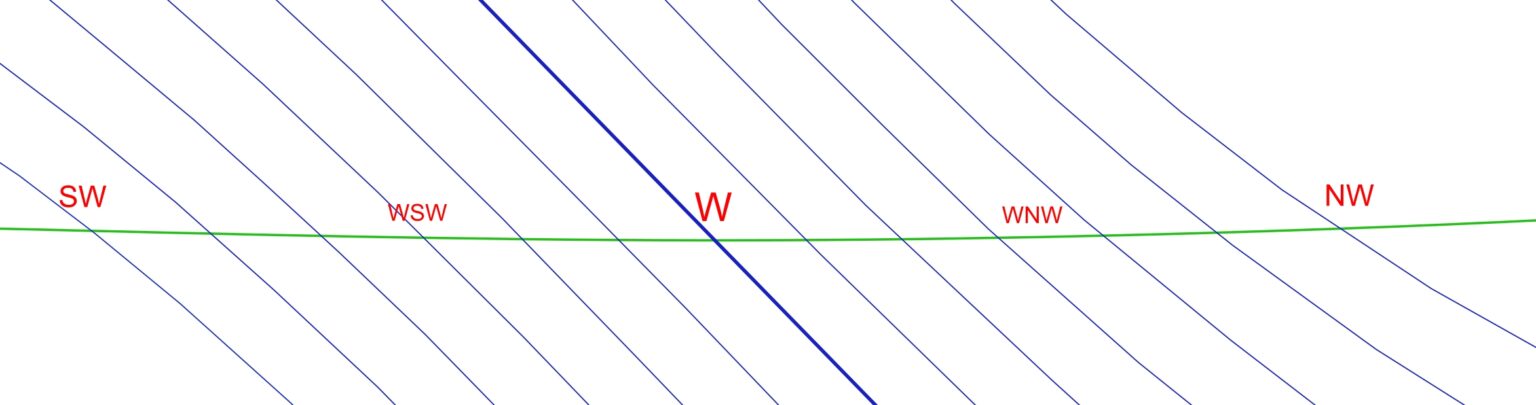
The same as the Sun and Moon do. As they aren’t perfectly aligned, the solar crescent is visible, but its position against the horizon depends strongly on the small circles illustrated above.
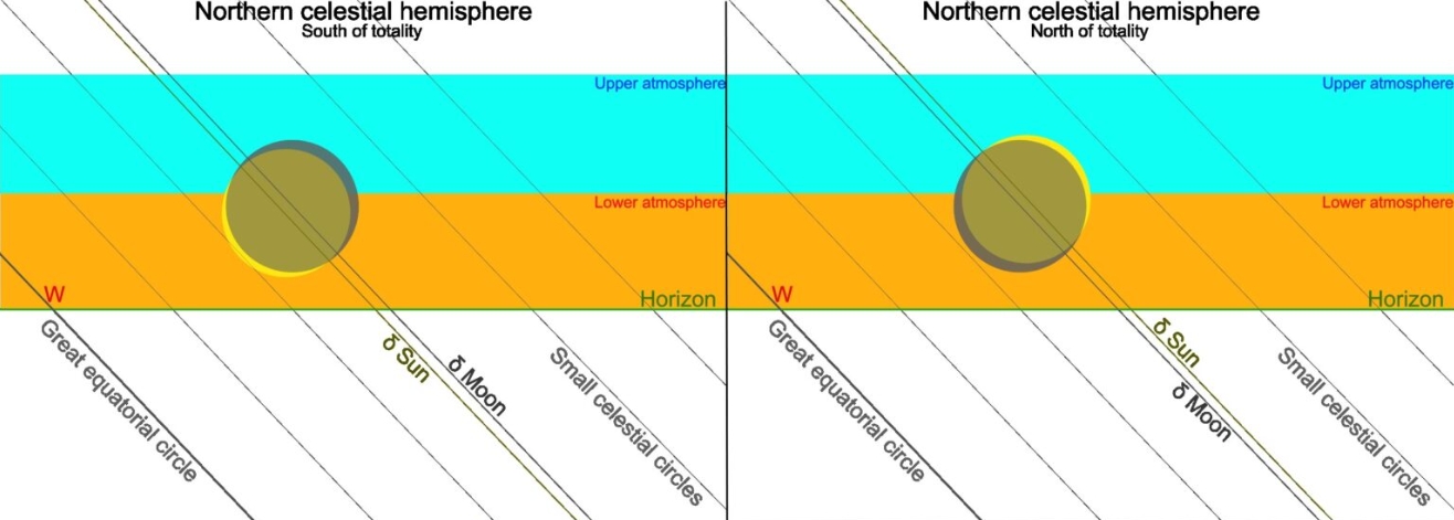
The illustrations, in fact, present the moments of the eclipse culmination, but because the Moon moves across the solar disk, the position of the solar crescent changes. Locations north of the totality path, at the exact moment before the eclipse culmination, will « produce » an arc-like sunset when the solar crescent has both horns down. Conversely, at all the locations south of the path, the solar crescent will have the opposite position, causing the « devil’s horns » appearance shortly before the greatest eclipse. In Europe, the « Sunset arc » is quite feasible. The most effective view is from south Sardinia, where the setting Sun will appear as a thin ring (Pic. 219).
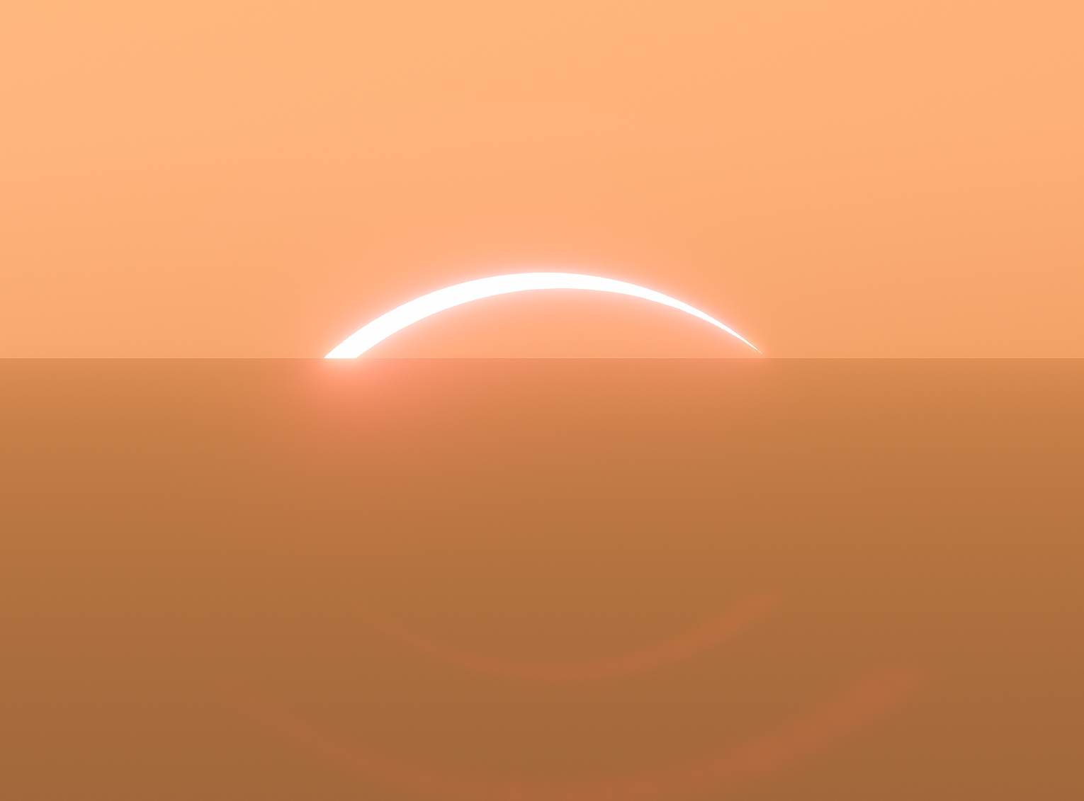
We need to know that Sardinia is not the only place where an observer can watch the sunset like this. The August 12, 2026, solar eclipse sunset map clearly shows the zone where the « Sunset arc » is possible across the entire continent!
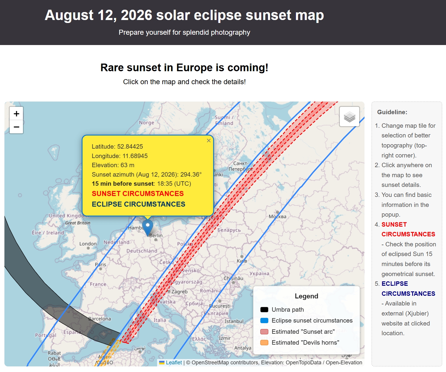
The website opens the Peakfinder.com panorama generator directly at the clicked location, indicating the sunset azimuth. The eclipsed Sun is visible above the horizon, as projected 15 minutes before its set. The second link directly indicates Xavier Jubier’s 2026 eclipse page, precisely at the clicked location. Everyone can check what the August 12 sunset will look like from their home location and plan the observation.
>>>BACK TO TOP<<<
11. SKY VIEW
The eclipse path extends from the polar regions to the Mediterranean, resulting in a very different view of the sky during the eclipse. The animation below shows the difference over Greenland between latitudes 83 and 65 north at the centerline, with the approximate eclipse path oriented from north to south.
Next, you will find the pioneer project for the entire 2026 total solar eclipse path, which shows how the Sun’s position changes from beginning to end.
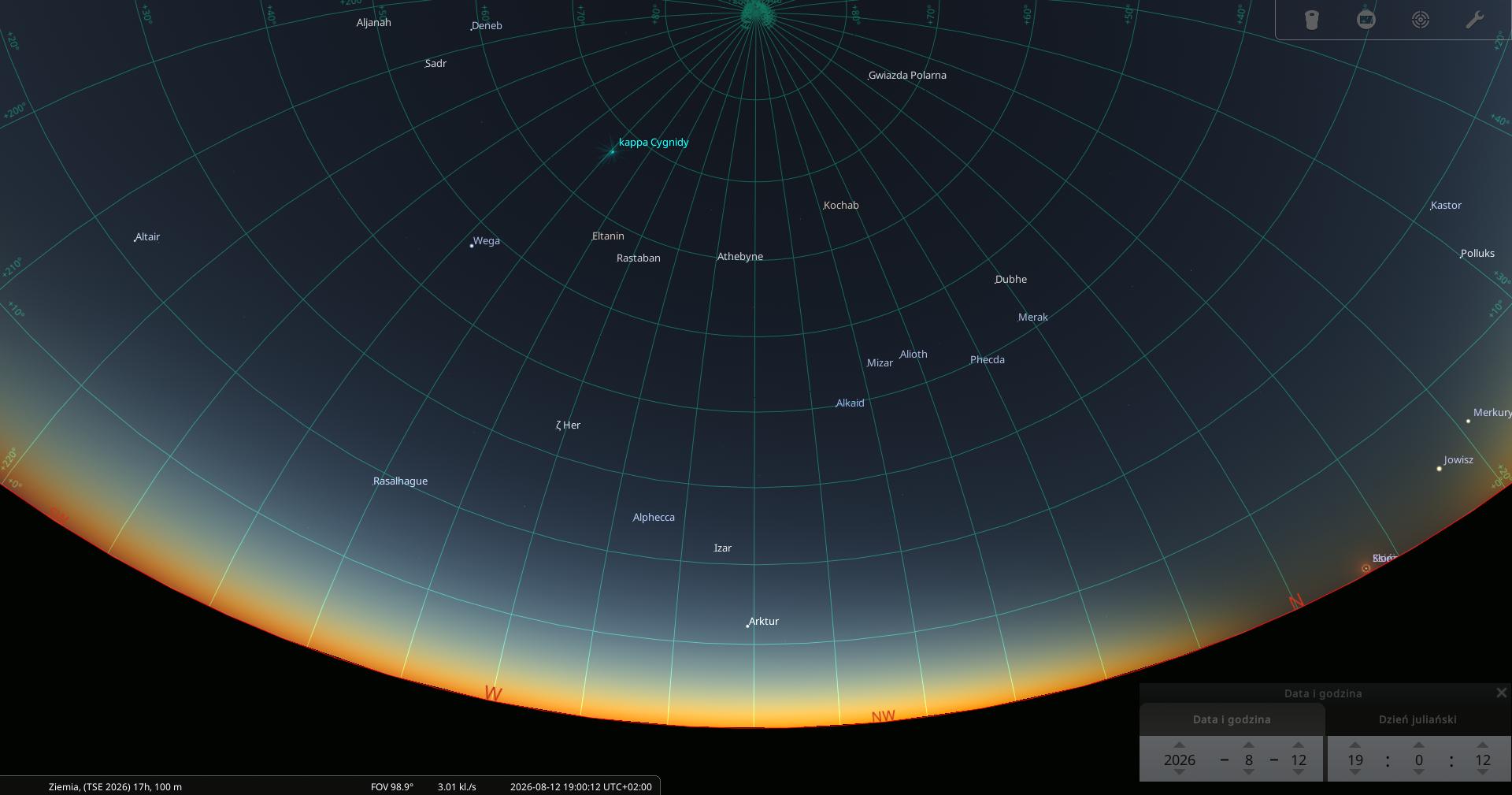
The final result can be reproduced in a single all-sky projection, which includes all 58 moments of mid-totality shown in the video above. The solar analemma is a diagram of the solar position in the sky as seen from the same location on Earth, exactly at mean solar time, over the course of a year. A lunar analemma is an analog diagram that shows the Moon at the same position at a fixed location every 24 hours and 50 minutes over the course of the lunar month. Here, we could experience something like « eclipsemma », which is the hypothetical way of the Sun across the celestial sphere as it marks from the very beginning to the very end of the eclipse path. In other words, the hypothetical observer watches the solar eclipse precisely at mid-totality, hurtling at the speed of the Moon’s shadow from the beginning to the end of the eclipse path. As a result, he could see how the Sun’s position changes along with the rising and setting of the brightest stars visible at mid-totality. The video above shows exactly what it looks like. The image below illustrates the theoretical appearance of a totally eclipsed Sun across the entire path.
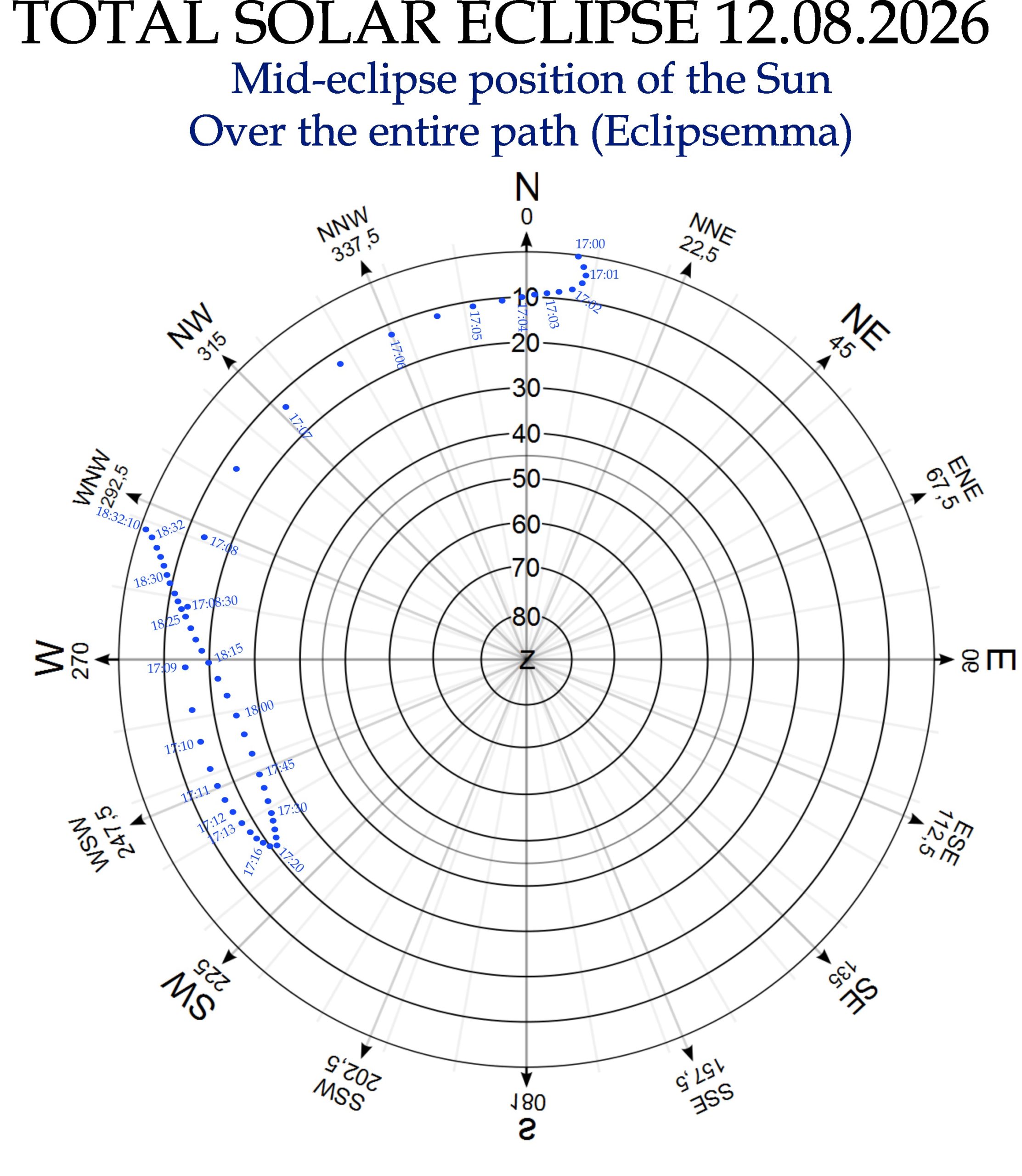
Additionally, there is a map of several other places, which aren’t aligned with the centerline, and therefore, the single-order scattering umbra projection was necessary to emphasize the visibility of the umbra and thereby determine which section of the sky will still be directly illuminated by the solar crescent over the period of totality (Pic. 223, 224).
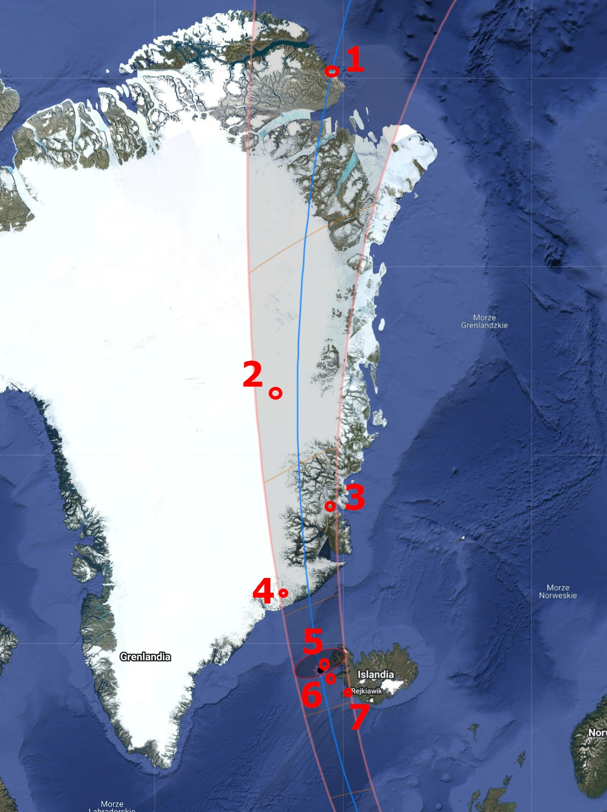
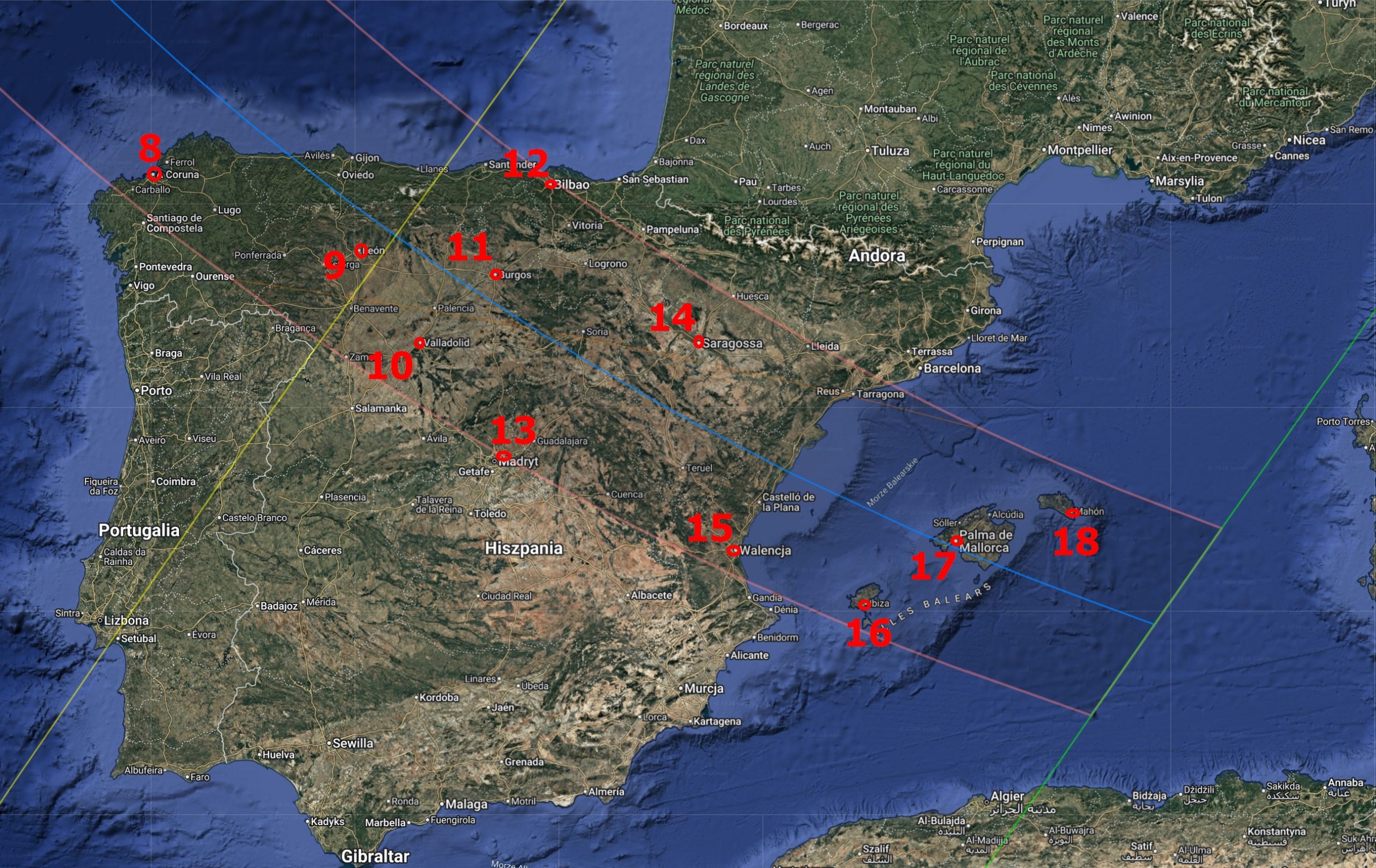
Place 1 – Northernmost shore of Greenland (82° 50′ 17.95″ N; 23° 42′ 20.23″ W)
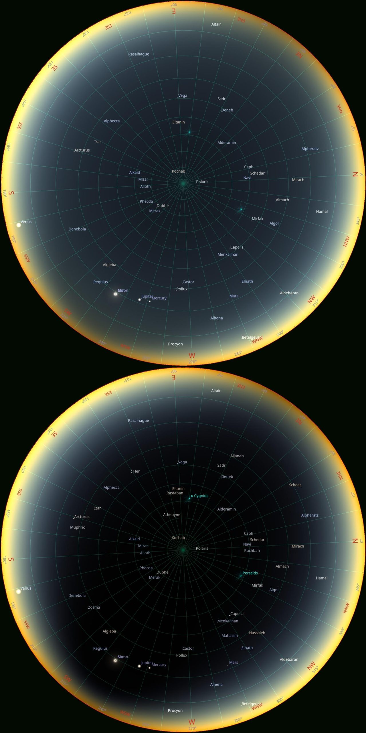
Place 2 – Greenland, the Avannaarsuani region (75° 59′ 18.17″ N; 27° 56′ 11.50″ W)
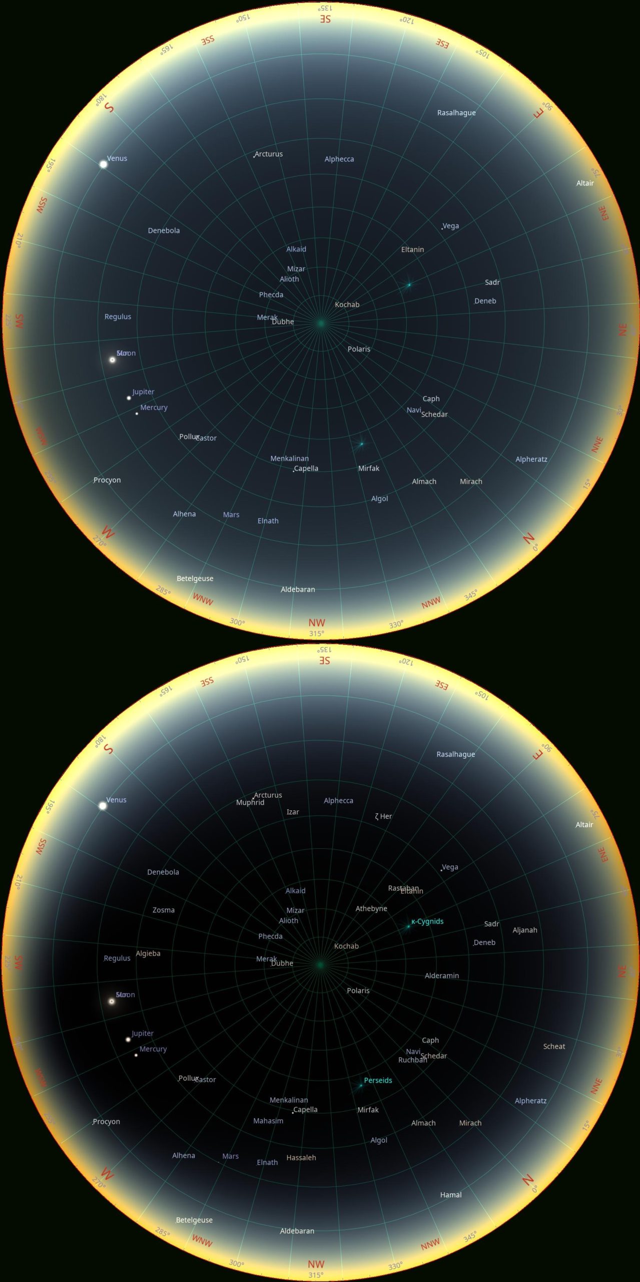
Place 3 – Greenland, the Mestersvig town (72° 13′ 28.24″ N; 23° 56′ 30.11″ W) – because of the umbral depth of 14% only, many fewer stars are estimated to be visible in the sky, since the zenith sky is being illuminated by the crescent Sun.
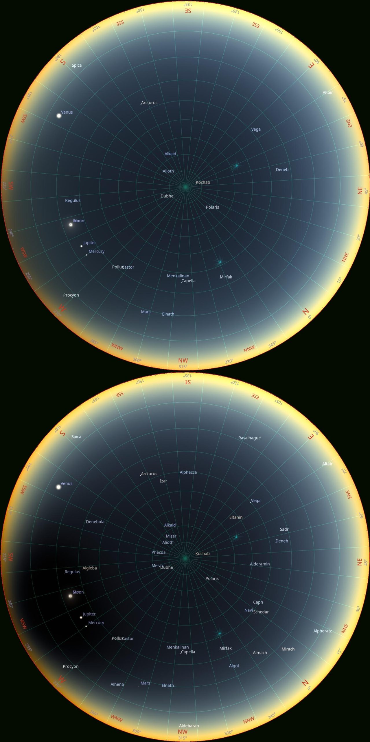
Place 4 – Greenland, Gunnbjørn Fjeld (68° 55′ 28.38″ N; 29° 58′ 33.36″ W) – the perspective of the highest summit in Greenland and the North Arctic Circle. Despite a shadow depth of only 11%, the stars are clearly visible. This is because the location near the southern limit of totality at a low altitude means the umbra is higher in the atmosphere.
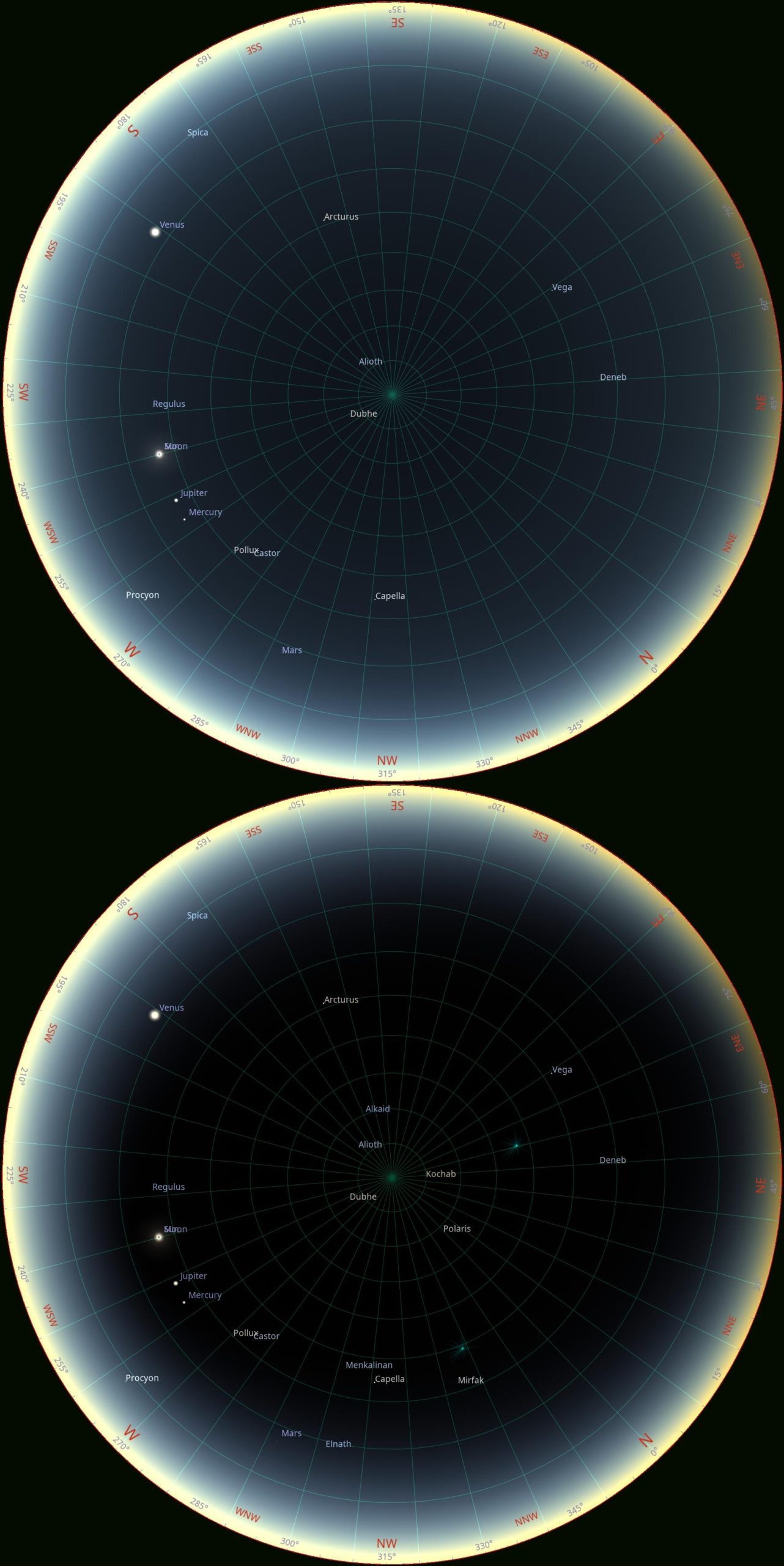
Place 5 – Iceland, Látrabjarg (65° 30′ 06.67″ N; 24° 31′ 51.53″ W) – the westernmost tip of Iceland with the longest duration of totality 2m13s and umbral depth of 74% on the northern side of the path.
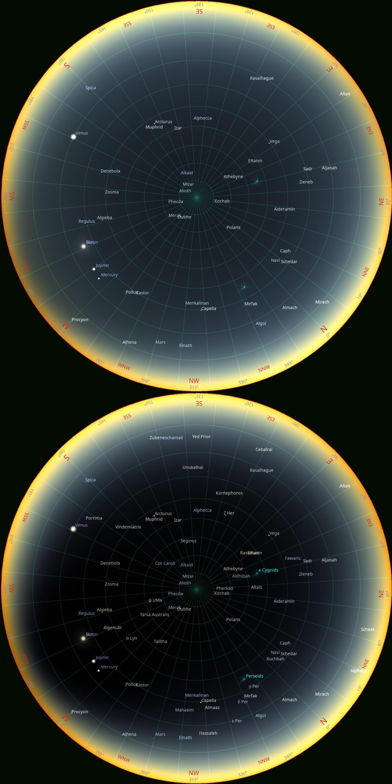
Place 6 – Iceland, Snæfellsjökull (64° 48′ 39.64″ N; 23° 47′ 38.24″ W) – one of the most famous sites in Iceland with 2m04s totality and umbral depth of 57%.
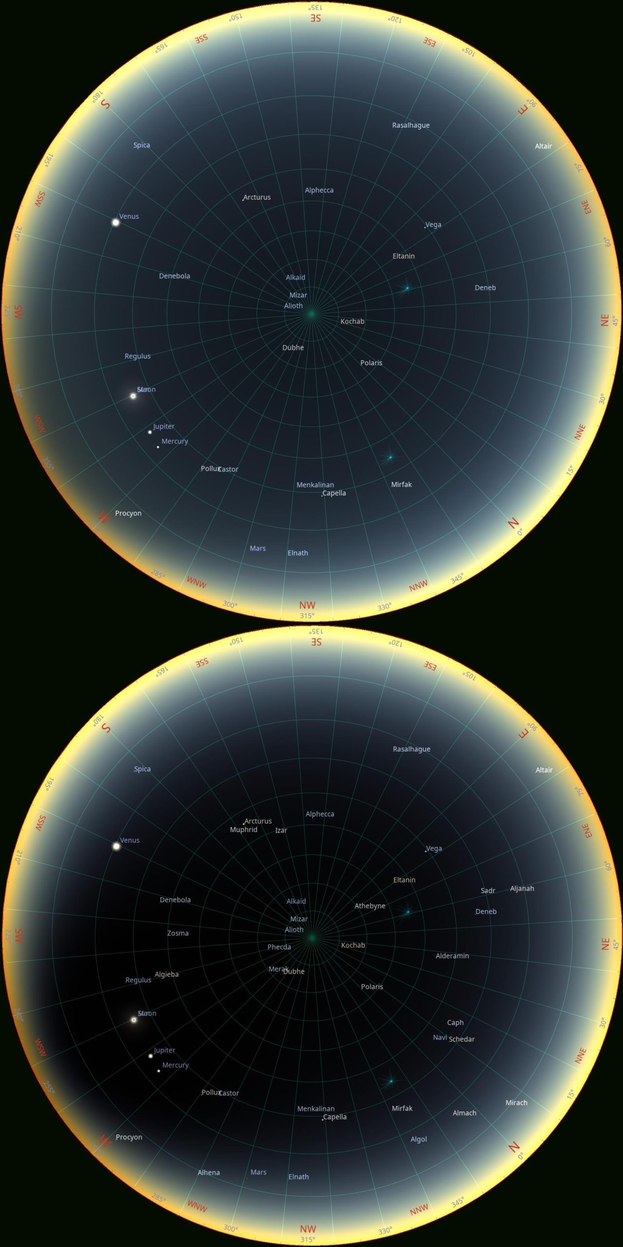
Place 7 – Iceland, Reykjavik (64° 08′ 49.92″ N; 21° 56′ 22.85″ W) – umbral depth about 10% only.
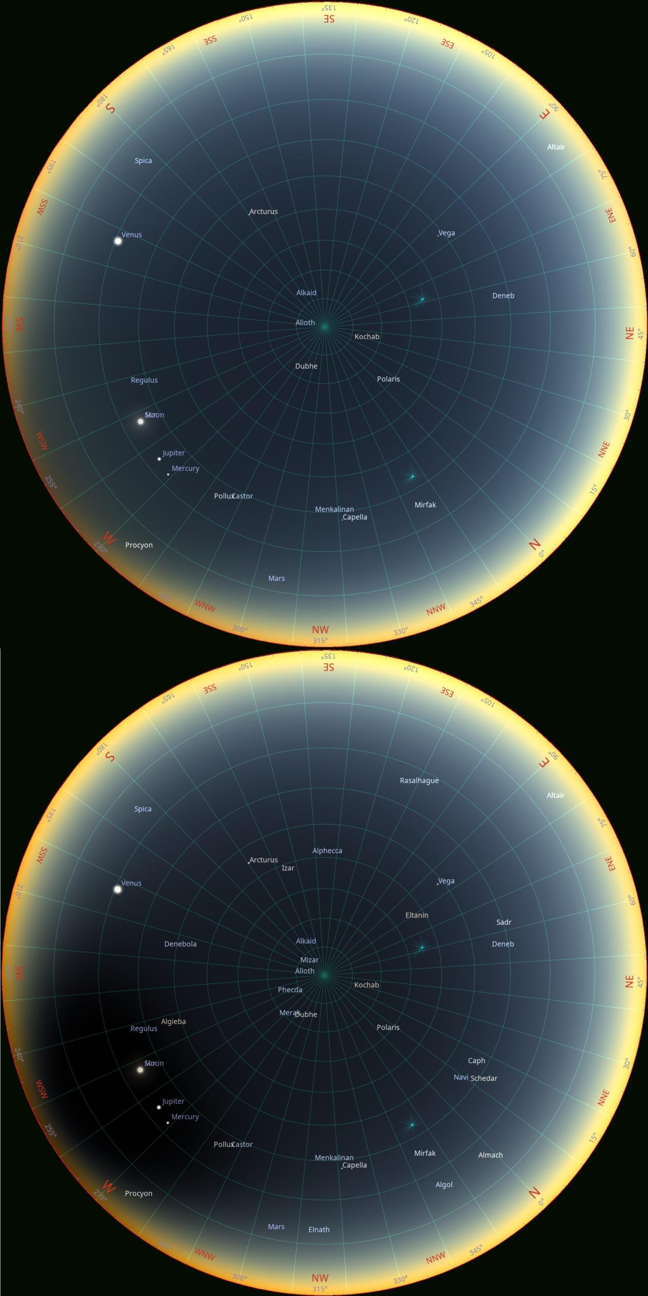
Place 8 – Spain, A Coruña (43° 20′ 55.99″ N; 8° 24′ 31.22″ W) – umbral depth 25% only at the southern part of the path.
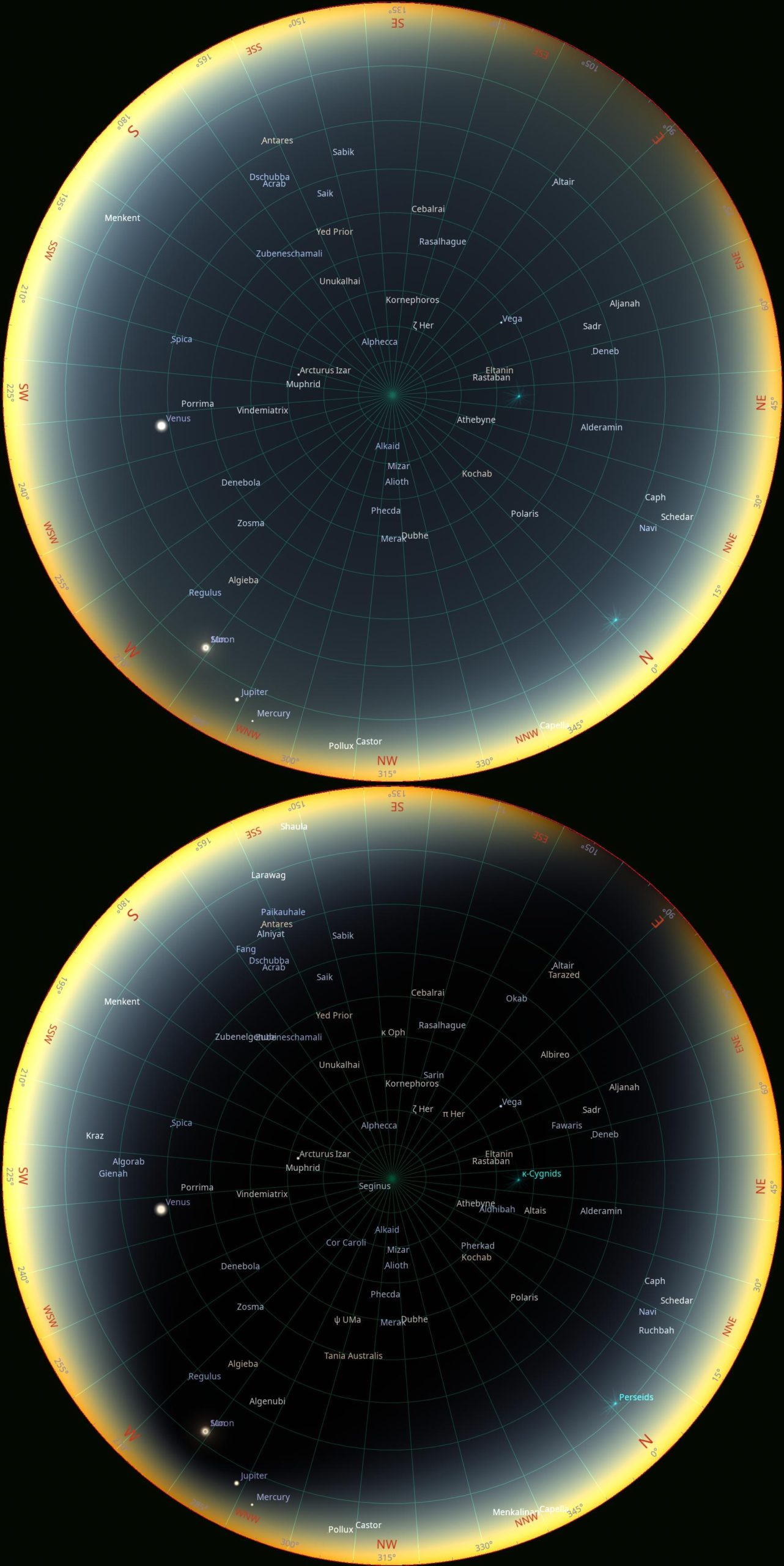
Place 9 – Spain, León (42° 35′ 51.28″ N; 5° 33′ 47.56″ W)
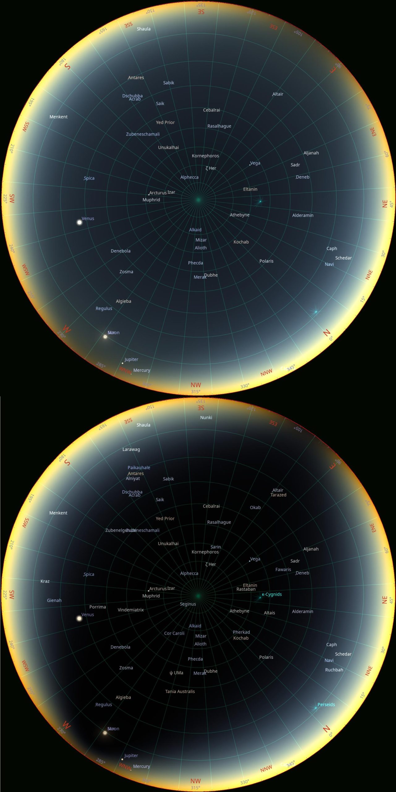
Place 10 – Spain, Valladolid (41° 38′ 24.28″ N; 4° 43′ 21.93″ W)
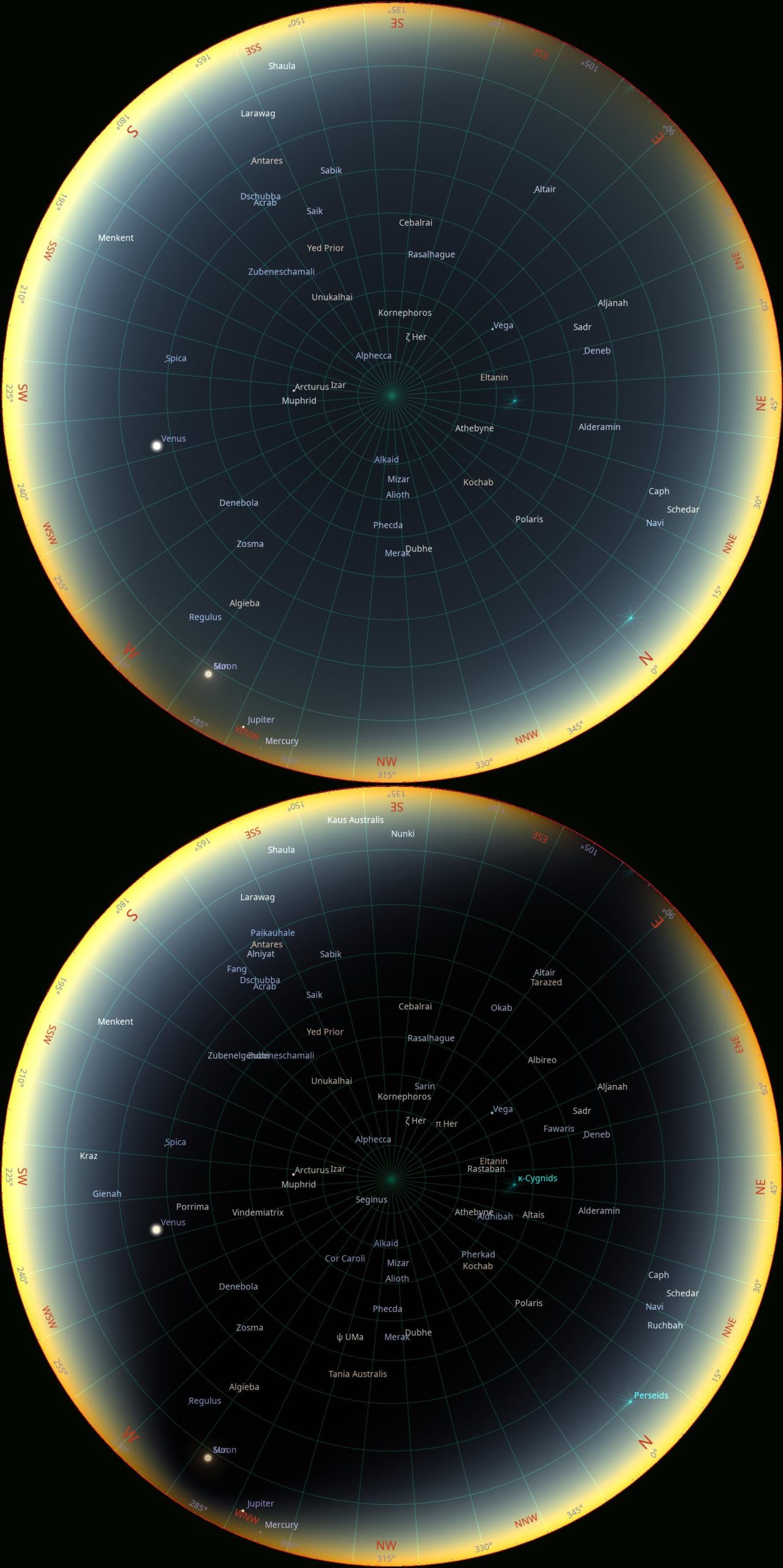
Place 11 – Spain, Burgos (42° 20′ 46.92″ N; 3° 41′ 24.16″ W)
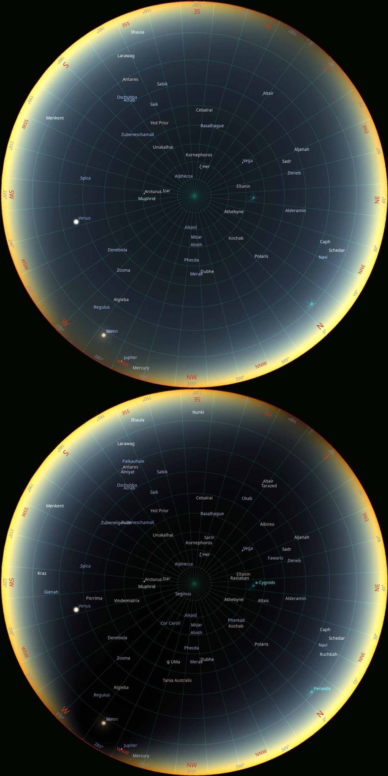
Place 12 – Spain, Bilbao (43° 16′ 37.94″ N; 2° 56′ 54.48″ W) – one of the most interesting locations, where the totality will last 27s only with umbral depth just as small as 3,5%. The umbra will cover only the nearest surroundings of the Sun, leaving the entire sky illuminated. Hence, a small number of stars are visible. What is most curious is that the eclipse limit is around 4000m above Bilbao, reflecting the difference in star visibility. This article will outline what to expect in situations like this.
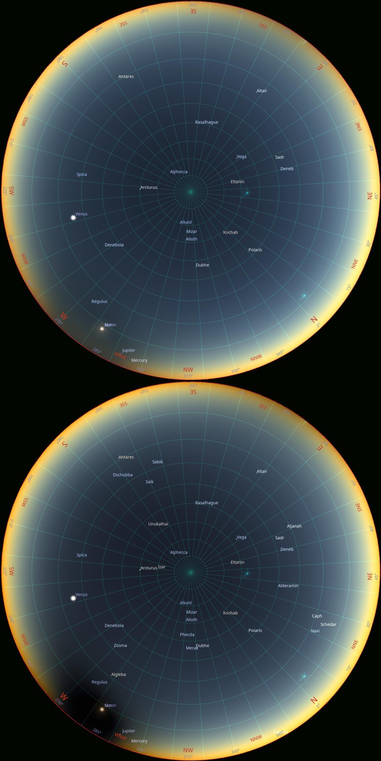
Place 13 – Spain, Madrid (40° 25′ 30.60″ N; 3° 40′ 24.83″ W) – The only location considered just outside of the path with the greatest obscuration of 99,79%. However, because it’s a grazing zone at the southern limit, almost the entire sky will be shadowed, making it difficult for observers to see stars. This is the opposite of the previous observation and is explained in the same article.
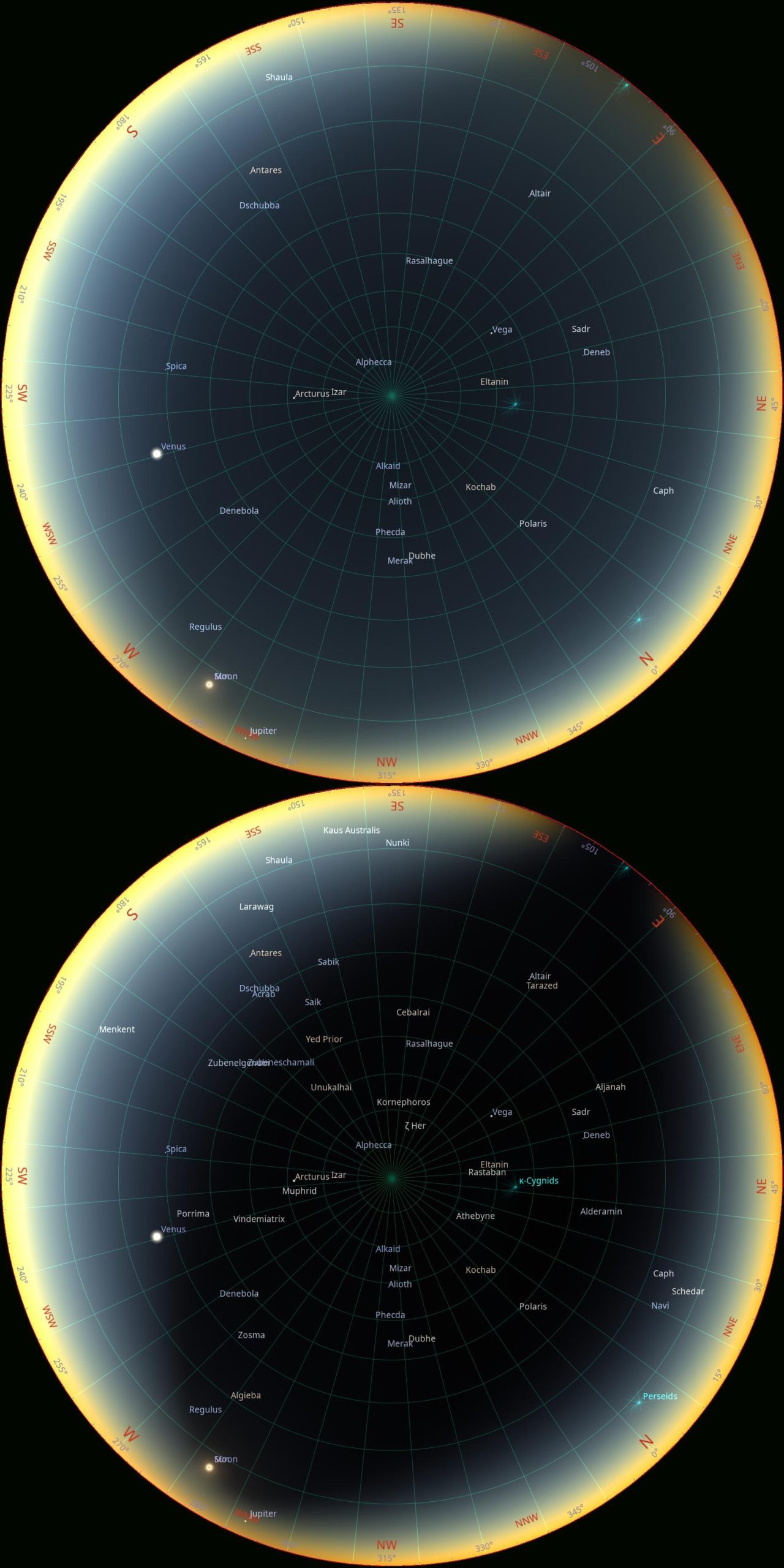
Place 14 – Spain, Zaragoza (41° 38′ 21.19″ N; 0° 53′ 18.71″ W)
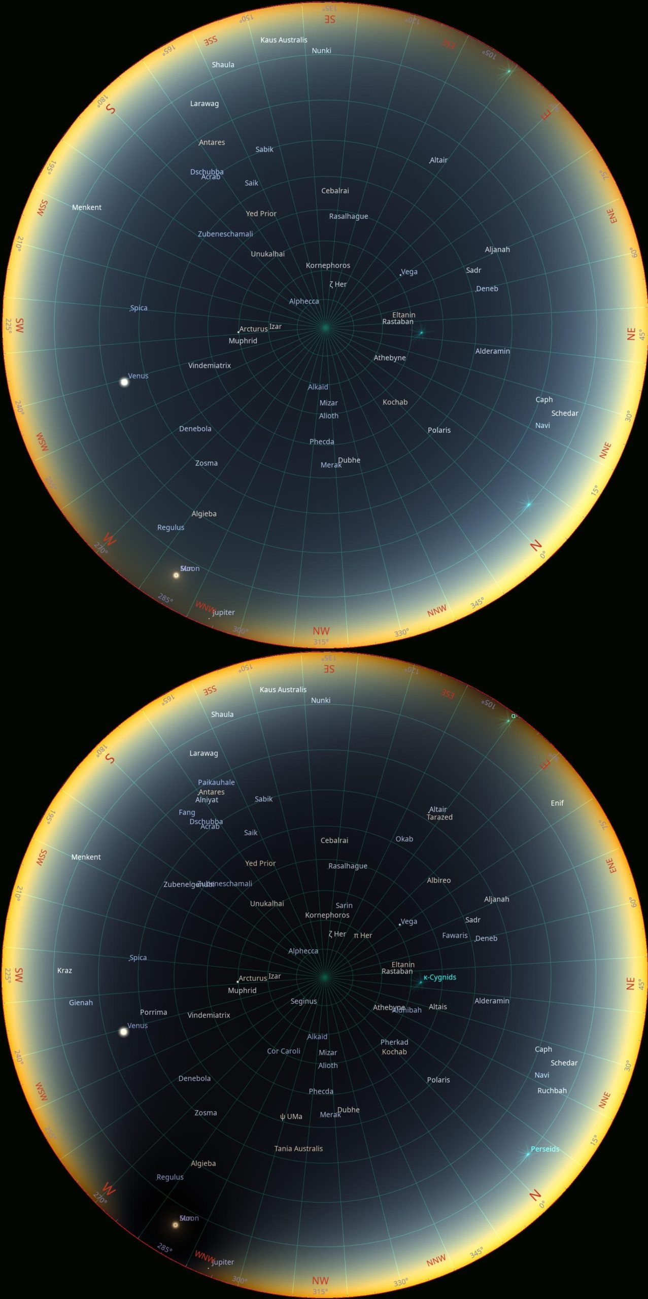
Place 15 – Spain, Valencia (39° 27′ 53.99″ N; 0° 22′ 19.82″ W) – umbral depth just about 20%.
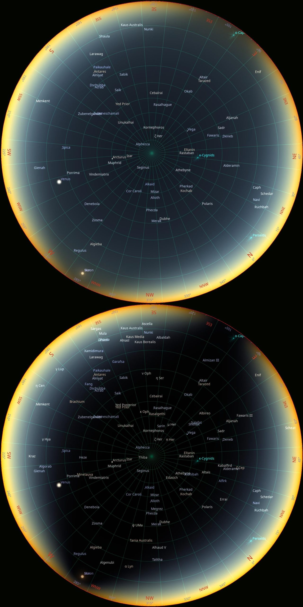
Place 16 – Balearic Islands, Formentera, Cap de Barbaria (38° 38′ 23.68″ N; 1° 23′ 11.52″ E) – another extreme location where the totality can be watched from, but for a very short period of 19s, as far as the lunar limb corrected is considered. The umbral depth is only 3%, but near the southern limit, it means almost the entire sky is bathed in the Moon’s shadow.
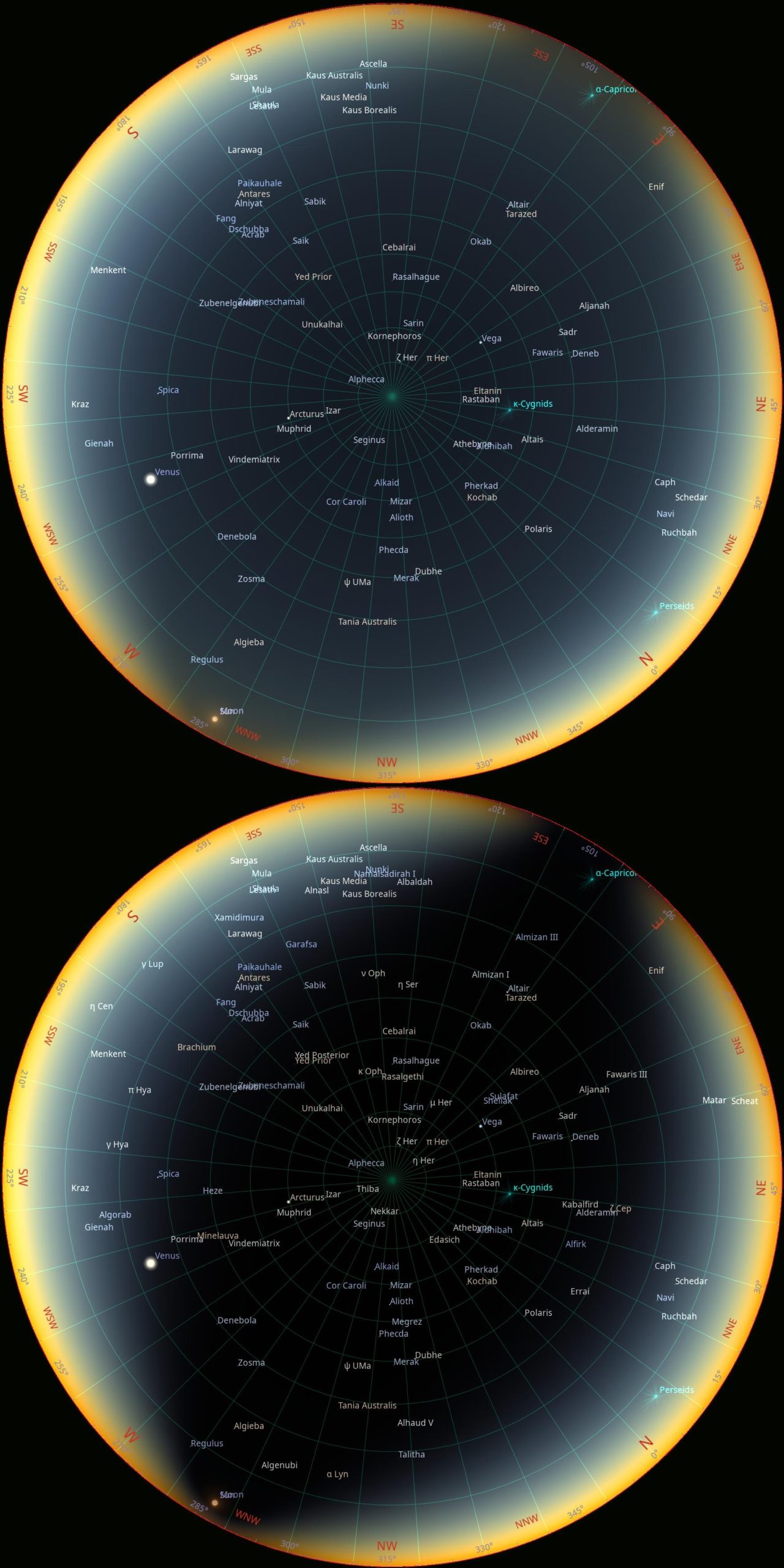
Place 17 – Balearic Islands, Mallorca, Palma de Mallorca (39° 34′ 17.95″ N; 2° 39′ 05.84″ E) – the increased number of stars is a consequence of the low position of the eclipsed Sun above the horizon, as the key role the atmospheric extinction starts to play.
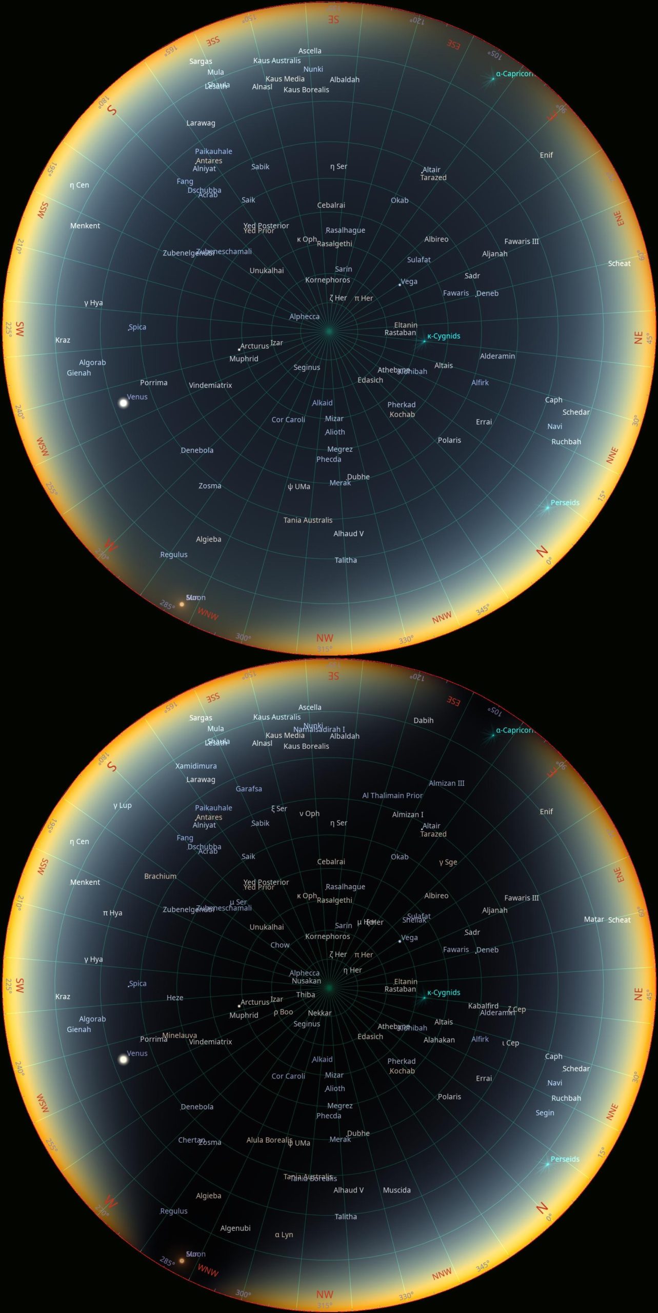
Place 18 – Balearic Islands, Menorca, Mahón (39° 53′ 21.34″ N; 4° 15′ 53.51″ E) – One of the easternmost places the total solar eclipse can be watched from, and thereby one of the easternmost Spanish lands. The greatest eclipse occurs only 1,7° above the horizon, so due to atmospheric extinction, an observer should expect the largest number of stars visible in the sky.
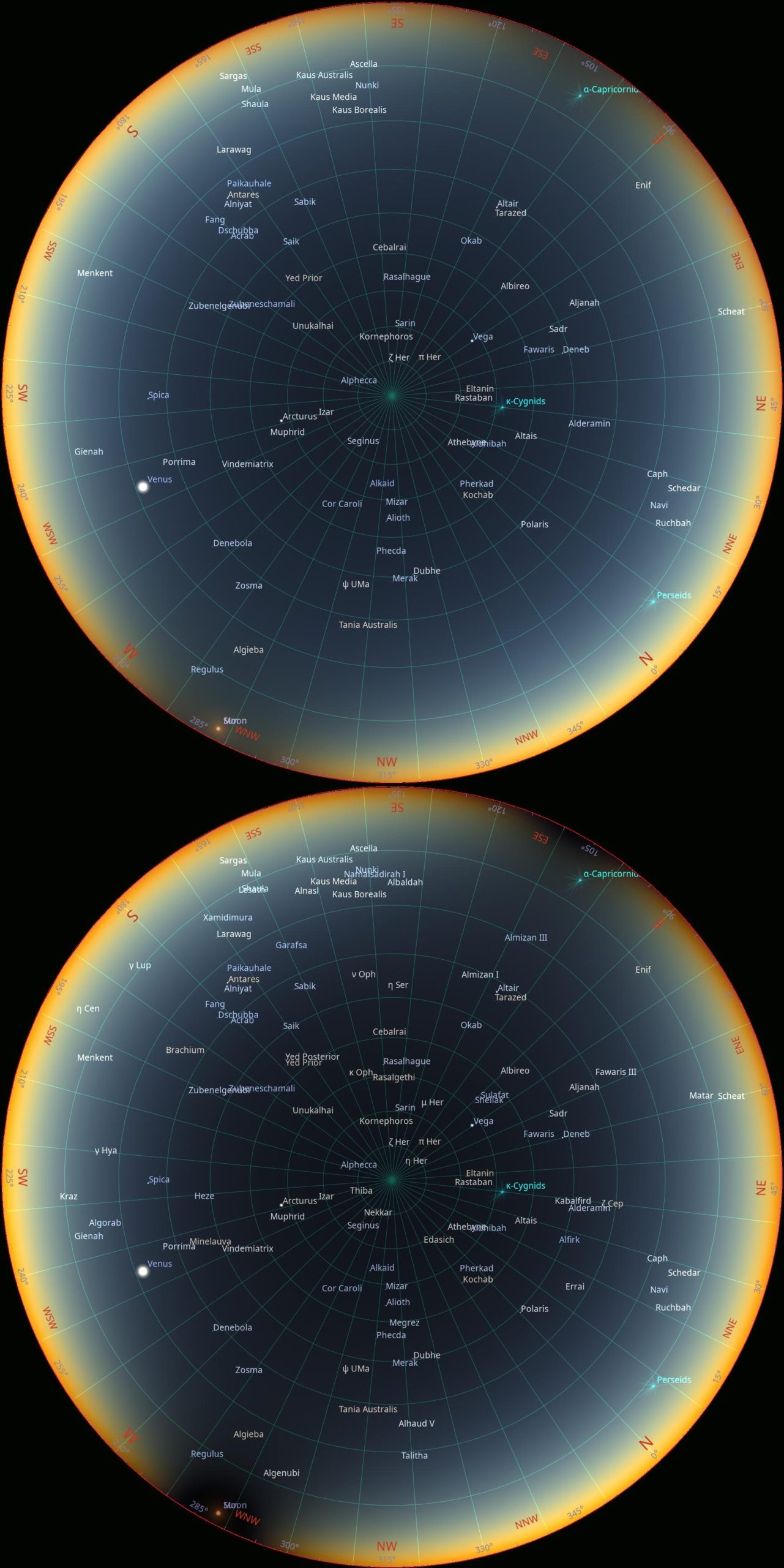
All these projections represent the moment of the greatest or mid-eclipse.
>>>BACK TO TOP<<<
12. PERSEIDS
Around August 12, the Perseids reach their peak. This meteor shower originates from debris left by the periodic comet Swift–Tuttle, which has an orbital period of approximately 133 years. Exceptional outbursts, such as in 1993 following the comet’s 1992 perihelion passage, have produced zenithal hourly rates (ZHR) approaching 300 meteors per hour. Such enhancements are associated with orbital resonances involving meteoroid particles and the gravitational influence of Jupiter and Saturn (Sekhar, Asher, Vaubaillon, 2016). A comparable resonance-related enhancement is projected around 2111, though this remains subject to further modeling. In 2026, no major resonance enhancement is expected; typical Perseid activity (ZHR ~50–100 under dark skies) should prevail. During the 12 August 2026 total solar eclipse, meteor visibility will depend strongly on radiant altitude and local sky brightness. The Perseid radiant, located in the constellation Perseus, will remain high above the horizon for observers in the northern portion of the eclipse path, improving the probability of detecting bright fireballs (magnitude ≤ –3). Optimal observation requires viewing ~30–60° away from the radiant rather than directly toward it.
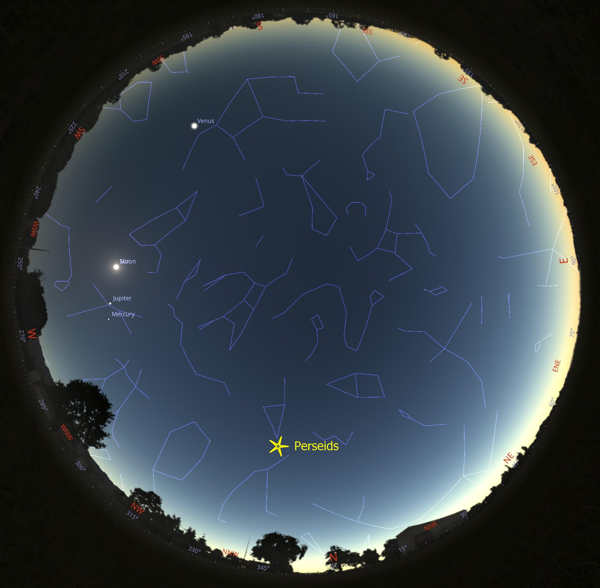
At lower latitudes (e.g., Spain), the radiant will be near the horizon at maximum eclipse, reducing detection probability (Pic. 228).
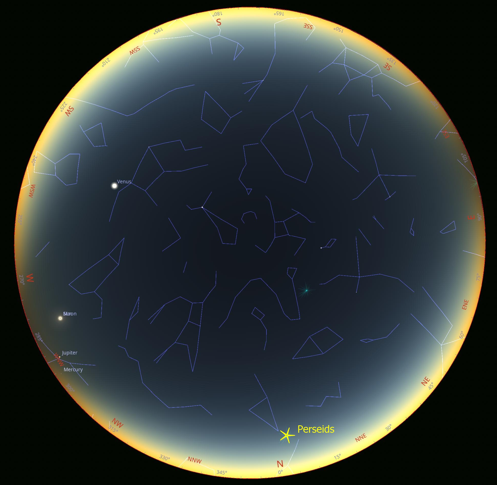
More favorable geometry may occur in parts of Italy, Malta, and Tunisia, where twilight combined with eclipse-induced darkening could marginally enhance visibility. Nevertheless, meteor rates during daylight totality will be substantially lower than nighttime ZHR values, and the probability of observing a bright Perseid during totality remains low, though non-zero.
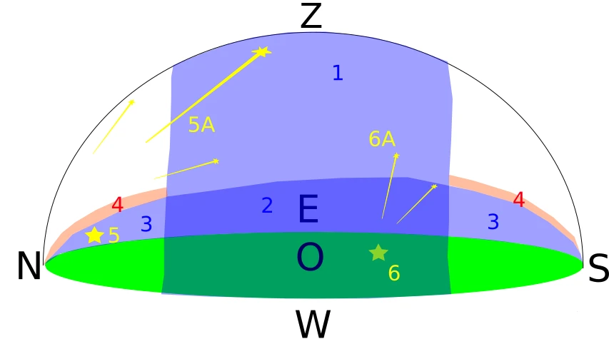
The Southern Delta Aquariids, active from late July to late August (peak ~July 28), will also be present, but the radiant is generally positioned unfavorably during eclipse maximum. Overall, while simultaneous observation of meteors during totality is physically possible, expected event frequency is limited by sky brightness and radiant geometry.
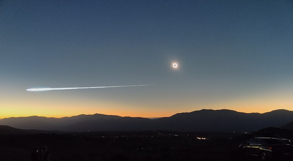
The position of the Perseids in a given location can be simulated in the 3D version of the Photography Ephemeris app (Pic. 230).
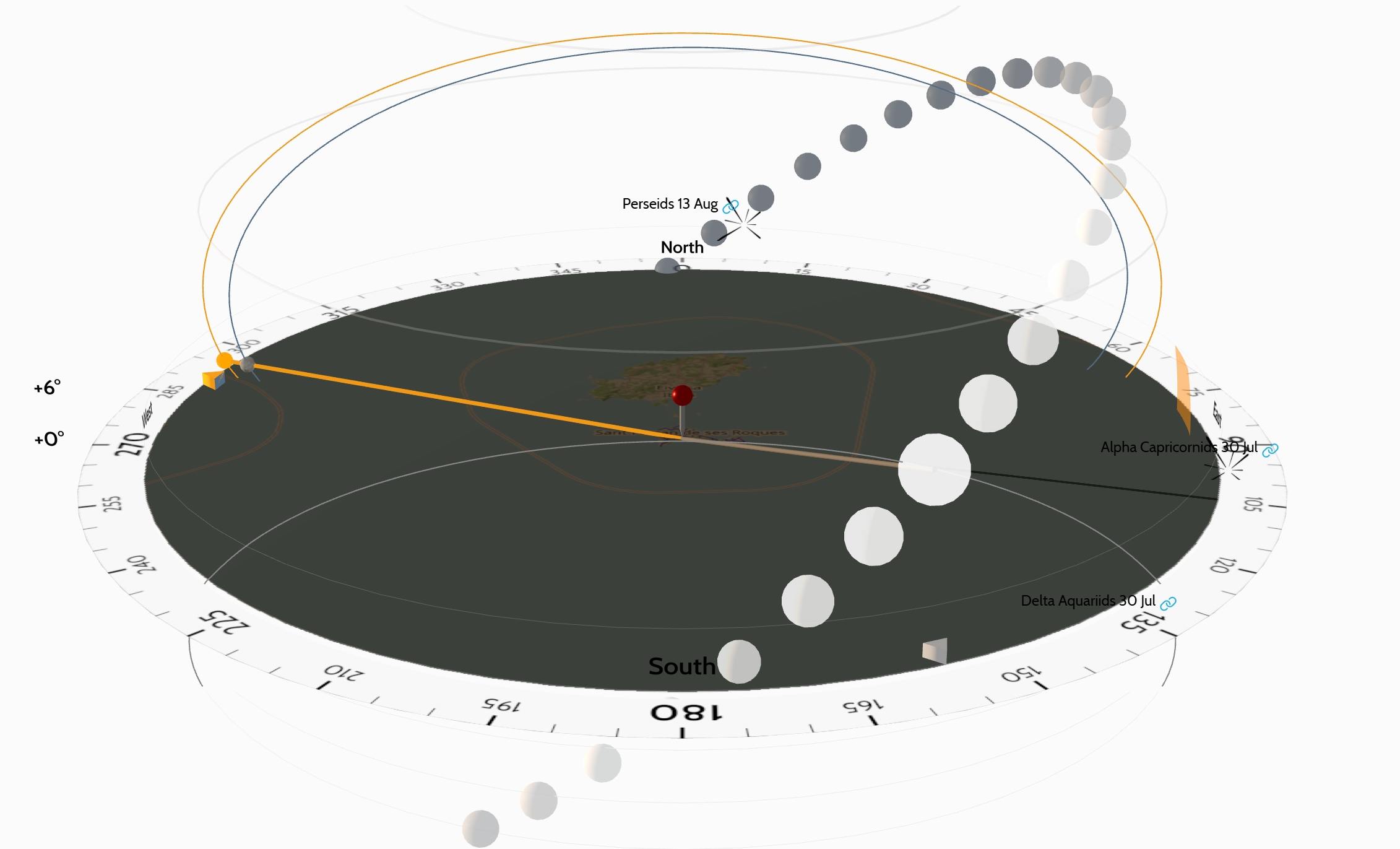
>>>BACK TO TOP<<<
13. WEATHER PROSPECTS
The weather circumstances have been widely discussed in several sources. They refer to the geometrical path of a solar eclipse, which makes this chapter a supplementary section on the twilight zone, as no one has seriously addressed this topic so far. Before I start the analyses, it is worth mentioning one key website, which explains the weather along the solar eclipse path. This is undeniably Jay Anderson’s Eclipsophile.com portal, where we can find useful information about mean cloud coverage over the eclipse area. From the perspective of the impact of the solar eclipse on twilight, what is important is the average nighttime cloud amount for August (Pic. 231).
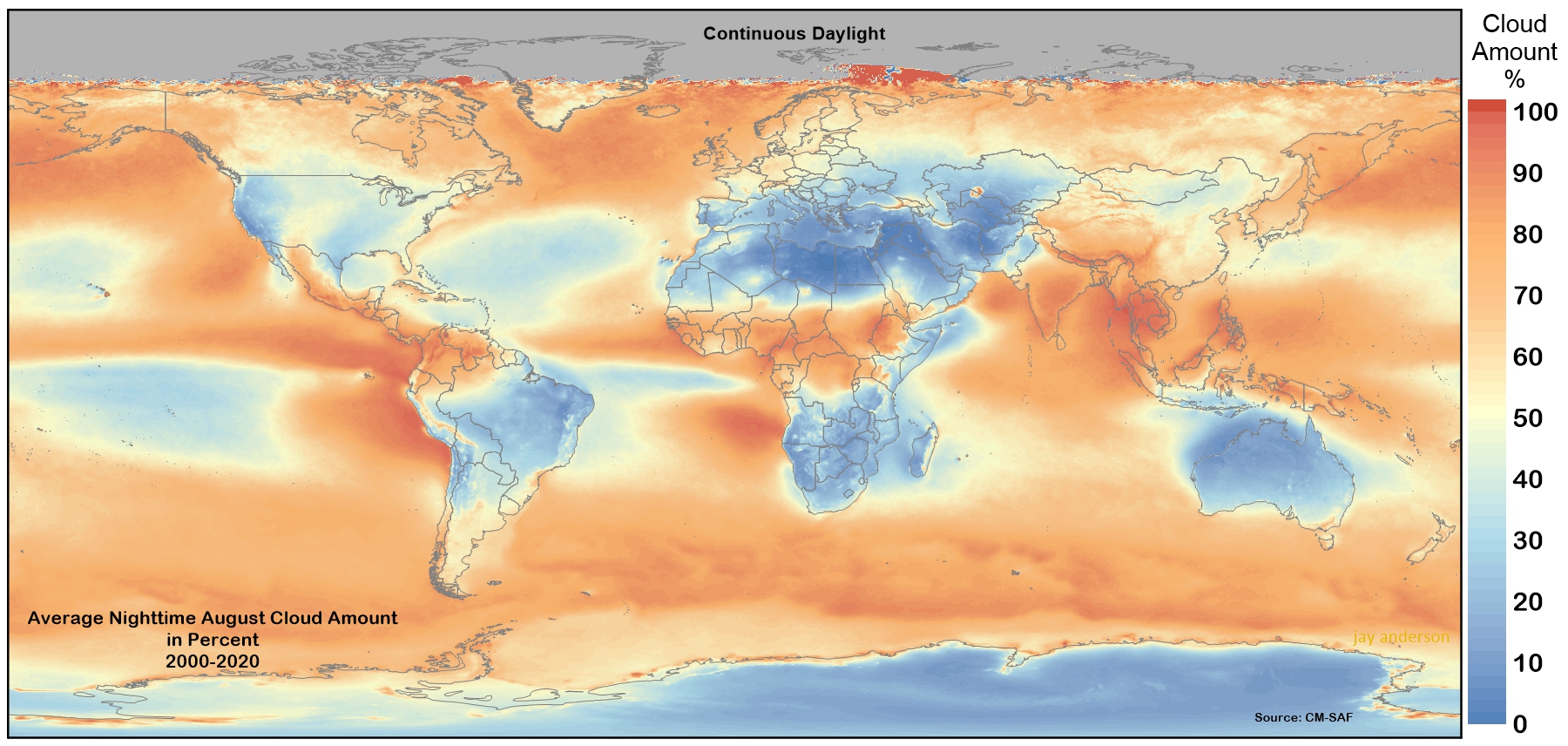
Other, more detailed maps refer to cloud cover at daylight hours. In the map below, the observation venues of the eclipse below the horizon have been marked (Pic. 232).
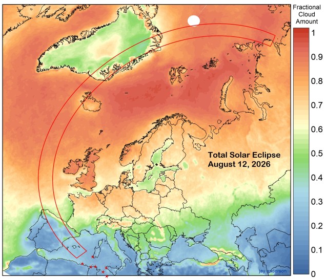
Except for Eclipsophile, this article lists other sources that could help you plan the observation. Additionally, it’s worth looking at two important articles, which explain typical weather patterns for the afternoon of the August 12 eclipse. The cloud coverage is too general, especially since it shows the situation exactly at the considered location. Even if these estimations cover the entire sky, an observer should still be aware of the object’s position. For example, if in the observation area the fractional cloud amount is, let’s say, 20%, but in the adjacent area to the west it increases to 50%, an observer should keep in mind that the western horizon may be more obstructed by clouds. Important is the line of sight, instead of the sky just above your head. Another important thing is the types of cloud. Usually, clouds are about 3-7km above the ground, but when vertically developed, they can reach 10 km. There is a good article explaining which types of clouds are most « dangerous » for observing a solar eclipse, when it occurs low above the horizon, and a map that lets you simulate the shadow of clouds at various altitudes (Pic. 233).
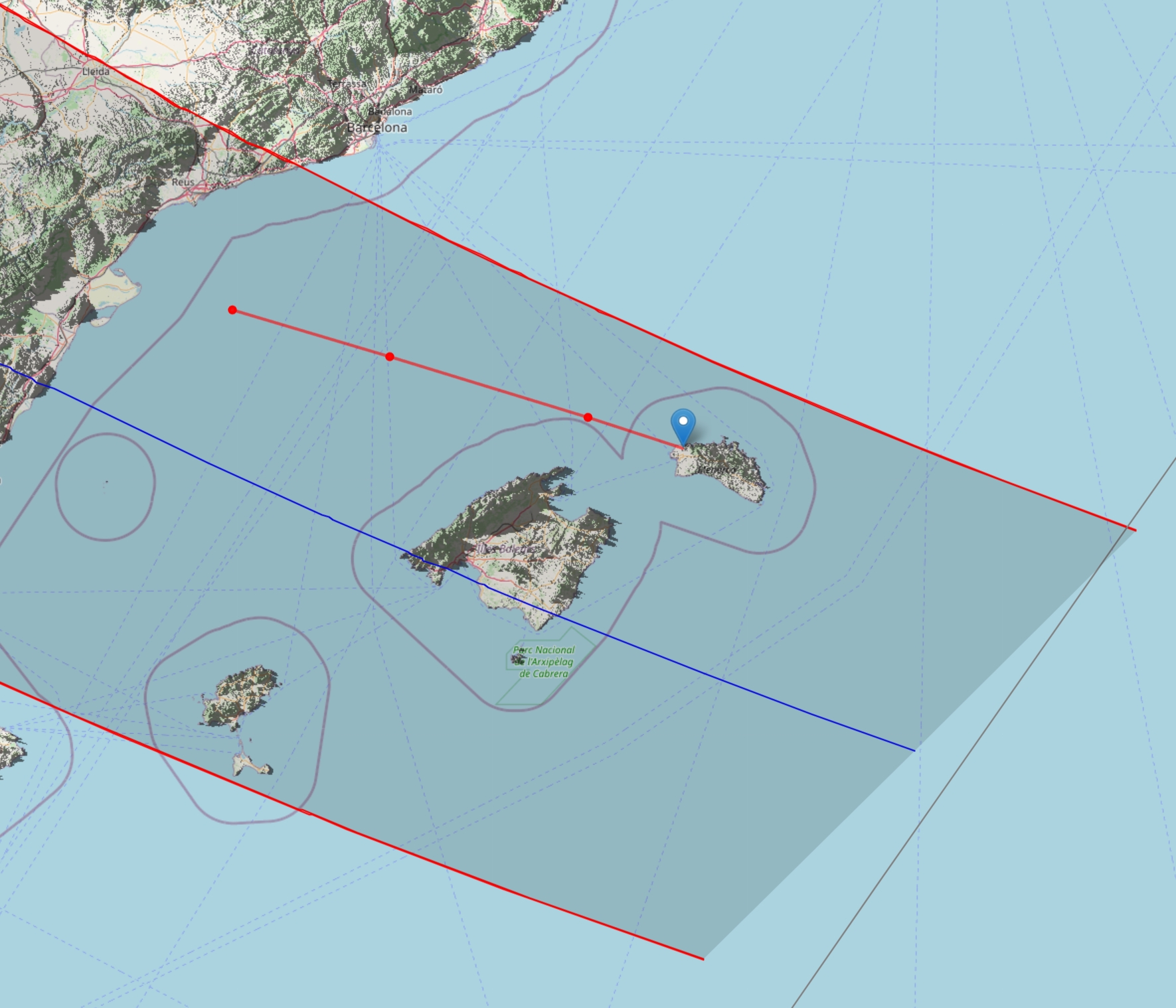
Also, the Photographer’s Ephemeris is a good tool for checking the weather, though it’s only valid for a short time before the eclipse. The level of detail, combined with an interactive map, can be very useful when looking for a place with good weather.
Now let’s dig down into the satellite imagery, on which the aforementioned Eclipsophile.com maps are based. There is a major flaw in these images, as they depict the fixed time of day at which the given region was captured. The weather can change within hours, and when the eclipse occurs in the late afternoon, the static satellite imagery may no longer be valid. This particular problem has already been discussed here. The best example is August 12, 2025, when the Iberian Peninsula was almost completely free of clouds at noon, whereas several hours later the situation was quite the opposite (Pic. 234).
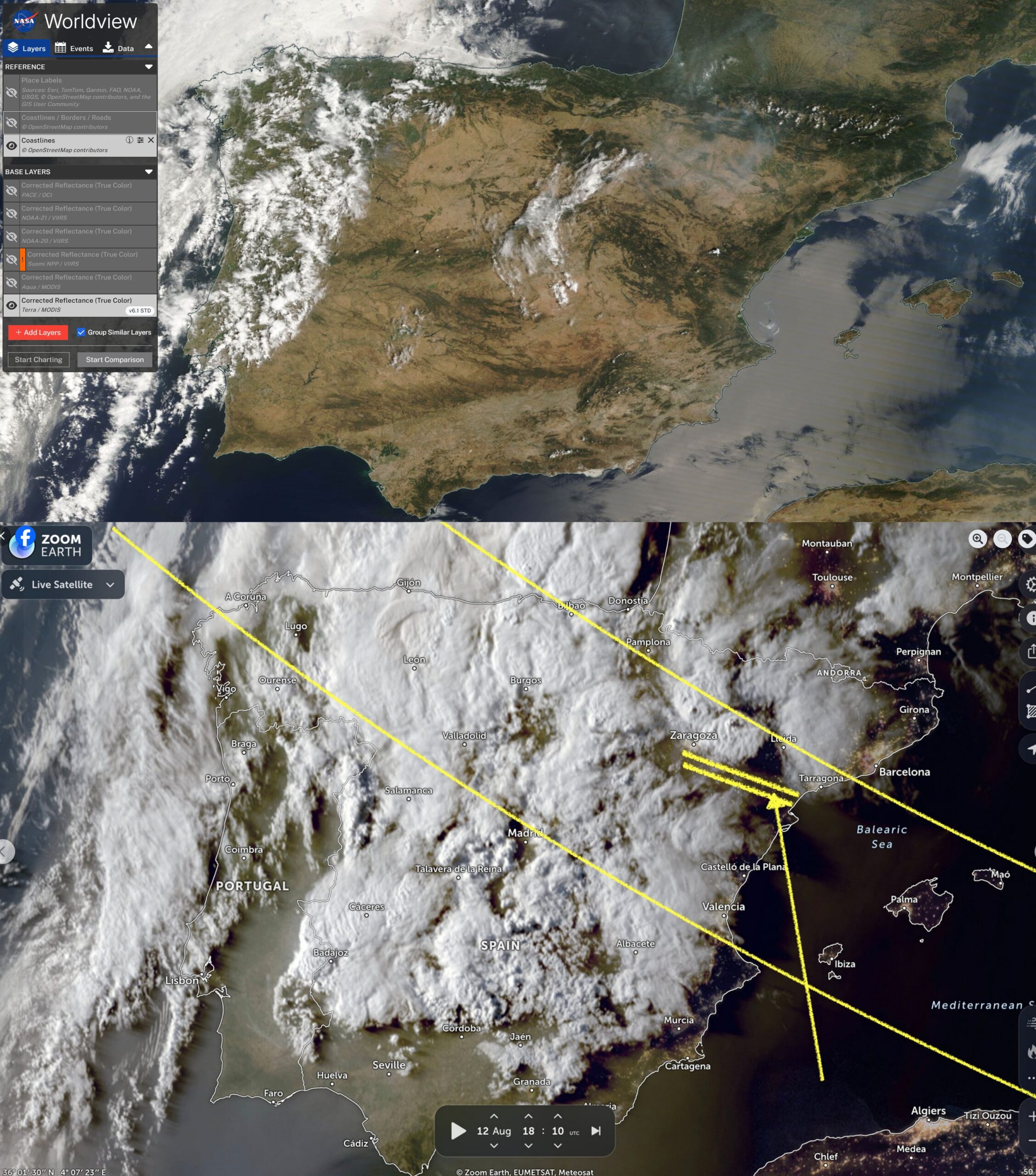
The circumstances are slightly different when the eclipse occurs in the morning, as the probability of vertical cloud development is much smaller than during the afternoon. In the case of a total solar eclipse in Spain and its impact on twilight in the Mediterranean region, deep analyses of satellite imagery aren’t sufficient. I used them only as the statistical data for the places where the eclipse below the horizon can be watched (Pic. 235). I’ve assumed them by the following criteria:
1 – Clear skies
0,75 – Clear skies with a tendency for vertical cloud development during the afternoon hours, presence of cumulus, and other types of patchy clouds at a distance of less than tens of kilometers from the observation venue,
0,5 – Serious sky obstruction by the clouds at a distance smaller than 50km from the observation venue. The clear sky above head, but not clear at the line of sight, intensive cumulus clouds developed over the day
0 – The overcast or partially overcast day with a probability of serious cloud coverage at late afternoon hours. As a full overcast day is extremely rare at this time of the year, various types of cloud presence are common. Intensive thunderstorm clouds are developing in places.
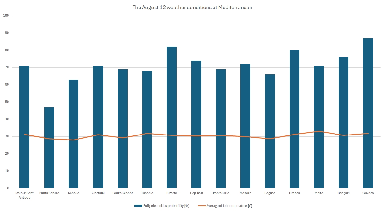
The chart shows that the probability of clear skies tends to increase as we move eastwards. In my estimations, I accounted not only for the pinpointed location but also for the surrounding area, assuming that nearby clouds can cover a significant portion of the sky. The biggest problem is the potential for thunderstorm clouds and significant wildfires or dust storms, which can eventually ruin the observation, as smoke can completely veil the sky (Pic. 236).
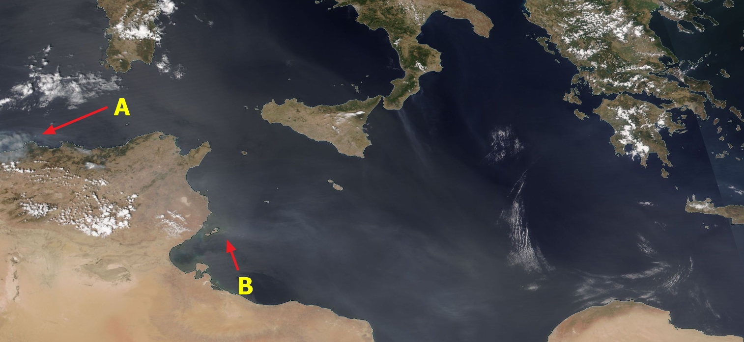
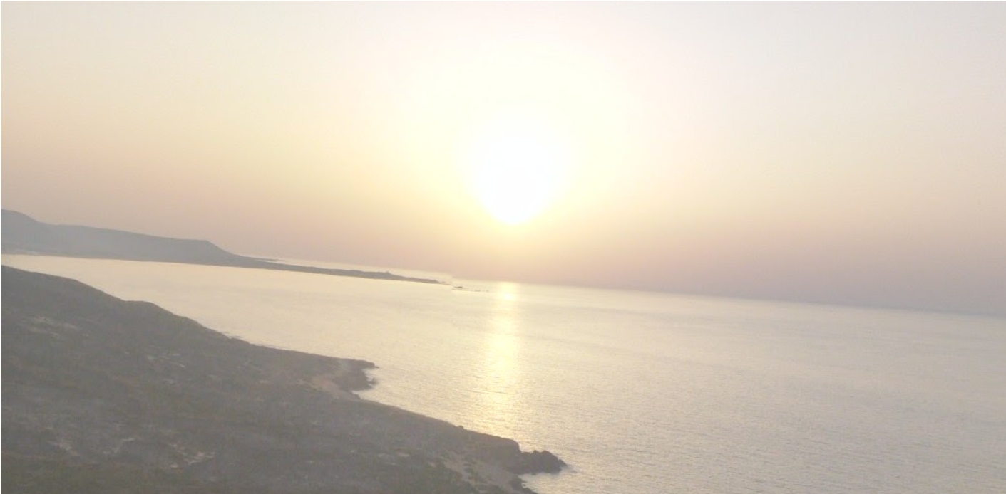
Not to mention, smoke creates favorable conditions for various types of cloud development.
To partially verify the data in the chart above, we can use the Ventusky.com application, which provides daily satellite imagery captured every 3 hours since 2022! (Pic. 238)
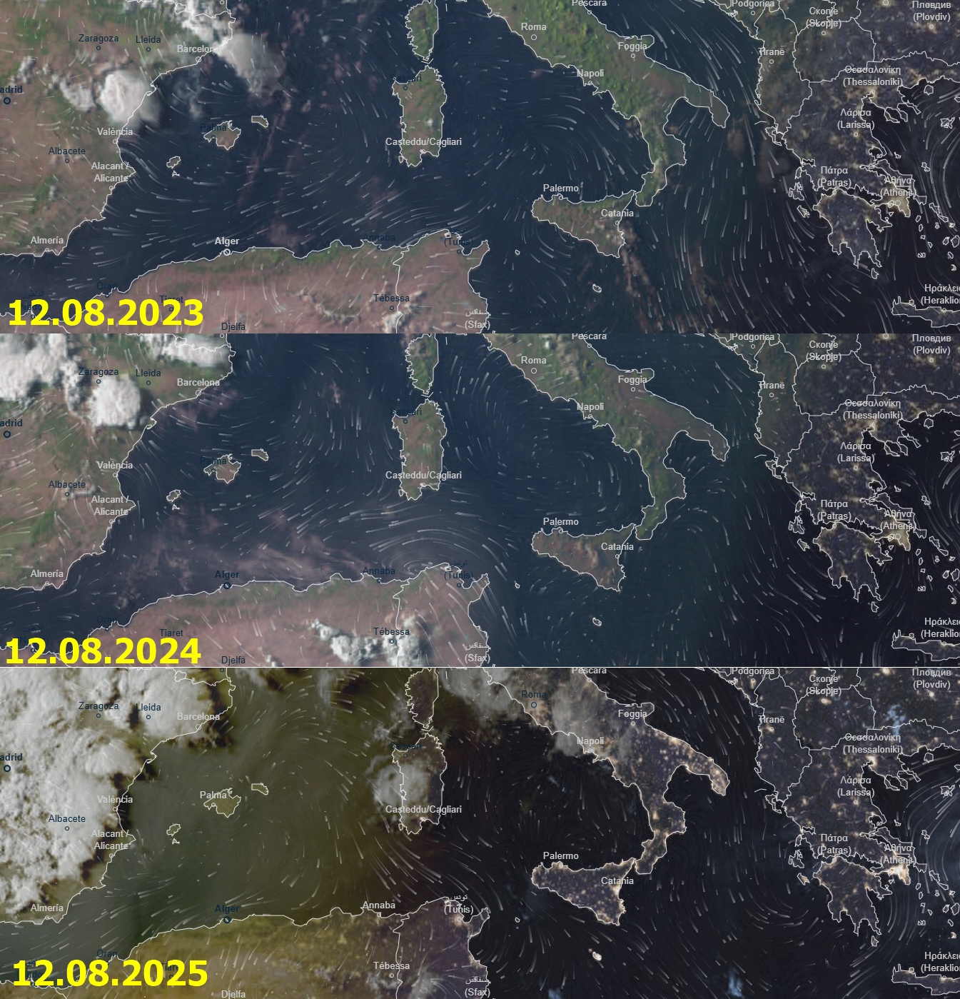
Next, all these places are located within an area almost free of clouds, according to the Eclipse App.
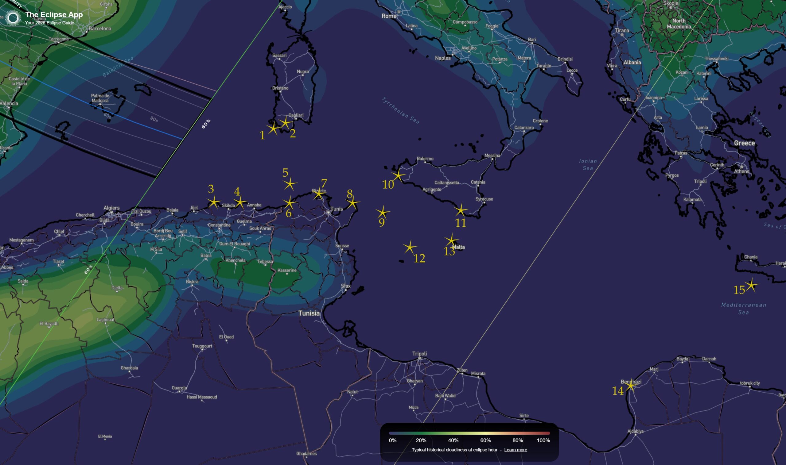
By looking at the results directly from the map above, we can see in detail what the cloud coverage can look like on August 12 between 8 and 9 pm (Pic. 240).
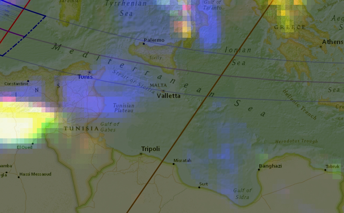
Finally, most of the locations listed on the map above are subject to deep analyses provided by the weatherspark.com service.
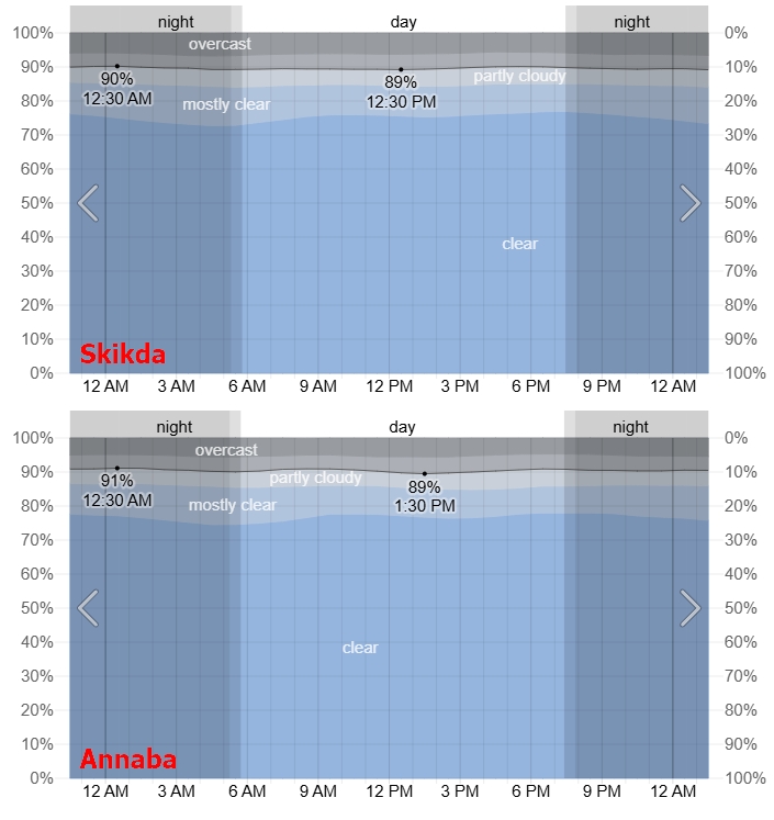
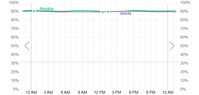
Unfortunately, Weatherspark.com doesn’t support data from the mountainous Algerian coast except for the largest cities nearby. A potential observer must be aware that climbing above 1000 m above sea level can result in much worse weather, as the probability of vertically developed clouds and thunderstorms is quite high. A good hint is to look at the eclipsophile’s average total cloudiness over Spain in August, which occasionally includes northern Algeria. We have a high probability of cloudiness along the coast, where the air rises adiabatically towards the Atlas mountains (Pic. 243).
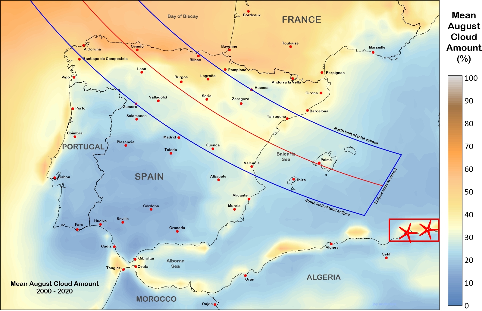
The weather tends to improve as moving eastwards along the southern Mediterranean coast. In Tunisia, the probability of clear skies exceeds 90%, especially at the eastern tail of the Atlas Mountains (Pic. 244-245).
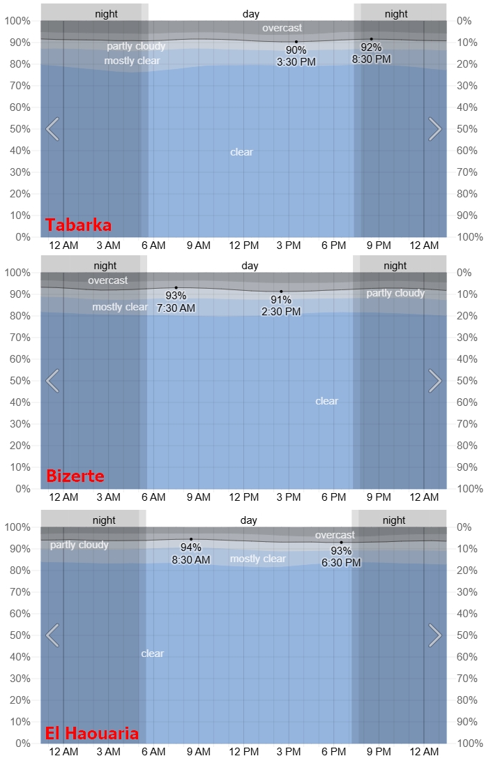
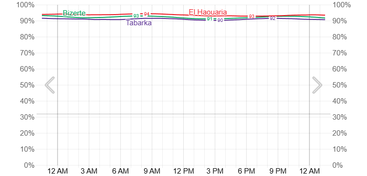
Unlike Tunisia, the western coast of the Mediterranean, at Sardinia, seems to be the most risky for evening thunderstorms. In fact, they disappear as the eclipse progresses, but we must be aware that the event occurs late in the afternoon, when thundery cells develop, often with capillatus clouds, which eventually won’t dissipate as quickly, veiling large sections of the sky. Another thing: even if we assume the thundery clouds will dissipate quickly, this process mostly occurs on the ground, where cooling is much faster than in seawater. Again, the analyses below don’t cover the Punta Sebera surroundings, so two adjacent locations have been picked up (Santadi and Pula).
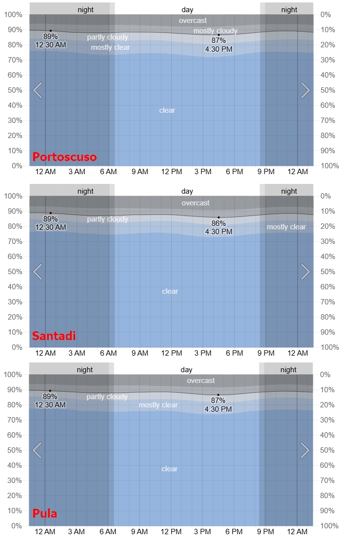
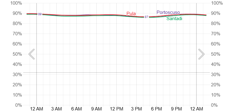
The weather prospects significantly improve in southern Sicily, where the chance of clear skies is fairly high, exceeding seriously 90%. However, a potential observer must be aware of the possibility of vertically developed clouds in the evening. Especially around Ragusa, the probability of clear skies is just 80%.
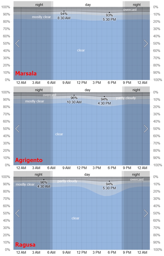
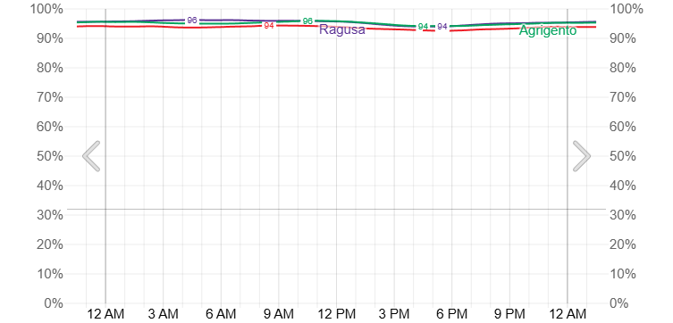
The best weather prospects are for the central Mediterranean section, where, unfortunately, the greatest eclipse effect won’t be observed within the civil twilight zone, except for Pantelleria.
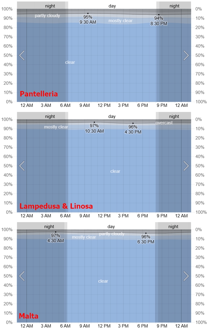
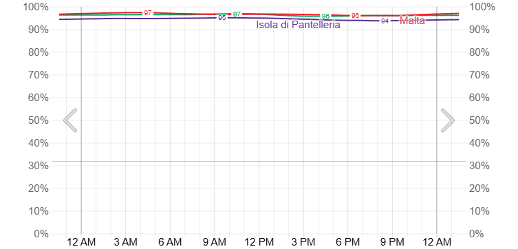
The largest chances of clear weather, almost 100% of the sky free of clouds, apply to the easternmost locations considered, where the eclipse impact can be observed just within the astronomical twilight zone.
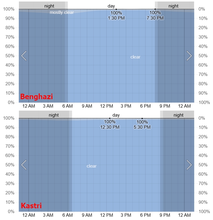
In conclusion, the predictions show the general probability of clear skies, with an understanding of sky visibility under partially cloudy conditions! The color charts provided suggest an additional 10-15% on average, with the sky being rather clear but not fully so. It means a lot, especially when the sky is veiled by thin cirrus or cirrostratus clouds, which can disrupt the observation of optical effects or, on the other hand, enhance them when the event occurs just after sunset. Another important point is that these analyses mostly refer to the sky above our heads. Most of the charts show an increase in cloudiness in the late afternoon, which directly precedes the observation time between 8 and 9 pm. It does look clearer, however, the presence of potential « old » thunderstorm cells or their remnants might deteriorate observation, especially in the antisolar direction. Conversely, towards the setting Sun, the presence of especially high-level clouds can help observe the movement of the umbra near the terminator line, or even allow the observer to see shadow bands?! Who knows?!
There is, fortunately, a more advanced weather forecast platform – Meteologix.com, which includes the archival weather data back to 1977! It allows us to confirm all the theories developed above. This is mainly because satellite imagery can be browsed at any time in various modes (see Pic. 82).

Alternatively, the cloud coverage data from the period of nearly 50 years can be used (Pic. 255)

Apart from the standard « cloud coverage » projections, we should also consider atmospheric clarity (Pic. 256).
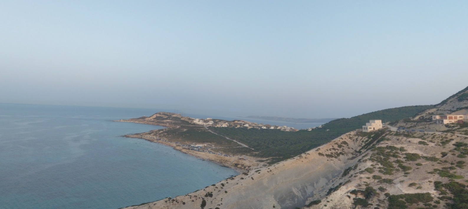
The presence of aerosols, especially lithometeors produced by local wildfires, combined with extremely high coastal humidity, can significantly alter the appearance of the sky and reduce the horizontal visibility (Pic. 96). The humidity level varies predominantly between 60 and 90% across the considered observation sites (Pic. 257).
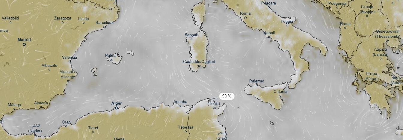
Where the value exceeds 90%, it applies strictly to coastal areas at sea level or to areas near thunder cells. The Meteologix.com observational data show various levels of relative humidity over the central Mediterranean region (Pic. 258).


As described below, relative humidity, combined with wildfire effects, can seriously degrade visibility of the lowest section of the sky above the horizon. This combination definitely reduces horizontal visibility, which is generally very poor across the area (Pic. 260).


The high humidity and occasional wildfire activity result in very short horizontal visibility, which rarely exceeds 20km in this area on August 12 (Pic. 262, 263).
At last, potential wildfire hazards can be checked in real time on this website. It’s important to do it directly before your observation, along with a wind direction.
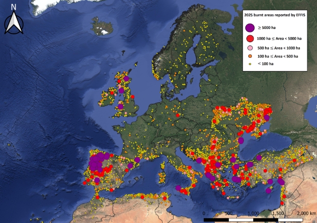
For historical data back to 2000, you can use this website to see exactly the wildfires occurred on August 12 (Pic. 263).
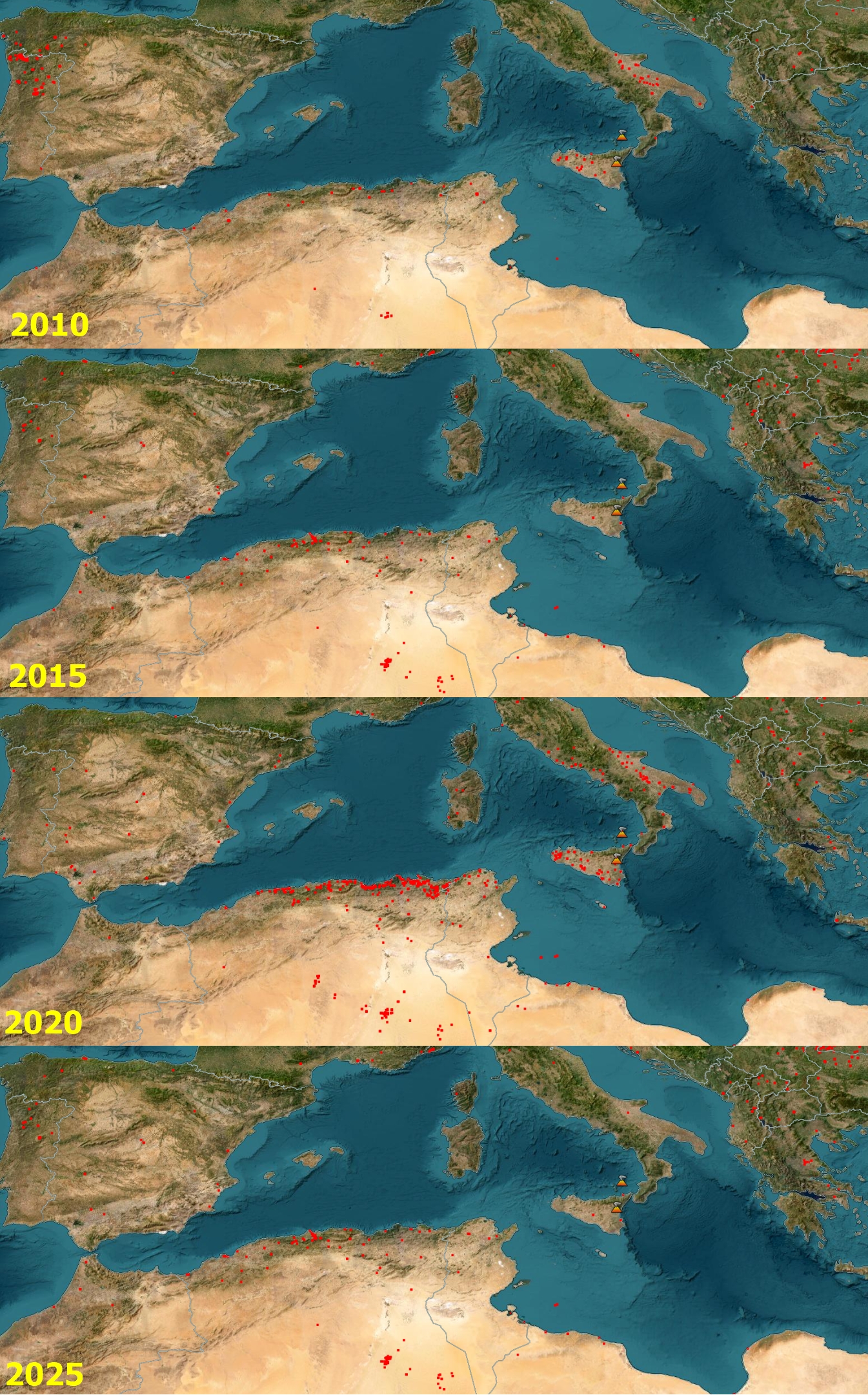
The probability of wildfires between 2001 and 2025, combined with altered projections of clear skies, including an additional 19 years prior to 2001, clearly indicates the regions that are potentially risky (Pic. 264).

They again confirm the worst-weather projection on the western side of the Mediterranean region, which can be explained by the proximity of the Atlantic Ocean and its influence, as tropical air masses are more common there. Another crucial factor is a large landmass, where the probability of thunderstorms and other vertically developed clouds increases. As a rundown, the worst prospect applies to the northern Atlas region, where, paradoxically, the effect of the solar eclipse below the horizon will be the most prominent, with even devil’s dorns visible. Another region with quite poor weather & wildfires estimation is Sicily, where an observer can get relatively easily.
The last thing is the observation conditions themselves. The good weather might not be enough, as comfortable observation conditions are essential for focusing and achieving decent results. Unfortunately, the Mediterranean region features rather miserable conditions with an average temperature of around 30 degrees, which, combined with high humidity, can make observers distracted.
Finally, it is important to know a few weather forecast websites that can help you choose a suitable observation site shortly before the eclipse. They’re listed below with all relevant layers to consider:
-> Windy.com (satellite imagery, humidity, aerosols, dust concentration, wind)
-> Ventusky.com (satellite imagery, clouds forecast, wind gusts, air quality)
-> Dust.aemet.es (dust concentration and its movement within hours)
Moreover, it’s good to have the Weather & Radar app on your phone.
>>>BACK TO TOP<<<
14. LIGHT POLLUTION
Light pollution can affect the observation of the solar eclipse’s effect on twilight, especially in the antisolar direction. Because the light begins to disrupt at a solar depression of approximately 9°, the problem has been considered only in the twilight zone. According to the eclipse’s impact on the twilight nomograph, the light-level conditions corresponding to the aforementioned solar depression occur just after sunset, at least for totality. Second, based on observational experience in Spain and the relevant visualizations presented in Chapter 15, light pollution is considered for locations near the projected extension of the umbral path. It doesn’t mean the effect won’t be visible in other locations; it will simply be less pronounced. Placing yourself at the estimated extension of the totality means at least a minimum period of time, during which the fleeting umbra will be visible exactly at solar direction, which by definition is the brightest in the sky. Analyses of light pollution have been divided into 3 major areas, most favorable for the event’s visibility. They refer not solely to European boundaries but to the entire Mediterranean region.
Mediterranean west – the first area, where the eclipse is to be watched mostly within the civil dusk (Pic. 265).
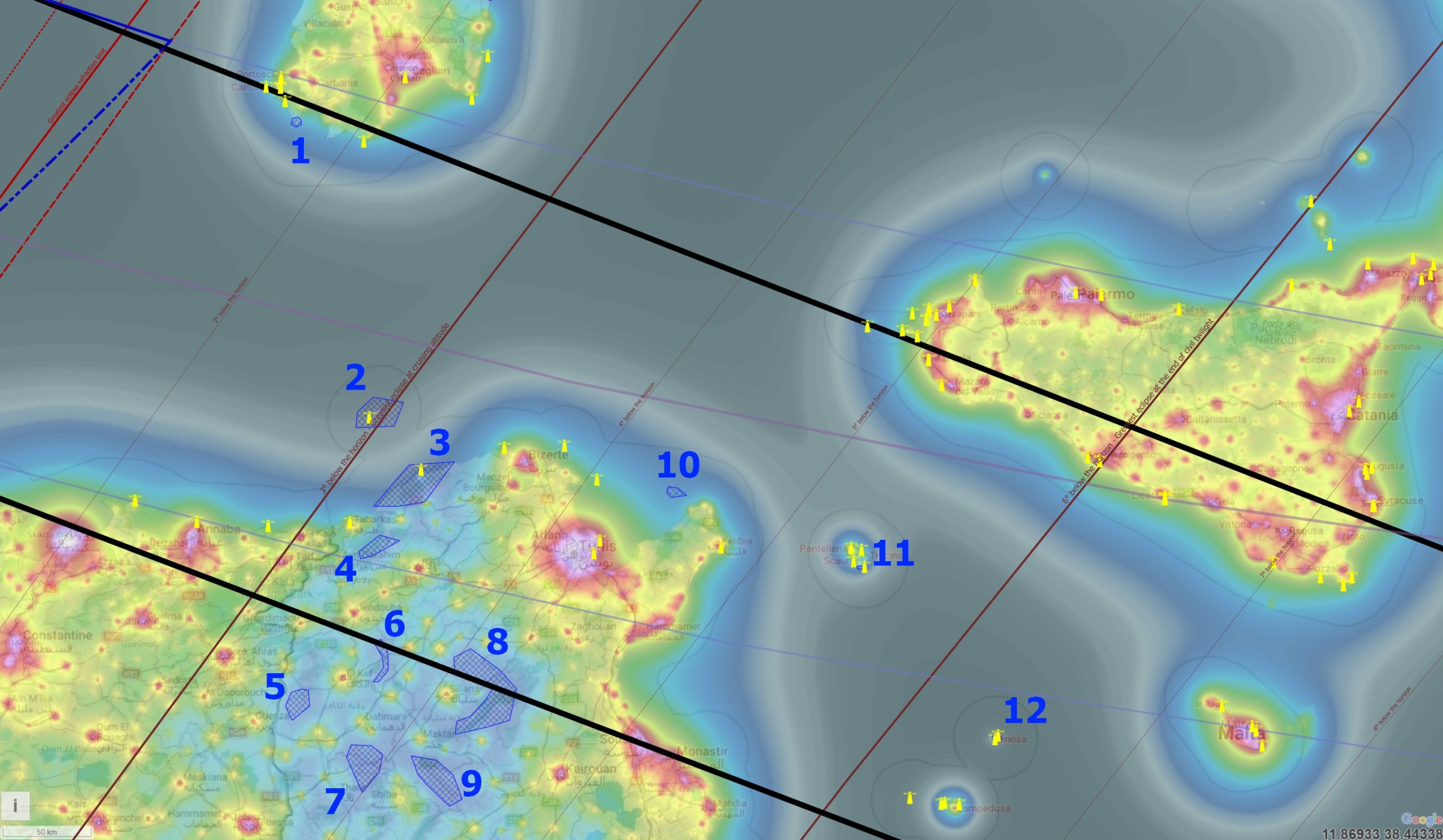
There are 12 areas found in the following region, which are described in detail below:
1 – The Capo Sperone surroundings – precisely the Peonia Rosa village, easily accessible by car. Next, you can take a short walk to the Su Monti de Su Sumafuru summit and enjoy the elevated view. An estimated antitwilight sky quality is Bortle 2, as the observer is located north of the NATO military polygon at Cape Teulada, the southernmost tip of the Sardinian mainland. See Google Street View.
2 – Galite Islands – this intriguing and inhabited archipelago belongs to Tunisia and offers Borelt 1 sky at solar and zenith direction. Unfortunately, due to proximity to one of the largest metropolitan areas – Bizerte, located approximately 80km in a beeline, the sky quality at antisolar direction could be at most Bortle 2. Moreover, the western part of the sky can be occasionally disrupted by the Galiton lighthouse. There are 2 spots to be occupied during the observation: Gran Sommet, the highest, and the Eastern Summit, which rises 360m above sea level. See the on-site view here.
3. The Cap Serrat region – a quite large section of the Mediterranean coast in Tunisia, stretched at a distance of about 30km wth Bortle 2 scale. The best place appears to be around the Sidi Ferjani village, because of the lighthouse at Cap Serrat. The only source of light here is the Lac Zayotine water dam. See an example location here.
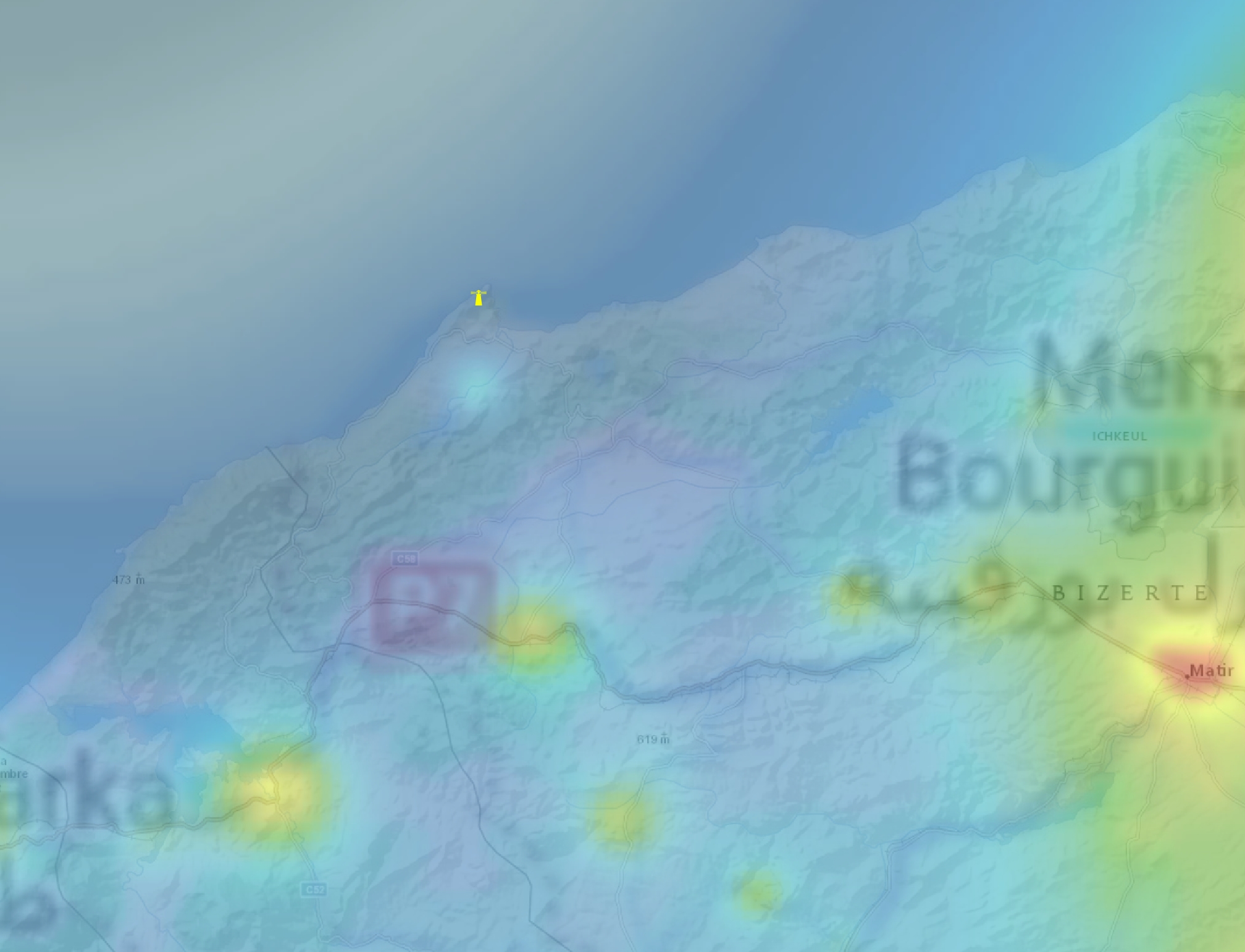
4. Ai Houadidia – precisely the mountainous region south of the village, where the local road zig-zags across the Ain-Draham range. The sky at the antitwilight azimuth looks promising, although the proximity of Beja city (around 30km) results in a Bortle 3 scale.
5. West of Al Kaf – the sparsely inhabited Atlas hills offer a good sky with Bortle 2 scale. However, the average distance to the nearest towns is less than 25km, which can be problematic.
6. Borj El Messaoudi – Another mountainous area in northern Tunisia, where the event should be visible well. It’s easily accessible, i.e., from Tunis. This place is potentially considered for the Eclipser Terminus 2026 project (See chapter 17).
7. Jebel Ballouta – This mountain rises over 1200 m.a.s.l., and a huge part of the ground northwest towards Ain Eddisa and Labar villages is almost free of light pollution with a Bortle 2 sky. A relatively short distance to Siliana town (15km) can make antitwilight observation problematic.
8. Oum El Abouab – the region located near Tunis, it’s around 1,5 hour drive from the capital of Tunisia and is famous for some archeological sites. Sightseeing can be combined with the observation of fleeting umbra in both directions. The bortle 2 sky at zenith doesn’t compensate for the antisolar direction, because the light pollution increases significantly towards the east.
9. South of Maktar – the southernmost region in Tunisia, considered for watching the eclipse event below the horizon. Another great area with bortle 2. You won’t find any settlements nearby, so nothing will disrupt the observation. There is over 35km to the nearest town in an antisolar direction.
10. Zembra Island – the Zembra National Park area protection with an elevation of almost 400 m.a.s.l., comparable with the Galite Islands. The Bortle 2 sky at zenith is seriously interrupted by the vicinity of Tunis lightglow located just 60km away in the southwest direction, although it shouldn’t disrupt the observation at solar direction, which remains bright enough. In the antisolar direction, the sky turns to Bortle 1 in the background, although the presence of a lighthouse on the adjacent islet of Zembretta can be problematic.

11. Pantelleria – this volcanic island is very intriguing from a geological point of view. Moreover, it’s possible to see even the Etna volcano from there. Given the eclipse, it could be a compelling destination. Unfortunately, the light pollution is serious, and the only place from which clear observation could be performed is the southeast section of the island, which, regrettably, can be disrupted by the lighthouse. Another unfavorable factor is the topography. The western horizon can be completely obstructed by the hills, so the observation venue should be carefully considered! See an example of Google Street View here.
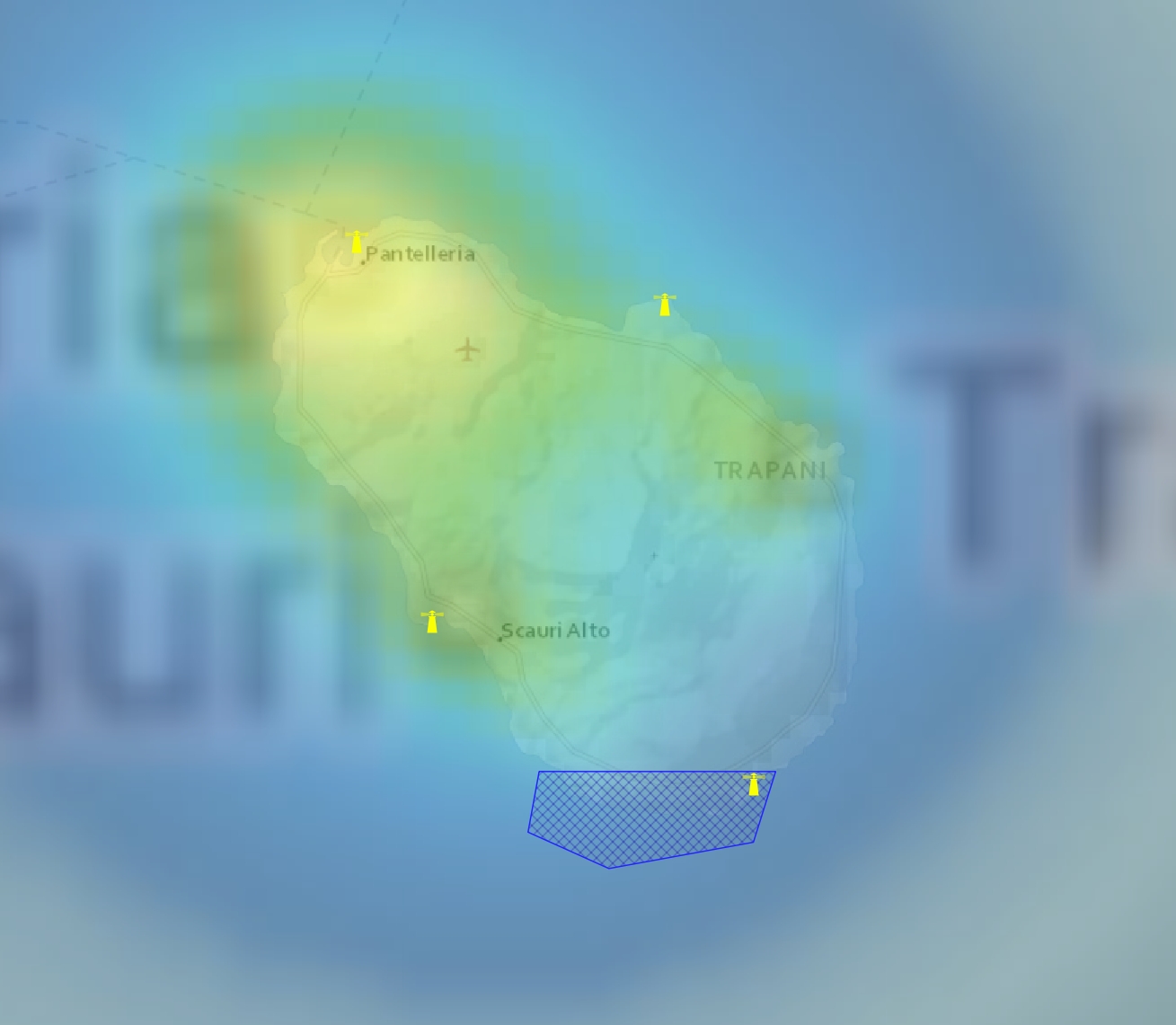
12. Linosa – This small Italian island looks promising because of its low light pollution. Theoretically, the sky at zenith is Bortle 2, but because the area of land is small, we shall assume that the influence of local light can be stronger. The best observation site is in the north, where both solar and antisolar directions are clear. The only problems are lighthouses.
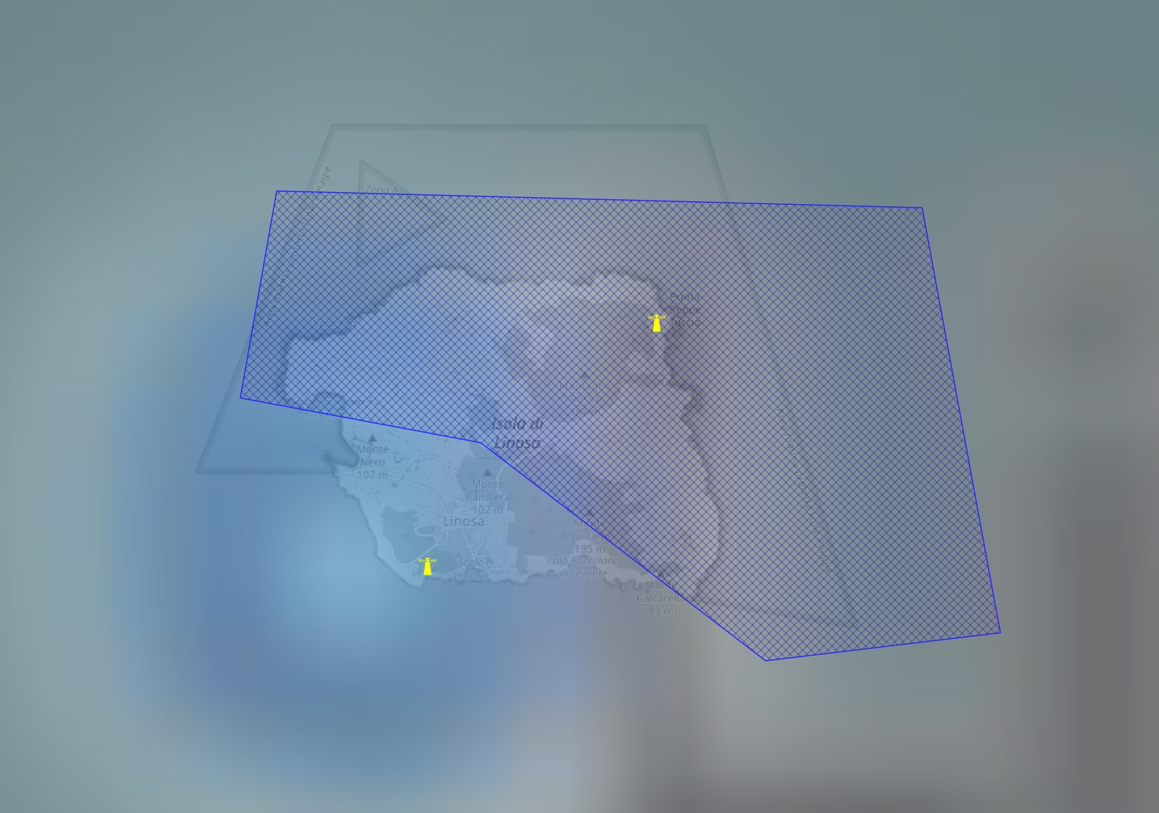
The second area considered lies entirely along the African coast and is referred to, for simplicity, as the Mediterranean South. Among all the regions, it’s the best for observing the event, which will in fact occur within the astronomical twilight zone.
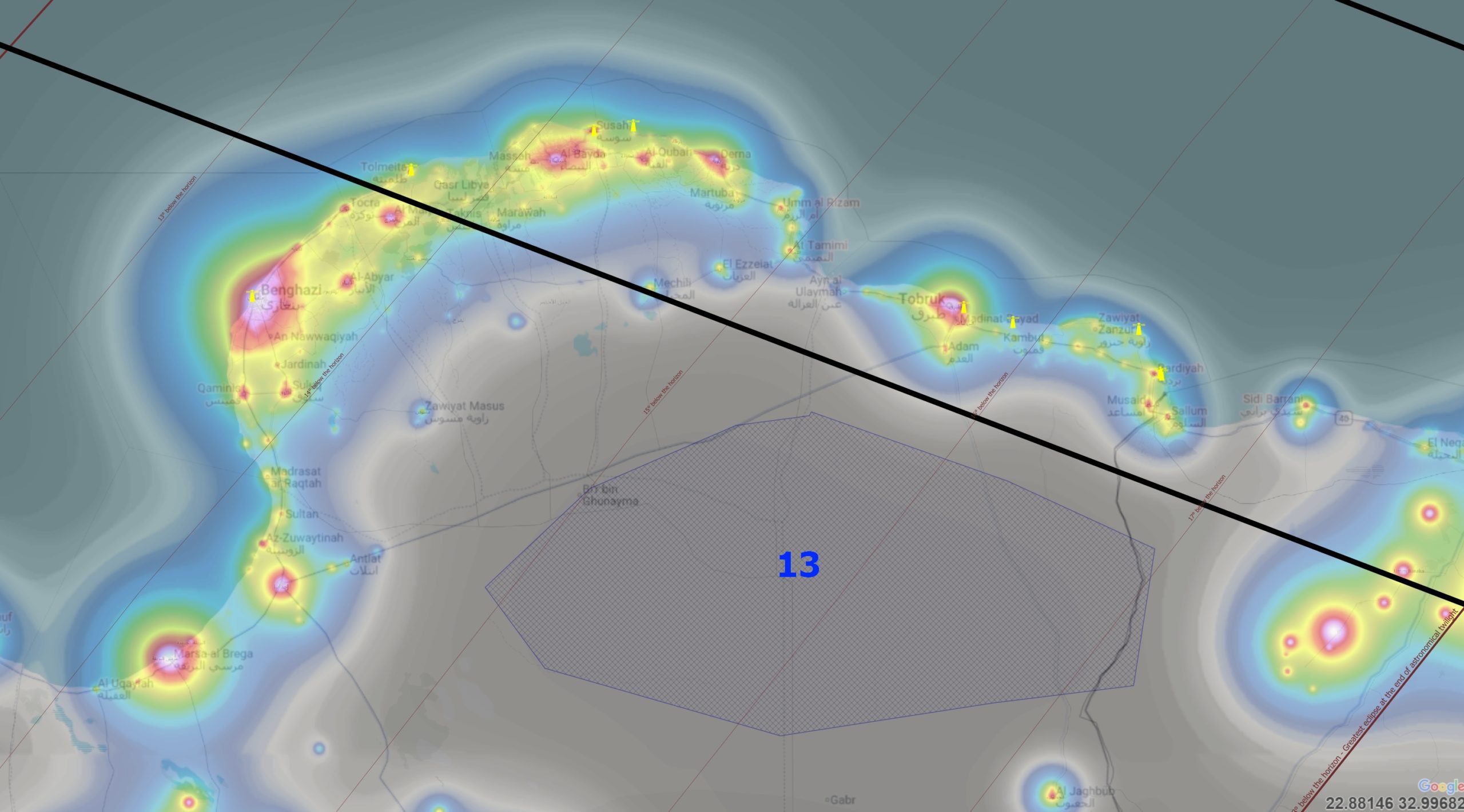
13. North Libya – the best place for watching the 2026 solar eclipse below the horizon event, as the area of Bortle 1 sky is so large, covering a distance of about 400km! Despite the Sun’s deep position, as the event occurs during early astronomical twilight, it should be noticeable. The best is to set yourself in the middle of the route between Tobruk and Ajdabiya. At solar direction, some faint glow from Benghazi can be detected at a distance of 225km.
The final area considered is the southernmost part of the Aegean and eastern Mediterranean Seas, specifically southern Greece. This area lies at the on-the-ground umbral extension zone. Southwestern Crete nearly misses the northern limit of the umbra projection in the space, but because the eclipse event will occur at least 13° below the horizon, it doesn’t matter, as the zenith sky is going to be rather black. In this situation, an observer will see the umbra limit above the western horizon, near the lower part of the atmosphere illuminated by the Sun (learn more in this article). Concluding, the effect in Crete should be visible quite well, but the sky should be free of light pollution. The map below indicates potential observation locations for the evening of August 12.
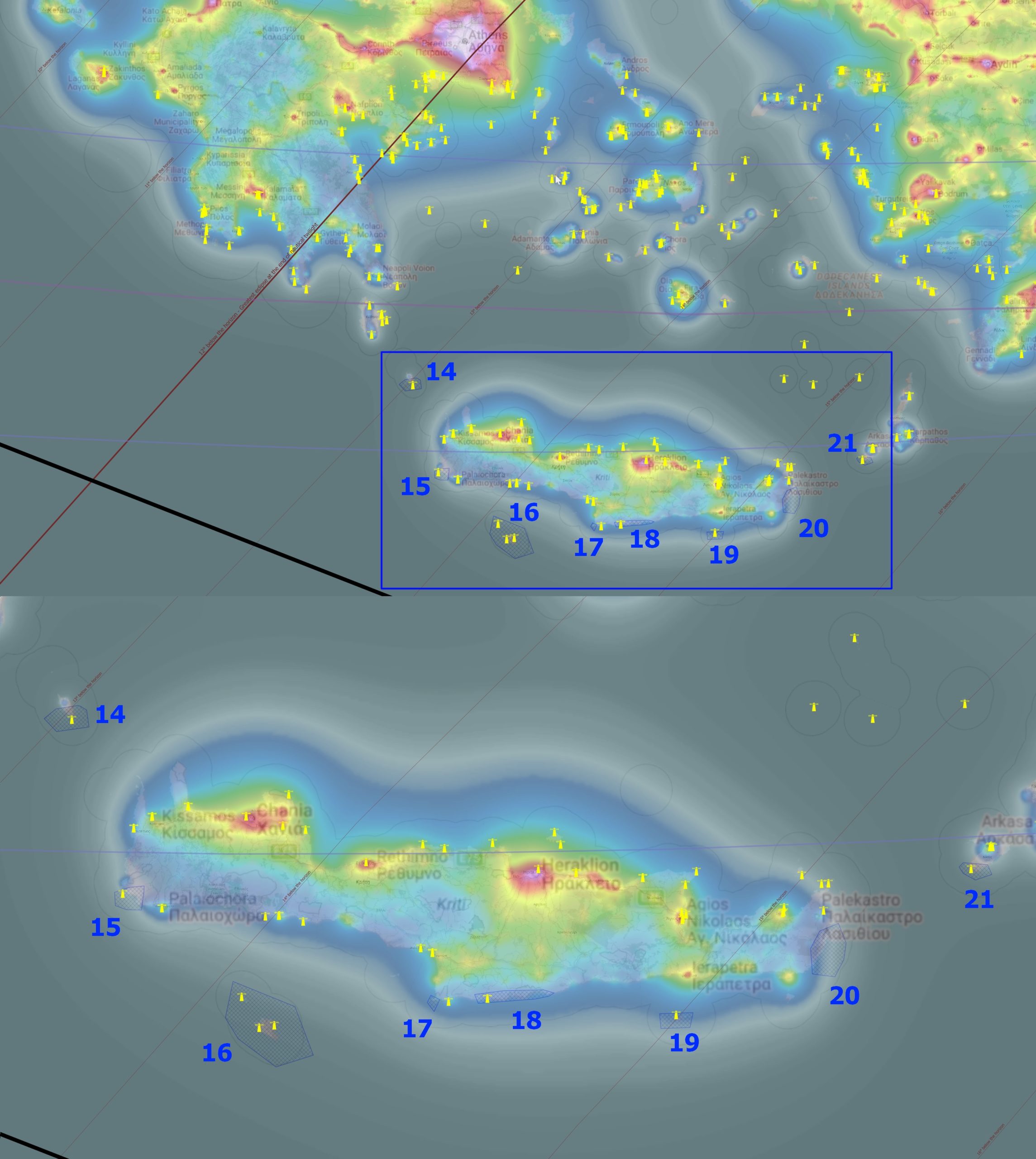
14. Antikithira – This small island could probably be the best place for watching the 2026 eclipse below the horizon event, because of the solar depression of 13°. The northern part of the island has some sky pollution, which affects the northern sky. Except for the town, the zenith sky hovers around the Bortle 1 scale. It looks similar for solar direction, but the proximity of Chania (65 km) definitely disrupts the sky at antisolar direction. The best suggested observation point could be the island’s highest point. The worst part is that the island lies well outside the projected umbra extension.
15. Elafonisi – the island accessible by the beach, as well as the entire southwestern « corner » of Crete, has Bortle 1 zenith sky, because light pollution from larger urban areas is blocked by the local mountain ranges. Perfect view of the solar direction will be, unfortunately, interrupted by the lighthouse, so it’s advisable to move further north. See the example of Street View here.
16. Gavdos – the island known as the southernmost point of Europe, lies closest to the projected extension of the umbra and offers one of the clearest skies at once. The Bortle 1 sky is one of the clearest in Europe, but the historic lighthouse’s operation disrupts it. The greatest eclipse will occur 13,5° below the horizon. See the street view example here.
17. The southernmost beach of Crete – accessible only by boat, or alternatively, you can reach the Kefali summit by 4×4 car or by bike/on foot directly from Monastir Odigitrias. The sky is, in fact, Bortle 2 at most, but the lack of lighthouses can seriously facilitate the potential observation.
18. East of Lentas – another perfect area for potential stargazing, because the landscape is epic. Moreover, the sky at antisolar direction is not interrupted by artificial light up to 70km. Because of this, the best approach is to set yourself just above the cliff, as distant mountains can slightly hinder distant light pollution. See the Street View example here.
19. Chrisi Island – another recommended place for conducting the observation on August 12, when the Sun will be 14° below the horizon. This flat island has a lighthouse, but the overall sky brightness is estimated at Bortle 2. The biggest problem is the proximity of Ierapetra town, just 15km away, which results in significant disruptions to observation quality, especially in the north direction. In contrast, the west-east directions should be fine. See the Street View example here.
20. Kato Zakros region – the easternmost coast of Crete, which is one of the best on this island for stargazing purposes. There are two factors against the August 12 observation – the deep solar depression at the greatest eclipse, almost 14,5°, and the obscuration of the western horizon. Lighthouses aren’t problematic because the area is large and topographically varied. See the Street View example here.
21. Kasos Island – the worst location considered for watching the August 12 event, but another one of the best as far as the clear sky is considered. The greatest eclipse occurs 14,5 degrees below the horizon, and the island lies the furthest from the estimated projection of the umbra extension. The proposed site is in the southwestern part of the island, where the topography allows it to be elevated above 200m above sea level. See the Street View example here.
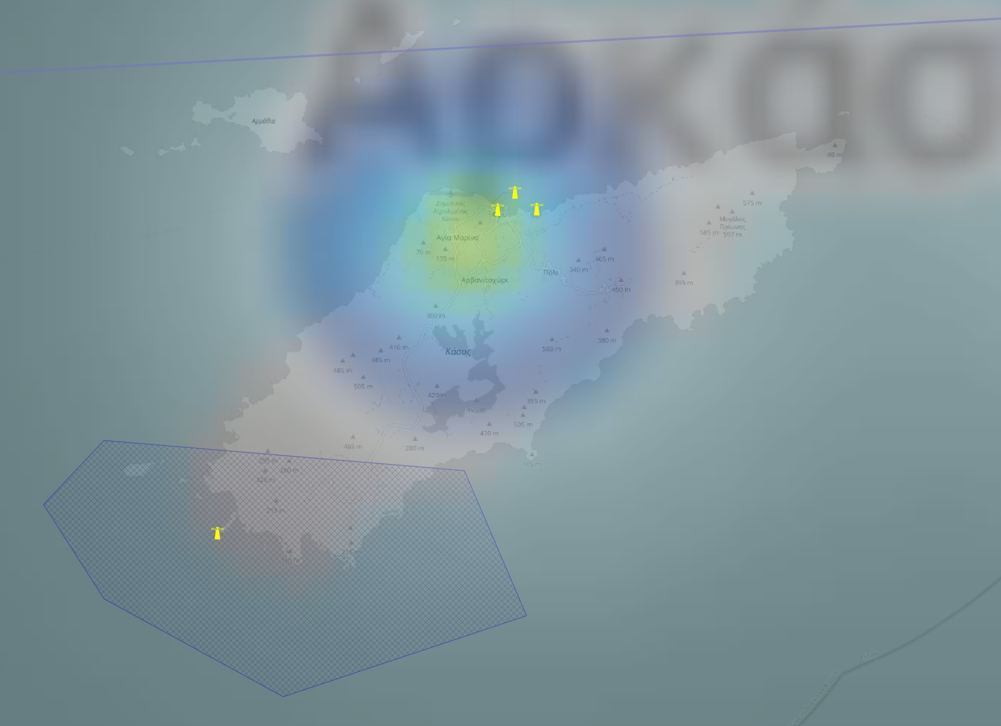
There are still alternative locations to consider for a hypothetical extension of the eclipse path. They will be located more east or north. I brought only one of them from Cyprus.
22. Akama National Forest Park – The northwesternmost tip of Cyprus, which lies close to the on-the-ground eclipse path extension and states the most extreme location, at which only late nautical twilight can be affected by the eclipse. This is at most Bortle 3 sky area.
In conclusion, all the described places are listed in the table below, which summarizes the relevant information concisely (Tab. 3).
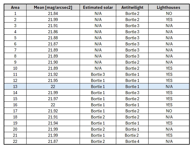
>>>BACK TO TOP<<<
15. OBSERVATION CASE STUDIES
There are some specific locations that guarantee the most valuable observations when the weather is good. They’re listed in the map below (Pic. 277) and described accordingly.

These are pretty much random places, especially within the mainland. For example, the eclipse effect in the twilight zone can be observed along the entire southern Sicilian coast or along the entire stretch between Tabarka and Bizerte. The case studies provide estimates of what the event will look like on a perfect-weather day. With perfect weather, we observe an utter lack of clouds and a high degree of atmospheric clarity, allowing for near-Rayleigh scattering conditions; likewise, the ShowMySky mode in Stellarium does. Frankly speaking, in Mediterranean climes, a situation such as this is rather unlikely during the summer (See section 13), although in most locations the shadow rises high above the horizon, so it should be visible even in the worst weather conditions.
15.1 Kanoua
Kanoua is the first described place and the most interesting at once. Because of its altitude above sea level, reaching even 950m.a.s.l. locally, this town, as per the PhotoEphemeris.com shadow maps produced for Mallorca and surrounding areas, marks the limit of eclipse visibility. The estimated obscuration at this location is 99,75%, which practically would mean a fantastic spectacle with Baily’s Beads. Regretfully, this particular moment occurs around 30 seconds after the Sun plunges beneath the horizon.
At the time, when the totality reaches the terminator point (U3), the Sun still shines above the Mediterranean Sea (Pic. 277).

Unfortunately, the 70 seconds will be enough for the Sun to touch the large waterbody, and at the moment when the central eclipse is about to reach completion on the Earth’s ground, the shadow map no longer shows solar beams in the Kanoua region (Pic. 278).

On the other hand, fortunately, the Sun is not just a point. It’s a disk with a diameter of approximately 16′. Even if the map or other tool defines the very center of the solar disk position beneath the geometrical horizon, it doesn’t mean that an observer is deprived of the visibility of the major objects of interest. Moreover, these calculations probably don’t take into account the atmospheric refraction, which by definition lifts up all the bodies by an additional 35′. Combining these 2 elements, the visibility of the Sun with corona or even Baily’s beads becomes reality! The pattern below displays the scenario in which the eclipsed sunset would trigger another interesting optical phenomenon, whose position is indicated and described in the image below (Pic. 279).

Another image shows the detailed sunset circumstances as expected from Kanoua or the gihhest hills of Collo Range (Pic. 280-282).


For better imagination, I also used the terrestrial perspective rendered by the Space Engine 0.99 tool (Pics. 283-284).


This unforgettable eclipse sunset simulation is shown in the video below.
Additionally, the close-up view in another video is provided.
Apart from the Sun, the celestial dome will offer a formidable, surrealistic view as the umbra passes across it. Because of the southern location against the ending eclipse path, the entire spectacle will begin in the northern section of the sky just about the time the central eclipse reaches completion further north (Pic. 285).

Details on how the event will proceed from the north can be found in the video below.
Following the matter related to the Belt of Venus, the antitwilight sky remains extremely noteworthy, as the twilight wedge is already rising above the antisolar horizon. After the umbra resembles the extension of the reddish band around the end of the central eclipse, it starts to gradually truncate the Belt of Venus until the end of the event after 19:34 GMT+1 (Pic. 286).

Again, the video below shows the rendering for the entire event regarding the anti-twilight sky.
Obviously, the solar section of the sky will not be less interesting, especially since the setting coronality will be directly followed by the approaching shadow column (Pic. 287), which at 19:32 UTC+1 will be characterized by a strong reddish band. The explanation is coming in further readings.

The umbral column will be visible yet before the sunset from the tops of Collo Range. At the greatest phase, when an observer will be able to see half of the solar corona directly after the Mediterranean surface, the umbra will truncate the celestial sphere directly near the zenith (Pic. 288).

The video below shows the final event circumstances in the northwestern direction.
The last paragraph summarizes the optical circumstances of the sky on the evening of August 12 from Kanoua by presenting the all-sky perspective for the greatest eclipse at the centerline and terminator coincidence (Pic. 289), which, from the perspective of Kanoua’s observers, will be noticeable in the northern section of the sky.

The greatest eclipse impact for this Algerian location occurs about 2 minutes later, at 19:34 UTC+1, and the umbra spreads across the entire sky (Pic. 290).

The video below summarizes the overall effect’s visibility.
15.2 Chetaibi
The second Algerian venue to watch the solar eclipse effect at the very beginning of civil twilight. The Sun will be geometrically about 2° below the horizon, but the altitude will be about 450 m a.s.l. will decrease this value by about 0,5 degree. Chetaibi is a small fishing port in Annaba province. The observation can be conducted from Zgaa village, where the hills locally exceed 500 m a.s.l.
The greatest umbral visibility at 19:32 UTC+1 isn’t pronounced well from that location, as it lies south of the totality path extension. However, the effect will be very similar, and opposite to that of south Sardinia (see 15.3 Capo Sperone below) (Pic. 291).

Thanks to this effect, the Belt of Venus will appear significantly extended away from the twilight wedge, over the northern horizon, where the Perseids could potentially be observed. The video below shows how the umbra will move towards the observer’s head from the north.
Continuing the thread of the twilight wedge, at antisolar direction, an observer will see a fantastic spectacle. At 19:34 (UTC+1), when the effect is expected to reach its greatest visibility in Chetaibi’s surroundings, the umbra is about to leave the atmosphere. At the antitwilight, an observer will see the umbra tightening towards the horizon (Pic. 292).


The video below shows exactly how everything will look.
At solar direction, the umbra at the greatest eclipse phase, at 19:32 UTC+1, will be accompanied by an intensive reddish band, which will be explained in the article in the near future (Pic. 294).

The best visibility of the umbral column occurs about 2 minutes later, when the entire eclipse event approaches the end (Pic. 295).

An interesting moment occurs when the umbra approaches the Venus azimuth (Pic. 296), but at this moment, it will be a rather reddish column, as the total solar eclipse impact is almost over at 19:35 (Pic. 296).

The video below summarizes the entire effect.
The last view is the all-sky perspective, as shown in the two images below. The first one shows the effect, in which the distant umbra in the north direction resembles an additional Belt of Venus (Pic. 297). The second one shows the effect above the observer’s head (Pic. 298).


At last, the video shows the entire effect in a short time-lapse.
15.3 Capo Sperone
Capo Sperone is one of the southwesternmost peninsulas of Sardinia, which would experience a few seconds of totality if lying 200 km westwards. The greatest eclipse occurs just 3 minutes after sunset, which can be technically visible from the altitude of low-level clouds. Despite the offset location, some beautiful phenomena are expected to be seen there. First of all, this location gives an opportunity to spot the weird effect described in this article, as we can see two separate shadowed areas becoming visible at opposite sides of the sky (Pic. 299). The effect won’t last longer than 30 seconds.

Next, the eclipse continues, and both shadowed areas merge into one near the zenith and move rapidly towards the south, as seen in the videos below. The first video displays the effect of visibility at solar azimuth.
The moment of maximum umbra visibility is illustrated in the picture below (Pic. 301).

The next video shows the event visibility in the southern direction, which appears most interesting.
The same moment of umbra visibility in the southern direction is illustrated in the image below (Pic. 302).

Finally, the anti-twilight direction cannot be left unattended, as it will be a place of true spectacle.

After the best umbra visibility, when the central solar eclipse reaches completion, there is a chance of seeing an unforgettable optical effect, in which the belt of Venus will optically merge with the receding umbra, extending with its coloration outside of the antitwilight arch, across the entire southern direction! (Pic. 304). More details are available in the video above.

The last thing is to display the event visibility in an all-sky perspective, which at 20:32:30 UTC+2 shows something like the Belt of Venus across most of the horizon! (Pic. 305).

The video below provides a detailed overview.
15.4 Galite Islands
This volcanic group of islands appears to have the best location for watching the eclipse event below the horizon. Unfortunately, the area is inhabited, and the only way to get there is an occasional escorted trip from Tabarka. The other thing might be the weather, which, by definition, is better than on the African mainland, but when cumulonimbus clouds develop above the Atlas Mountains, they usually head northeast and might affect sky clarity. The same applies to the wildfires in the Atlas Mountains; therefore, the observation location is quite risky. However, if on any occasion you will be there, it’s definitely worth trying, especially since the highest summit – Grand Sommet reaches almost 400m.a.s.l. giving a good elevated spot. The umbra is viewed from the perspective shown in the video below.
Next, for an antisolar direction, the observer can expect the view to be as shown below.
The greatest eclipse impact occurs around 19:32 local time and corresponds exactly to the last moment of the central eclipse on the ground, as the archipelago lies exactly on the centerline extension.

The all-sky perspective also looks interesting, as the umbra will divide the sky quite symmetrically during the eclipse culmination. You can get more details by watching the video below.
15.5 Tabarka
This cozy coastal resort in northwestern Tunisia is located at the southern limit of the totality extension within the twilight zone. The non-central position relative to the eclipse centerline will produce antisotropy in the umbra limit coloration from the southern side. The column starts to disappear at the azimuth of Venus, and then it’s visible as the strong reddish extended band representing the deep partial eclipse, at a magnitude just a bit smaller than 1. As seconds fly, this band fades out towards the south. The video below shows this effect exactly.
Standing by the solar azimuth, it’s worth comparing the circumstances with those of the Galite Islands, located approximately 60 km to the northeast of Tabarka. They’re visible on the horizon from the town when the weather is good. The difference in distance isn’t big in itself, though it’s reflected in the event’s circumstances. As the greatest impact occurs at 19:32 UTC+1 (local time), the view in Tabarka is about 1 minute behind.


The most interesting view is expected at the antisolar direction. As the eclipse approaches its end, the umbra begins to fade. As described in this article, it will become narrower from the bottom. Therefore, its boundaries are diagonal against the twilight wedge. The fill behavior in the umbra direction is shown in the attached video.
At last, an all-sky view of the greatest event would be beneficial (Pic. 309).

The most interesting moment occurs when the umbra is approaching from the north. The strong red band constitutes the optical extension of the Belt of Venus, which disappears as the umbra moves further north. Directly after the dark column, an observer will see an intense greenish band followed by the typical coloration of the illuminated near-horizon sky. It’s a common view for all places within early civil dusk, as far as the greatest eclipse is concerned, and it will be described in detail in the future.
15.6 Bizerte
This northernmost city in Tunisia is placed exactly at the extension of the centerline and will experience the greatest impact at solar depression of approximately 4°. This solar depression marks the moment at which the Belt of Venus disappears. However, as the umbra approaches from the north, the very beginning of the effect should be very interesting, as the twilight wedge will feature various coloration. Everything you can watch in the video below:
The greatest phase at antitwilight direction will look as follows (Pic. 310).

When looking towards solar azimuth, an observer should definitely see the fleeting umbral column on the high-level clouds. Given these circumstances, shadow bands should be visible.

The view of the event at solar direction is expected to be pronounced for at least 6 minutes.
In summary, it’s good to see what the estimated shadow movement across the entire sky will look like. The video below shows the event from an all-sky perspective.
15.7 Cap Bon Peninsula
This is the northeasternmost part of Tunisia, which will be aligned with the eclipse centerline extension on August 12. The greatest eclipse will be observed at a solar depression of 4,8° on average and presents the same analogy as the difference between Isola di Marettimo and Marsala, or between Marsala and Pantelleria. The 130 km span between the Aegedian Islands will make the umbra more visible, though its initial ingress, known as the weird effect, will be less noticeable because it occurs farther north.
The antitwilight sky will be truncated by the umbra after the Belt of Venus disappearance (Pic. 311).

The solar direction at the greatest phase will look very interesting (Pic. 312), as the umbra will likely be visible through high-level clouds still illuminated by the Sun.

Finally, worth watching is the all-sky perspective record, which shows how the umbra will move across the sky dome.
15.8 Isola di Marettimo
This is the second largest and westernmost of the Aegadian Islands, located directly west of Trapani. The primary downside of this location is a bit offset by the limitation of the umbra extension. The plus side is the high elevation, reaching almost 700 m a.s.l. despite the fact that access to the peak can be demanding. The island can be accessed by about 1h15m ferry from Trapani. Apart from a quite unfortunate position against the umbral view, as displayed in the video below:
The perspective for viewing the effect at the antisolar direction remains the best across the entire Sicilian area as the greatest eclipse occurs when the Sun is 4,7º below the horizon.

15.9 Marsala, Sicily
Marsala will experience the greatest impact at solar depression of approximately 5°, so nearly the end of civil twilight. The sunset with a magnitude of 0.525 occurs at 20:06 local time. In its last moment, when the center of the Sun goes under the horizon, the Sun appears like a full disk (Pic. 313).

The geometrical greatest eclipse occurs at 20:30, but the effect is delayed. This is because of the parallax. If the ground were transparent, an observer would see the short totality 5° below the horizon. However, direct sunlight is observed from an altitude of 32 km, just at the edge of totality, for a second. The best reflection of it is the zenith sky, which turns dark only for a while, and next, the umbra moves southwards, like in the video below.


The umbra will become best visible at antitwilight direction, truncating the twilight wedge. It’s unfortunately too late to see the Belt of Venus, but an observer should still detect the coincidence of the Moon’s and Earth’s shadows in the sky.
The greatest visibility of the effect will occur around 20:31 local time. Despite the side-off shadow position, it will be visible well in both directions. The best view of solar direction will occur at 20:32, but the umbra will start to separate from the twilight wedge (Pic. 316).

The Venus (-4.4 Mag) within the umbra should be able to produce the corona if some thin clouds are present nearby. The planet is visible within the umbra for about 90 seconds.

The umbra disappears around 20:35, but the darker sky at the southern horizon remains visible until at least 20:38. The entire event can be watched in the video below.
15.10 Pantelleria
This Italian island is the closest to Africa. The distance to the Tunisian coast is just about 70 km. This place is fortunate to be placed roughly at the centerline extension, at the very end of the civil dusk. As the greatest eclipse occurs at solar depression of 5,5°, the antitwilight sky represents the event only a little. Moreover, the centerline position means that, in this case, the false umbra appearance at the twilight wedge will be visible from the side, in the north or north-eastern direction, as shown in the image and the video below.

The shape of the umbra should remain visible in the sky around the entire eclipse event (Pic. 319), followed by the twilight wedge reaching zenith at the moment when the umbra disappears.

Surely, the most interesting will be the sky at solar azimuth, where the umbra provides excellent contrast against the adjacent illuminated sky. It’s likely that the column will be visible on high-level clouds at the horizon (Pic. 320).

In conclusion, the movie above presents the animation of the event as expected for Pantelleria.
15.11 Ragusa (Sicily)
Ragusa is a large town perched on a hill in southeastern Sicily, a bit northwest of Pozzallo, from where the ferries to Malta depart. This is the same perspective as across the entire southern coast of Sicily. Despite the event’s geometrical culmination at 20:32 UTC, the best visibility will occur a bit earlier, as only the side view of the umbra is possible (Pic. 123). The video below represents the largest impact of the solar eclipse on early nautical twilight at solar depression of approximately 7° from these locations.
15.12 Pelagian Islands
This group of volcanic islands belongs geographically to Africa, but is a part of the Italian (Sicilian) province of Agrigento. The distance in a beeline between the whole group of islands is about 50km, quite enough to make the August 12 twilight view slightly different. Considering overall circumstances, the greatest eclipse effect occurs at the very beginning of nautical twilight, at solar depression of 6,5°. All the islands are located south of the eclipse centerline extension, especially the largest and most easily accessible one, Lampedusa. Despite a good visibility of the event, the umbra will disappear at the azimuth of Venus from there.
The video below shows the estimated view from Lampedusa and the image of the greatest event occurrence (Pic. 321)

Analogically to the places offset north, the greatest impact marked as the moment when the central eclipse reaches completion doesn’t occur at the same time. For locations south of the centerline extension, the culmination is belated. At Lampedusa or Linosa, the culmination is expected approximately at 20:33 UTC+2.
The distance to Linosa is 45 km in a straight line. It makes the difference, as the culmination of the event will be about 20-25 s earlier, and the perspective changes just slightly (Pic. 322).

Analyzing the entire time at which the umbra truncates the solar section of the sky, the most interesting moment can occur when the Moon’s shadow column approaches the azimuth of Venus. The closest planet to Earth will shine at -4.4 mag. The umbra will reach it at 20:35:01 UTC+2 from Linosa and 39s later from Lampedusa, effectively vanishing into the space (Pic. 323).

15.13 Gozo (Malta)
Malta is the southernmost country in Europe, which is perfectly aligned with the eclipse path extension. Unfortunately, the event will occur at the beginning of nautical twilight, so only the solar section of the sky will be interesting. At the greatest phase, at 20:32 UTC+2, the twilight glow at solar azimuth will be symmetrically divided between two sections. The details are displayed in the video below:
At 20:32 UTC+2, the central eclipse ends its way on the ground, so the umbra is best pronounced in the atmosphere, unless the location isn’t aligned perfectly. For observers located at the southern coast of Sicily, and likewise in Pozzallo, located just over 90 km north, they can enjoy only a side view of the event (Pic. 324).

15.15 Tripoli, Libya
Tripoli is the capital of Libya, with a population of almost 1,2 million people. The city is located about 250 km south of the August 12 total solar eclipse path extension, which is still favorable for the visibility of the effect at solar depression of 9,5°. Prior to it, the partial eclipse starts just at sunset. The video below animates what the entire event will look like when you leave the city, as light pollution in the city center is terrible.
Despite the end of the eclipse at 20:34:12 UTC+2 and the moment when the umbra leaves the Earth’s atmosphere completely at 20:35:20 UTC+2 (Pic. 325), the effect still persists, at least until 20:38, even if an observer can see the dark band fading out against the nautical twilight glow.

15.15 Benghazi, Libya
The extension of the eclipse centerline eventually leads to the other side of the Mediterranean coast. Benghazi, the second-largest city in Libya, will experience the greatest eclipse impact at astronomical twilight on August 12. Because of the solar depression of 13°, the umbral column can be quite hard to detect, at least as far as the Stellarium visualization is considered (Pic. 326).

The twilight begins at late civil dusk, and the sky and scene start to darken rapidly.

Despite a large solar depression, the view could still be promising, as the projected twilight glow is divided into two distinct sections, with the umbra in the middle.
15.16 Gavdos, Greece
Gavdos lies 36 km south of Crete and is renowned as the southernmost island in Europe, both geographically and politically. The island will experience quite an unusual evening on August 12 after the normal sunset and most of the civil dusk. The eclipse starts at solar depression of approximately 5° and culminates at early astronomical dusk, almost 14° below the horizon. This is the moment when, at first glance, the shadow column is excluded from view, but it might be very interesting when a long exposure is applied. The worst thing is that the island is located north of the limit of extended totality, so if anything occurs, it will be noticeable outside of the greatest twilight glow.

As in the previous example, the image above doesn’t say much about the event; therefore, enhanced contrast and gamma have been applied (Pic. 329).

The side view of the effect will make it less noticeable against the main background of twilight glow, which will be significantly reduced in the optical sense. Observers will probably detect rapid changes in the illumination in the southwestern direction.
>>>BACK TO TOP<<<
16. RESOURCES
This chapter is about external methods for capturing the August 12, 2026, solar eclipse. These are rather uncommon ways, including major visualization tools used to project the scenario of this thrilling celestial event. There are 4 categories to look at before August 12 for casual observers who can just accidentally capture the eclipse in any configuration.
16.1 Webcams
An important part of the eclipse observation is knowledge of potential webcams, which could facilitate data collection. Even if you are on site, it might not be enough to investigate the event in various configurations. Examples of webcam observations have been conducted at varying levels of success here, here, and here. Apart from the webcam quality, very important is the orientation, in other words, how much « sky » is in the frame, and finally, does the device have a backup option
The attached maps below include a majority of the webcams available in the most typical webcam portals, which are classified as follows:
– green – back up available. Usually, webcams provide a live stream for up to 12 hours, which is fair enough for downloading data after the eclipse event. Sometimes, instead of it, a user can download a detailed timelapse with a 2-minute interval, or (in rare cases) the streams are available back to a maximum of 7 days.
– yellow – only the timelapse backup available for a previous day. The 47-50s of footage indicate that the frame is stored every 5 minutes, despite the webcams being in operation all the time.
– orange – backups with single shots available every 10 or even 15 minutes. The eclipse event could be chased only with a bit of luck.
– red – no backup available. The webcam operates in real time, but recordings aren’t stored.
Additionally, all the webcams indicate the estimated orientation as sections of circles. If the entire circle is marked instead, the webcam rotates.
As the maps below don’t include all the webcams, it is important to mention the general websites where a user/observer can find additional sources of data.
SkylineWebcams – a robust webcam database worldwide, which collects the HD webcams only, and sometimes FHD or even 4K if you decide to buy a subscription. They predominantly offer a time-lapse-based backup lasting 47-50s per day. Some of them have an ISO sensitivity good enough to see the brightest stars.
Webcamera24 – not as robust as the previous one, but its largest advantage is providing the webcams with 12 hours of backup. Unfortunately, quite a lot of the listed are unavailable.
Webcamtaxi – Another good webcam source for users to rely on. In fact, some live streams are linked without backup, but at least 2/3 webcams can be browsed up to 12 hours before the current moment. Same as above, usually HD version in operation, sometimes FHD quality
Earthcam – This service is based mostly on the Skylinewebcams engine.
Worldcams – Similar to Webcamtaxi. Usually, webcams with insight are possible 12 hours before the current moment, as they’re YouTube-based. Unfortunately, the coverage is quite poor compared to other services.
Whatsupcams – The primary advantage of this service is that you can find webcams here that are not visible on other sites, as mentioned above. Unfortunately, the coverage is poor, and the only backup is the same as for SkylineWebcams; however, the quality is at most HD.
VisionEnvironement – A good source for YouTube-based webcams not available in other services. Some of them are just live, but others accommodate a backup of up to 12 hours.
Webcamhopper – similar to Webcamtaxi, with quite sparse coverage, but webcams provide a 12-hour backup. Usually, the same webcams as in previous services.
OutdoorActive – fetches the webcams from the Windy service.
BalticLiveCam – quite robust service of webcams worldwide, which aggregates various local providers with UHD resolution. Unfortunately without backup option.
Youwebcams – another aggregator of webcams worldwide, but without backup.
Worldviewstream – A multitude of webcams worldwide with various locations, unfortunately, without the backup option.
Camscape – A general world provider of webcams, but without backup options.
EarthTV – a lot of rotating webcams. No backup option.
Meteoblue – An international weather service, which includes the webcams linked directly to the local places. They’re usually poor and without decent backup.
EarthliveTV – a service similar to Webcamtaxi. Poor coverage, but webcams usually have backup for up to 12 hours.
WorldWievstream – General webcam aggregator, but usually poor quality webcams.
Webcams.scs.com.ua – Ukrainian world aggregator, some of the webcams have backup.
Ventusky – a parallel webcam database to Windy.
Openwebcams – aggregates YouTube-based and other webcam sources. Backup is sometimes available.
Camstreamer – Only YouTube-based webcams with a 12-hour backup available.
Spotcameras – a vast aggregator of various types of webcams in some countries.
Geowebcams – a nice service, which usually guarantees links to the YouTube-based webcams with up to 12 hours of backup.
IPLiveCams – another service, but provides only a real time webcams withot backup option.
SeeCam – another aggregator, various webcams, sometimes with backup
Webcamgalore – another service, but it provides poor webcams.
Finally, worth mentioning are all the aurora webcams, which operate under the following services:
Aurorawebcams – Aggregates webcams without backup, refreshing every 2 minutes.
LiveAuroracams – the same webcams can be found here.
Seetheaurora – gathers local aurora webcam providers.
Russia
The main webcam operator in Russia is Geocam, but it doesn’t provide devices in the eclipse area. The same as CamWorld, an aggregator of webcams worldwide. VitsTV – includes a lot of FHD webcams worldwide, backup up to 90 minutes but not from the eclipse zone.
Russia, as a country, has quite a lot of webcams, but they are concentrated around major cities. Considering the Krasnoyarsk Krai and the Yakutsk Oblast, they’re located at the southern edges of these regions and aren’t useful at all for the eclipse, because they’re within the astronomical twilight zone. The only exception is the Lena River Valley, which has a few webcams that could capture the solar eclipse’s impact on twilight. Another one is in Norilsk. There is only one webcam in that area with backup confirmed. The map below presents their location and estimated orientation (Pic. 330, 331).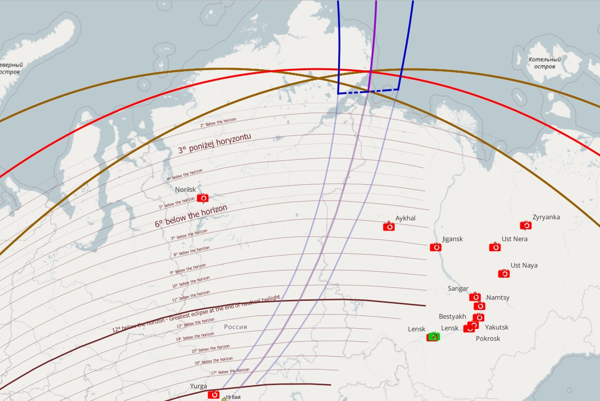
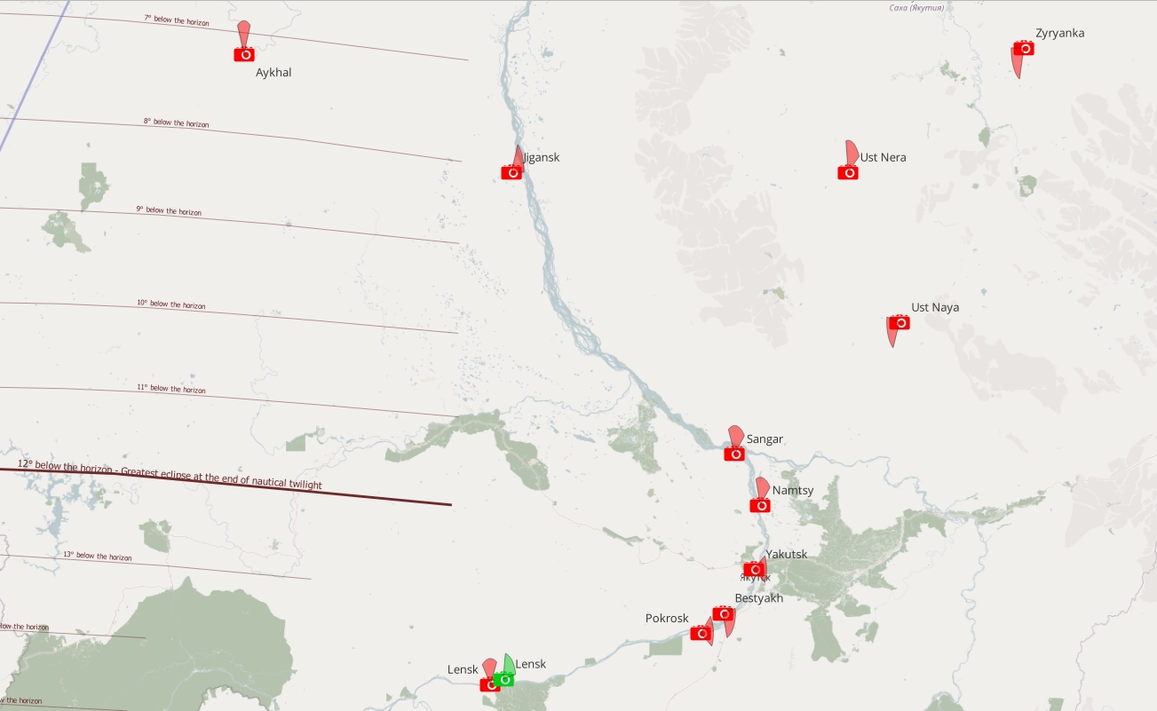
The only hope is given by two webcams located within the twilight zone, when the greatest eclipse occurs at early nautical twilight. At this time, it’s a big probability to see what is happening in the sky, especially since one of them is aimed at aurora chasing.
Greenland & Iceland
The largest webcam coverage of Iceland is provided by the LiveFromIceland portal. The webcams operate in real time and don’t provide backup options, unfortunately. Apart from those, there is a significant shortage of live stream coverage across the country, but the largest webcam concentration is observed in the immediate vicinity or even within the eclipse path. This is because Reykjavik, Iceland’s capital, lies in the west of the island. The map below (Pics. 332, 333) primarily lists webcams with backup. There are a few more across the island, but because of their unfavorable orientation, they aren’t listed. The same applies to Greenland, which has three webcams, but only one can be used for the eclipse purpose.
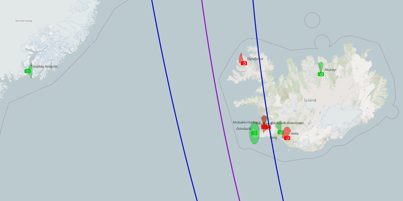
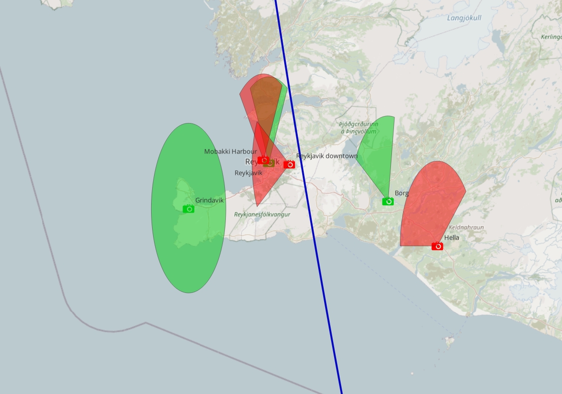
UK & Ireland
One provider across the UK is Camsecure, which offers live views from the Isles of Scilly. However, whatever it means, backup isn’t available. Fortunately, there is one webcam in western Ireland with good backup for a few days, which will be extremely useful for chasing the optical effects driven by the Sun, which is obscured by almost 98%.
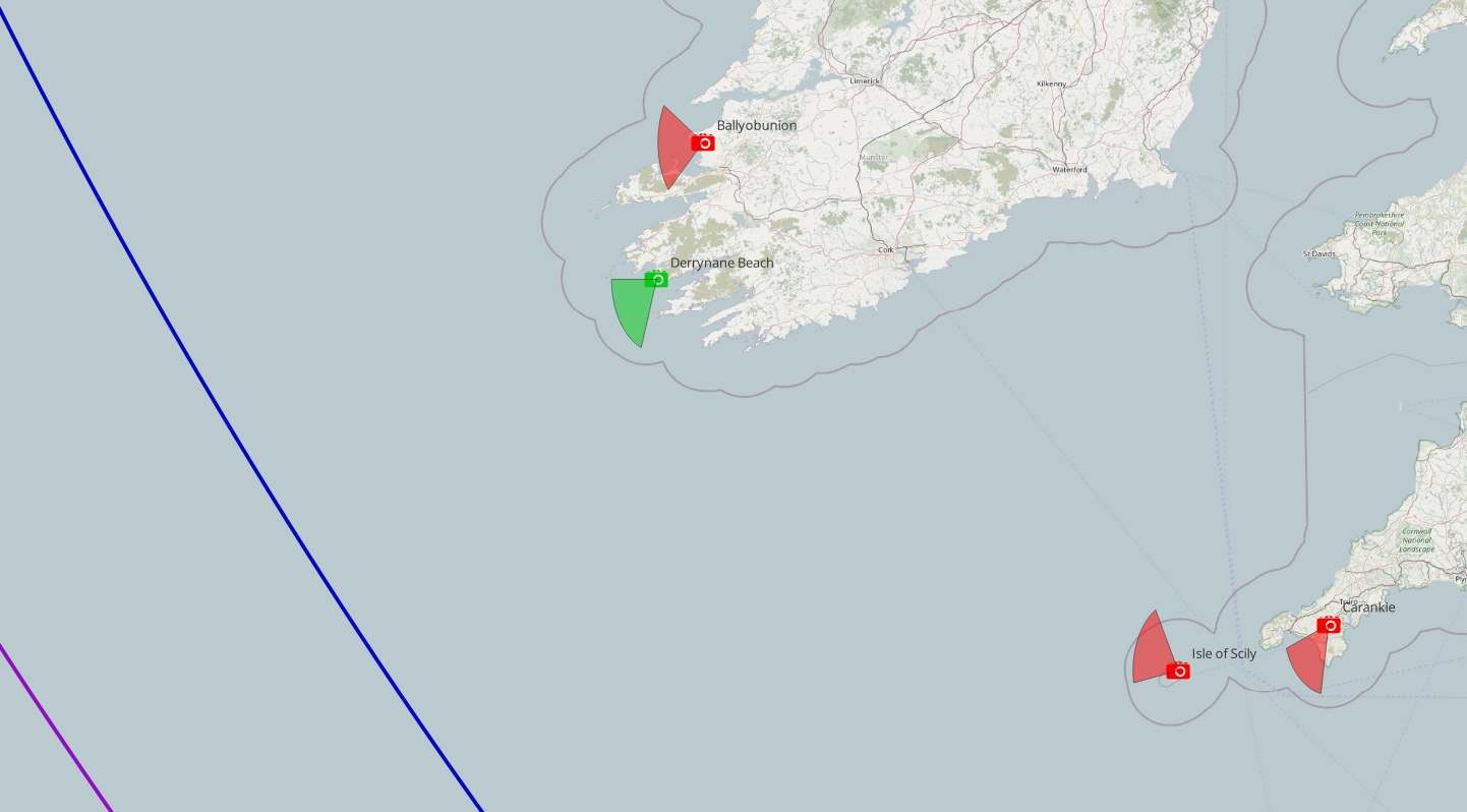
France
There are several individual webcam providers in France. One of them – Skaping features the 4K rotational webcams with the archive every 30 minutes, which is unfortunately not enough for the solar eclipse purposes. Another bunch of FHD webcams is offered by the Viewsurf service, which is the same as the previous one, providing rotational devices with the archival records every 30 minutes. As a third, however, a worldwide provider in this case can perform the Vision-environment service, which hosts over 400 webcams across the country, but regrettably, none of those have a backup in the manner required for the eclipse observation. The map below shows just a few suggested webcams to watch during the eclipse.
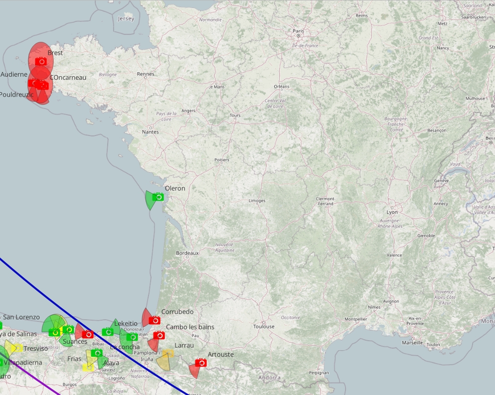
Portugal
There is an utter lack of webcams in the Braganca region, which lies close to the eclipse path. All worldwide webcam providers, as well as the Portuguese ones, don’t cover this particular area.
The most popular webcam operators in Portugal are:
– Portugal live
– Portugalwebcams
Spain
The eclipse path crosses Spain centrally; therefore, I focused mostly on webcams within the path or in its immediate vicinity.
The topmost local webcams operators in Spain are:
– MeteoGalicia – a good operator with quite a dense coverage of the webcams and a previous day backup available.
– Vayawebcam – the YouTube-based webcam channel, which guarantees the 12 hours backup.
– Meteo365 – The main nationwide weather service, which includes a robust webcam database, although without a backup option.
– MallorcaWebcam – fantastic YouTube-based provider with 4K resolution and 12 hours backup.
– VisionDigital – another YouTube-based host focused on Mallorca Island.
– IberiCam – nation-wide webcam aggregator, but without backups
– ComunitaTVValencia – collects local webcams from the Valencia region, but without backup.
– VisionaConBalear – perfect provider with timelapses a few days before.
– Avistabaleares – Good webcams, but unfortunately without backup options.
The map of suggested webcams for use in Spain is below.
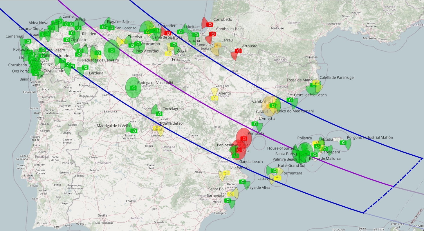
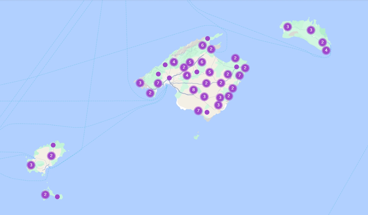
North Africa
Unlike all the countries listed and described in this section, there is a large « white spot » in Algeria and Tunisia, which are crucial for observing the eclipse as it passes low on the horizon.
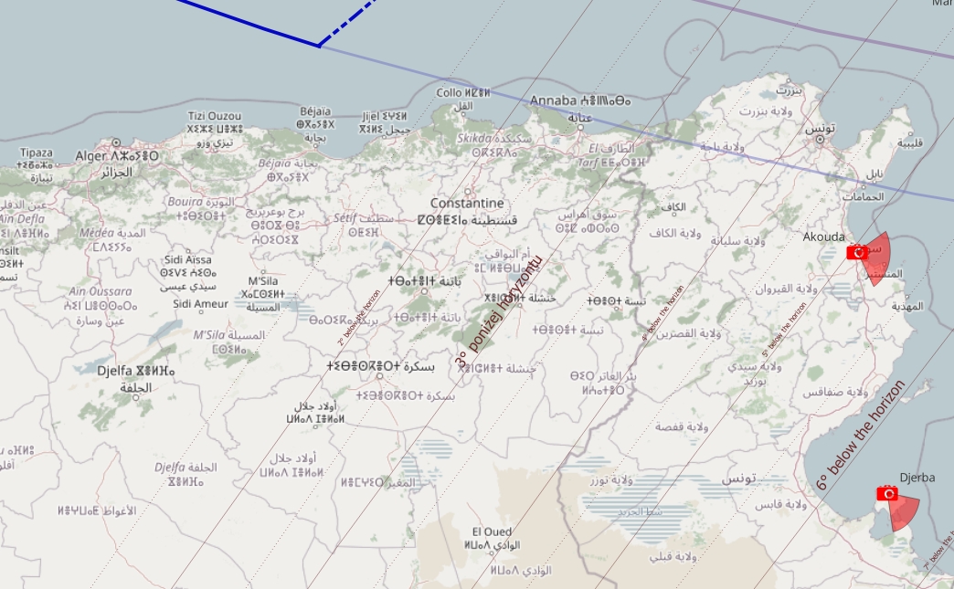
There may be some webcams in Algeria, according to the Pictimo service. However I don;t think it’s reliable source, as most of links don’t work there. These webcams may have been in operation for a while and aren’t available now.
Italy
As in Spain, there is a high density of webcams across Italy. However, a minority of them have a decent backup. Some of them are currently under maintenance, with the hope that they will be operational on August 12. The best local webcam provider seems to be Weather Sicily, which has a dozen or so YouTube-based webcams at various orientations. Another one, Vedetta, is a nationwide operator that provides high-quality live streams, but unfortunately, without a backup option.
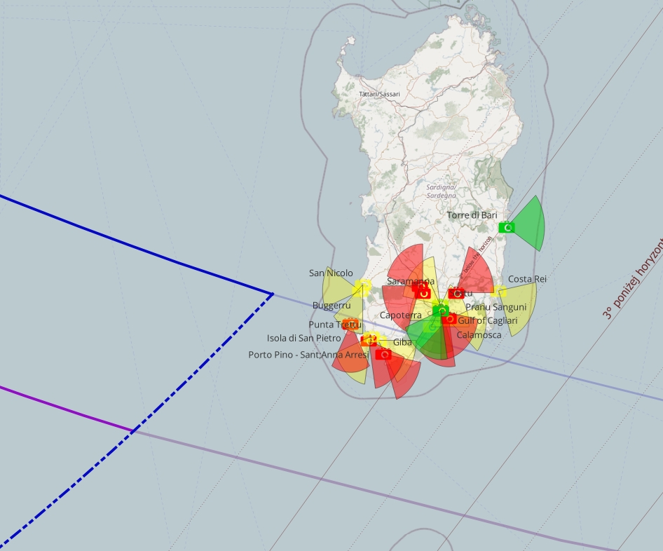
Unfortunately, the distribution of webcams across southern Sardinia isn’t the best. There are around 20 devices in operation, but almost none of them accommodate the backup option. Moreover, they’re a must in HD quality. The situation looks much better in the Sicily region, including the Pelagian Islands and Pantelleria. There is a much higher chance of backup from those devices, as shown in the map below (Pic. 261).
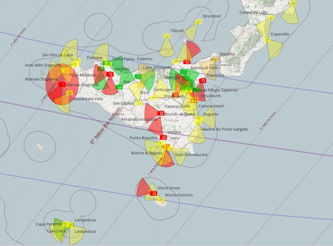
Because the eclipse culminates over Sicily at the end of civil twilight, not all webcams have been considered.
Malta
There are quite a few webcams in operation in Malta, but only two seem to have the correct azimuth for the eclipse at twilight (Pic. 340). In other cases, it’s rather impossible to catch anything, especially since they’re located in light-polluted areas.
Greece
As the solar eclipse culminates at the end of nautical dusk in Greece, the only webcams that have been considered are oriented strictly to the western direction. I took into consideration only these, which have a backup, at least in the time-lapse version. Let’s hope that something will be noticeable at Crete, where the webcams seem to have quite a high ISO sensitivity.
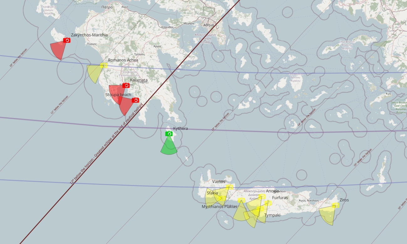
For the sake of finalization. All the webcams with their links can be found here.
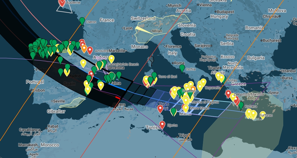
16.2 Casual flights
The other way to catch the eclipse is by flying in a plane. In fact, there are no commercial eclipse flights this time, unlike previously. However, the AstroAula service is planning the pure scientific flight into totality (Pic. 343) with no public admissions.
Fortunately, the air traffic above Europe is high enough to give an option for chasing the totality from casual, regular flights! All the flights are shown in the animations below. They include direct screenshots from Flightradar24.com at a specific time during the eclipse (in UTC), located at the top and in the middle. Each screenshot shows the information window, which appears when the given cruise is clicked.
As of August 12, 2025, the best option is to fly with Yakutia Airlines from Petersburg to Yakutsk or with Aeroflot from Moscow to Kamchatka. These 2 cruises offer a great chance to chase the totality below the horizon from the perspective of the upper troposphere.
Considering Greenland and Iceland, there are many more planes crossing the Atlantic on August 12, 2025. We can estimate traffic very similar to eclipse day.
Only within 25 minutes of the eclipse above Greenland, over 30 planes are on the way across the path. Another 20 is expected within the next 10 minutes, as the totality moves southwards over Iceland.
Much larger traffic is expected between Great Britain and Iceland (Pic. 347).
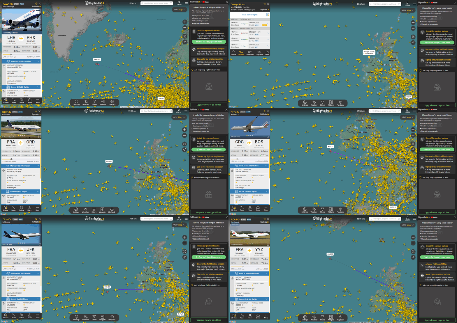
The largest air traffic is expected above Western Europe. At the time, when the totality sweeps through the eastern Atlantic, there are at least 50 commercial flights available in various directions.
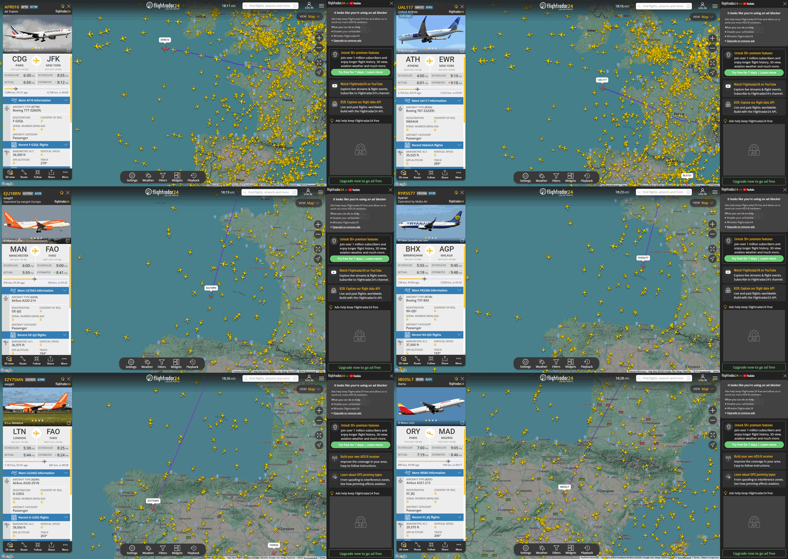
When the Moon’s shadow enters the European mainland, there are more than 100 commercial flights within the path and a few hundred nearby! The video below displays them separately.
Wherever you are flying on August 12 late afternoon, the eclipse will be worth a look from cruising altitude! Don’t miss it!
16.3 Casual cruises


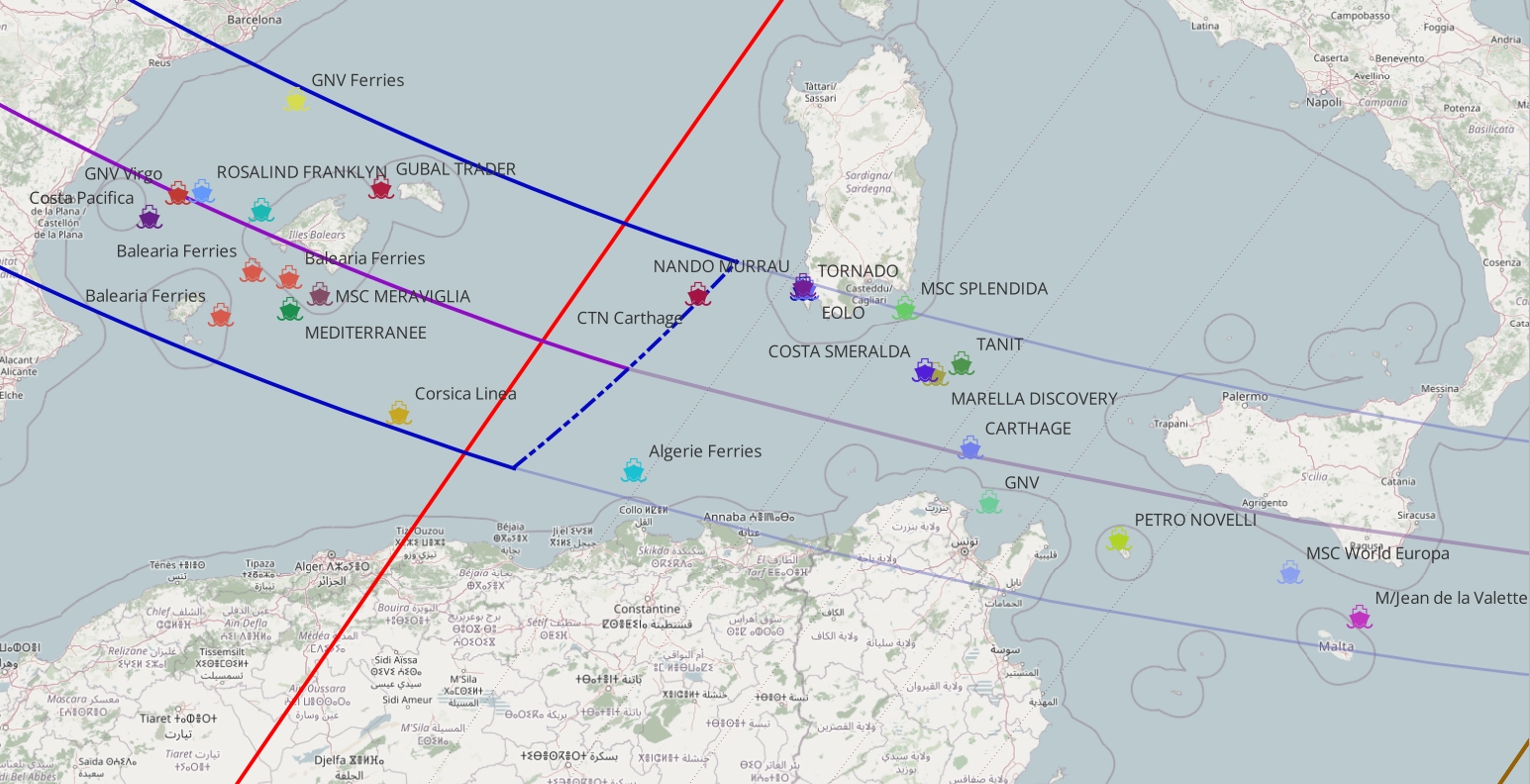

17. ECLIPSE TERMINUS PROJECT
This is a groundbreaking project designed to capture the entire scene from an altitude of 32-34 km above the ground. I was fortunate to participate as a speaker at the recent Solar Eclipse Conference (SEC 2025) on June 13-15, 2025, in Leuven. My primary area of study is the impact of solar eclipses on twilight, which, with the exception of a few publications, hasn’t been investigated historically and has not been reported by any electronic devices. My speech was placed in the Eclipse Experiences panel, which I closed. The panel began with a remarkable, pioneering observation of the total solar eclipse of 2012 in Australia, conducted from a stratospheric balloon (Stratospheric flight into Totality – Australia 2012), led by the Romanian astronomer and eclipse chaser Catalin Beldea and his team. I was very excited about the project, especially since the observation covered both stratospheric and ground-based perspectives, providing an excellent example of parallax. The totally eclipsed Sun above shone as a thin crescent from the ground. It will be described on the main page later. After finishing Catalin’s speech, there was a typical question panel, as usual, after every speaker’s performance. I asked about the possibility of viewing the totality from the path’s extension on August 12, 2026, with optional locations of Sardinia, Sicily, or Tunisia. The totality at these locations occurs after sunset, but because of the relatively small solar depression, the event can still be observed from above! The elevated view of the eclipse, as well as its impact on twilight from the ground’s perspective, has fired my imagination since 2015. Catalin concluded that the idea is very good and that we, as astronomers, can pursue it, especially since a similar approach has never been implemented globally. Unfortunately, I am not technically strong and am only moderately proficient in computations, so I am doing my best to support the team on the graphical side.
The core plan of the project is the deployment of the gliding wing into the cone of the total solar eclipse, approximately 600km beyond the ground-based limit of totality. Due to Earth’s curvature, the eclipse won’t be visible from the launch site. From the ground’s perspective, the Sun is about 5° below the horizon, around 25 minutes after sunset, or 4° below the horizon, around 20 minutes after sunset, depending on the place of the experiment.
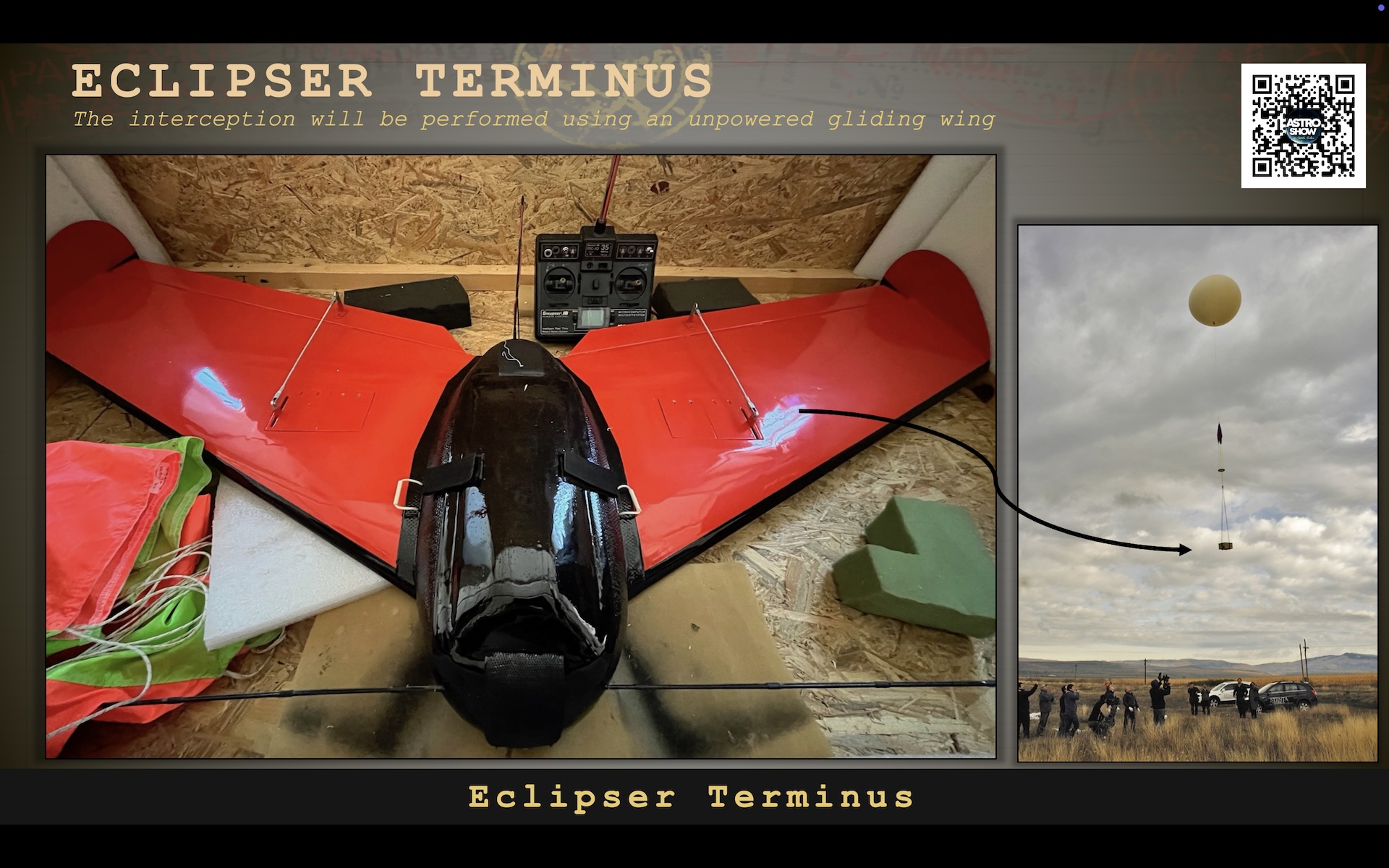
The gliding wing, as presented above, will be aided by the helium balloon.
There are two locations under consideration for launching the project (4.02.2026). The main one is northern Tunisia, about 80 km southwest of Tunis, near the southern limit of the extended totality. Thanks to Dan McGlaun, an owner of the former website Eclipse2024.org, we have a quite detailed projection of the umbral cone at the very last moment of its contact with the ground (Pics. 354-357, 359-360), in relation to the space.
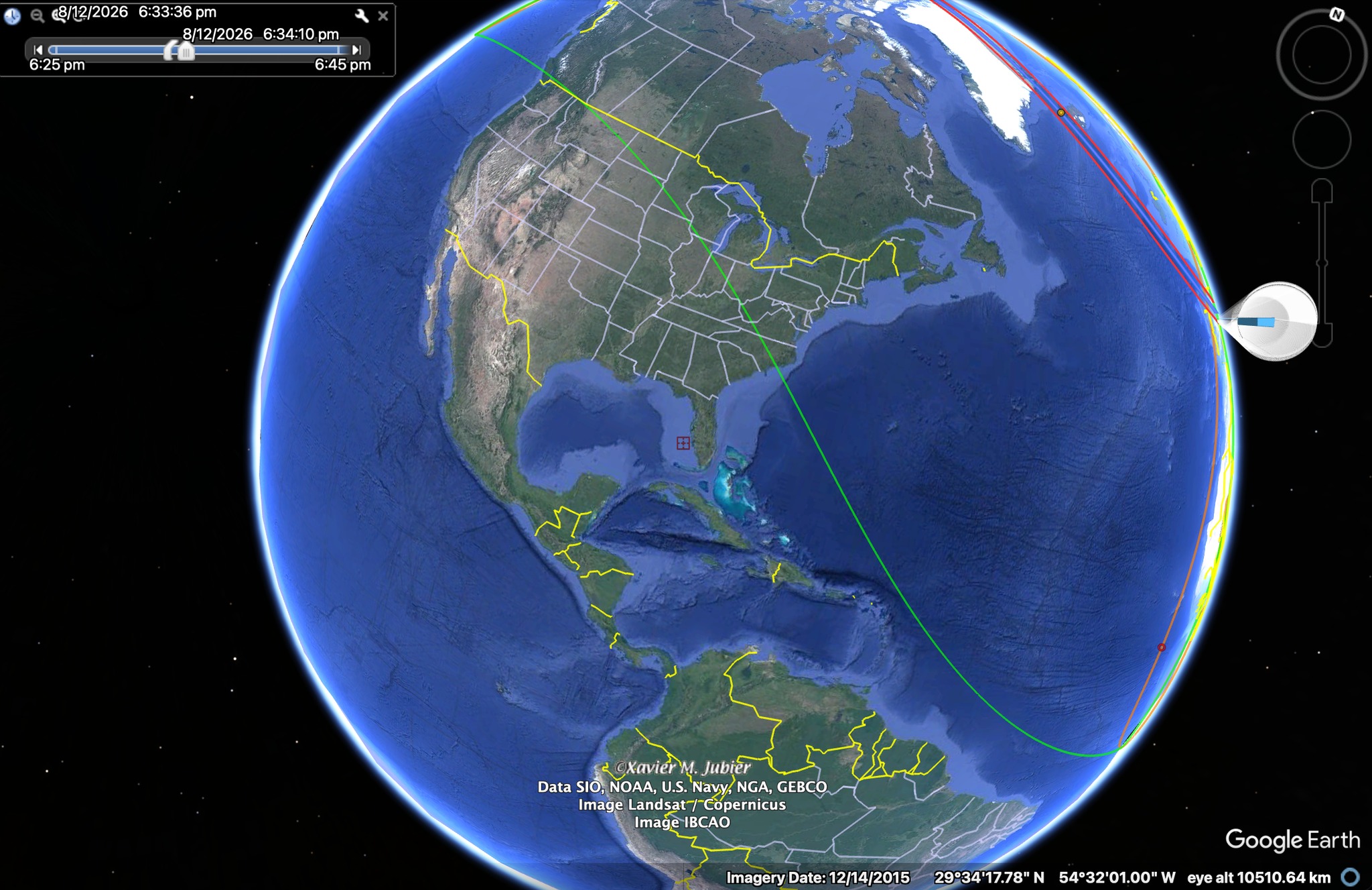
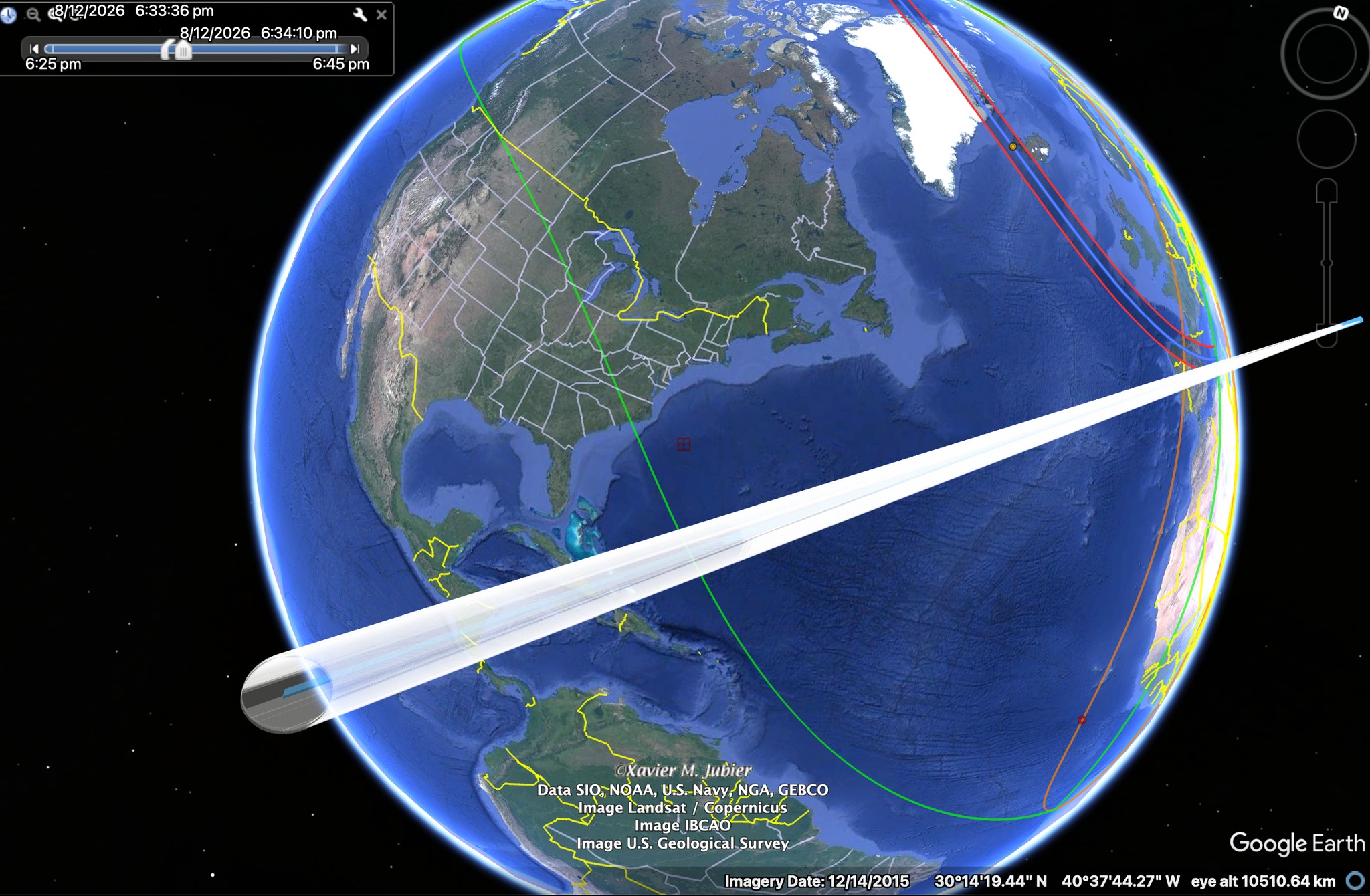
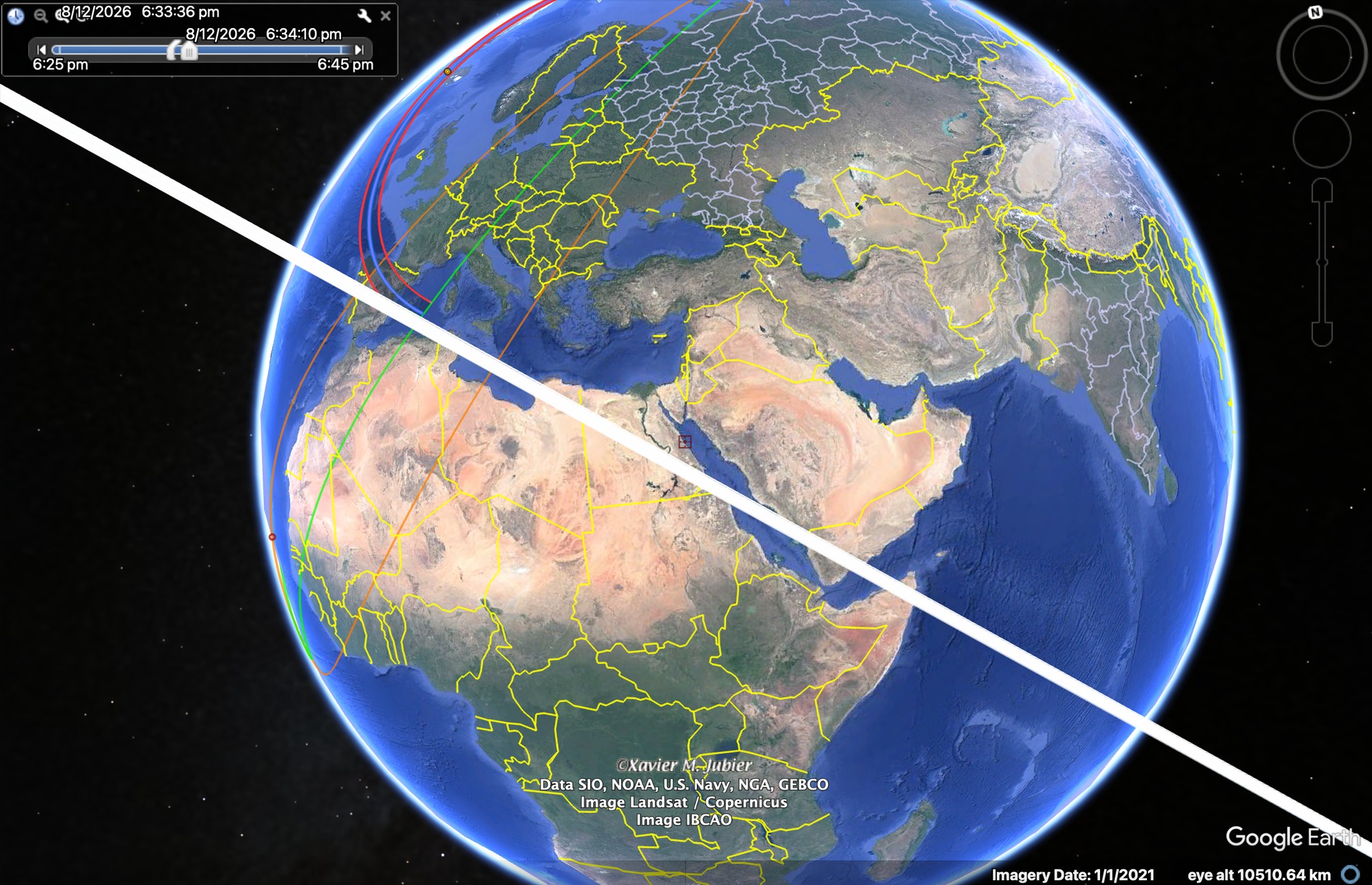
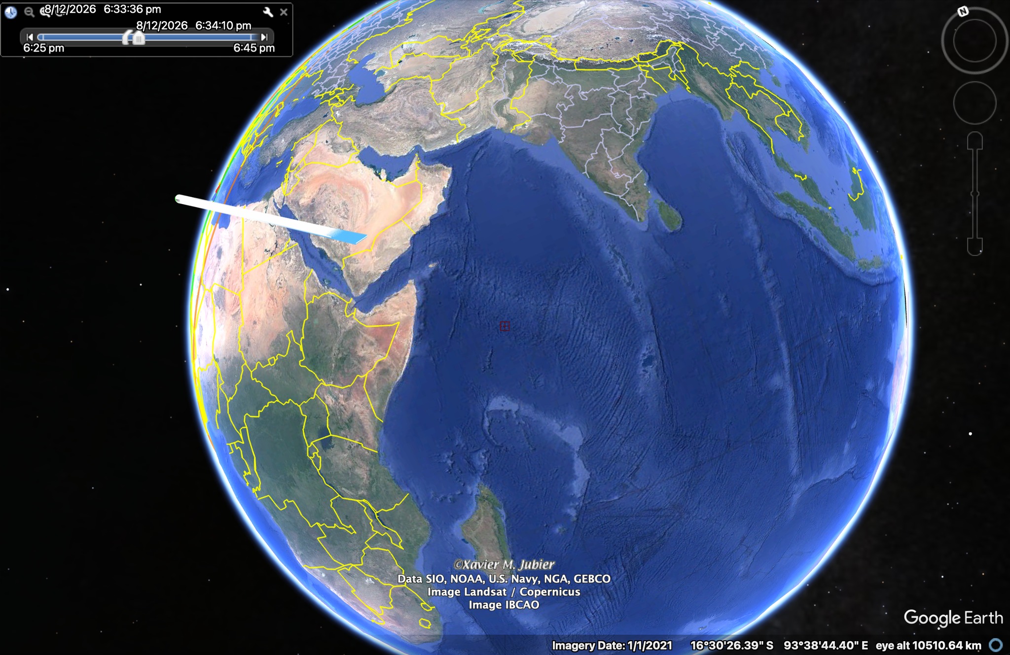
To be clear, all these visualizations correspond strictly to the situation illustrated in the map below (Pic. 358), where the Moon’s shadow is approximately at its last contact with the Earth’s surface.
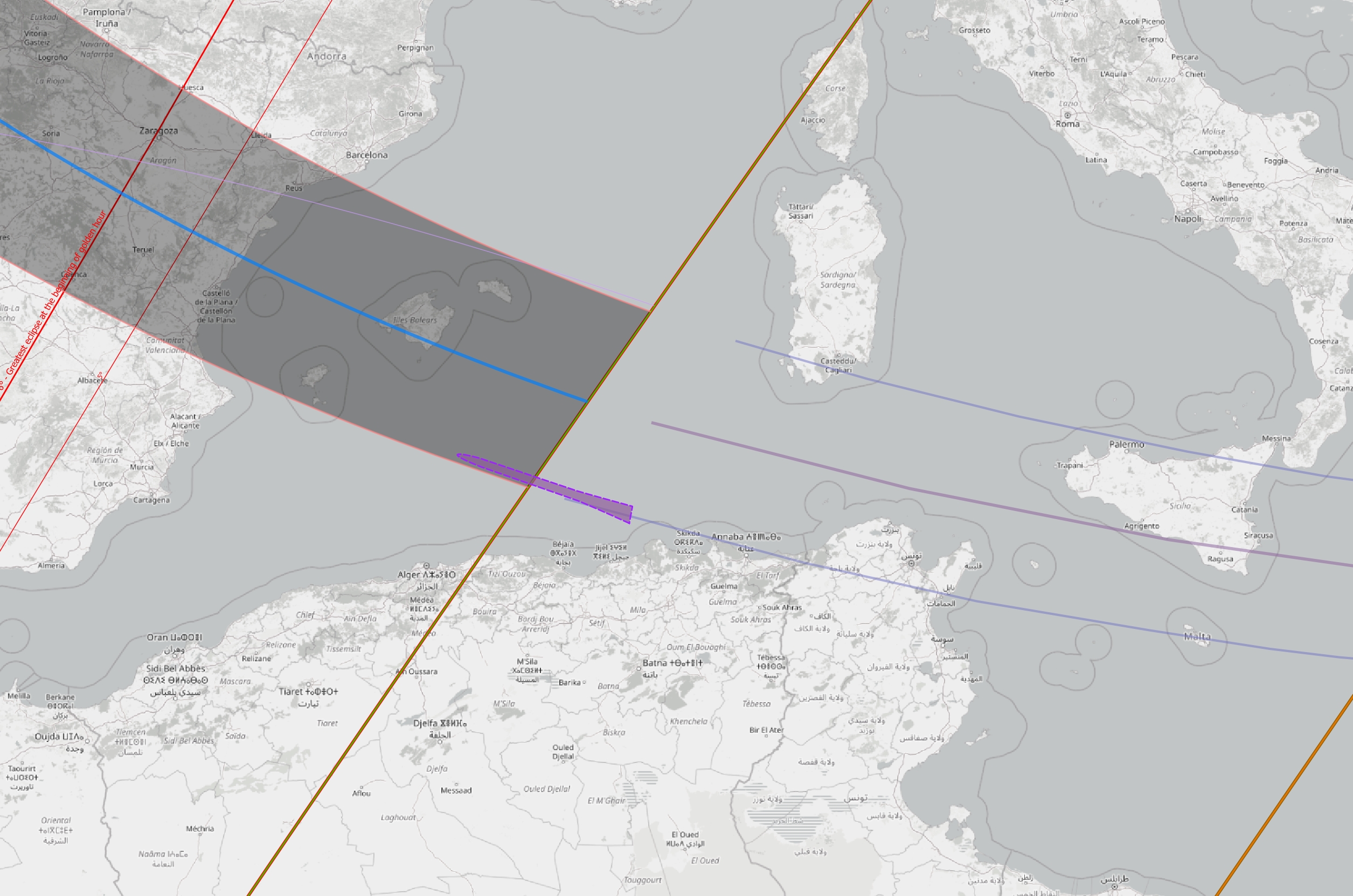
Unlike the Moon’s shadow cone projected onto the ground (map), we can visualize it from space.
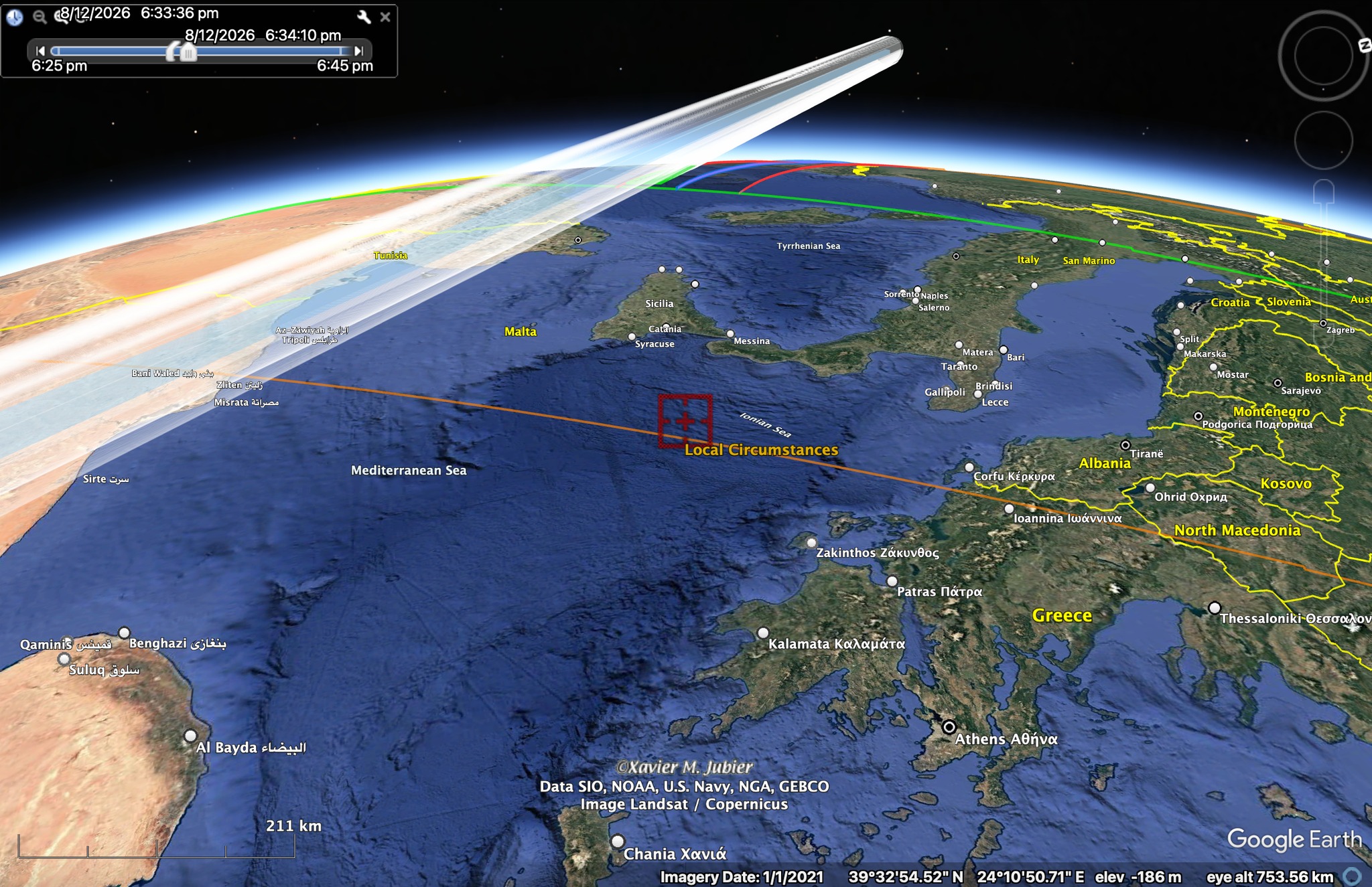
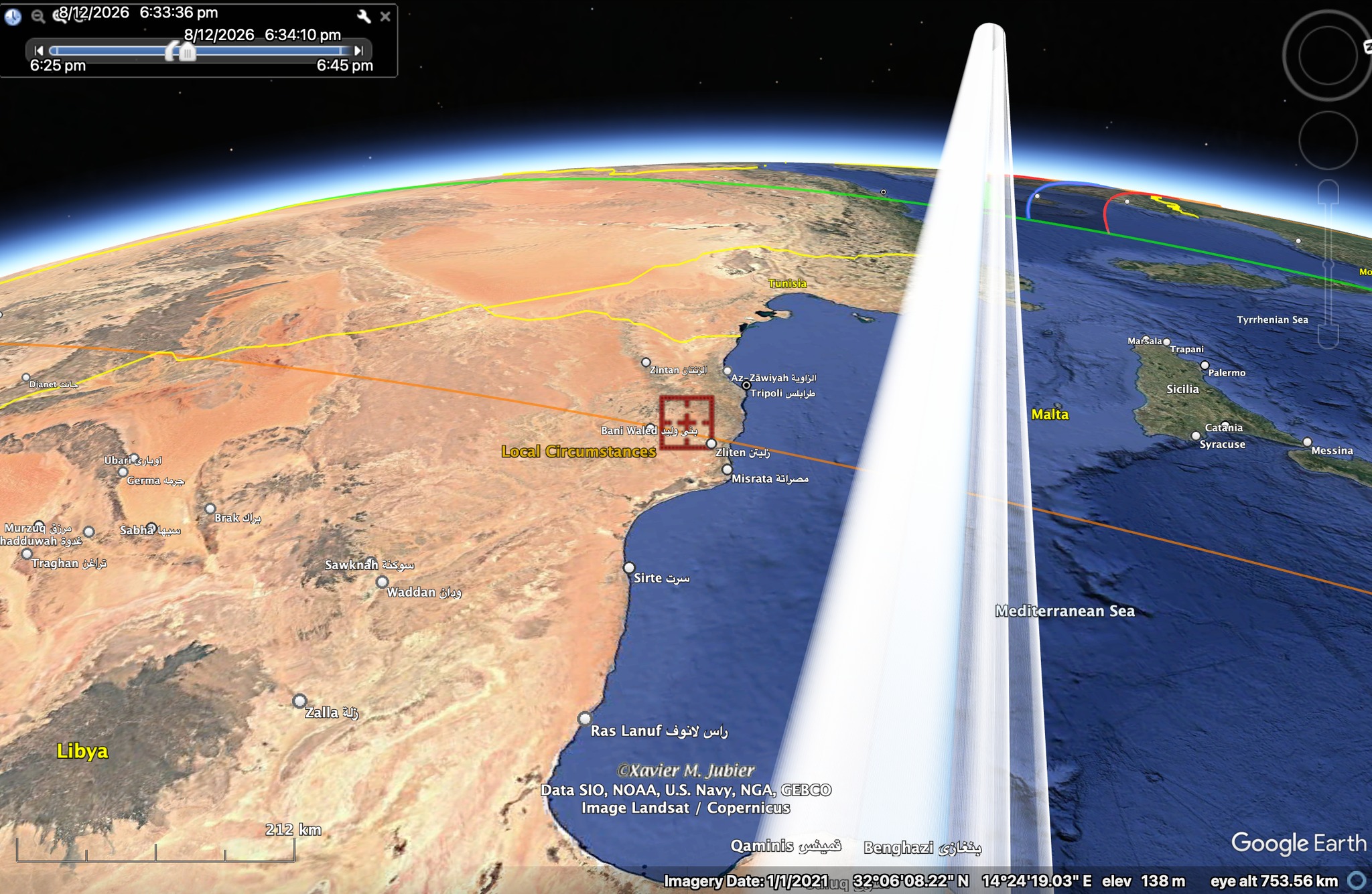
An alternative location for the following project is Sicily, specifically in the Marsala area. Based on Fred Espenak’s and Xavier Jubier’s maps, this place appears to be near the centerline of the path extension (Pic. 360). It surely does! However, Earth’s curvature must be taken seriously here. By expanding the computations for typical solar eclipse maps, we see that all the lines curve northward. It specifically applies to the Sun’s position below the horizon. Since the Sun isn’t visible after sunset, the only factors we can rely on are the umbral cone and the atmosphere. By looking at the map above, you will understand the Earth as a transparent globe, where the Moon’s shadow overshoots on the opposite side, as discussed in this article. The only way to see it is just behind the terminator line, where the umbra approaches from both sides of the sky at once. We need to consider the terminator line as the Earth’s most extreme line. Beyond this line in the twilight zone, due to Earth’s curvature, the locations are placed « deeper » by the solar depression angle. In turn, the lines, which follow typical eclipse maps, refer strictly to the umbral position if the Earth were transparent (See chapter 4). For an observer with a transparent view of the ground, the total solar eclipse in Marsala could be seen at a depression of 5°. strictly. However, because the sunset occurs at an altitude of nearly 30 km, the totality is almost missed due to parallax! As per Dan McGlaun’s visualizations above (Pic. 107), the umbra behavior is no longer ground-related. Any kilometer above the ground changes the total extension limits, as initially calculated and visualized by John Irwin below (Pic. 360).
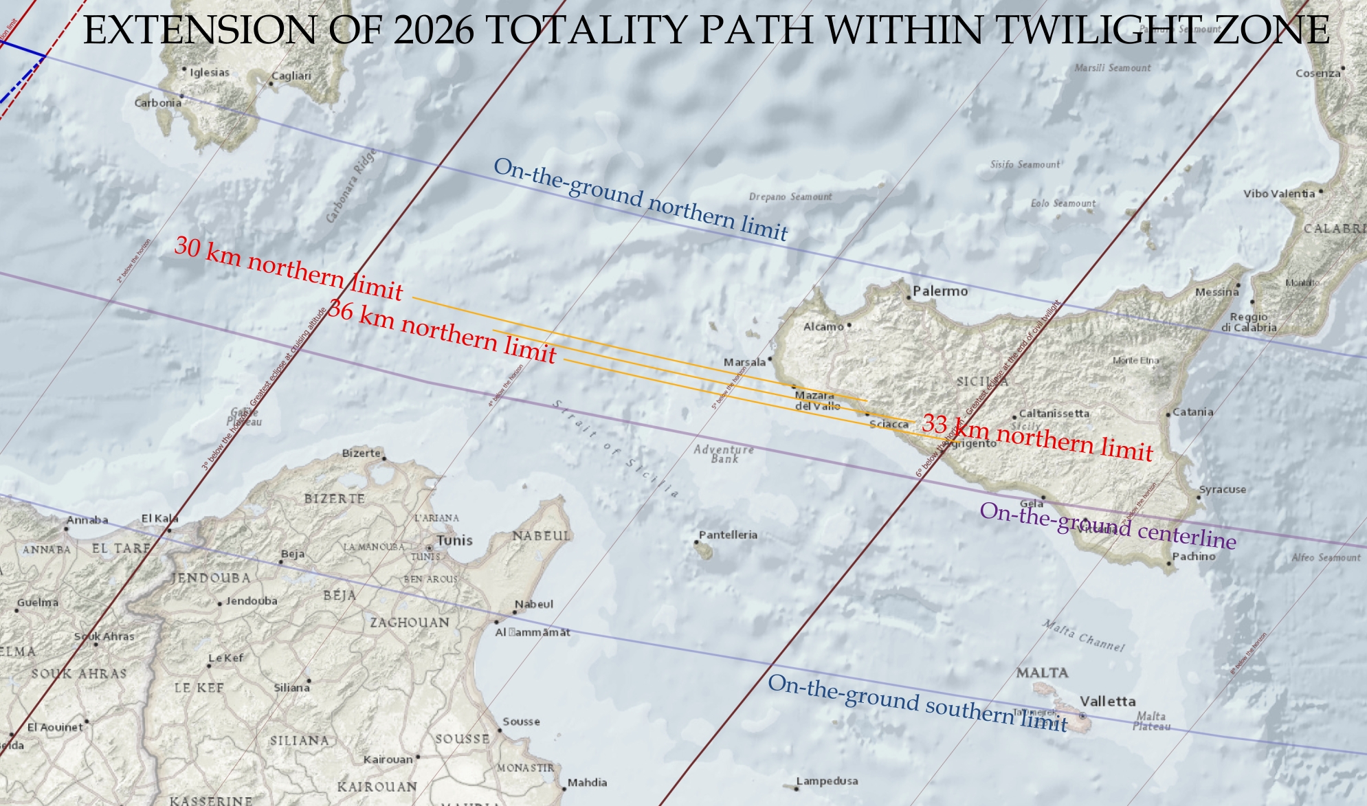
For the altitude of 36 km, we can practically estimate the dark sky at daylight, and the true limitation of the umbra from the perspective of this altitude. Based on the estimates above, the shift in umbra extension is significant and effectively eliminates the possibility of observing it directly from western Sicily. Of course, the umbra will be visible in the sky because there is no direct sunlight to scatter. However, as mentioned in Chapter 15, the effect won’t be as pronounced as it might appear from a more suitable location. The actual motion of the shadow is shown below (Pic. 361). As discussed in this article, we should view it from a space perspective, as ground-based computations are no longer viable.
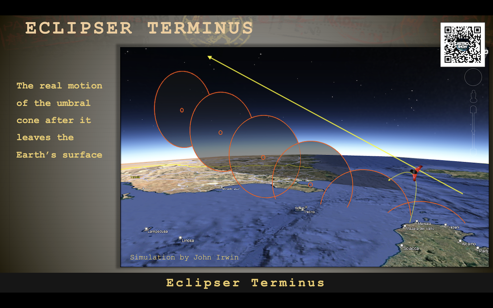
In conclusion, the circumstances for Sicily aren’t favorable enough, despite its geometrically ideal position at the end of the eclipse path.
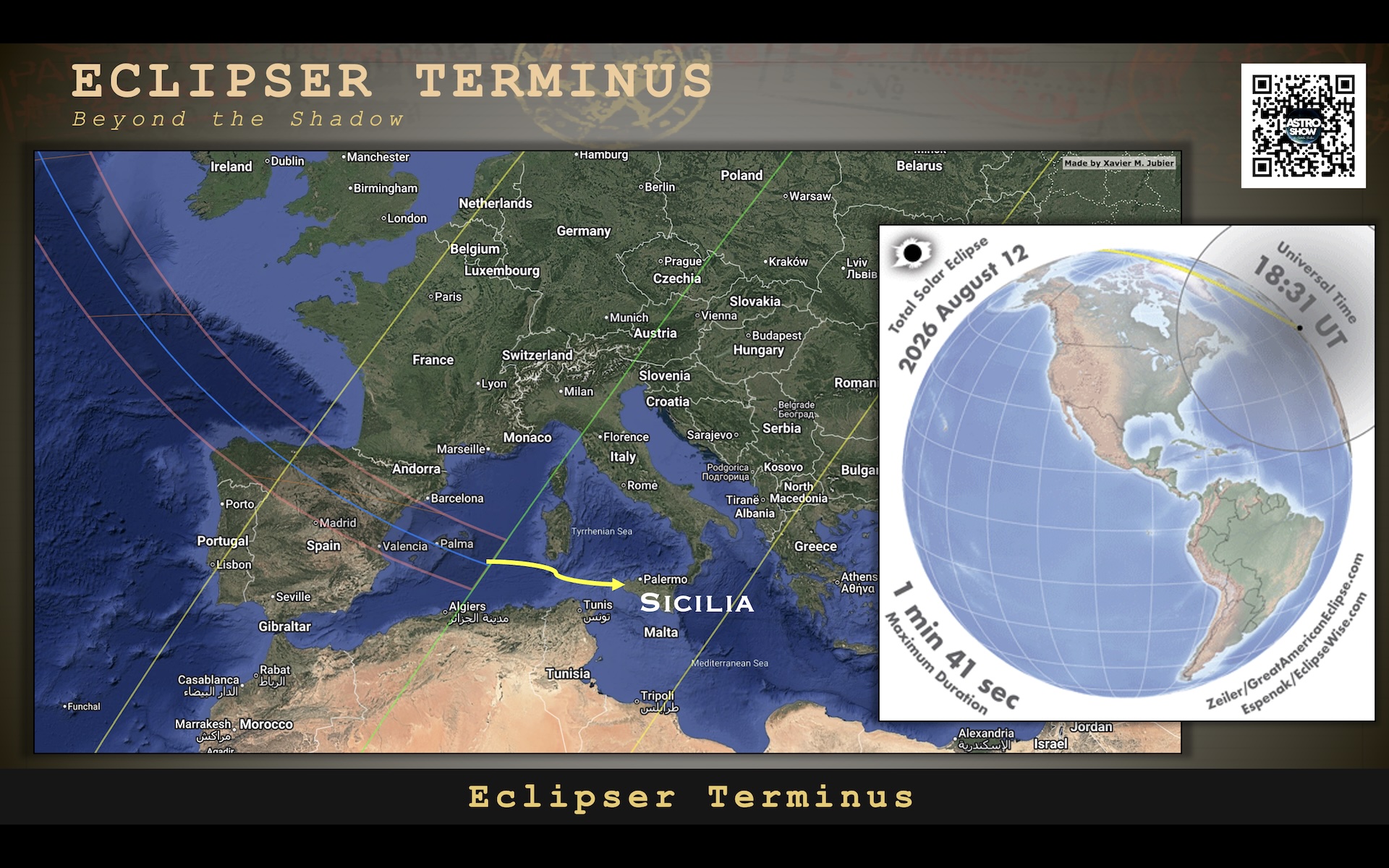
On the other hand, the Eclipser Terminus project isn’t restricted to a ground perspective. The gliding wing is planned to be sent around 45 km (30-60 km) southwest of the Marsala coast (Pic. 363-364). The basic limitation in this regard is the boundary of Italian territorial waters within which all devices must be recovered from the Sea.
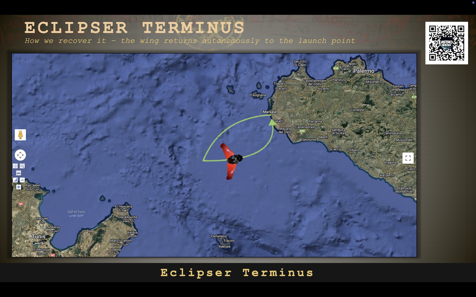
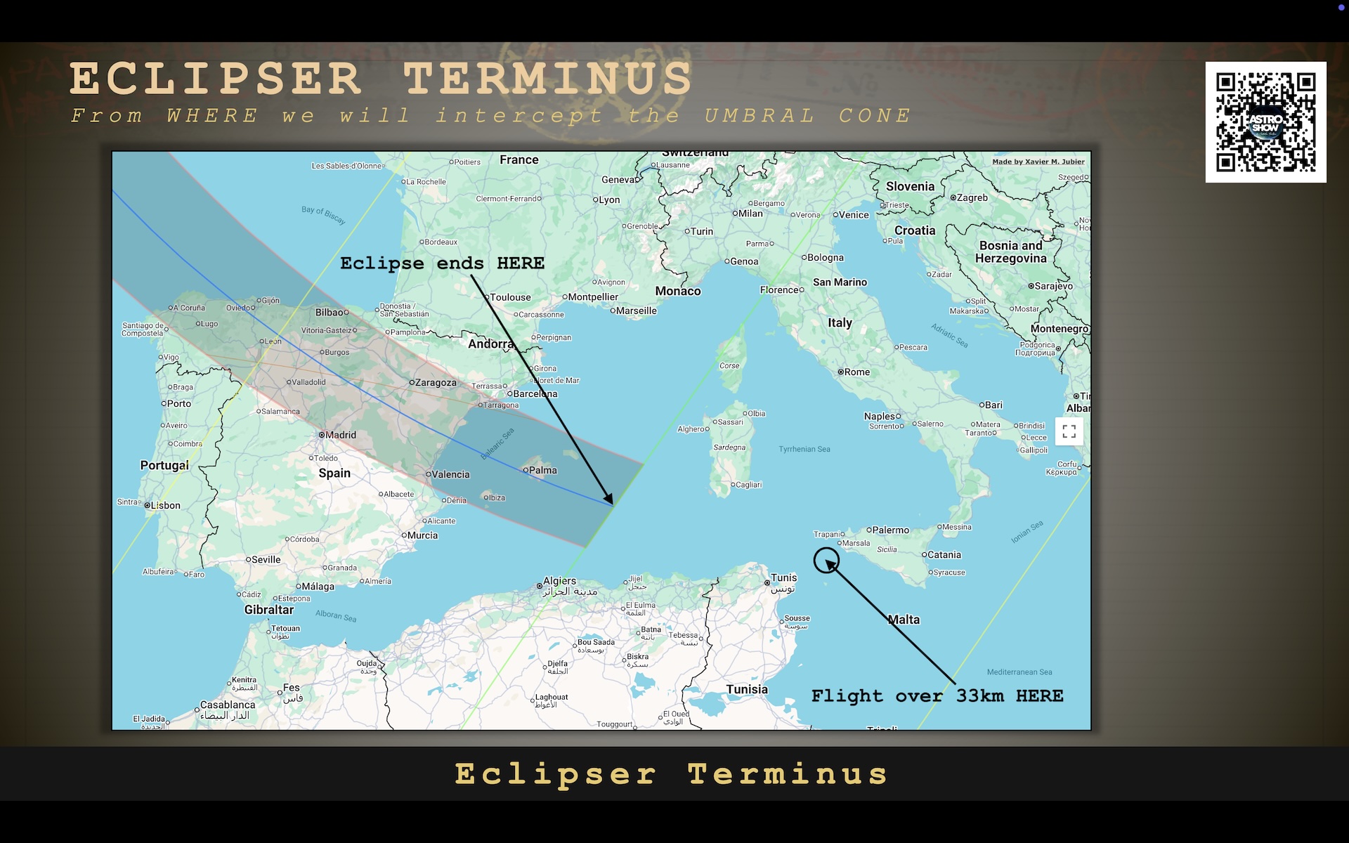
Given the umbra conditions discussed above (Figures 359 and 360), the project has a slim chance of achieving totality from this location (Pic. 366).
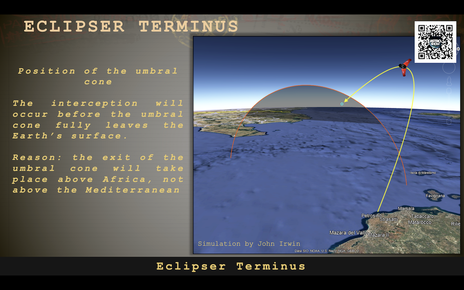
Flying into the stratosphere around 45 km southwest of Sicily guarantees at most 20s of totality with the Sun located approximately 1° above the geometrically dipped horizon (Pic. 115).
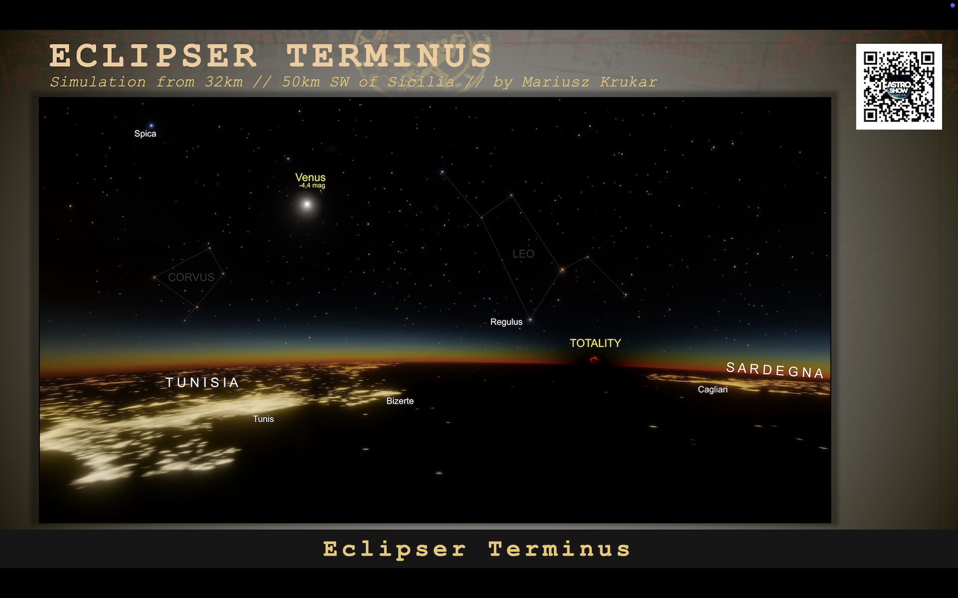
In this situation, to ensure the project’s success, clear weather over the Balearics and a geometric end of the path are necessary. A similar map was projected for ground-based eclipse observers within the path. Since the fully-developed cumulonimbus or high-level clouds (i.e., cirrus) can disrupt the ground observation over 350km away, what happens if the stratospheric balloon records the eclipse from an altitude of 34 km?
Since the Sun will be visible only 1° above the geometrically dipped horizon, we should consider how the geometrically dipped upper boundary of the troposphere, approximately 10 km above the local horizon, is typical for high-level cloud development. The Sun can be at least partially blanketed by the clouds located at a distance of over 600 km away from the observation point. The Space Engine image above shows a sample cloud deck at an altitude of 10 km, gently veiling the horizon on the left.
In conclusion, the alternative approach from Sicily may be problematic given the issues raised above, though success remains possible.
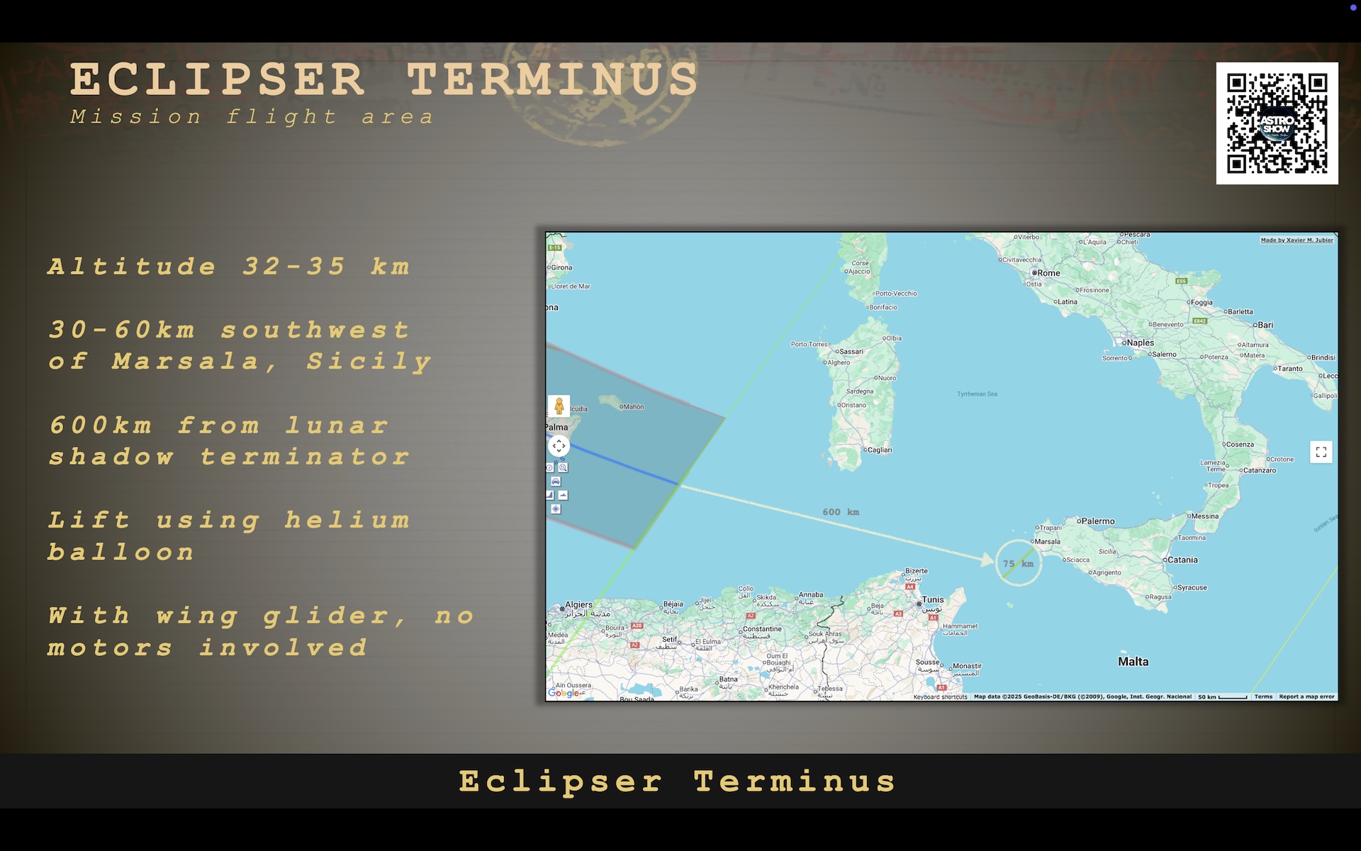

UPDATE (3.07.2026):
The Eclipser Terminus program has been officially revoked because the Tunisian authorities didn’t grant permission to fly. The reason behind it is the military and defense issue.
>>>BACK TO TOP<<<
18. OBSERVATION RESULTS
Results of the 2026 total solar eclipse observations will be presented after August 12, 2026.
If you want to help to contribute to the project, you can upload your media to the service here:
TO BE ADDED SOON
results
>>>BACK TO TOP<<<
19. SUMMARY
The article presents a detailed scientific analysis of the total solar eclipse of 12 August 2026, with its extension below the horizon, including particular emphasis on its geometric configuration, atmospheric interactions, and observational phenomena. This eclipse is specific, as it falls almost under a Type V event, in which totality occurs in one part of the day, predominantly after local noon. The path of totality is situated at higher latitudes, resulting in a comparatively low solar elevation of approximately 26.5 degrees above the horizon. This geometry significantly influences the overall width of the path and the position of the shadow visible in the sky against the eclipse path projected on the ground.
During totality, the temporary obscuration of the solar photosphere enables direct observation of the chromosphere and corona. Thanks to modern visualizations of the lunar limb profile, we can determine the location around the Moon’s limb where the Baily’s beads disappear and reappear at the third contact. On top of that, knowledge of the lunar limb profile helps us determine where the double diamond ring can be observed.
The eclipse at lower altitude has a substantial effect on the sky surface brightness due to reduced direct solar irradiance and the dominance of scattered light. The spectral composition of the sky evolves from typical daylight scattering toward longer wavelengths, producing reddish tones that eventually turn bluish-gray as totality approaches. They will look very effective in the golden hour and in early twilight. Notably, the minimum sky brightness does not coincide exactly with the temporal midpoint of totality but occurs slightly thereafter, reflecting asymmetries in atmospheric scattering and the geometry of the lunar shadow. Directional anisotropy in sky brightness becomes pronounced, with brighter sections near the horizon outside the umbral path and darker regions within it.
Several transient optical phenomena arise from diffraction, refraction, and the topography of the lunar limb. Baily’s beads result from sunlight passing through valleys along the Moon’s edge, while the diamond ring effect occurs shortly before or after it, depending on the stage of the eclipse. Shadow bands, consisting of rapidly moving interference patterns caused by atmospheric turbulence, may be observed on plain-coloured surfaces (or clouds). These surfaces can also be useful for capturing the disappearance and reappearance of specular solar reflections, illustrating changes in the color of light reaching the observer, and, finally, changes in the azimuths of direct illumination. In regions near the path of totality, a “contrast triangle” may form as a result of sunlight reflection on the seawater in contrast with the shadowed sky at the horizon.
During the partial phases, progressive limb darkening of the Sun and the reduction in irradiance lead to gradual changes in the color balance of the sky. Small apertures, including natural gaps in foliage, act as pinhole cameras, projecting crescent-shaped images of the Sun onto nearby surfaces. These effects provide indirect observational evidence of the eclipse’s progression.
The article also highlights rare optical phenomena observed during this event. Due to the period just after a maximum of solar activity, there exists a potential for simultaneous observation of auroral phenomena in high-latitude regions. The presence of noctilucent clouds, which form at mesospheric altitudes, may also coincide with the eclipse under suitable conditions. In certain geographic locations, particularly near sunset in the Mediterranean region, atmospheric dispersion effects such as the green flash may be enhanced by the eclipse. Furthermore, reducing scattered light can increase the contrast between the sky and horizon, potentially extending the distance at which terrestrial objects remain visible.
Finally, the article discusses an experimental observational concept involving a stratospheric balloon platform at altitudes of approximately 30 to 34 kilometers. Such an approach aims to reduce atmospheric interference and extend the observational horizon, thereby enabling unique measurements of various eclipse-induced effects at this altitude. Overall, the study underscores the importance of geometric configuration, atmospheric physics, and observer position in determining the full range of phenomena associated with the 2026 total solar eclipse, which remains the most intriguing astronomical event of the current decade.
>>>BACK TO TOP<<<
20. ACKNOWLEDGMENTS
I would like to express my sincere appreciation to the Stellarium Development Team, under the leadership of G. Zotti and A. Wolf, for their outstanding work. This research has been partly carried out using the ShowMySky mode, a feature that has proven essential for accurately visualizing and comparing eclipse phenomena across different locations.
Stellarium stands out as one of the finest open-source platforms for sky simulation. With the integration of the ShowMySky mode, it achieves an exceptional level of realism in 3D sky rendering, closely replicating observations made with the naked eye, binoculars, or telescopes. I am especially grateful to the team for incorporating advanced atmospheric modeling, including the capability to simulate solar eclipses and their effects on twilight conditions.
Their work represents a significant milestone in studying how solar eclipses influence atmospheric light and twilight behavior. Given the rarity of such celestial events, the ability to simulate eclipse-induced twilight under various conditions and solar depressions is invaluable. This powerful feature enables ongoing and future research, and several upcoming studies will continue to rely on the Stellarium ShowMySky simulations.
I would also like to express my sincere hope that future developments of the ShowMySky mode will incorporate additional atmospheric phenomena, such as aurorae and noctilucent clouds. The inclusion of these features would enable even more refined and visually compelling representations of rare celestial events, particularly when they coincide with eclipse conditions.
Furthermore, I wish to extend my gratitude to Vladimir Romanyuk, the developer of the remarkable sky-simulation software, SpaceEngine. With the release of version 0.99, users can simulate solar eclipse views from a wide range of spatial perspectives, including arbitrary altitudes above Earth’s surface. This functionality provides an invaluable complement to ground-based simulations, enriching both visualization and scientific understanding of eclipse phenomena. Thanks to Space Engine, the geometrical umbral projection within the astronomical twilight zone is possible. Another « thank you » to the developers of the G’mic plugin for GIMP, which helped me with projections of the sky surface brightness distribution for various locations.
Another great tool that facilitates understanding of the relationship between the lunar limb profile and the character of a total solar eclipse is Photography Ephemeris, which, in my view, greatly supersedes the Solar Eclipse Maestro tool, available only for macOS. I hope that Crookneck Consulting LLC will continue to develop this fantastic tool in various ways. Cordial appreciation is due to the panorama generator Peakfinder.org, developed by Fabio Soldati, which helps project the setting eclipsed Sun above the local horizon. On a different note, the Udeuschle panorama generator seems to be the most detailed with refraction and rendering the farthest landscape features. Finally, I am grateful to the individuals who significantly contributed to the development of my project, especially Catalin Beldea, who leads the ECLIPSER TERMINUS 2026 project, and who gave me the opportunity to broaden our understanding of atmospheric behavior beyond the limits of solar eclipses. I would also like to extend my sincere thanks to Dan McGlaun, the eclipse mathematician and observer, who helped Catalin and me to visualize what happens when the umbra leaves the Earth’s ground and the atmosphere. At last, I wouldn’t forget about all the people who contribute to my work with small donations.
>>>BACK TO TOP<<<
References:
- Abell G.O., Kearns C.E., 1954, The effect of the solar eclipse of June 30 upon the morning twilight at Palomar Observatory, (in:) Publications of the Astronomical Society of the Pacific, vol. 66, no. 392, p.233
- Bruneton E., Neyret F., 2008, Precomputed Atmospheric Scattering, Computer Graphics Forum 27 (4)
- Geyer EH., Hoffmann M., Volland H., 1994, Influence of a solar eclipse on twilight, (in:) Applied Optics, vol.33 (21), p.4614-4619.
- Guliaev R.A., 1992, On a possible use of total solar eclipse below the horizon for observations of the inner zodiacal light (as applied to the eclipse of 30 June, 1992), (in:) Solar Physics, vol. 138, p.209-211
- Koepke P., 2001, Spectral variation of the solar radiation during an eclipse, (in:) Meteorologische Zeitschrift, vol.10, No 3, 179-186
- Können G.P., Hinz C., 2008, Visibility of stars, halos, and rainbows
during solar eclipses (in:) Applied Optics v. 47 no. 34 - Lee S.H., Lee S., 2012, Illuminance during a solar eclipse with limb darkening: A mathematical model, (in:) Journal of the Korean Astronomical Society v.45, 111-116.
- Meeus J., 1997, Mathematical Astronomy Morsels I, Willmann-Bell
- Meeus J., 2007, Mathematical Astronomy Morsels I, Willmann-Bell
- Richtsmeier S.C., Lynch D.K., Dearborn D.S.P., 2017, Antitwilight I: structure and optics, (in:) Applied Optics, vol. 56, no. 19
- Richtsmeier S.C., Lynch D.K., Dearborn D.S.P., 2017, Antitwilight II: Monte Carlo simulations, (in:) Applied Optics, vol. 56, no. 19
- Saha S., 2020, Ground-based observations of noctilucent cloud
brightness and frequency, Indian Institute of Science Education and Research, Kolkata - Sekhar A., Asher D., Vaubaillon J., 2016, Three-body resonance in meteoroid streams, (in:) Earth and Planetary Astrophysics
- Telepun G., 2023, Eclipse day: How to observe and photograph any total solar eclipse, Ebook
Links:
- https://eclipse.gsfc.nasa.gov/SEsaros/SEsaros126.html
- https://www.solar-eclipse.info/en/saros/detail/126/
- Theskysearchers.com: 12th anniversary of eclipse flight into stratosphere
- https://stevealbers.net/albers/allsky/twilight.html
- https://twanight.org/gallery/lunar-analemma-composite/
- Hpwren.ucsd.edu: Lunar analemma
- Lasco-www.nrl.navy.mil: SOHO solar corona information
- https://www.swpc.noaa.gov/products/goes-solar-ultraviolet-imager-suvi
- https://suntoday.lmsal.com/
- https://www.solarmonitor.org/
- Jsoc1.stanford.edu: Latest images of the Sun
- Astroshop.eu: Flash spectrum and how to create it
- https://www.besselianelements.com/the-flash-spectrum-an-introduction/
- https://skyandtelescope.org/2024-total-solar-eclipse/how-to-see-the-diamond-ring-effect-during-a-total-solar-eclipse/
- https://sciencenotes.org/total-solar-eclipse-diamond-ring-effect-bailys-beads-and-more/
- https://www.timeanddate.com/eclipse/diamond-ring.html
- https://photoephemeris.com/en/articles/searching-for-the-double-diamond-ring/
- https://www.greatamericaneclipse.com/double-diamond-ring
- https://www.reddit.com/r/solareclipse/comments/6v5f9e/natural_pinhole_camera_effecteclipse_thru_tree/
- https://www.besselianelements.com/why-the-chromosphere-is-purple/
- https://www.besselianelements.com/total-eclipses-from-the-edge-coronality-vs-totality/
- https://www.besselianelements.com/eclipse-maps-accuracy/
- https://10110111.github.io/CalcMySky/using-in-stellarium.html
- https://github.com/10110111/CalcMySky
- https://steamdb.info/app/314650/patchnotes/
- https://spaceengine.org/
- https://photoephemeris.com/en/help/photo-ephemeris-web/solar-eclipse-simulator/
- https://photoephemeris.com/en/help/photo-ephemeris-web/advanced-solar-eclipse-planning/
Forums:
- https://www.reddit.com/r/spaceengine/comments/bowhg3/whats_new_in_space_engine_0990/
- Gimpchat.com: G’mic isophotes
Wiki:
- Analemma
- Baily’s Beads
- Belt of Venus
- Ellipse
- Great circle navigation
- Slitless spectroscopy
- Solar corona
- Solar_Saros_126
- Stellarium